Crypto Fast - Day 7 of 33
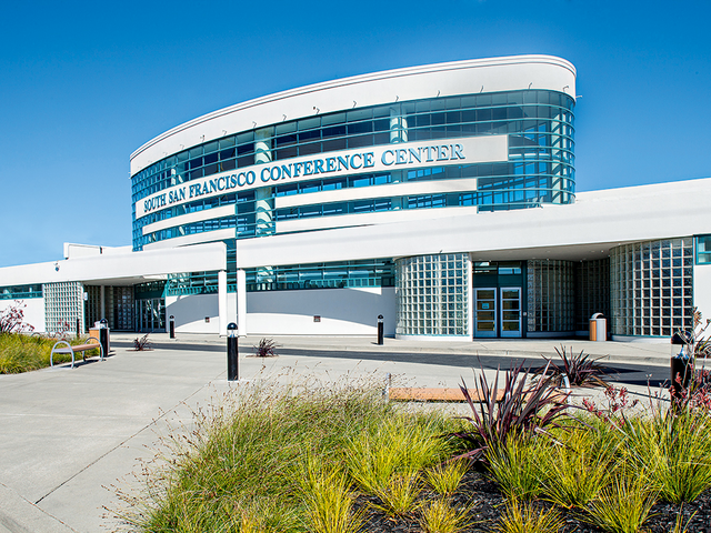
I wonder what is going on in Crypto Land? I know the Litecoin Summit started yesterday and will be going on today as well. Anybody attend the event in South San Francisco? If not for my crypto fast I would have considered going. But a fast is a fast and you either go all in or you don't do it at all!
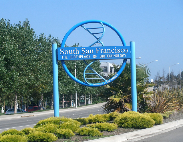
Given that the Litecoin Summit is in South San Francisco, I am going to talk about the City of South San Francisco. Most people who are not from Northern California do not know that South San Francisco is not part of San Francisco in any way. In fact, South San Francisco does not even border San Francisco. The two cities that border San Francisco to the south are Brisbane, Colma, and Daly City.
The City of South San Francisco has about 62,000 residents. The city is located in northern San Mateo County. The city’s boundaries include Colma, Daly City, Brisbane and the San Bruno Mountains to the north; the Bay to the east; San Bruno to the south; and Pacifica to the west. Downtown San Francisco lies about 10 miles to the north, while Silicon Valley is 15 to 40 miles south.
West of Spruce Avenue, land use within South San Francisco is primarily residential. East of Spruce Avenue, industrial facilities form the focus of development. The area east of U.S. Highway 101 has a core of industrial and research & development properties, interspersed with newer offices and hotels. West of 101, the industrial facilities are older and less conforming. The preponderance of industrial development within South San Francisco has led to the city commonly being referred to as the “Industrial City.”

South San Francisco is positioned to the northwest of the San Francisco International Airport. Properties within the city are affected by airplane noise. This condition affects most properties competing with the subject, with a similar effect in South San Francisco, San Bruno, and Millbrae. The subject property lies near the northern periphery of South San Francisco. Within this area, topography begins to change from the flatlands near Highway 101 to the relatively steep foothills bordering San Bruno Mountain.
Miller Avenue begins at Airport Boulevard (at the US 101 Southbound Off-Ramp) and continues west to Chestnut Avenue. It is the primary vehicle route to City Hall and the new Miller Avenue parking structure. Between Airport and Spruce, there are very few driveways, and parking is not permitted between Linden Avenue and Maple Avenue. Traffic on Miller Avenue generally moves smoothly. Sidewalks are narrow, particularly along the south side between Maple Avenue and Spruce Avenue, making the pedestrian environment less attractive. As part of the Miller Avenue parking garage project, sidewalk improvements along the garage’s frontage have widened the sidewalk and improved the streetscape somewhat; however, parking removal was required for this improvement. Miller Avenue is a signed bicycle route (Class III facility). The wider vehicle lanes allow for more space for bicyclists; however, the grade of the street going westbound and the speed of traffic makes cycling less attractive.
Baden Avenue is an east-west collector street one block south of Grand Avenue. Between Airport and Linden, Baden has two travel lanes in each direction and no on-street parking. In this block, the southern sidewalk is narrow at four feet. This block also connects vehicles traveling north on Linden Avenue to Airport Boulevard to access the northbound on-ramp at Grand Avenue. West of Linden, Baden has one lane and on-street parking in each direction. The portion west of Linden also becomes predominately residential in character. Linden Avenue is a two lane north-south minor arterial.
Linden Avenue provides access to the Lindenville industrial area and the City of San Bruno. North of Grand Avenue, Linden has several smaller retail and small office type uses. SamTrans operates on Linden Avenue north of Grand Avenue. At Baden Avenue, Linden Avenue has a wide double right turn lane to allow vehicles, especially larger vehicles, to make a right turn. This makes the crosswalk longer and the eastern sidewalk narrower. Although Linden Avenue is a bicycle route, cyclists are rarely observed.
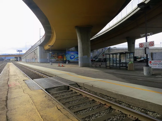
The location and configuration of the South San Francisco Caltrain Station has been an issue for the City for many years. It is located at 590 Dubuque Avenue, on the east side of US 101, north of East Grand Avenue, just across the highway from the east edge of Downtown, and at the western edge of the East of the 101 area. This station is located within Zone 1 of the Caltrain commuter rail corridor, just over nine miles from the northern terminus at King Street Station in San Francisco. It serves local and limited stop trains and provides access to commuters with South San Francisco origins, east of 101 area destinations, and commuters connecting from the newly established ferry service at Oyster Point Ferry Terminal.
The station has experienced limited ridership over the years but recently plans have emerged for improvements to the lines and service. The Caltrain Modernization Program will electrify and upgrade the performance, operating efficiency, capacity, safety, and reliability of Caltrain’s commuter service and is scheduled to be completed by 2019. The modernization program will help prepare the corridor to eventually accommodate California’s statewide high-speed rail service, which is planned to initiate service in 2029. Caltrain and high-speed rail will primarily share Caltrain’s existing tracks, operating as a blended system.
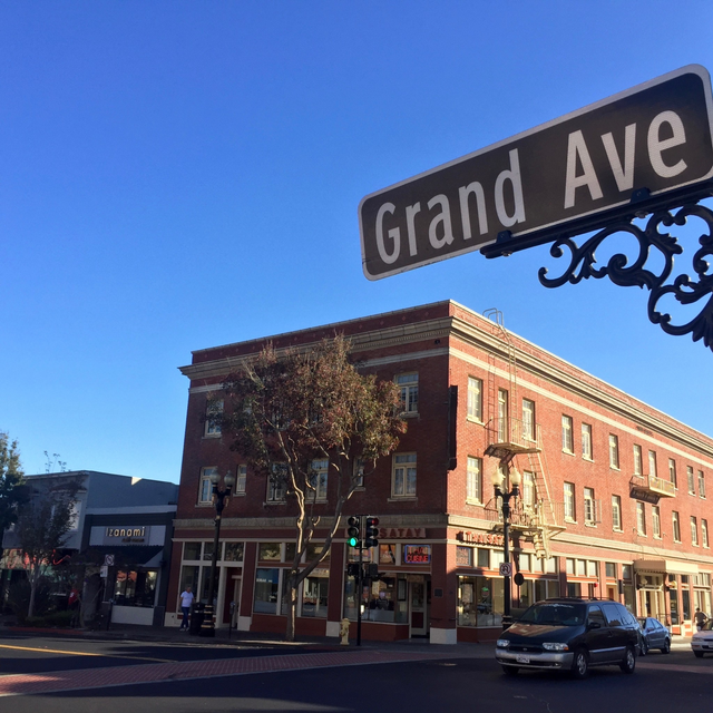
The Downtown neighborhood to the west of US 101 and along Grand Avenue has a well-connected, smaller block grid network with mostly two lane streets. East of US 101, the streets are generally wider, multi-lane arterials that create larger, asymmetrical blocks. Properties east of US 101 within the Specific Plan area are poorly served by few existing streets, and are isolated from the surrounding street network. The Grand Avenue overpass (over US 101 and the rail tracks) is the only connection between the Downtown and East of 101 areas. US 101, which bisects the plan area, is the major freeway through eastern San Mateo County between San Francisco and San Jose. Several on- and off-ramps (at Miller Avenue, Grand Avenue, East Grand Avenue and Industrial Way) serve the plan area but also carry traffic destined for SFO-related uses or other regional destinations.
Grand Avenue is the Downtown’s “main street” and is one of the few continuous east-west routes through the City. Grand Avenue has one travel lane in each direction with on-street angled parking on both sides of the street. Grand Avenue is a major connection to the US 101 Northbound on-ramp located at Airport Boulevard. East of US 101, Grand Avenue becomes East Grand Avenue, widens to six lanes (three in each direction), and crosses under US 101 and over the Caltrain right-of-way. East Grand Avenue continues east to the Bay. In the Downtown, Grand Avenue carries approximately 12,000 vehicles per day.
East Grand Avenue carries approximately 18-19,000 vehicles per day. Front-in angled parking and generally higher traffic volumes (particularly eastbound between Linden and Airport) make Grand Avenue uncomfortable for bicyclists because the parking configuration limits visibility between drivers exiting spaces and bicyclists vying for limited right-of-way with vehicle traffic. Miller Avenue is an east-west collector street one block north of Grand Avenue.

Parking Downtown has several surface parking lots and one garage managed by the City’s Parking District. Generally, the on-street parking closest to Grand Avenue is effectively at or near capacity during peak shopping hours. This creates a sense for users that Downtown parking is full, but in fact it is a relatively small portion of the total parking that experiences consistently high occupancies. The side streets and streets adjacent to Grand Avenue typically have parking available. Off-street parking facilities, including the City’s newly constructed parking garage, are underutilized. On-street parking in the Downtown parking area is typically metered whereas areas further from Downtown are unrestricted and free. The over saturation of parking on Grand Avenue, which can make it difficult for people to find parking on their desired block, is typical of downtowns that do not employ variable parking rates that encourage longer parking durations to occur off of their main street. Residential areas appear to have higher parking demand during the evening, but abundant on-street parking during the day. This is typical of residential neighborhoods where most people drive to and from work.
Congratulations @redwood419! You have completed the following achievement on the Steem blockchain and have been rewarded with new badge(s) :
Click on the badge to view your Board of Honor.
If you no longer want to receive notifications, reply to this comment with the word
STOP