Developing the ingenuity of children | America (Part 4 )
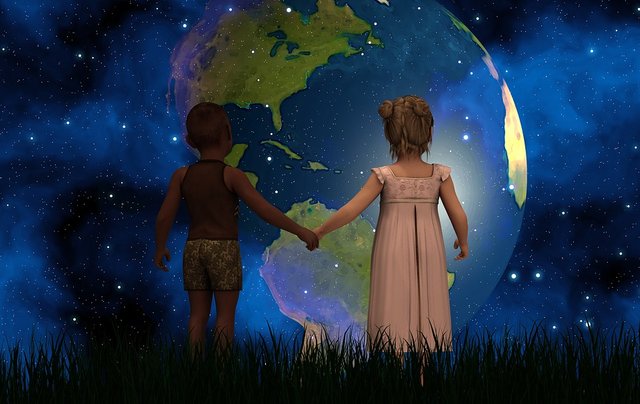

Hello, dear STEEMAINS! Welcome to our virtual classroom, Sometimes we are not aware of how education influences our lives, educating is an act of vital commitment to help build or save lives. Today I bring you a very important content for the development of any child. So I invite you to enjoy this class where we can clarify questions and doubts in children about America! A new world, as the Europeans called the American continent, because of its discovery.

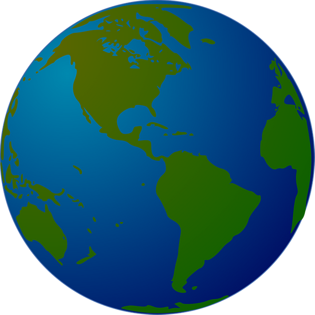
AMERICA

A new world
The continent is conformed by 35 sovereign nations, in which they are: Antigua and Barbuda, Argentina, Bahamas, Barbados, Belize, Bolivia, Brazil. Canada, Chile, Colombia, Costa Rica, Cuba, Dominica, Ecuador, El Salvador, United States, Grenada, Guyana, Haiti, Guatemala, Honduras, Jamaica, Mexico, Nicaragua, Panama, Paraguay, Peru, Dominican Republic, Saint Kitts and Nevis , San Vicente, Santa Lucia, Suriname, Trinidad and Tobago, Uruguay and Venezuela. It is also accompanied by a Commonwealth and 24 independent territories.
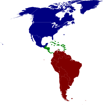
From the territorial and physical point of view, it is possible to differentiate "three Americas":
From the territorial and physical point of view, it is possible to differentiate "three Americas":
SOUTH AMERICA

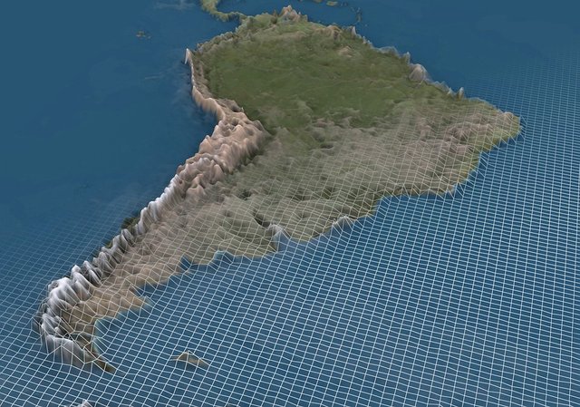
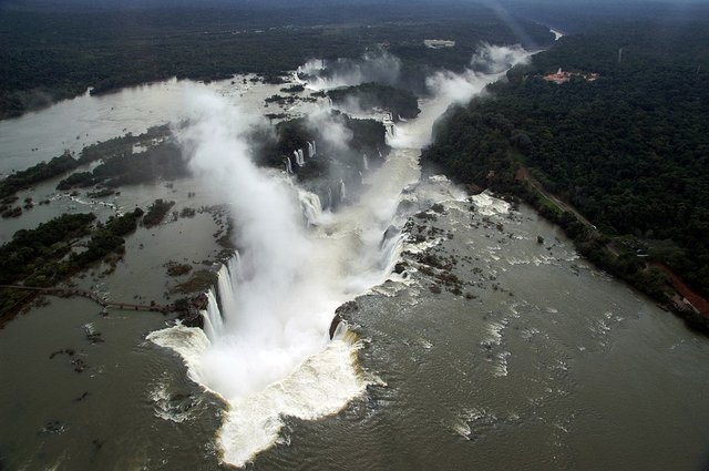
South America, occupies the southern part of this continent. It extends from the south of the Isthmus of Panama to the Cape of kilns. In this continent, we find high peaks in the Andes, with their immense valleys, huge meadows, scorching deserts or exuberant jungles like that of the Amazons. South America is currently made up of Argentina, Bolivia, Brazil, Chile, Colombia, Ecuador, Guyana, Paraguay, Peru, Suriname, Uruguay, and Venezuela.
Its fauna and vegetation are very varied and, nevertheless, the forests are threatened because many trees are being cut down since they want to take advantage of the land for cultivation or to build mines and roads.
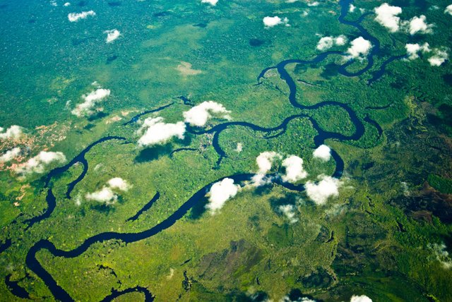
The Amazon rainforest is a treasure. In it live many animal and plant species, and their trees are a real lung that purifies the air. However, it is in danger because the man is cutting down his trees and exploiting them excessively.
In the sixteenth century, the first conquerors appropriated the lands of the natives, changed their customs and caused the death of many people. Once established, the descendants of these European colonizers fought for independence with numerous wars that ended with the birth of the 12 new countries.
Did you know? ...
Argentina
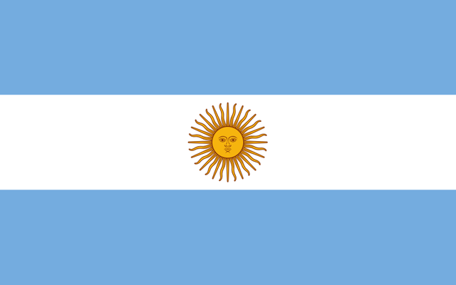
Official name of the country : Argentine Republic.
Area : 3,761,274 km2.
Capital : Buenos Aires (founded in 1536, by Pedro de Mendoza, and re-founded in 1580 by Juan de Garay).
Other important cities : Cordoba, Rosario, Santa Fe, Mendoza, La Plata, among others.
Official language : Spanish.
Currency : Argentine Pesos.
Argentina is a South American country that borders on the north with Bolivia and Paraguay, on the west with Chile, on the east with Brazil and Uruguay, with the Atlantic Ocean on the southeast and on the south with the confluence of the Atlantic and Pacific oceans. Argentina is the second largest country in South America and the eighth in the world.
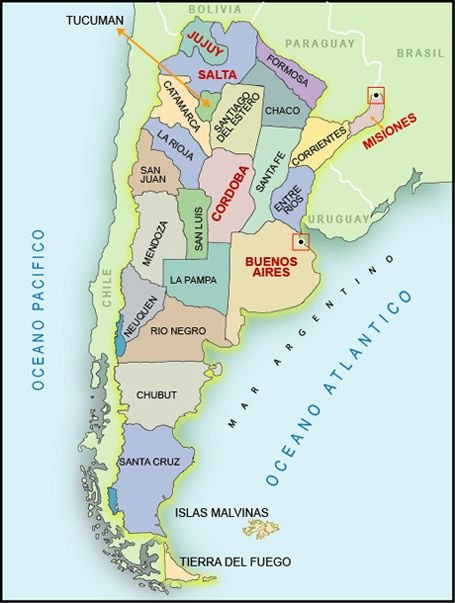
The Argentine Republic is organized in 23 provinces (Province of Buenos Aires, Catamarca, Chaco, Chubut, Córdoba, Corrientes, Entre Ríos, Formosa, Jujuy, La Pampa, La Rioja, Mendoza, Posadas, Neuquén, Río Negro, Salta, San Juan, San Luis, Santa Cruz, Santa Fe and Tucumán). And the Autonomous City of Buenos Aires,
Argentina produces cereals and meats, among which the one of ñandú (American ostrich) stands out. It is the second largest country in South America, it is famous for its huge meadows.
Did you know… Argentina was the main publisher of Hispanic American books? He specialized, fundamentally, in subjects of literature and social sciences.
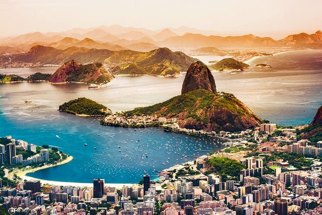
Brazil
Official name of the country : Federative Republic of Brazil.
Area : 8,511,996 km2.
Capital : Brasilia (founded in 1960).
Other important cities : Sao Paulo, Rio de Janeiro, Porto Alegre, Curitiba, among others.
Official language : Portuguese.
Currency : real.
Brazil is the largest country in South America and fifth in the world, after Russia, China, Canada and the United States. It stands out for its extension and its wealth and borders almost all the countries of South America, except Chile; to the north with Venezuela, Suriname, French Guiana, Guyana and the Atlantic Ocean; to the south with Uruguay; to the west with Argentina, Bolivia, Paraguay and Peru; and to the northeast with Colombia.
Brazil is made up of 26 states (Acre, Alagoas, Amapá, Amazonas, Bahia, Ceará, Espírito Santo, Goiás, Maranhão, Mato Grosso, Mato Grosso do Sul, Minas Gerais, Pará, Paraíba, Paraná, Pernambuco, Piauí, Río de Janeiro, Rio Grande do Norte, Rio Grande do Sul, Rondônia, Roraima, Santa Catarina, São Paulo, Sergipe, Tocantins, Tocantens) and one federal district: Brasilia.
Did you know that ... Paulo Freire was a Brazilian pedagogue who implemented an educational revolution in Brazil and significantly reduced the illiteracy rate?
Brazil has large mineral deposits. It is the second producer of iron and the first of quartz. It also has gas and oil reserves. Other natural resources are crystal, quartz, diamond, copper, gold, titanium, graphite, zinc and mercury.
Soccer is their national sport, everywhere, children kick the ball aspiring to be like Pelé or Ronaldo.
Did you know ... Sao Paulo is the most populous city in South America and one of the fastest growing cities in the world, second only to Tokyo?
Bolivia

Official name of the country : Republic of Bolivia.
Area : 1,142,581 km2.
Capital : La Paz.
Other important cities : Sucre, Santa Cruz de la Sierra, Cochabamba, El Alto, Oruro, Potosi, Tarija, Trinidad, Cobija.
Official language : Spanish, Aymara and Quechua.
Currency : Bolivian.
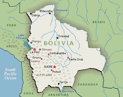
Bolivia is a Mediterranean country in South America, which borders Brazil to the north and east, Paraguay and Argentina to the south, and Chile to the west. It presents a series of features that make it an original country. The Eastern region (the East) where the plains of the Amazon and the buttresses of the high zones of Brazil are found, is also the zone of the Chaco (Southeast). The Western Region (The West) is made up of the Andes mountain range and the Altiplano.
Bolivia lost its coast to the Pacific Ocean in the war with Chile in 1879 and is now divided by 9 autonomous departments: Chuquisaca, Cochabamba, La Paz, Oruro, Pando, Potosí, Santa Cruz, Tarija, and Beni.
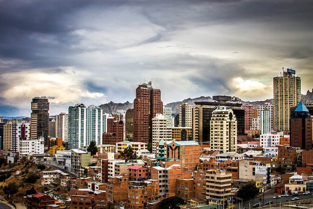
Did you know…? La Paz, located at 3,627 meters high, is the highest capital in the world and has the El Alto airport, located at 4,805 meters high, the highest in the world?
Chile
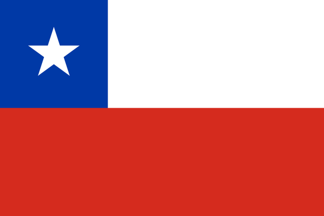
Official name of the country : Republic of Chile.
Area : km2.
Capital : Santiago (founded in 1541 by Pedro de Valdivia).
Other important cities : Concepcion, Viña del Mar, Valparaiso, Talcahuano, Temuco, Antofagasta, San Bernando, Rancagua, Arica, Talca, among others.
Official language : Spanish.
Currency : Chilean Peso.
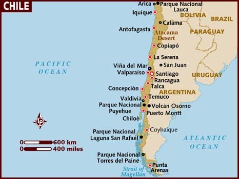
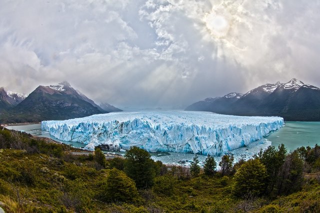
Chile is located on the southwest coast of South America, bounded on the north by Peru, on the south by the South Pole, on the east by Argentina and Bolivia, and on the west by the Pacific Ocean. Its shape is peculiar, it is one of the longest countries in the world, with 4,300 km in length, as well as one of the narrowest, with an average width of only 180 km. Its landscape is very varied, with deserts such as the Atacama in the north, mountains, glaciers, forests in the south, and fertile lands in the central region.
It has 15 regions (Arica and Parinacota, Tarapacá, Antofagasta, Atacama, Coquimbo, Valparaíso, Metropolitan of Santiago, Libertador General Bernardo O'Higgins, Maule, Biobío, La Araucanía, Los Ríos, Los Lagos, Aysén of General Carlos Ibáñez del Campo , Magellan and Chilean Antarctic).

Did you know…?
Colombia

Official name of the country : Republic of Colombia.
Area : 1,141,748 km2.
Capital : Bogota (founded in 1538 by Gonzalo Jimenez de Quesada).
Other important cities : Cali, Medellin, Barranquilla, Cartagena, Cucuta, Bucaramanga, Pereira, Ibague, Maninnzales, Pasto, among others.
Official language : Spanish.
Currency : Colombian peso.
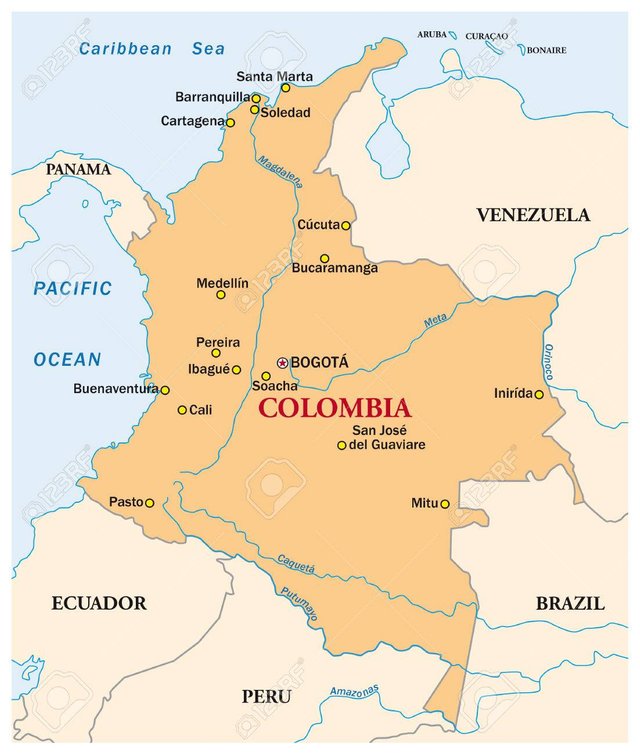
Colombia "land of coffee", is considered as the gateway to South America and is located northwest of South America. It has coasted to the Pacific and the Caribbean Sea, separated by the Isthmus of Panama. It borders on the north with the Caribbean Sea, on the east with Venezuela and Brazil, on the south with Peru and Ecuador, on the west with the Pacific Ocean, and on the northwest with Panama.
Colombia is Amazonas, Antioquia, Arauca, Atlántico, Bogotá, Bolívar, Boyacá, Caldas, Caquetá, Casanare, Cauca, Cesar, Chocó, Córdoba, Cundinamarca, Guainía, Guaviare, Huila, La Guajira, Magdalena, Meta, Nariño, Norte de Santander , Putumayo, Quindío, Risaralda, San Andrés and Providencia, Santander, Sucre, Tolima, Valle del Cauca, Vaupés, Vichada
Colombia is famous for its coffee. once the beans are harvested, they are washed, fermented and left to dry in the sun. Finally, they are toasted and the coffee is ready for sale!
Half of the world's emeralds are produced in Colombia. The purest are found in Muzo north of Bogotá.
Did you know…
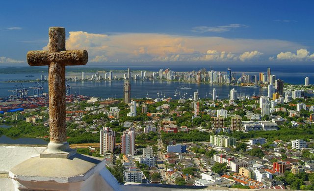
Ecuador
Official name of the country : Republic of Ecuador.
Area : 272,044 km2.
Capital : Quito (founded in 1534 by Sebastian de Benalcazar).
Other important cities : Guayaquil, Cuenca, Machala, Portoviejo, Manta, Ambato, Santo Domingo, Esmeraldas, Loja, Riobamba, Ibarra.
Official language : Spanish.
Currency : US Dollar.
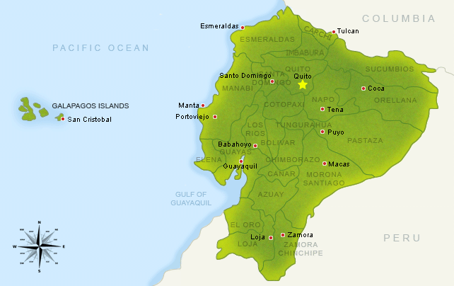
Ecuador is located in the Northwest of South America, in the zone where the continent penetrates more into the Pacific. Located between Colombia to the north, but to the east and south, and the Pacific Ocean to the west, it completes its territory with an insular part formed by the Galapagos Islands, located on the ocean, 1,000 km from the coast. His name must have been Quito (Quito in the Inca language). This was called for more than 1,000 years, but after independence, its name was designated due to the equatorial line that crosses the country.
This country is divided into; Parishes, which conform the Cantons, these the Provinces, and these, in turn, the Administrative Regions. Each of these entities and the Metropolitan Districts has a Decentralized Autonomous Government, in charge of executing policies within their scope.
The Galapagos Islands are 1000 km from Ecuador. They are named for their giant tortoises, unique in the world.
Did you know…? Ecuador has a remarkable biodiversity: one-sixth of the number of animal and plant species in the world? Some of the most curious are found in the archipelago of Colon or Galápagos (located 970 km from the Ecuadorian coast), where there are plant and animal species that do not exist in other parts of the world.
Guyana
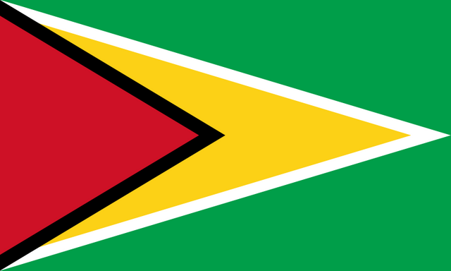
Official name of the country : Republic of Guyana.
Area : 214,970 km2.
Capital : Georgetown.
Other important cities : Linden, New Amsterdam, Corriverton, Bartica.
Official language : English.
Currency : Dolar de Guayana.
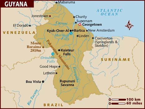
Guyana is a republic since 1970, it is located on the north coast of South America, former British Guyana, member of the Commonwealth. Bordered on the north by the Atlantic Ocean, east by Suriname, south, and west by Brazil and west by Venezuela. It is divided into 10 regions: Barima-Waini, Pomeroon-Supenaam, Essequibo-Demerara Occidental, Demerara-Mahaica, Mahaica-Berbice, East Berbice-Corentyne, Cuyuni-Mazaruni, Potaro-Siparuni, Alto Tacutu-Alto Essequibo and Alto Demerara -Berbice.
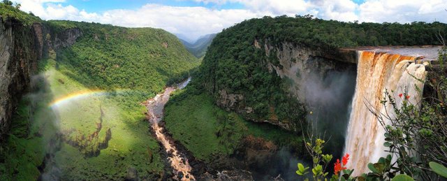
Guyana means, "land of many rivers". One of them is the Optara, which has a drop of 226 meters in the impressive Kaiteur waterfalls.
Paraguay
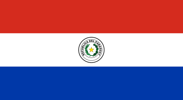
Official name of the country : Republic of Paraguay.
Area : 406,752 km2.
Capital : Asuncion (founded in 1537 by Juan de Salazar and Espinosa).
Other important cities : Ciudad del Este, San Lorenzo, Lambare, Fernando de la Mora, Concepcion, San Pedro, among others.
Official language : Spanish and Guarani.
Currency : Guarani.

Paraguay is bordered to the northwest and north by Bolivia, east by Brazil, south, and southwest by Argentina. Its territory, like that of Bolivia, does not have access to the sea.
Agriculture is its main economic activity and far exceeds local needs. Soybeans, tapioca, cotton, sugarcane, corn, soybeans, sweet potatoes, bananas, oranges, and wheat are the main agricultural products. The raising of cattle, main cattle, constitutes a primordial agricultural activity.
The Paraguay River divides the country into two regions: El Chaco or Paraguay west to the west and Paraguay east to the east. the country is conformed by 17 departments in which are: Concepción »Concepción, San Pedro, Cordillera, Guairá, Caaguazú, Caazapá, Itapúa, Misiones, Paraguarí, Alto Paraná, Central, Ñeembucú, Amambay, Canindeyú, president, Hayes, Boquerón and Alto Paraguay.
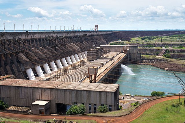
Did you know… The Itaipu dam located on the Paraná river generates almost all the electricity in the country??
Peru
Official name of the country : Republic of Peru.
Area : 1,285,216 km2.
Capital : Lima (founded in 1535 by Francisco Pizarro).
Other important cities : Callao, Arequipa, Trujillo, Chiclayo, Piura, Iquitos, Huancayo, Cuzco.
Official language : Spanish.
Currency : New Sun.
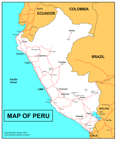
Peru is located in the region of South America and borders Ecuador and Colombia to the north, Chile to the south, Brazil and Bolivia to the east, and the Pacific Ocean to the west. Peru is divided into three regions: the coastal zone, the mountains, and the mountainous area.
Peru's largest cities, as well as its industrial zone, are located in the coastal zone. While the mountains occupy about 30% of the territory and cross the country from southeast to northwest. To the northeast of the mountain range is the jungle, which extends to Brazil.
Peru is divided into 24 departments: Amazonas, Ancash, Apurimac, Arequipa, Ayacucho, Cajamarca, Cusco, Huancavelica, Huanuco, Ica, Junin, La Libertad, Lambayeque, Lima-Provinces, Loreto, Madre de Dios, Moquegua, Pasco, Piura , Puno, San Martin, Tacna, Tumbes and Ucayali. In addition to Callao, constitutional province.
Its highest point is Huascarán with 6768 meters in height. Titicaca stands out among the lakes.
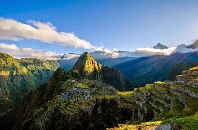
Peru was the center of the vast INCA empire. there they built buildings with large blocks of stone, as can be seen in the ruins of Machu Pichu.
Did you know… Is Peru the fourth largest fishing country in the world? Sardines, anchovies or tuna are canned or frozen for export to the whole world.
Uruguay

Official name of the country : Eastern Republic of Urugay.
Area : 176,215 km2.
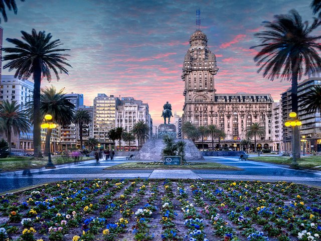
Capital : Montevideo (founded in 1726 by Bruno Mauricio de Zabala).
Other important cities : Salto, Paysandu, Las Piedras, Rivera, Melo, among others.
Official language : Spanish.
Currency : Uruguayan peso.
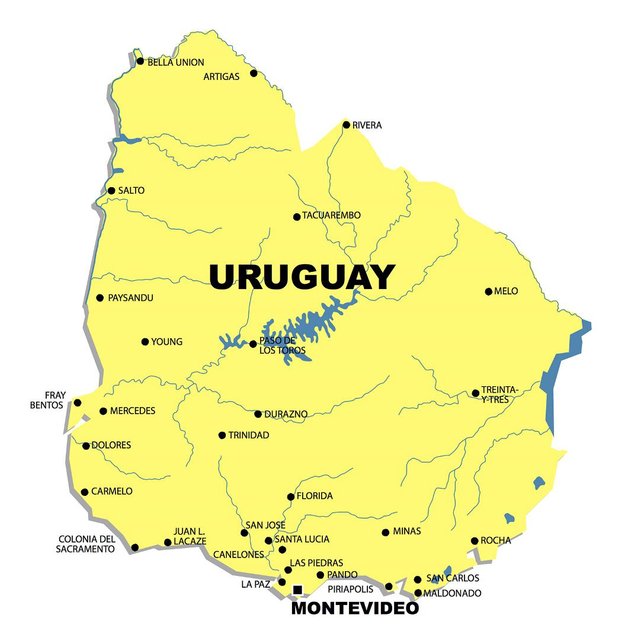
Uruguay is a country with the coast in the Atlantic and limits to the north and this with Brazil, to the west with Argentina, and to the south with the river of the Silver, and to the east with the Atlantic Ocean. The border with Argentina is the Uruguay river and with Brazil the Cuareim river, by the north. The capital of the country is Montevideo, the official language is Spanish. The country is divided into 19 departments: Artigas, Salto, Paysandú, Rivera, Tacuarembó, Cerro Largo, Treinta y Tres, Soriano, Durazno, Río Negro, Colonia, Flores, Florida, Lavalleja, Rocha, Caneloes, Maldonado, San José, and Montevideo.
Uruguay has a long coastline full of sandy beaches and is one of the smallest countries in South America. Montevideo, its capital, concentrates almost half of the population.
Did you know…? Uruguay has one of the highest rates of schooling in Latin America?
Venezuela

Official name of the country : Bolivarian Republic of Venezuela.
Area : 912,050 km2.
Capital : Caracas (founded in 1567 by Diego de Lozada).
Other important cities : Maracabia, San Cristobal, Valencia, Barcelona, Maracay, Ciudad Bolivar, Barquisimento, Maturin, Merida, among others.
Official language : Spanish.
Currency : Bolivar.
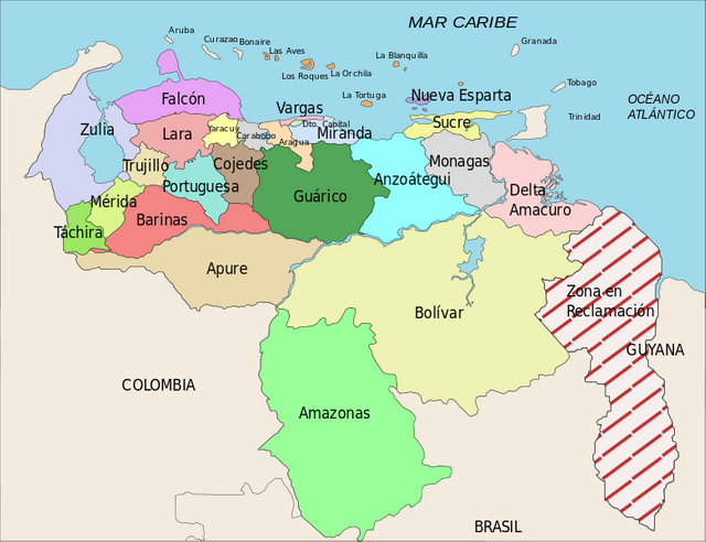
Venezuela is located in the north of South America, its border borders are Colombia to the west, Brazil to the south and Guyana to the east. To the North of the country is the Caribbean Sea. It is the nation richest in natural resources of this part of the continent, thanks to the oil reserves of the Orinoco oil belt. The Venezuelan territory is divided into 23 states, a Capital District (Caracas).
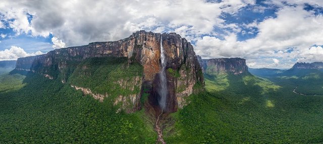
In Venezuela, there are the highest waterfalls in the world, "Angel Falls", which fall on the jungle from 979 meters. They became famous in 1937 when the pilot James Angel gave them his name.
Venezuela was a mainly agricultural country until huge oil reserves were found in Lake Maracaibo, currently, it has the largest oil reserves in the world, located in the Orinoco oil belt.
Despite being such a rich country, in natural resources, minerals, and human talent, this country is governed by a "socialist" dictatorship regime, where 15% of the population has had to emigrate to other countries due to the great economic crisis, the high level of corruption in all its ministries and governments.
Did you know…?
CONCLUSION
- The South American continent contains some of the most populated cities in the world and many of them concentrate a large percentage of the population of their country. Some examples are Sao Paulo and Rio de Janeiro in Brazil, Buenos Aires in Argentina, Lima in Peru, Caracas in Venezuela and Bogotá in Colombia.
- The American continent presents a very broad climate variety, which corresponds to the extension of its territory. This influences the distribution of its flora and faunam that offer an amazing biodiversity.
Thank you all for joining me in this fantastic and perfect exercise for the development of children, With this fun series of questions and answers, you can have a good time with the little ones in the house, help you in your physical and mental development, allowing you to expand his technique of concentration and observation to help them understand their environment. In addition, they provide us with the necessary knowledge and skills that allow us to protect ourselves against all adversities.
REFERENCES
- South America.
- Argentina.
- Bolivia.
- Brazil.
- Chile.
- Colombia.
- Ecuador.
- Venezuela.

@steemiteducation "If we are alone in the Universe, it would surely be a terrible loss of space" - Carl Sagan

@saracampero
(promoting education)

@ecoTrain
Supporting People Who Help
Make The World A Better Place
Discover amazing people in the ecoTrain magazine at @ecoTrain


@eSteemapp
🌐eSteem.app| 👨💻GitHub| 📺YouTube
✍🏻Telegram| 💬Discord
vote witness@good-karma
Please replace one of the pictures with a watermark so that we can support you.
Work completed @steemiteducation, thanks for the recommendations
Congratulations @saracampero! You have completed the following achievement on Steemit and have been rewarded with new badge(s) :
Click on the badge to view your Board of Honor.
If you no longer want to receive notifications, reply to this comment with the word
STOPTo support your work, I also upvoted your post!