Fetsund Timber Booms
Yesterday we had a quick walk at Fetsund Lenser. I love this place, it's particularly nice to go there with kids. I would strongly encourage a stop here if you're ever in the area.
The longest river in Norway meets a lake a bit downstream from here, the river was used for timber transport, so in this place they had massive installations to intercept the timber, they would pick it up, throw it on barges, and then it would be transported across the lake by ship.
At some point it became unprofitable to transport the timber by river as compared with transporting it by the car roads, so the last timber was collected in 1985. Eventually they turned the place into a museum - and that's a great thing, it's a very nice place. There is quite a lot to see in this area - unfortunately this time we didn't have much time.
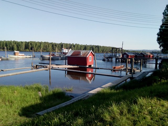
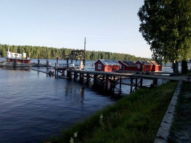
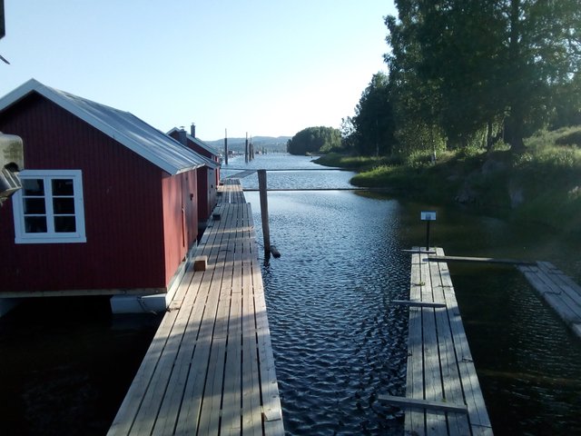
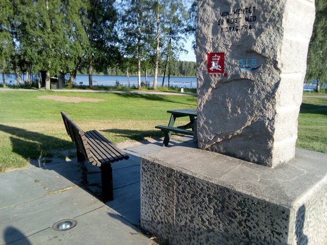
Here are some buildings and some boats. View downstream.
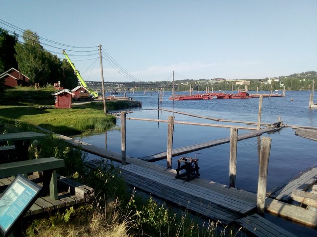
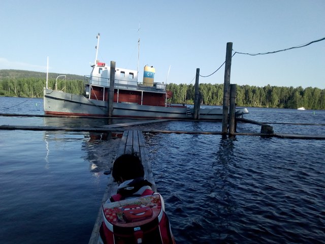
View upstream.
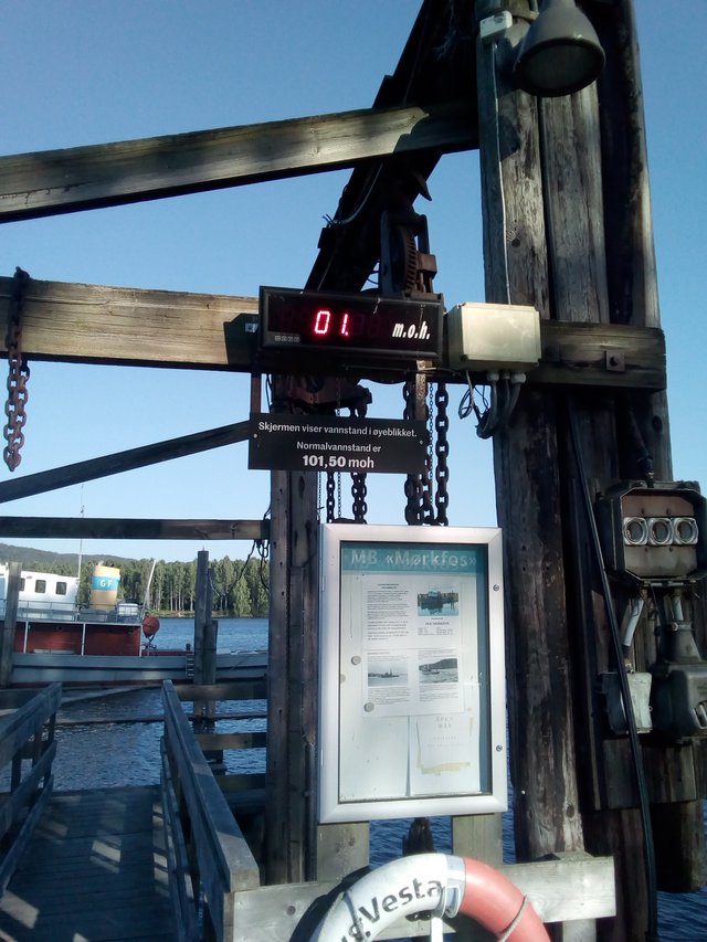
I don't remember this sign before, it's probably new - it shows the water level. Unfortunately the technology used is not compatible with my camera. It read 101.38 - we're currently having a drought here in southern Norway, we've had extraordinary much sun, extraordinary high temperatures and extraordinary little rain during the last two months. The water level is 12 cm below the normal. I was actually expecting even lower water levels. Last time I was here, it was a small flood and probably some 20-30 cm above the normal.
There seemed to be no current at all in the river today, with the low water level and wind going upstream.
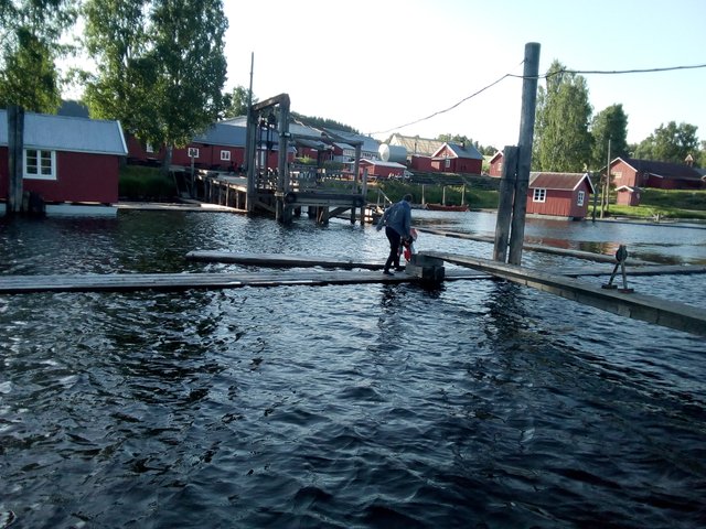
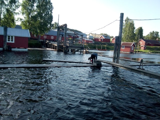
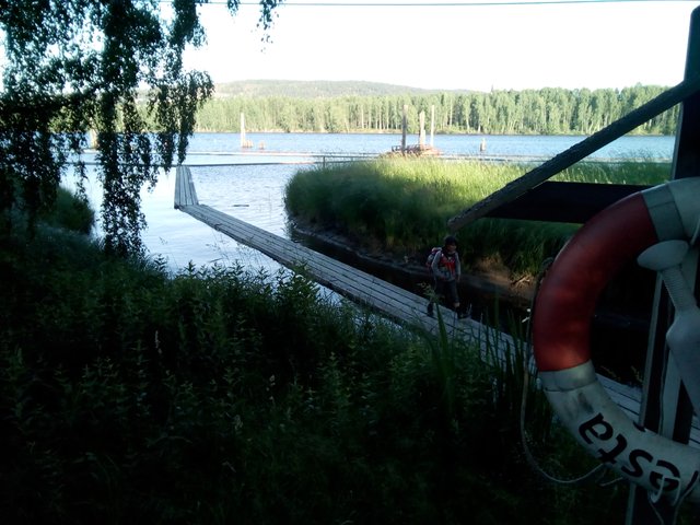
Kids were playing from the moment they came out at the water. The floats where slightly unstable, here they have found a short segment that is connected with the main walkway by a relatively long chain. Came to think, for my youngest son that haven't even learned to swim yet, probably a life west would be more appropriate than a rucksack.
The timber was directed between those two walkways.
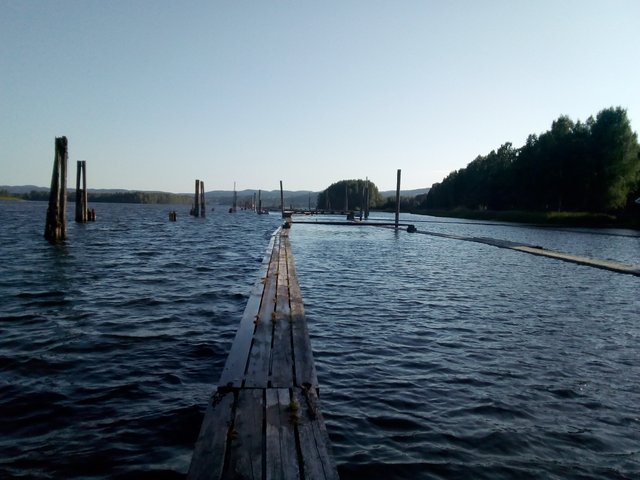

I'm not sure if this walkway has been there, it feels to me that they made it like this for the pleasure of tourists.
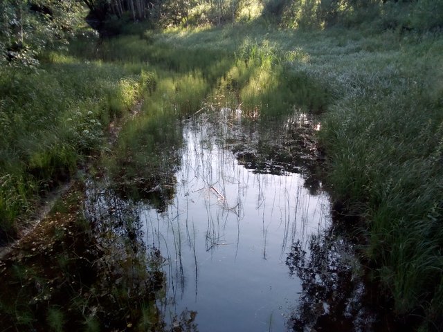
A small stream - is it visible that there is 12 cm of water "missing" here?
This is a flood monument. The last big flood was in 1995.
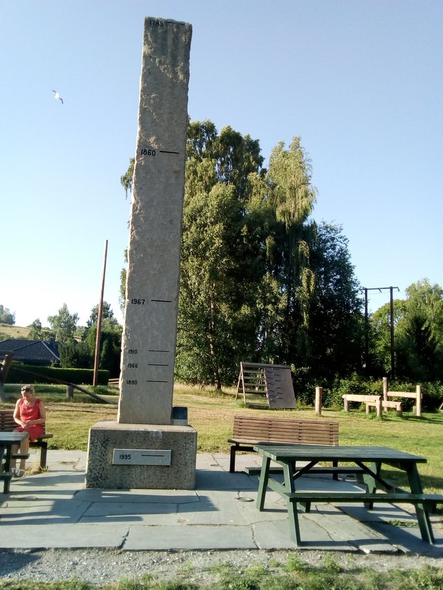
As you can see, we're quite far away from the river and quite high above it as well. I cannot understand how so much land can be flooded. Flooding is relatively rare in Norway, we have mountains, sea, islands and hills ... and not so many big lakes, plains and rivers. Anyway, this is Norways biggest river, so probably this is also the site in Norway with the worst floods? The land here is pretty flat as well.
Here are the measurements in cm - it must be relative to the place of this flood monument. The water level will already be several metres above normal water level before it comes up to the flood monument.
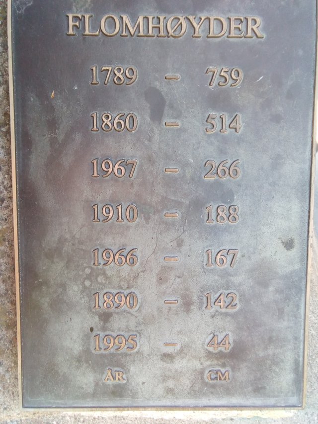
Worth noting, the total amounts of water in 1995 was much bigger than in 1967. More dams have been built upstream, causing a better management of the water masses, again probably causing the flood to last for longer, but not grow that insanely high.
Further reading and references:
English:
Norwegian:
- Fetsund Lenser - Museumene i Akershus
- Fetsund Lenser - wikipedia (Norwegian)
- Flomstøtta ved Fetund - norsk hydrologiwiki
- Photos with comments from Lillestrøm 1995 (Norwegian)
The two boys of mine has been at the grandmother in Tromsø, and arrived by airplane today. We went by car this time, and we're passing nearby Lillestrøm at the way, so I thought it would be a quick detour to visit Fetsund on the way. Unfortunately, my wife had timed the dinner to be ready when she expected us home, so she was not much happy with this trip.
All photos available in better resolution on IPFS QmWNY4da4Nva4JmAUEydvXH41U4euF5jXVs3w3x9seVB8f. License: CC BY-SA 4.0
Congratulations, Your Post Has Been Added To The Steemit Worldmap!
Author link: http://steemitworldmap.com?author=tobixen
Post link: http://steemitworldmap.com?post=fetsund-timber-booms
Want to have your post on the map too?
Beautiful pictures. With the pictures indicate that kids enjoyed a lot. Great photography as well. Rightly said, people should have a visit this nice place.
Great job I like it
Oh my gosh, those flood levels! 😨 Beautiful place, though.
its super nice there have been in the same area on a bike. nice photos interesting on the walk ways whit the timber never seen it like this befor. just seen the "normal one where u have one big place where it all come together way bigger these this. is it more places where the timber where move off the river maby? seem complicated to get the big logs in the this small opening. "Storofsen" in 1789 even in gubransdalen where am from its was over 7 meter above normal. crazy stuff to think of. like them to make a bit more room on top of the big stone. bot maby good thing to.
I think the whole river was covered with diagonal walkways, guiding the timber in the right direction.
a was thinking it was like a place the remove them form the river but this make way more sens
Hiya, just swinging by to let you know that this post made the Honorable Mentions list in our daily Travel Digest. Please drop by to check out all the rest of today's great posts and consider upvoting the Travel Digest if you like what we're doing.