British Advanced Landing Grounds In Europe, WW 2, "B" Series
B Series Airfields
B1
Asnelles-Sur-Mer, Carpiquet.
49^20’25”N, 00^34’58”W
France
Opened 10 June 1944
Off Gold Beach,
Operational with Spitfires on D-Day + 4
B2
Bazenille.
49^18’17”N, 00^ 33’43”W
France
Lower Normandy,
Used by RAF, RCAF, FFAF
B3
St Croix-Sur-Mer, Banville
49^19’08”N, 00^ 31’06”W
France
Lower Normandy,
Used by RAF, FFAF
B4
Beny-sur-Mer, Douvers,
49^ 17’54”N, 00^25’49”W
France,
Used by RCAF
B5
Le Fresne, Camily,
49^15’58”N, 00^29’07”W
France
B6
Coulombs, St Croix-Grand-Tonne
49^14’41”N, 00^33’07”W
France,
Opened August 1944
Closed ?
Used by 137 Sqn RAF [Typhons] from August 1944
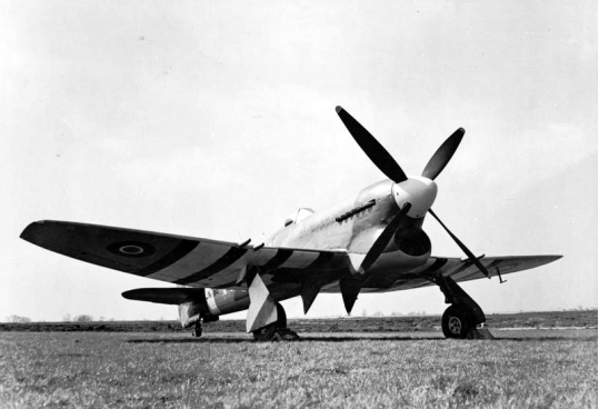
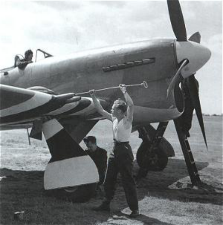
Hawker Typhoon
B7
Rucqueville, Martagny
49^15^11”N, 00^36”58”W
France
B8
Sommervieu
49^18’00”N, 00^40’43”W
France,
B9
Lantheuil
49^16’22”N, 00^31’41”W
France,
Used by RAF,RCAF
B10
Plumetot
49^16’22”N, 00^21’20”W
France,
B11
Longues-su-Mer,
49^20”34”N, 00^41’27”W
France,
Used by RAF, RCAF, RAAF,
Has a Memorial
B12
Ellon
49^12’58”N, 00^39’52”W
France
B13
Not Used
B14
Amblie
49^17’21”N. 00^29’25”W
France
B15
Ryes
49^18’46”N, 00^37’25”W
France
B16
Vilons-Les-Buissons
49^14’07”N, 00^24’29”W
France,
Used by RAF, RNAF,
B17
Carpiquet, Caen,
49^10’36”N, 00^27’26”W
France,
Opened 17 August 1939 by France, used to assemble aircraft for SNCA
Captured in June 1940 by Germany and used as a rear base during the Battle Of Britain
Mainly used for long-range reconnaissance aircraft
Fitted with Lorenz night flying system
7 heavy flak and 14 light flak positions
[the first of the existing airfields to be captured and re-used]
One of the objectives of the 3rd Canadian Division during the invasion, the airfield was taken during ‘Operation Windsor’ on 9 July 1944.
Runway 5,400 feet long approx
Concrete
Used by 485 [NZ] Squadron 31 August 1944 to 12 September 1944
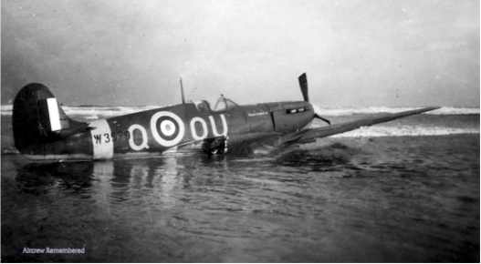
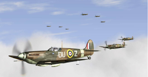
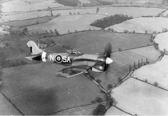
Supermarine Spitfire Vb W3579, Wing Commander Ryder, 485 [NZ] Squadron,
Landing at Dunkirk
Now Caen - Carpiquet Airport
B18
Cristot
49^11’41”N, 00^34’48”W
France
B19
Lingevres
49^10’41”N, 00^40’23”W
France
B20
Demouville
49^10’41”N, 00^16’08”W
France
Not used
B21
Sainte-Hononine, Caumont
49^49’28”N, 00^29’08”W
France
B22
Authie
49^12’23”N, 00^25’52”W
France
B23
Morainville /La Rue Huguenot
49^12’06”N, 00^26’10”E
France
B24
St Andre-de-L’Eure
48^53’43”N, 01^15’05”E
France,
Opened November 1944,
Closed September 1945,
Used by 184 Squadron RAF
Used by 442d Troop Carrier Group USAAF
Runway 14 / 32
250 feet wide x 5,260 feet long
Concrete
Runway 06 / 24
250 feet wide x 5,220 feet long
Concrete
Now Saint - Andre - de - l’Eure Airport
B25
Le Theil Nolent [Le Treport]
49^09’15”N, 00^32’017”E
France
B26
Lillers l’Eveque
48^49’18”N, 01^16’01”E
France
B27
Boisney
49^09’16”N, 00^39’21”E
France
B28
Evreux / Fauville
49^01’39”N, 01^13’06”E
France,
Now FAF Base Evreux - Fauville
B29
Valailles [Bemay]
49^07’18”N, 00^36’06”E
France
B30
Creton
48^49’53”N, 01^17’17”E
France
B31
Londiniere [Frosnoy, Folny]
49^53’16”N, 01^29’43”E
France
B32
Prey
48^57’47”N, 01^12’43”E
France
Not completed
B33
Carnpneuseville
49^51’32”N, 01^29’27”E
France
B34
Angers / Avrill
48^32’21”N. 00^36’52”W
France
B35
Godelemesnil
50^00’19”N, 01^24’44”E
France
B35
Reune ?
France
Used by 485 [NZ] Squadron RAF 7 September 1944 12 September 1944
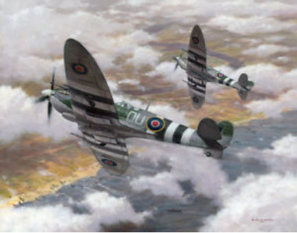
Supermarine Spitfire 1X, ML 407, 485 [NZ] Squadron
B36
Boussey
48^53’52”N, 01^24’21”E
France,
Not completed
Now La Couture - Boussey
B37
Corroy [Tours-en-Vimeal]
48^42’08”N. 03^56’20”E
France
B38
La Lande /La Lande - sur Eure
48^33’26”N, 00^51’50”E
France
B39
Ecoufflar
France
Not completed
B40
Beauvias / Nivillers
49^27’23”N. 02^09’58”E
France
B41
Le Plouy
50^40’N. 02^08’E
France
Not completed
B42 / A61
Beauvais / Till
49^27’16”N 02^06’46”E
France,
Captured 6 September
Opened 10 September 1944
Closed 17 August 1945
Used by USAAF 322nd Bombardment Group September 1944 to March 1945
[B - 26]
Runway 12 / 30
164 feet wide x 6,023 feet long
Concrete
Runway 04 / 22
164 feet wide x 5,510 feet long
Concrete
Now Paris Beauvais Airport
B43
St Omer / Fort Rouge
50^45’01”N, 02^15’07”E
France
B44
Poix / Croixrault
48^57’52N. 04^36’57”E
France,
Used by RAF,
USAAF 314th Troop Carrier Group February to October 1945
Runway 04 / 22
165 feet wide x 5,160 feet long,
Concrete/Asphalt
B45
St Omer / Louguenesse [Wizernes]
50^44’16”N, 02^14’43”E
France
B46
Grandvilliers
49^39’57”N. 01^56’23”E
France
B47
Enquin
France
Not completed
B48
Amiens / Glisy
49^52’20”N, 02^23’20”E
France,
Opened as a French Air Force Airfield in 1937,
The Luftwaffe added considerable improvements after taking over in June 1940.
It was used as a major bomber base during the air offensive against England.
Little used after July 1941.
Both runways equipped with permanent illumination and flare paths, and a visual Lorenz system for night flying,
Defended with 4 heavy and 10 light flak positions surrounding the airfield by September 1943.
With a satellite airfield at Amiens - Boves [49^49’35”N, 02^25’40”E] and a
Decoy field at Amiens - Camon 5km SSW,
And a dummy flare path 3 km NNW of the main airfield
Liberated by the British Second Army in August 1944.
Used by 488 [NZ] Squadron August to November 1944
De Havilland DH 98 Mosquito, 488 [NZ] Squadron
Used by USAAF 315th Troop Carrier Group 6 April to May 1945
438th Troop Carrier Group 3 May to August 1945
HQ, 52nd Troop Carrier Wing 5 March to 20 Jun 1945
Runway 12 / 30
164 feet wide x 5,310 feet long
Concrete
Runway 05 / 23
164 feet wide x 5,244 feet long
Concrete
Now Amiens - Glisy Airport
B49
Lisbourg
France
Not completed
B50
Virty - en - Artois
50^20’14”N, 02^59’31”E
France,
Runway 11 / 29
160 feet wide x 5,400 feet long
Concrete
Runway 05 / 23
160 feet wide x 5,250 feet long
Tar Sealed
Now Vitry - En - Artois Airport
B51
Lille / Vendeville [Lesquin]
50^34’00”N, 03^06’11”E
France
B52
Doual / Dechy
50^21’09”N. 03^07’43”E
France
B53
Merville / Calonne
50^37’01” N. 02^38’27”E
France,
Built by France in 1936
Used by RAF during the phoney war [September 1939 to May 1940]
Taken over by Luftwaffe and used during “The Battle Of Britain”
Used as a bomber base,
Operational use fell of to almost nothing June 1941 to August 1943
Used for flying training
Equipped with Lorenz night flying system
Defended by 7 light flak positions in Oct 43
Captured
Opened September1944
Closed ?
Also known as AAF - 182
Used by 135 Wing [122, 222, and 485 [NZ] Squadron]

Supermarine Spitfire Mk 1X. 485 [NZ] Squadron
Runway 04 / 22
160 feet wide x 5,280 feet long
Concrete
Runway 14 / 32
160 feet wide x 5,280 feet long
Concrete
B54
Achiet [Bapaume / Grevillers
50^06’19”N, 02^47’04”E
France,
Used by USAAF 313th Troop Carrier Group 28 February to 4 August 1945
Runway 11 / 29
150 feet wide x 3,960 feet long
Concrete
Runway 03 / 21
250 feet wide x 4,950 feet long
Asphalt
B55
Courtral / Wevelghem
50^49’08”N, 03^12’35”E
Belgium,
B56
Brussels / Evere
50^54’03”N, 04^20’09”E
Belgium
B57
Lille / Wambrechies
50^41’14”N. 03^04’33”E
France
B58
Brussels / Melsboerk
50^54’26”N, 04^29’33”E
Belgium
Built by Belgium as a fighter airfield in the late 1930s
Occupied by Luftwaffe May/June 1940
Equipped with Lorenz for night flying
3 heavy flak positions with up to 6 guns each, and 9 light flak positions
Captured
Opened
Closed
Used by No 487 [NZ] Squadron
De Havilland DH 98 Mosquito Mk Vb, 487 [NZ] Squadron
Runway 5,700 feet long approx
Concrete
Runway 5,200 feet long approx
Concrete
Runway 5,200 feet long approx
Concrete [approx]
B59
Ypres / Vlarnertinge
50^49’25”N. 02^50’01”E
Belgium
B60
Brussels / Grimbergen
50^56’56”N 04^23’31”E
Belgium
Belgium Air Force base.
Taken over by Germany on 18 May 1940
1 heavy and 4 light flak defence positions
Captured 3 September
Opened 6 September 1944
Closed ?
Used by 3 x 122 Wing, Mustang Squadrons
Used by C47s supporting operations in the Arnheim area
Used by 486 [NZ] Sqn RAF 28 September 1944 2 October 1944
Hawker Tempest Mk V, NV969, 486 [NZ[ Squadron
Used by 132 “Norwegian” Wing 2 October to December 1944
Used by 131 “Polish” Wing January to April 1945
Used by USAAF to stock pile their excess equipment prior to sale or return to the USA
Two pilots of No. 486 [NZ] Squadron , Warrant Officer Owen David "Ginger" Eagleson (NZ 421689) of Auckland, and Flying Officer Raymond John Cammock (NZ 414723) of Christchurch, stand by the tail of a Hawker Tempest four days after the Squadron's arrival at B60 Grimbergen airfield, Belgium. October 2 1944.
Both pilots achieved high scores against V.1 flying-bombs launched against the United Kingdom before the Squadron moved to Europe; Eagleson destroyed 21 and Cammock 20.5. (0.5 = one shared)
[ex Ohakea Museum]
486 [NZ] Squadron at B60 Grimbergen airfield
B61
Gent St Denis Westrem
51^01’36N. 03^41’22”E
Belgium
B62 / A92
St Trond / Brusthem Saint Truiden
50^47’23N, 05^11’48E
Belgium,
Captured 16 September
Opened 18 September 1944
Closed ?
Used by USAAF 48th Fighter Group 30 September 1944 to March 1945
[A - 20]
Douglas A 20 Havoc
Used by USAAF 404th Fighter Group 4 October 1944 to 30 March 1945
[P - 38]
Lockheed P 38 Lightning
Used by USAAF 386th Bombardment Group 9 April to 27 July 1945
[B - 26]
Martin B 26 Marauder
Runway 14 / 32
165 feet wide x 5,250 feet long
Concrete
Runway 09 / 27
165 feet wide x 4,740 feet long
Concrete
Runway 06 / 24
165 feet wide x 5,70 feet long
Concrete
Now BAF Sint - Truiden Air Base
B63
Bruges / St Croix
51^12’51”N, 03^15’05”E
Belgium
B64
Diest / Schaffen
51^00’07”N, 05^03’52”E
Belgium
B65
Eekloo / Maldeghem
51^11’53”N, 03^28’41”E
Belgium
A pre-war Belgium airfield
Luftwaffe upgraded extensively prior to the Battle of Britain.
Little used after that offensive.
From October 1940 to April 1941 the airfield was extensively used by Fiat G50s of the Corpo Aereo Italino [Italy]
Fiat G50 Freccia Light Fighter
From 1941 onwards the Luftwaffe resumed operations from the airfield
14 light flak positions in towers and 2 AA machine guns in January 1944
Runway 270 feet wide x 2,250 feet long
Concrete
Captured September
Opened Sepyember 1944
Closed ?
Home of 135 Wing [122 , 222, and 485 [NZ] Squadron
Used by 485 [NZ] Sqn RAF 1 November to 5 November 1944
Used by 485 [NZ] Sqn RAF 24 November 1944 13 January 1945
485 [NZ] Squadron
The concrete rubble from the airfield was used to build a pilgrimage site dedicated to “The Virgin Mary” in the nearby village of Kleit.
Some of the hangers have inscriptions in German, Italian and English inside them and they are protected as historical sites.
Queen Wilhelmina returned to Belgium here after the war.
B66
Blankenberg
50^56’43N, 05^03’01E
Belgium
B67
Ursel
51^07’30”N 03^27’14”E
Belgium
Now a Belgium Air Force Reserve Base
B68 / A89
Le Culot [Beauvechain]
50^46’20”N. 04^46’04”E
Belgium,
Captured 28 October
Opened 28 October 1944
Closed ?
Used by USAAF 373rd Fighter Group 22 October 1944 to 11 March 1945
[P - 47]
Republic P 47 Thunderbolt
Used by USAAF 36th Fighter Group 27 October 1944 to 26 March 1945
[P - 47]
Used by USAAF 322nd Bombardment Group March to June 1945
[B - 26]
Runway 04 / 22
165 feet wide x 5,793 feet long
PSP / Tar Seal
Runway 12 / 30
165 feet wide x 4,955 feet long
Tar Seal
Now BAF Beauvechain Air Base
B69
Meerbeke
51^49’25”N, 04^52’26”E
Belgium
B70
Antwerp/ Deume
51^11’24”N, 04^27’41”E
Belgium
B71
Coxyde / Fumes
51^05’22”N, 02^39’22”E
Belgium
B72 / A75
Cambrai / Epony
50^13’50”N, 03^09’48”E
France,
Captured 17 May 40
Opened 17 May 40
Used by Germany until
Opened 12 September
Closed 16 September 1944
Used by 487 [NZ] Squadron
487 [NZ] Squadron, updating the “Nose Art”
Used as an Emergence Refueling and Re-Arming Airfield
Runway 05 / 23
165 feet wide x 5,300 feet long
Concrete
Runway 17 / 35
165 feet wide x 5,425 feet long
Concrete / PSP
B73
Moorseele
50^51’06”N 03^08’54”E
Belgium
B74 / A83
Denain / Prouvy [Valenciennes]
50^19’N, 03^09’E
France,
B75
Nivelles
50^35’53”N, 04^19’42”E
Belgium
B76
Peer
51^10”01”N, 05^28’03”E
Belgium
B77
Breda / Gilze Rijen
51^33’50”N. 04^56’18”E
Netherlands
Limited Civil and Military use recorded from 1909
Developed as Nerhoven Airport in 1937
Captured by Luftwaffe 10/12 May 1940, and merged with Molenheide,
building largely completed by the end of 1940
One of the most important Bomber and Night Fighter bases in the West
Equipped with Lorenz for night flying.
Well camouflaged to look like farm buildings.
3 Heavy Flak positions with 4 guns each, 10 Light flak positions, most of which were in towers.
There were also 8 searchlight positions as part of the defenses
On 11 January 42, there were 2,840 Officers and Men working at the Base
The Luftwaffe departed the Base 4/5 September 1944
Captured
Opened
Closed
Used by 485 [NZ] Squadron 13 January to 25 February 1945
Oooops, 485 [NZ] Squadron
Used by 486 [NZ] Sqn RAF 13 January to 25 February 1945
[Image Source]( ]
]
486 [NZ] Squadron, rearming with wing rockets
[Image Source]
Royal Air Force- 2nd Tactical Air Force, 1943-1945.
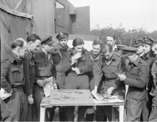
An Army Liaison Officer (7th from left), aided by photographs and a scale model, briefs Hawker Typhoon pilots of No. 123 Wing at B77/Gilze-Rijen, Holland, for an attack on the Headquarters of General Blaskowitz, the Commander-in-Chief of German Army Group H.
To the ALO's right, holding a cigarette to his mouth, stands Wing Commander J Button, the 123 Wing leader.
Runway 150 feet wide x 5,200 feet long
Concrete
B78
Eindhoven / Vligerbasis Eindhoven
51^27’04N, 05^22’29”E
Netherlands
B79
Bergen / Woensdrecht
51^26’55”N, 04^20’31”E
Netherlands
B80
Uden / Volkel
51^39’27”N, 05^42’22”E
Netherlands
Built by Germany using 4,300 Dutch workers and 150 trucks.
Initially equipped with 3 grass runways, 10 buildings and a heated hanger, and a staff of 75, for use as an ALG for Bf 110 night fighters.
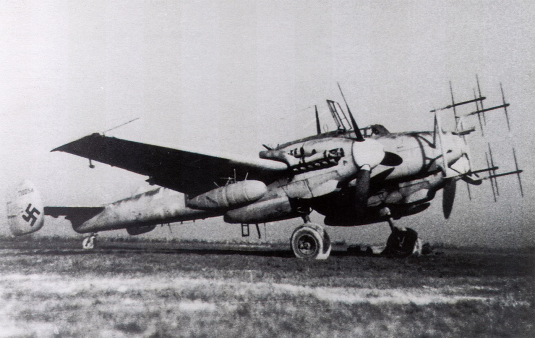
BF 110 G, night fighter
Upgraded in 1941 / 1942 to 43 covered aircraft shelters, all camouflaged as farm buildings,
Fitted with Lorenz night landing system
Defended with 25 light flak positions [20mm and 37mm] mounted in towers, and 9 searchlight positions
Luftwaffe withdrew 15 September 1944
Used by 486 [NZ] Sqn RAF 2 October 1944 10 April 1945
486 [NZ] Squadron on patrol in October 1944
Runway 150 feet wide x 4,560 feet long
Paved
Runway 150 feet wide x 4,900 feet long
Paved
Runway 150 feet wide x 3,840 feet long
Sod
Captured
Opened
Closed
B81
Le Madrillet [Rouen - Rouvray]
49^23’27”N 01^04’15”E
France
Now Technoppole Du Mandrillet in Saint - Etienne - du - Rouvray near Rouen
B82
Grave
51^45’32N, 05^44’18”E
Netherlands
B83
Knocke - le - Zoute
51^21’21”N, 03^20’56”E
Belgium
B84
Rips
51^31’01N, 05^25’58”E
Netherlands
B85
Schijindel
51^37’12”N 05^25’58”E
Netherlands
B86
Helmond
51^28’41”N, 05^39’04”E
Netherlands
B87
Rosieres - en - Santerre
49^48’17”N, 02^44’45”E
France,
Build by British Engineers for the RAF in 1939
Opened 18 October 1939
Used by 185 Squadron RAF Blenheim October 1939 to 17 May 1940
Used by 575 Squadron RAF Blenheim October 1939 to 17 May 1940
Occupied by Luftwaffe May 1940
Used by He 111 medium Bombers during the Battle Of Britain to June 1941
Used by Fw 190, 1943 to 1944
Defended by 2 heavy and 8 light flak positions
Captured
Opened August 1944
Closed November 1945
Used by USAAF 387th Bombardment Group 24 May to November 1945
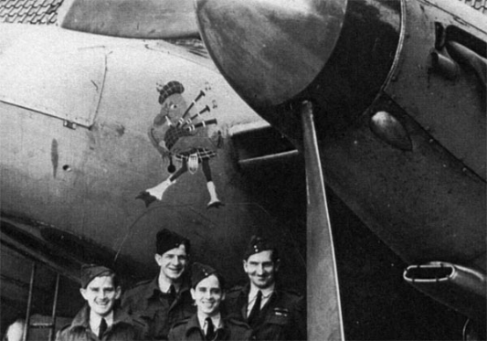
Used by 140 Wing [21 Squadron, 464 [RAAF] Squadron and 487 [NZ] Squadron to 17 April 1945, Mosquito FBV1
487 [NZ] Squadron, Nose Art
Runway 04 / 22 [03/21]
160 feet wide x 5,400 feet long
Concrete
Runway 16 / 34 [15/33]
160 feet wide x 5,300 feet long
Concrete
Runway [10/28]
160 feet wide x 5,200 feet long
Concrete
C-47 [Dakota] KG 630
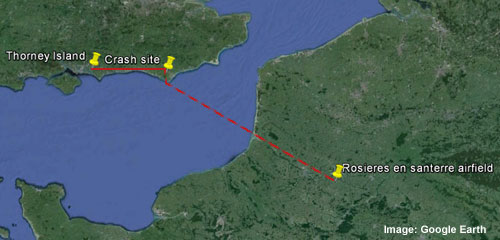
6 Feb 45 KG630 crashed in thick mist on the South Downs half a mile from Folkington, East Sussex en-route to Rosieres - en - Santerre.
Several Dakotas had been moving men from Thorney Island, Hampshire to
Rosieres - en - Santerre, At 0930 hrs two Dakotas took off from Thorney Island with RAF, RNZAF, RAAF and RCAF personnel and equipment aboard.
Only one reached Airfield B 87, Rosieres - en - Santerre.
Transcript of the Official Crash Report
575 Squadron Operation Transport. Aircraft: Dakota III KG630
1st Pilot: Oleinikoff P.M. (Aus) Warrant Officer
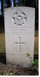
2nd Pilot: Barsby E.A. (Aus) Flight Sergeant
County: Sussex. Place: Hunters Burgh, Folkington
Flight duration: 30mins. Accident approximately 10.05a.m.
Transport of passengers from Thorney Island to B87 in low flight in cloud aircraft struck the side of a hill 500 feet above sea level.
Starboard wing broke off and aircraft crashed into the wood at bottom of it.
All occupants were killed, actual weather at the place of accident was worse than forecast.
Pilot struck high ground when either:
a) Descending through the cloud to fly contact or
b) Flying too low in cloud without knowing where he is and not paying attention to the higher ground below.
Pilot failed to brief himself sufficiently of the high ground en-route.
Weather forecast cloud base 1500ft. - 2000ft. with patches at 600ft. locally, but hill 500ft. ASL was in cloud.
Pilot not briefed re. high ground by Station Navigation Officer.
Aircraft struck hill 500ft Above Sea Level whilst flying in cloud.
Aircraft burnt out upon crashing.
As above, recommend that Station Navigation Officer briefs crews re. High ground and gives minimum safety height.
AOC concurs with findings and does not consider accident could have been avoided by action not already taken by DPA.
Transcript
This plane is from 575 Squadron, RAF. Broadwell Oxon. and was flying south.* The Downs where hidden by a thick mist and the machine struck the top of a hill and dived into a wood and caught fire.
A Mr. Ronald CROUCH, of Sayerlands, Polegate, was working 300 yards away but did not see the crash owing to the mist but ran towards the sound.
He found the blazing plane but could not see or hear anything of the crew.
He then rang for assistance and met Mr. PRODGER and Mr. HEATH who had come from Folkington Manor where they are employed.
Mr. HEATH returned to telephone the police whilst the others made a reconnaissance of the wreck and surrounding land in order to locate the occupants.
At 10.45 hrs. Mr. Reginald BECK of Polegate FAP and myself arrived with an ambulance and with my axe I managed to cut a way through the trees and branches which had been brought down by the plane.
The machine was still burning and small arms ammunition was occasionally exploding.
At about 10.55 hrs. Sgt. HOPKINS and PC. BOON arrived and was followed in about 15 minutes by Eastbourne NFS.
A body was located under the wreckage and with the help of Section Leader PHILLIPSON in charge of the NFS, the debris was moved and trees pulled away and further bodies recovered.
Rescue work was hampered by lack of water as the wreck burnt continually and it was 18.00 hrs. when the last body was removed.
During the later stages, the police were assisted by police from Hailsham and the NFS. was relieved by a crew from Eastbourne.
Difficult rescue work was made successful by the excellent co-operation of the above named.
RAF Guard was supplied from Friston.
Bodies were moved by tractors and trailers provided by Mr CARR, Home Farm, Folkington and Lt.Col GWYNNE, Folkington Manor as far as the Rectory and then by FAP. Ambulance and RAF. transport.
Time and date information received by Police: 10.30 hrs. 6th February, 1945.
Signature: Edward Page PC.94.
*Note:
Whilst KG630 originated from RAF Broadwell, its task was to move personnel and equipment from Thorney Island to France.
It seems possible that the aircraft had flown a route eastwards in poor visibility along the south coast to a point a few miles north of Beachy Head, the location of an RAF radio station, a useful way-marker in poor visibility, and a common departure point for aircraft leaving the south coast of the UK for the continent during WW2.
The accident then happened as the aircraft turned south or southeast and descended, presumably in an attempt to get below the forecast cloud-base, before passing over Beachy Head on course for Rosieres-en-Santerre.
Casualties
The 140 Tactical Bombing Wing of the RAF comprised 21 Squadron RAF, 464 Squadron RAAF and 487 Squadron RNZAF, so there were casualties from both UK and commonwealth countries.
The Dakota Crew (575 Squadron RAF Broadwell)
First Pilot - Warrant Officer Peter Matthew OLEINIKOFF RAAF (34yrs.)
Second Pilot - Flight Sergeant Edgar Alan BARSBY RAAF (20yrs.)
Navigator - Flying Officer Kenneth Gilbert FORSETH RCAF (22yrs.)
Wireless Operator - Flight Sergeant Ronald Arthur BROCK RCAF (21yrs.)
140 Wing Aircrew and Technicians (RAF Thorney Island)
Flying Officer Edward William CURTIS RAFVR (40yrs.)
Pilot Officer Colin Alexander RATTRAY RAF (22yrs.)
Corporal Colin GIBSON RAFVR (21yrs)
Corporal Gerald Ernest Nelson David LEE RAFVR (33yrs.)
Corporal William George BLAIR RNZAF (23yrs.)
Corporal Edwin Bruce CHADD RAFVR (38yrs.)
Corporal David COOPER RAF (24yrs.)
LAC Frank BAINBRIDGE RAFVR (24yrs.)
LAC Ronald Grayham BALDRY RAFVR (21yrs.)
LAC Samuel Arthur BAMBER RAFVR (30yrs.)
LAC William Daniel DAVIES RAFVR (44yrs.)
LAC Thomas Henry FLOODY RAFVR (23yrs.)
LAC Jack NEALE RAFVR (35yrs.)
LAC Woolf NERDEN RAFVR (23yrs.)
LAC Robert SMITH RAFVR (23yrs.)
LAC Sydney MacKenzie SMITH RCAF (?yrs.)
LAC George STEVENS RAFVR (22yrs.)
LAC George STEVENS RAFVR (22yrs.)
LAC Albert Edward Dowler WILKES RAFVR (35yrs.)
LAC George WILSON RAFVR (22yrs.)
All the above are buried at Brookwood Military Cemetery London, except for Pilot Officer Colin Rattray, who is buried in Newmonthill Cemetery Forfar Angus Scotland, and LAC Woolf Nerden, who is buried in East Ham Jewish Cemetery London.
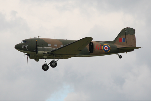
Image Source
Douglas C 47 Skytrain
B88
Heech
51^43’59”N, 05^31’34”E
Netherlands
B89
Mill
51^41’11”N 05^47’01”E
Netherlands
B90
Kleine Brogel
51^10’01”N, 05^27’00”E
Belgium
Now Belgium Air Force Base Kleine Brogel
B.91
Kluis (Nijmegen)
51^47’47”N, 05^52’51”E
Netherlands
B.92
Abbeville / Drucat
50^08’30”N, 01^49’51”E
France,
Used by USAAF 61st Troop Carrier Group 13 March to 19 May 1945
Runway 09 / 27
164 feet wide x 4,893 feet long
Concrete / Asphalt
B93
Leiden / Valkenburg
50^51’56”N, 05^49”55”E
Netherlands
B94
B.95
Deventer / Teuge
52^14’33”N, 06^02’49”E
Netherlands
B96
B.97
Amsterdam / Schiphol
52^18’56N, 04^45’34”E
Netherlands
B98
B99
B.100
Goch / Asperde
51^36’08”N, 06^08’31”E
Germany,
Later it became RAF Laarbruch
B.101
Nordhorn Klausheide
52^25’47”N 07^04’25”E
Germany
B.102
Vorst
51^18’16”N, 06^25’43”E
Germany
B.103
Plantlunne
52^26’03”N, 07^24’09”E
Germany,
Later became RAF Plantunne
B.104
Damm
52^29’25”N, 08^11’16”E
Germany,
Later became Verkehrslandeplatz
B.105
Drope
52^34’42”N, 07^29’43”E
Germany
Used ?
Runway
Used by 485 [NZ] Squadron RAF 29 April 1945 26 August 1945
485 [NZ] Squadron
B.106
Enschede / Twenthe
52^16’30”N, 06^53’11”E
Netherlands
Built in 1910
Used by KLM Airlines prior to the war.
Occupied by Luftwaffe and improvements begun,
There were 300 Germans and 6,000 Dutch working on the airfield.
There were over 540 buildings in the Twenthe complex
Defence was 13 positions with 88mm, 37mm and 20mm flak in early February 1944
Captured 1 April
Opened 3 April 1945
Closed
Used by 485 [NZ] Squadron RAF 19 April to 29 April 1945
Runway
180 feet wide x 5,6000 feet long
Concrete
Runway
170 feet wide x 5,600 feet long
Concrete
Runway 180 feet wide x 5,600 feet long
Concrete
Captured 1 Apr
Opened 3 Apr 45
Closed
To Dutch Armed Forces November 1945
B.107
Lingen (Meppen)
52^31’33”N, 07^19’27”E
Germany
B.108
Rheine Bentlage
52^17’31”N, 07^29’09”E
Germany
B.109
Quackenbruch
52^39’47”N 07^55’29”E
Germany
Now Quakenbruck Glider Club
B.110
Achrner (Osnabruck)
52^22’39”N, 07^54’43”E
Germany
B.111
Ahlhorn
52^53’19”N, 08^13’56”E
Germany,
Became Fliegerhorst Ahlhorn, closed early 1990s
B.112
Hopsten
52^17’31”N, 07^29’09”E
Germany
Construction commenced 1938
Opened 25 October 38
Used sporadically, for short periods.
Used by Air Defence Fighters in March 1944, followed by Me 262 Jets
Equipped with Lorenz night flying equipment
Defended by 50 flak guns in the surrounding area
Luftwaffe departed 6 April 1944
Opened 6 April 1944
British forces moved through the area in early April 1945 after crossing the Rhine in Operation Varsity. Designated an ALG on 6 April 45, after the war it was decided not to rehabilitate the airfield and it was abandoned.
Used by 486 [NZ] Squadron RAF 10 April to April 1945
486 [NZ] Squadron
Runway 9,000 feet long [approx]
Runway 3,000 feet long [approx]
Became Fliegerhorst Hopsten
B.113
Varrelbusch
52^54’30”N, 08^02’35”E
Germany
B.114
Diepholz
52^35’07”N, 08^20’27”E
Germany
B.115
Melle / Gronegau
52^11’59”N, 08^20’06”E
Germany
B.116
Wunstorf
52^27’17”N, 09^25’44”E
Germany
B.117
Jever
53^32’02”N, 07^53’05”E
Germany
B.118
Celle / Wietzenbruch
52^35’59”N, 10^0l’37”E
Germany
B.119
Cologne / Wahn
50^51’57”N, 07^08’34”E
Germany,
Became RAF Wahn in 1945
Now Flughafen Koln - Bonn “Konrad Adenauer”
B.120
Hannover / Langenhagen
52^27’42”N, 09^41’12”E
Germany
B.150
Hustedt (Scheuen)
52^53’46”N, 09^05’46”E
Germany
Used by 486 [NZ] Squadron RAF May 1945
486 [NZ] Squadron
B.151
Buckburg / Achurn
52^16’41”N, 09^04’49”E
Germany
B.152
Fassberg
52^55’09”N, 1O^10’59”E
Germany
Used by 486 [NZ[ Squadron Apr 1945 May 1945
486 [NZ] Squadron
B.153
Bad Oeynhausen
52^12’29”N, 08^48’16E
Germany
B.154
Schneverdingen (Reinsehelen)
53^08’50N, 09^47’41’E
Germany
B.155
Dedelsdorf
52^42’58’N, 10^31’58’E
Germany
Now Segelfuggelande Glider Club
B.156
Luneberg
53^14’50”N, 10^54’36”E
Germany
B.157
Werl
51^33’30”N, 07^54’36”E
Germany
B.158
Lubeck / Blankensee
53^48’18”N, 10^43’07”E
Germany
Used by 486 [NZ] Squadron RAF July 1945 to 7 September 1945
486 [NZ] Squadron
B.159
Mahlen
52^48’N, 09^10’E
Germany
B.160
Copenhagen / Kastrup
55^37’14”N, 12^38’57”E
Germany
B161
B.162
Stade
53^35’32”N, 09^28’21’E
Germany
B163
Dortmond
51^35’32”N, 07^ 33’33”E
Germany
B.164
Schleswigland - Holstein
54^27’34N, 09^30’59”E
Germany,
Later RAF Schleswigland
Now Fliegerhorst [alt Fliegerhorst Jag
B165
B.166
Flensburg / Schaferhaus
54^46’25”N, 09^22’36”E
Germany
B.167
Kiel / Holtenau
54^22’46”N, 10^0’39”E
Germany
B.168
Hamburg / Fuhlsbuttel
53^37’49”N, 09^59’27”E
Germany
B169
B.170
Westerland / Sylt
54^54’51N, 08^20’27E
Germany
B.172
Husurn
54^30’54 “N, 09^08’41”E
Germany
B173
B.174
Utersen
53^38’50”N, 09^42’21”E
Germany
For construction details, please refer to
Descrption of Advanced Landing Grounds

with thanks to son-of-satire for the banner

We now have monster aircrafts which are faster and well equipped.
Posted using Partiko Android
Congratulations @len.george! You have completed the following achievement on the Steem blockchain and have been rewarded with new badge(s) :
Click here to view your Board of Honor
If you no longer want to receive notifications, reply to this comment with the word
STOPTo support your work, I also upvoted your post!
Do not miss the last post from @steemitboard:
This is a curation bot for TeamNZ. Please join our AUS/NZ community on Discord.
Why join discord room? Here are 10 reasons why.<
Enjoying the bump? Please consider supporting your fellow Kiwis with a delegation. How? Read here.
For any inquiries/issues about the bot please contact @cryptonik.