The Kiel channel (Nord-Ostsee-Kanal)
We've been through the Kiel channel three times now, twice this year.
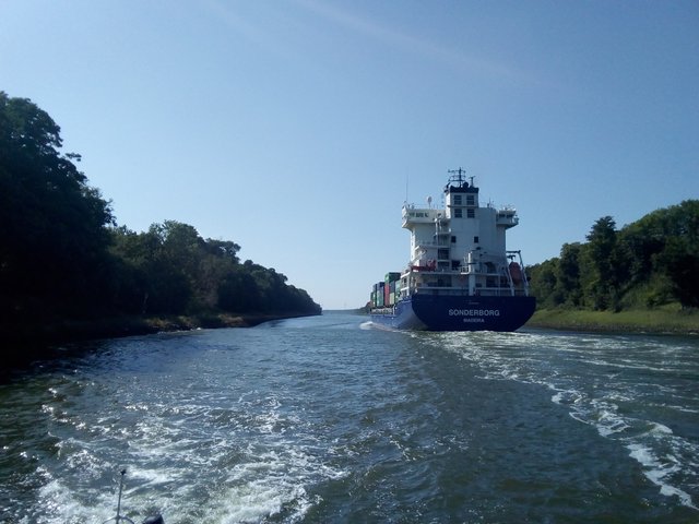
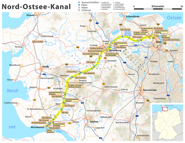
Image source: commons.wikimedia.org, Von Maximilian Dörrbecker (Chumwa) - own work, usingOpenStreetMap data for the backgroundtopographical background from Lencerthis map by NNW for the orientation map, CC BY-SA 2.0
Practical information
For anyone wanting to go through the channel on their own, the official pamphlet found on the official web pages is the authorative source of information. I don't have much to add ... or perhaps I do, there are quite many things I consider a bit unclear in the guide, and some few practical nice-to-know-things that don't belong in that guide.
Time-planning
The tidal current is very strong in the Elbe (also as it passes the Wadden sea), sometimes as much as 4 knots. With that in mind, it may be desirable to time the entry/exit at Brunsbüttel. Tides turns approx with the tides, best to leave from the channel just around the highest water or to enter Elbe just around lowest water. Of course, unless one is going towards Hamburg, then it's the opposite. It's also not allowed for pleasure crafts to navigate in the darkness in the channel. Either one should start in the early morning, or one should plan an overnight stay in the channel.
Preparing for the locks
One is supposed to wait in the Elbe on the outside of Brunsbüttel. That's quite easy, as the current is so strong one can simply put the bow against the current and adjust the speed so that one stands perfectly still in the water. For the other waiting areas there are quays where one can attach the boat by ropes while waiting. Listen to the VHF channels (channel 13 in Brunsbüttel, channel 12 in Kiel-Holtenau), eventually ask for information in English (or simply follow other boats) or check the traffic light. If contacting the lock by VHF, do remember to tell if you want to go into the channel or out of the channel.
In all the locks there are wooden floating platforms along the edges. That means the fenders need to be ridicolously low, take them down until they touch water and then continue lowering them with half a fender-length. Even then the fenders will probably end up on the top of the platform rather than between the platform and the boat. Well, it's only wood, most likely there won't be any scratches from touching it. It may also be that you'll have to stay on the side of another boat, or have another boat on your outside, so to really be prepared it's needed both to fender high and (ridiculously) low.
The platforms may be slippery and one is supposed to jump down on it, ropes should go through rings on the platform. The good thing is that since the platform follows the water level, once the rope is through the ring one doesn't have to worry more about the rise or fall of the water level.
Stopping places
One is generally not supposed to stop in the channel - with some few exceptions: in the official brochure there are marked eight places where one is allowed to stay overnight in the channel. Two of them are in the ends of the channel, two before Rendsburg, three in the Rendsburg area, and one after Rendsburg. Except for #1 Brunsbüttel and #8 Holtenau, I believe there is only one place that have facilities, services and commercial offerings - #4, "berths in Lake Obereider with narrows", where one actually can choose between several marinas and visit the town of Rendsburg (Obereider was a part of the Eider river). #8 Holtenau neither had electricity nor water, I don't remember if #1 Brunsbüttel had it. I believe all the harbours in Obereider has all the facilities, the central yacht harbour has it at least, and one can fill diesel there as well.
I believe all the stopping places except #1, #4 and #8 are for free - and #1, #4 and #8 are quite affordable anyway.
We've tried #3 and #4. #3 is a bit up the old Gieselau channel, right before the lock. We got a quite unpleasant surprise during the night; the waves from the biggest ships was easily going up the side channel all the way to the lock. Those waves have long wave-length - for a while the channel gets like a river flowing in one direction, before the wave returns and flows in the other direction. This caused massive jerks on the ropes. The lesson is that even if it looks very quiet and peaceful up in the Gieselau channel, when mooring up before the lock it's important to keep the ropes tight and use some dampers on the ropes. As mentioned in other posts, I have a teqnique of my own - tightening up ropes by connecting a rubber band on the middle of the rope and to some point. My wife claims my rubber ropes are "bullshit", but in situations like this it's golden - it really helps against the jerks.
At the #3 stopping place there was company to be found as there was lots of other boats moored up, there was a garbage bin, the lockkeepers house, and lots of fields around - but except for that, nothing. Though, my wife said that she would have enjoyed going for a bike trip if it would have been daylight and if we would have had time for it. That's quite amazing, usually she's the one wanting to go to the cities and claiming there is "nothing to see or do" at smaller places, while I prefer to see rural places, towns and villages.
Here are some photo of stopping place #7. One can stay in the middle of the lake, either by the poles or by anchor:
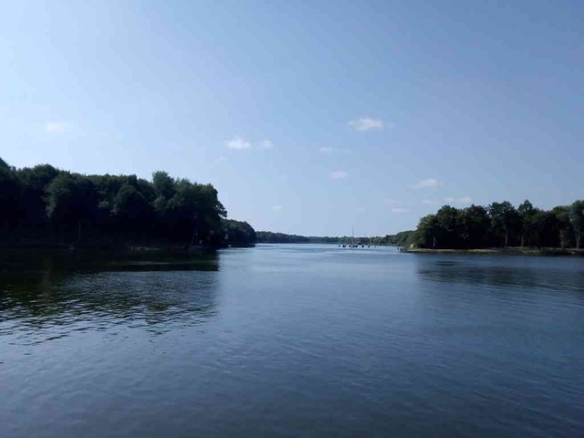
*Photo taken by tobixen - position: geo:54.342914,9.964574 - 2018-07-15 10:21:33 localtime - CC BY-SA 4.0 - full quality
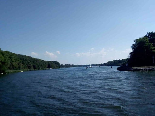
*Photo taken by tobixen - position: geo:54.341464,9.963232 - 2018-07-27 16:53:10 localtime - CC BY-SA 4.0 - full quality
I completely forgot taking photos of Rendsburg from Obereider, even if we were filling diesel there (and my wife went to the grocery shop), though I took quite many photos from the channel, I'll put them at the end of this post.
This is the only photo I have from Gieselau ... it was generally too dark to take photos. Here is the almost-full-moon, one day before the eclipse:
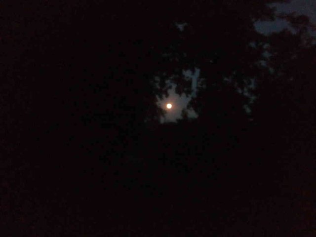
*Photo taken by tobixen - position: geo:54.183677,9.441316 - 2018-07-26 22:23:29 localtime - CC BY-SA 4.0 - full quality
Light signals
In the official English guide, the light signals are about "entering and leaving the siding area". My first thought was that a "siding area" is an area outside the channel - meaning that as long as one wouldn't go outside the channel, this information wouldn't apply. That was a big misunderstanding - the "sidings" are places where the channel is a bit wide and has poles suitable for mooring up while waiting for meeting traffic. Two red lights means the bigger ships should stop (and when spotting two red lights you can be reasonably sure that you will meet something huge). Though, on the practical side of things, I don't ever think the bigger ships will react on the lights, moore up and wait in the sidings, I believe the pilots will plan carefully and adjust the speed to ensure meetings will happen on the sidings.
Here is one of the sidings:
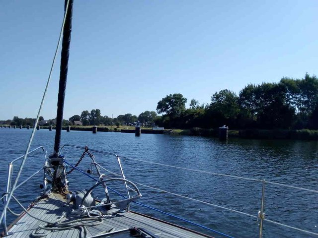
*Photo taken by tobixen - position: geo:54.255554,9.620697 - 2018-07-27 10:09:51 localtime - CC BY-SA 4.0 - full quality
And one of the "traffic lights":
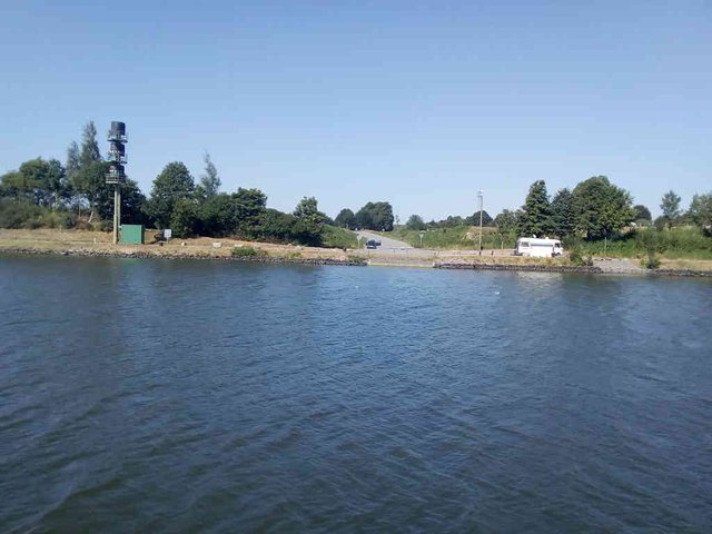
*Photo taken by tobixen - position: geo:54.352989,9.891273 - 2018-07-27 16:17:55 localtime - CC BY-SA 4.0 - full quality
Three red lights means that all traffic should stop. We've rarely seen three red lights - during our three passes and five days we've spent in the Kiel channel, only during one of those days we encountered red lights - but several times that day. First time we didn't understand anything, but we decided to turn around and ask someone why they were stopping.
Two white lights means that one has two options - one is to stop and wait, the other is to ensure the speed is at 8 knots all until the next "siding".
There are light signals before and after such a "siding area", but not always on the right side of the channel - sometimes one has to look at the left bank of the channel.
Other signage
Every now and then there are signs on the enbankment with a wave-symbol, I have no idea what it means.

*Photo taken by tobixen - position: geo:54.363914,9.807598 - 2018-07-15 11:30:23 localtime - CC BY-SA 4.0 - full quality
*Photo taken by tobixen - position: geo:54.284816,9.642823 - 2018-07-15 13:02:01 localtime - CC BY-SA 4.0 - full quality
A number and a left arrow means one should at the minimum keep that distance, in metres, to the land. That's a bit hard for me, how to measure the distance from the boat to the land? We got into a quite tight situation once as a really huge ship was passing us right as we were passing a bridge, and in the same time there was this signpost that we should keep a distance to the embankment.
There are also kilometer signs for each kilometer passed. The maritime world is quite conservative, we're still using ancient measurement units like feet and nautic miles, but in countries like Germany the metric system is gradually taking over.
VHF
There are four VHF-channels being used in the channel, at the locks; channel 13 for the Brunsbüttel lock, channel 12 for the Holtenau lock, then it's channel 2 and 3 when going along the channel, channel 2 from Brunsbüttel to "Breiholz reach". What is a "reach"? The Breiholz ferry crossing is at 54°12'23.2"N 9°34'04.6"E / 54.206438, 9.567934 - perhaps that's where one is supposed to switch?
On the VHF there is lots of German chatter, probably the pilots planning the meetings. I never heard English on channel 2 nor 3, nor anything that sounded like it could be relevant for us. All this noise can be slightly annoying. I must admit that we sometimes simply turned the radio off.
Setting sails
It's mandatory to go by engine in the channel - but it is allowable to set a sail in addition to the engine. When the wind is strong, one will typically see the sailing boats having tailwind setting the genoa to save some diesel. One is required to set the day-signal; a black cone with the pointed side down and forward. I'm not sure how to hang it up in such a way that it won't be hidden by the sails. Actually, we saw quite some sail boats coming against us with the genoa rolled out but on very few of those boats I was able to see any day signal. I've heard rumors that one can get really big fines in Germany if not obeying the rules at sea, so probably best to hoist that cone.
Paying channel dues
Channel dues are supposed to be paid before passing the Holtenau locks; there are payment automats at both sides of the lock. On the outside of the channel it's at the yacht harbour, which is right by the old locks. On the inside of the channel it's at the waiting place for entering the channel.
I believe that in the old lock the tickets will be inspected, but not in the new lock. All pleasure crafts and smaller ships are supposed to go through the old locks - except, they are currently down for maintenance. If being in a hurry and the green light is lit when approaching the gate, it's probably ok to pay the fee on the outside of the channel.
Other
If one wants to see the channel without a boat, there are bike routes at both sides of the channel.
We had quite some problems getting online with our telephones while going through the channel. It's mostly farmland so the density of the cellphone masts is not that great, in addition one is often a bit lower than the average terrain elevation.
Huge ships and waves
For people who like to have a close-up view on (relatively) big ships, the Kiel channel is just the right place. Almost for sure one will spot several huge ships while travelling through the Kiel channel - and with the current lock situation in Kiel-Holtenau, one will most likely be locked through together with big ships.
There is this rule of the thumb that there exists a certain physical "soft" speed limit - the hull speed. By using powerful engines it's certainly possible to push ships beyond this speed - the problem is that the bigger parts of the effect from the engine will be producing waves rather than increasing the speed of the vessel. Longer ships have bigger hull speed than shorter boats. Hence, in the Kiel channel, where all the commercial traffic keeeps close to the speed limit, the smaller ships actually produce much worse waves than the bigger ones; the motoryachts sticking to the speed limit is actually some of the worst. It's not that bad though, we can leave things on the table without them topling over while we're travelling the channel.
The biggest ships moves quite slowly, and the "ordinary" bow-waves they produce is insignificant - but at the other hand, as they occupy a significant part of the cross section of the channel, they do create some tsunami-style wave with long wavelength. We felt it the worse as we were moored up by the Gieselau lock, but also when meeting the biggest ships our speed would go down to 1.5 knots in the "uphill" and we'd get 7.5 knots in the "downhill".
Not much visible ... but there is a wave-valley with a long wavelength on this photo
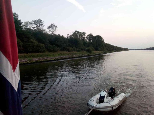
*Photo taken by tobixen - position: geo:54.161769,9.407283 - 2018-07-26 21:19:49 localtime - CC BY-SA 4.0 - full quality
Here are some very clear photos of a slow-going huge ship and the wave it's causing:
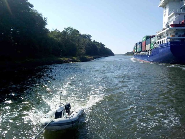
*Photo taken by tobixen - position: geo:54.344821,9.917138 - 2018-07-27 16:30:46 localtime - CC BY-SA 4.0 - full quality
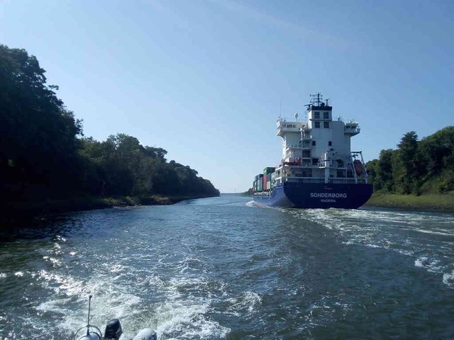
*Photo taken by tobixen - position: geo:54.344738,9.91744 - 2018-07-27 16:30:53 localtime - CC BY-SA 4.0 - full quality

*Photo taken by tobixen - position: geo:54.344738,9.91744 - 2018-07-27 16:30:54 localtime - CC BY-SA 4.0 - full quality
Our diesel crises
As mentioned in another post, usually I fuel the boat twice a year - in the spring and in the autumn. This time I had filled the diesel tanks right before leaving Norway - and yet we were pretty low on diesel on our half-way in the vacation. The starboard tank probably ran empty just as we were to leave from Terschelling (engine goes very cranky as air is sucked into the fuel line - I hurried into the engine room and changed tanks), but as we were in a hurry to catch the currents we skipped fuelling there - I expected the little we had left on the port tank would last until Cuxhaven at least as long as we would try to save a bit. As always, most of our journey we either had a head-wind or no wind at all ... but eventually we did manage to do some sailing.
We expected to be able to fuel in Brunsbüttel - that really is the right place to fuel ... but only for the bigger ships, not for recreational vessels. We didn't find any facilities there where we could fuel. So we just had to continue through the channel. Luckily it was side-wind and quite much of it, so we would be able to save quite some fuel by lifting the sails. I prepared the cone for sailing, took the fenders up, and as i was going to hoist the sail the wind diretion had turned, now we had a strong head-wind. Ouch.
Here is a ship fuelling in Brunsbüttel:
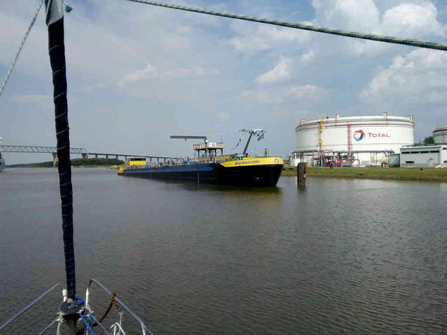
*Photo taken by tobixen - position: geo:53.914386,9.184553 - 2018-07-26 16:20:46 localtime - CC BY-SA 4.0 - full quality
Just one or two kilometers before we got to Rendsburg, we ran out of diesel on the port tank ... and the starboard tank was already empty. I changed the tank again ... even if it was empty. Weirdly enough, it got us all the way to Rendsburg, where we finally fuelled the ship.
Long-term closure of the smaller locks in Holtenau
They closed the old lock in Holtenau for maintenance last summer - and the maintenance was supposed to be finished during the summer. Actually, we passed through the channel two days after the maintenance was supposed to be completed - but the old lock was still closed. In the updated information - one year later - it says that the old locks will be down for quite some time. This means all traffic is directed through the new gates - meaning that the pleasure crafts are locked through together with the really big ships! Though, when we went from Kiel to Cuxhaven earlier this year we actually got locked through with only other pleasure crafts. It was Sunday morning ... but I think shipping is pretty much 24/7, the bigger ships aren't staying by anchor observing the holy Sundays ... or do they? But maybe the pilots like to sleep long on Sundays...
This is from when we were in the big lock with only other sail boats:
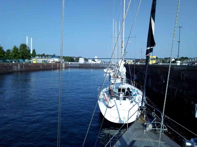
*Photo taken by tobixen - position: geo:54.365688,10.141661 - 2018-07-15 08:38:46 localtime - CC BY-SA 4.0 - full quality
Here is a bunch of photos showing the "chaos" before and as we were entering the new lock in Holtenau, on the way back to eastern Denmark:
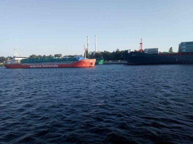
*Photo taken by tobixen - position: geo:54.368129,10.134423 - 2018-07-27 19:04:49 localtime - CC BY-SA 4.0 - full quality
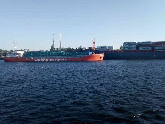
*Photo taken by tobixen - position: geo:54.368118,10.134552 - 2018-07-27 19:05:00 localtime - CC BY-SA 4.0 - full quality
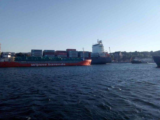
*Photo taken by tobixen - position: geo:54.368183,10.13479 - 2018-07-27 19:05:20 localtime - CC BY-SA 4.0 - full quality
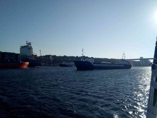
*Photo taken by tobixen - position: geo:54.368194,10.13483 - 2018-07-27 19:05:22 localtime - CC BY-SA 4.0 - full quality
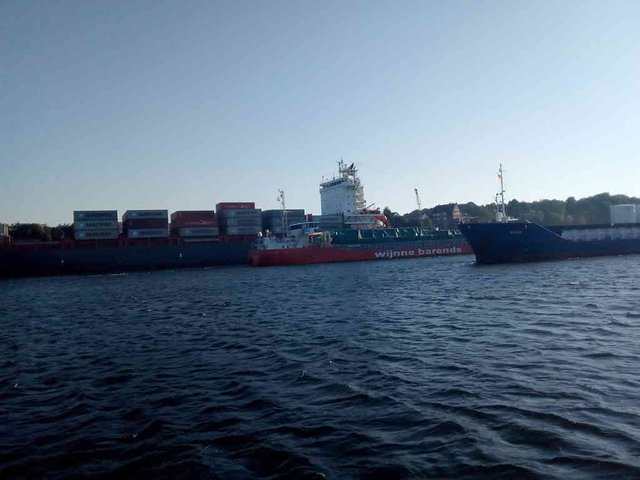
*Photo taken by tobixen - position: geo:54.36824,10.135016 - 2018-07-27 19:05:38 localtime - CC BY-SA 4.0 - full quality
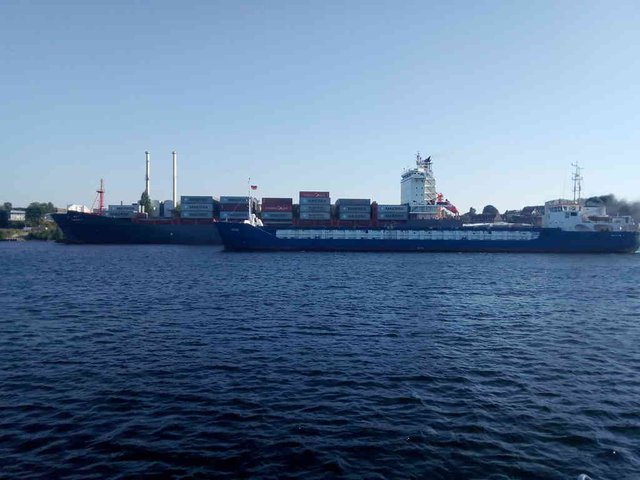
*Photo taken by tobixen - position: geo:54.368518,10.135397 - 2018-07-27 19:06:49 localtime - CC BY-SA 4.0 - full quality
*Photo taken by tobixen - position: geo:54.368518,10.135359 - 2018-07-27 19:07:43 localtime - CC BY-SA 4.0 - full quality
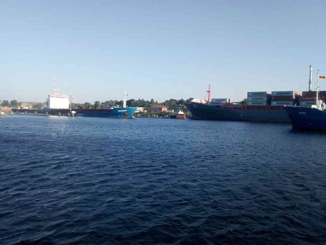
*Photo taken by tobixen - position: geo:54.368118,10.136119 - 2018-07-27 19:08:16 localtime - CC BY-SA 4.0 - full quality
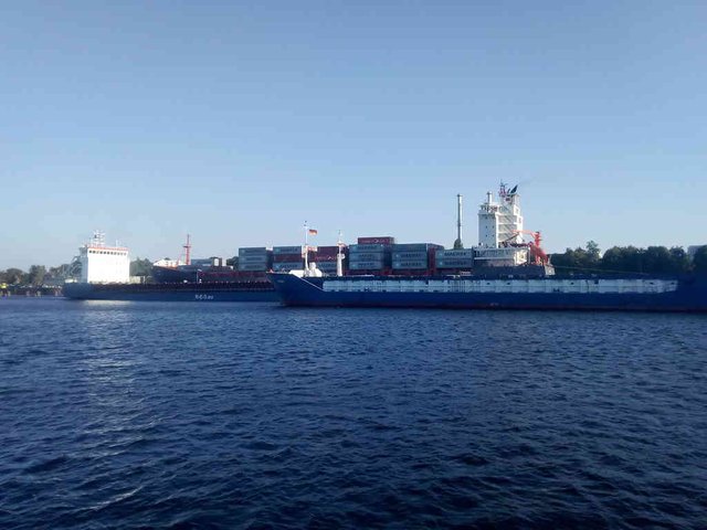
*Photo taken by tobixen - position: geo:54.369892,10.135509 - 2018-07-27 19:09:00 localtime - CC BY-SA 4.0 - full quality
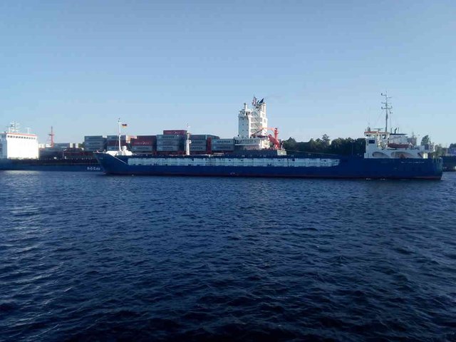
*Photo taken by tobixen - position: geo:54.368305,10.135524 - 2018-07-27 19:09:07 localtime - CC BY-SA 4.0 - full quality
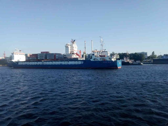
*Photo taken by tobixen - position: geo:54.368232,10.135129 - 2018-07-27 19:09:22 localtime - CC BY-SA 4.0 - full quality
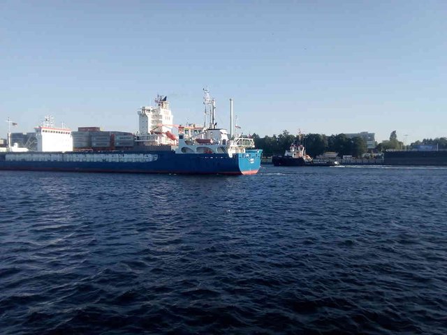
*Photo taken by tobixen - position: geo:54.368225,10.134956 - 2018-07-27 19:09:29 localtime - CC BY-SA 4.0 - full quality
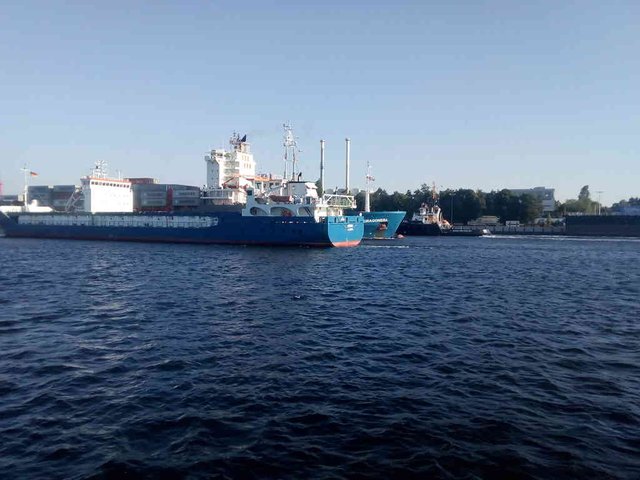
*Photo taken by tobixen - position: geo:54.368225,10.134895 - 2018-07-27 19:09:31 localtime - CC BY-SA 4.0 - full quality
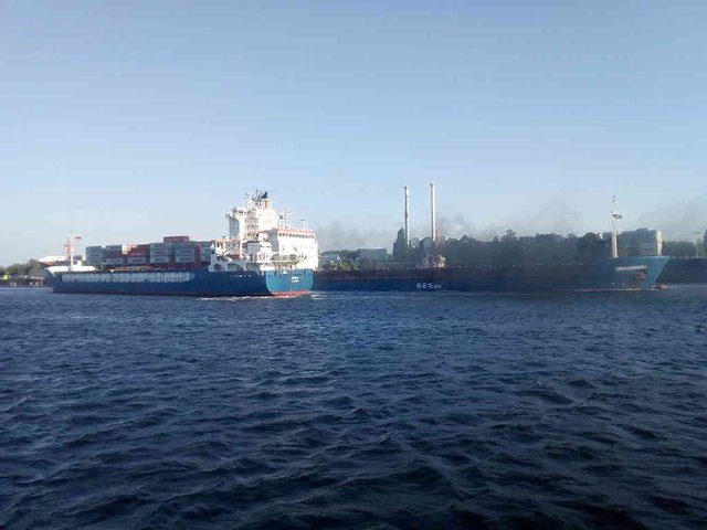
*Photo taken by tobixen - position: geo:54.368251,10.134645 - 2018-07-27 19:09:51 localtime - CC BY-SA 4.0 - full quality
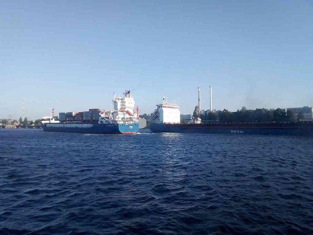
*Photo taken by tobixen - position: geo:54.368343,10.134166 - 2018-07-27 19:09:59 localtime - CC BY-SA 4.0 - full quality
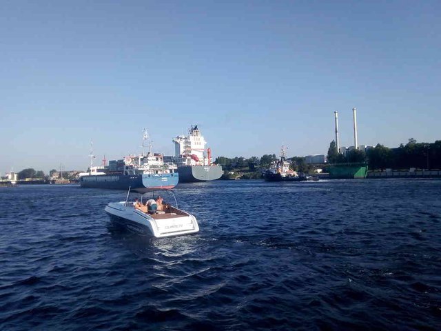
*Photo taken by tobixen - position: geo:54.368049,10.134162 - 2018-07-27 19:10:31 localtime - CC BY-SA 4.0 - full quality
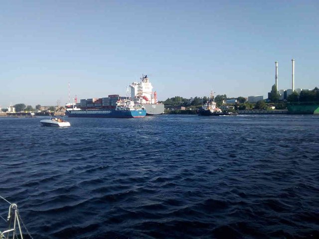
*Photo taken by tobixen - position: geo:54.367969,10.134998 - 2018-07-27 19:11:31 localtime - CC BY-SA 4.0 - full quality
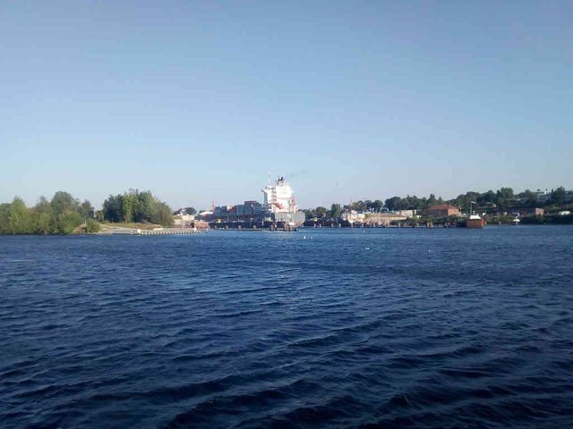
*Photo taken by tobixen - position: geo:54.368144,10.135813 - 2018-07-27 19:17:30 localtime - CC BY-SA 4.0 - full quality

*Photo taken by tobixen - position: geo:54.367477,10.135976 - 2018-07-27 19:29:40 localtime - CC BY-SA 4.0 - full quality
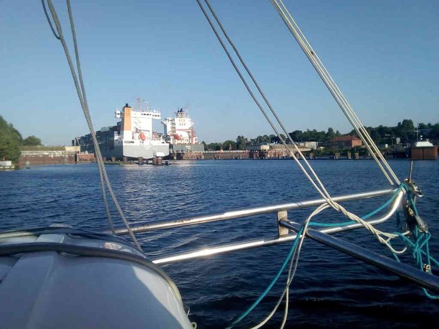
*Photo taken by tobixen - position: geo:54.367549,10.136619 - 2018-07-27 19:33:57 localtime - CC BY-SA 4.0 - full quality
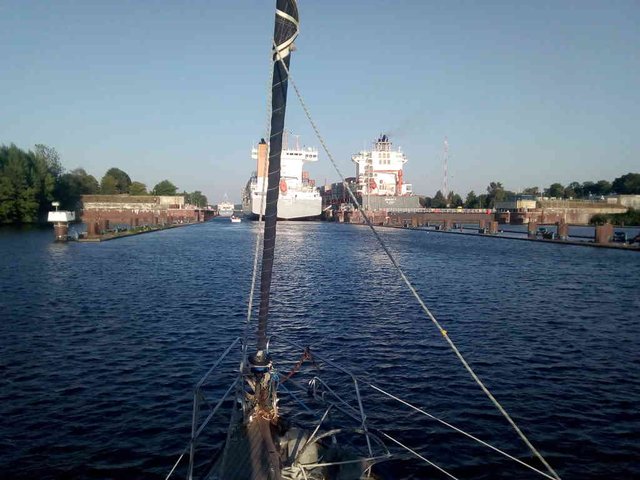
*Photo taken by tobixen - position: geo:54.36697,10.136732 - 2018-07-27 19:42:03 localtime - CC BY-SA 4.0 - full quality
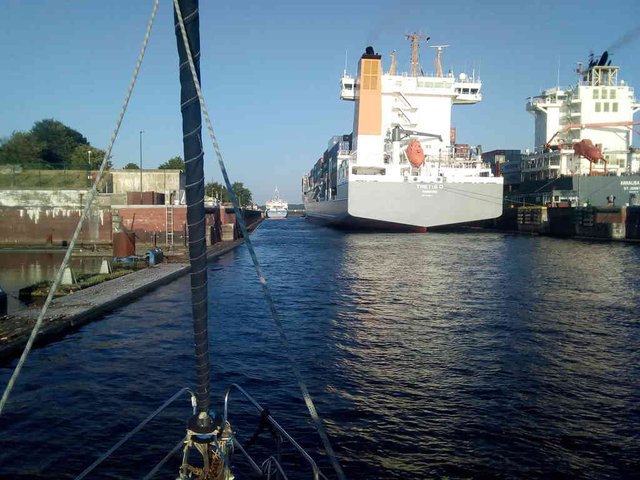
*Photo taken by tobixen - position: geo:54.366775,10.138511 - 2018-07-27 19:43:17 localtime - CC BY-SA 4.0 - full quality
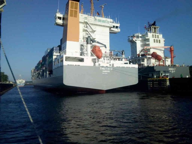
*Photo taken by tobixen - position: geo:54.366676,10.139151 - 2018-07-27 19:43:43 localtime - CC BY-SA 4.0 - full quality
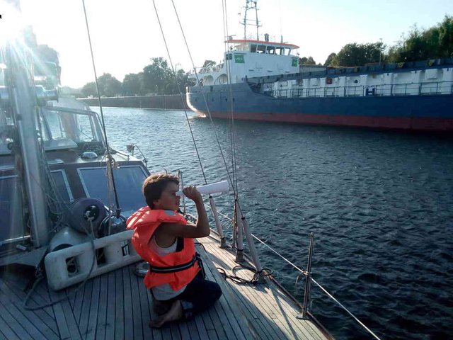
*Photo taken by tobixen - position: geo:54.365623,10.143723 - 2018-07-27 20:02:42 localtime - CC BY-SA 4.0 - full quality
Bridges, ferries and ... amphibiecrossings ..?
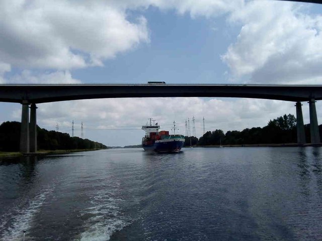
*Photo taken by tobixen - position: geo:54.329757,9.724983 - 2018-07-15 12:11:42 localtime - CC BY-SA 4.0 - full quality
There are extremely many bridges and ferries on the way. Just the first few kilometres from Brunsbüttel, one car bridge and four ferries!
There are also some weird roads that apparently is passing the channel - at both sides there is a gate stopping the cars from driving into the channel, but the road apparently continues down into the channel - and up again at the other side! Roads for military amphibiecars, maybe?
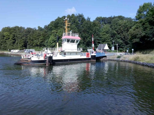
*Photo taken by tobixen - position: geo:54.345851,9.985665 - 2018-07-15 10:12:16 localtime - CC BY-SA 4.0 - full quality
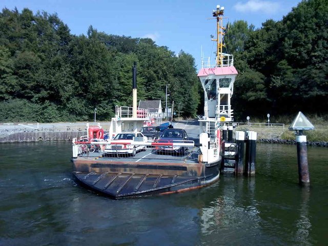
*Photo taken by tobixen - position: geo:54.345619,9.98534 - 2018-07-15 10:12:31 localtime - CC BY-SA 4.0 - full quality
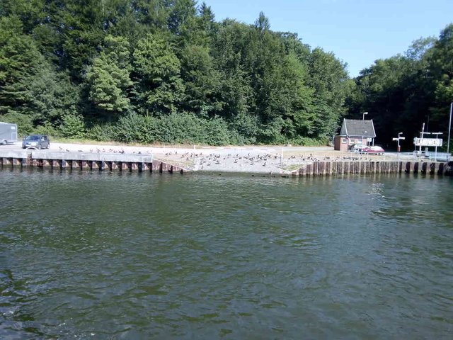
*Photo taken by tobixen - position: geo:54.345539,9.98503 - 2018-07-15 10:12:47 localtime - CC BY-SA 4.0 - full quality
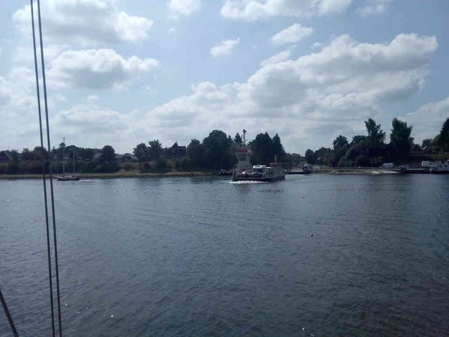
*Photo taken by tobixen - position: geo:54.364032,9.819056 - 2018-07-15 11:25:39 localtime - CC BY-SA 4.0 - full quality
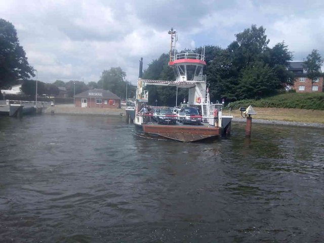
*Photo taken by tobixen - position: geo:54.308502,9.710818 - 2018-07-15 12:28:28 localtime - CC BY-SA 4.0 - full quality
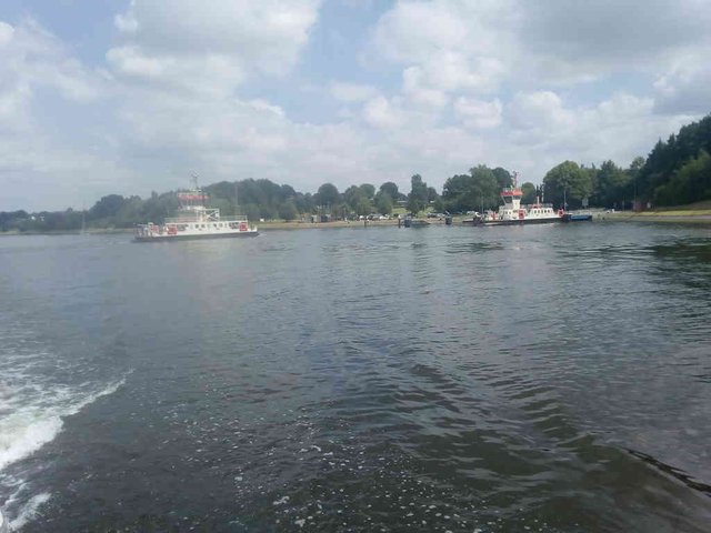
*Photo taken by tobixen - position: geo:54.305358,9.711574 - 2018-07-15 12:29:10 localtime - CC BY-SA 4.0 - full quality
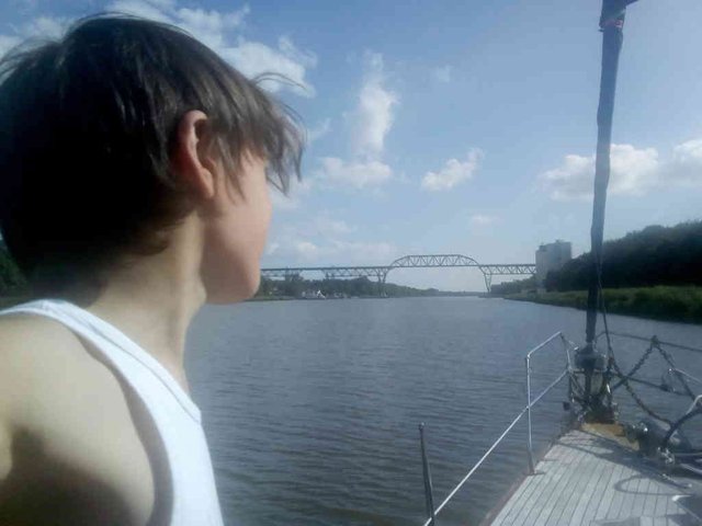
*Photo taken by tobixen - position: geo:54.023403,9.29839 - 2018-07-15 17:09:31 localtime - CC BY-SA 4.0 - full quality
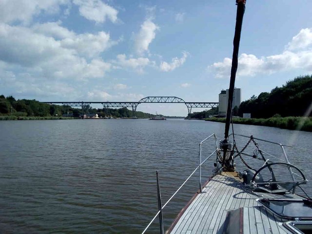
*Photo taken by tobixen - position: geo:54.022285,9.298186 - 2018-07-15 17:10:16 localtime - CC BY-SA 4.0 - full quality
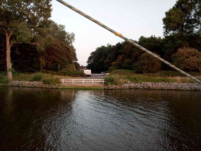
*Photo taken by tobixen - position: geo:54.152294,9.372073 - 2018-07-26 20:57:52 localtime - CC BY-SA 4.0 - full quality
*Photo taken by tobixen - position: geo:54.152297,9.372146 - 2018-07-26 20:57:55 localtime - CC BY-SA 4.0 - full quality
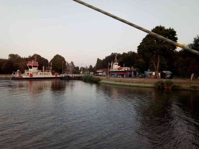
*Photo taken by tobixen - position: geo:54.184364,9.346107 - 2018-07-26 20:58:42 localtime - CC BY-SA 4.0 - full quality
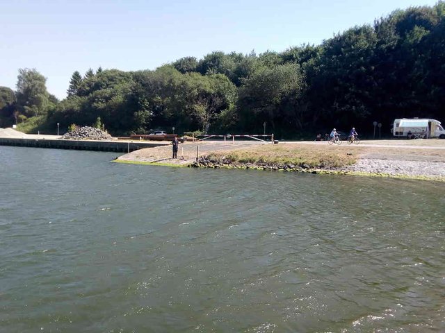
*Photo taken by tobixen - position: geo:54.362991,9.816695 - 2018-07-27 15:42:38 localtime - CC BY-SA 4.0 - full quality
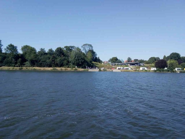
*Photo taken by tobixen - position: geo:54.363063,9.817118 - 2018-07-27 15:42:45 localtime - CC BY-SA 4.0 - full quality
Conclusion, plus more photos
I took really lots of photos ... but most of the way it's nothing to see except for the banks of the channel. The Kiel Channel is a bit ... boring actually ... unless one enjoys watching ships on a close distance, but there are big savings involved. Well, perhaps not that much for us. We're coming from Norway, we could have gone down on the west coast of Denmark instead. We do save ourself from quite some uncomfortable sailing though, as there is quite often quite much waves on the west coast of Denmark.
Here is something weird we saw on the way:
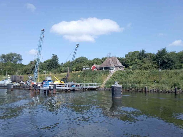
*Photo taken by tobixen - position: geo:54.342533,9.958847 - 2018-07-15 10:23:46 localtime - CC BY-SA 4.0 - full quality
Here is some fish farming pens:
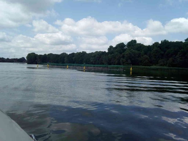
*Photo taken by tobixen - position: geo:54.343227,9.751158 - 2018-07-15 11:57:40 localtime - CC BY-SA 4.0 - full quality
Not as many birds in the Kiel channel as in the Netherlands ... but still I found those at least:
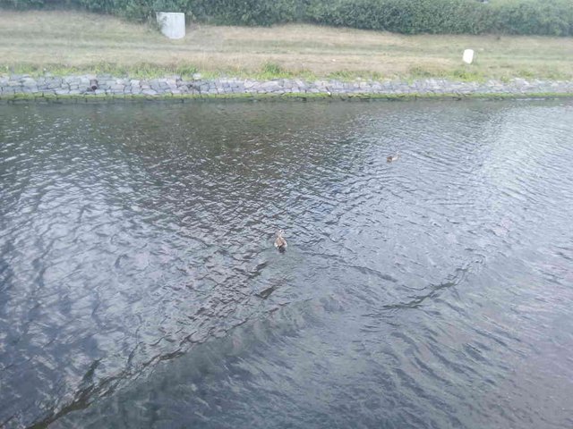
*Photo taken by tobixen - position: geo:54.272209,9.629396 - 2018-07-15 13:12:15 localtime - CC BY-SA 4.0 - full quality
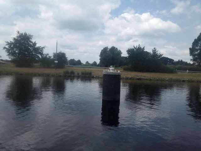
*Photo taken by tobixen - position: geo:54.266319,9.625408 - 2018-07-15 13:16:31 localtime - CC BY-SA 4.0 - full quality
Here is our teenager ... he's usually "stuck" by his laptop or cellphone, this is a rare occation that he's out in the fresh air (though, the freshness of the air is maybe questionable, with so much heavy traffic passing ... I wouldn't like to live in Brunsbüttel ... or Holtenau)
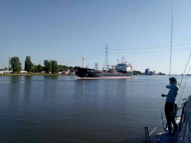
*Photo taken by tobixen - position: geo:53.91484,9.182789 - 2018-07-15 18:36:34 localtime - CC BY-SA 4.0 - full quality
One out of many big-ship-photos taken. Or, rather, small ships compared with the biggest supertankers!
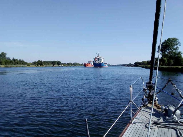
*Photo taken by tobixen - position: geo:54.25238,9.618909 - 2018-07-27 10:05:42 localtime - CC BY-SA 4.0 - full quality
The surrounding landscape is quite much higher than the channel, and one can get up to some lake system through the lock ... except for the small problem that the lock is permanently closed.
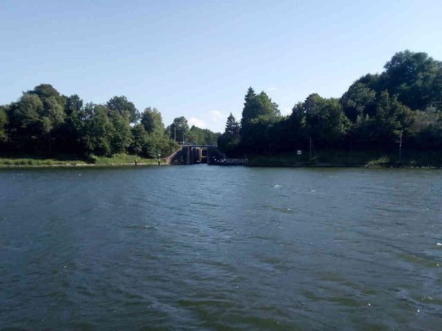
*Photo taken by tobixen - position: geo:54.342163,9.968277 - 2018-07-27 16:55:14 localtime - CC BY-SA 4.0 - full quality
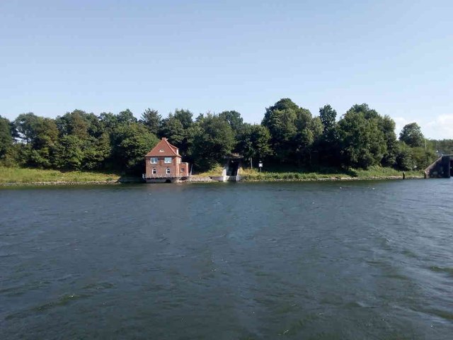
*Photo taken by tobixen - position: geo:54.34222,9.968701 - 2018-07-27 16:55:26 localtime - CC BY-SA 4.0 - full quality
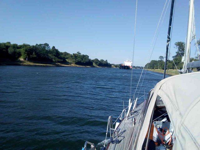
*Photo taken by tobixen - position: geo:54.34893,9.995605 - 2018-07-27 17:08:32 localtime - CC BY-SA 4.0 - full quality
Here are some sights just north-west of Holtenau ... a ship with windmill parts and
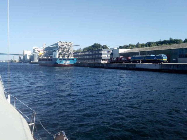
*Photo taken by tobixen - position: geo:54.370403,10.10715 - 2018-07-27 18:05:56 localtime - CC BY-SA 4.0 - full quality
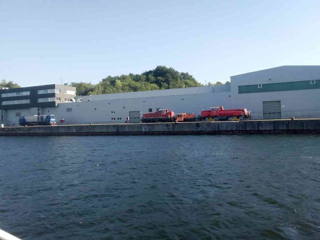
*Photo taken by tobixen - position: geo:54.370109,10.110463 - 2018-07-27 18:07:40 localtime - CC BY-SA 4.0 - full quality
Photos from the Rendsburg area
The Lürsen wharf, in the main channel:
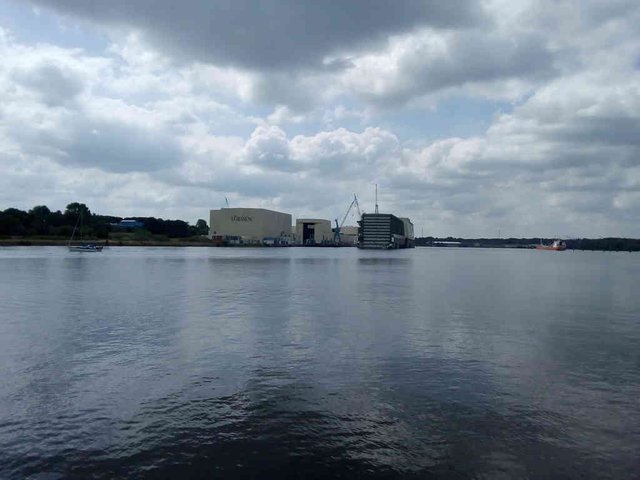
*Photo taken by tobixen - position: geo:54.326591,9.719387 - 2018-07-15 12:14:57 localtime - CC BY-SA 4.0 - full quality
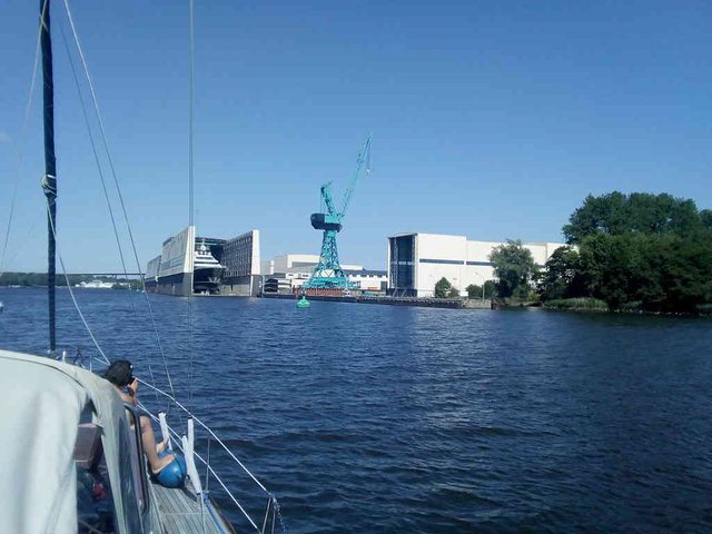
*Photo taken by tobixen - position: geo:54.317699,9.713778 - 2018-07-27 14:40:14 localtime - CC BY-SA 4.0 - full quality
The Obereider entrance:
*Photo taken by tobixen - position: geo:54.325107,9.716478 - 2018-07-15 12:16:21 localtime - CC BY-SA 4.0 - full quality
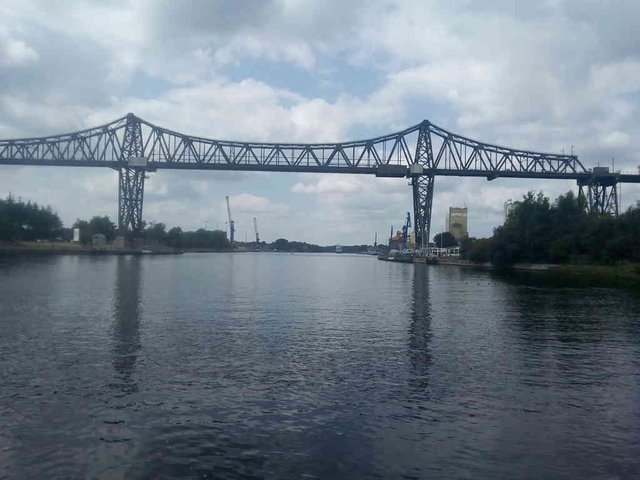
*Photo taken by tobixen - position: geo:54.294818,9.686798 - 2018-07-15 12:43:05 localtime - CC BY-SA 4.0 - full quality
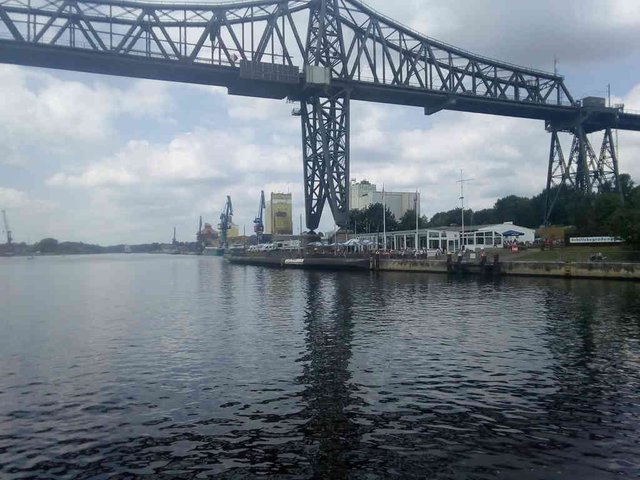
*Photo taken by tobixen - position: geo:54.294166,9.684418 - 2018-07-15 12:43:56 localtime - CC BY-SA 4.0 - full quality
*Photo taken by tobixen - position: geo:54.293766,9.682477 - 2018-07-15 12:44:44 localtime - CC BY-SA 4.0 - full quality
*Photo taken by tobixen - position: geo:54.293586,9.682319 - 2018-07-15 12:44:52 localtime - CC BY-SA 4.0 - full quality
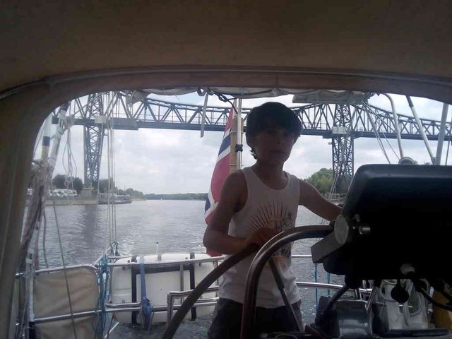
*Photo taken by tobixen - position: geo:54.293201,9.679661 - 2018-07-15 12:46:00 localtime - CC BY-SA 4.0 - full quality
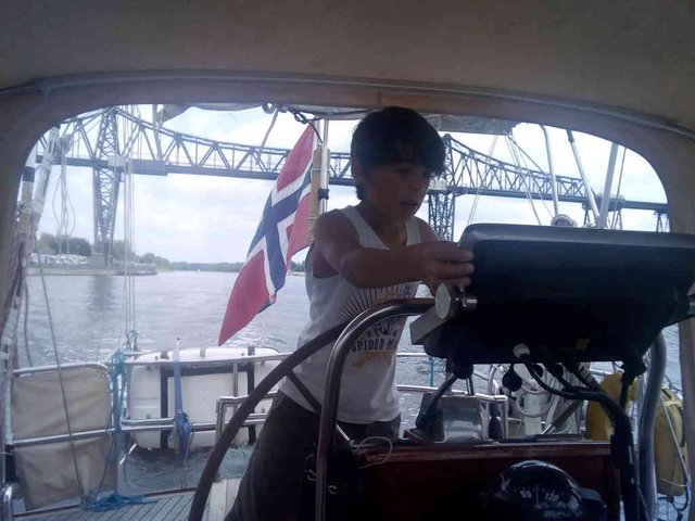
*Photo taken by tobixen - position: geo:54.293182,9.679296 - 2018-07-15 12:46:14 localtime - CC BY-SA 4.0 - full quality
*Photo taken by tobixen - position: geo:54.292819,9.676304 - 2018-07-15 12:47:22 localtime - CC BY-SA 4.0 - full quality
*Photo taken by tobixen - position: geo:54.272476,9.629153 - 2018-07-15 13:12:10 localtime - CC BY-SA 4.0 - full quality
This is the railroad bridge near Rendsburg. There is sort of a "bridge ferry" on the underside of the bridge, sort of a horizontal lift, a vehicle that can carry passengers across the channel. Trains were passing in both directions ...
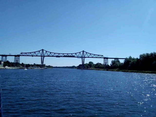
*Photo taken by tobixen - position: geo:54.292369,9.67603 - 2018-07-27 10:57:43 localtime - CC BY-SA 4.0 - full quality
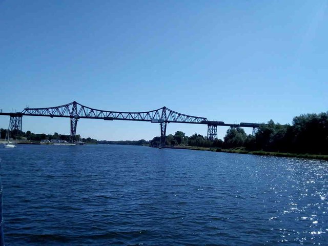
*Photo taken by tobixen - position: geo:54.292427,9.67632 - 2018-07-27 10:57:51 localtime - CC BY-SA 4.0 - full quality
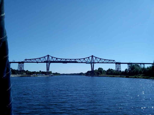
*Photo taken by tobixen - position: geo:54.29261,9.676685 - 2018-07-27 10:58:09 localtime - CC BY-SA 4.0 - full quality
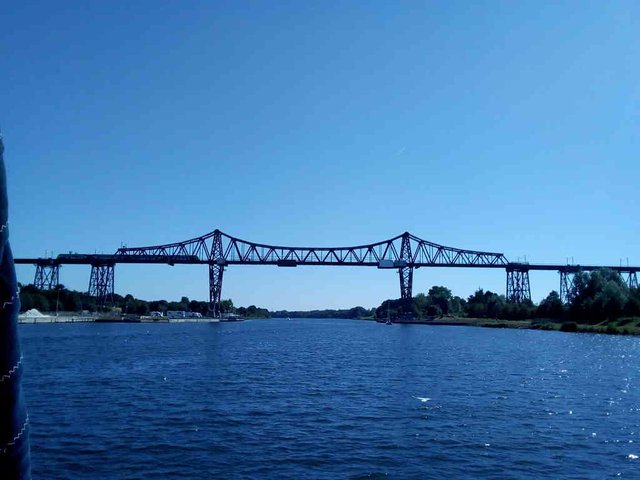
*Photo taken by tobixen - position: geo:54.292678,9.67687 - 2018-07-27 10:58:15 localtime - CC BY-SA 4.0 - full quality
A wharf building or doing maintenance on some military ship, in the Obereider:
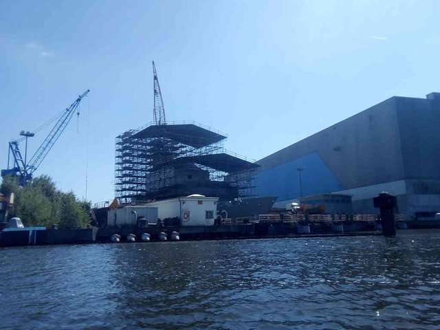
*Photo taken by tobixen - position: geo:54.312076,9.699186 - 2018-07-27 14:25:49 localtime - CC BY-SA 4.0 - full quality
My wife photographing the military ship while I was doing some maintenance to the dhingy:
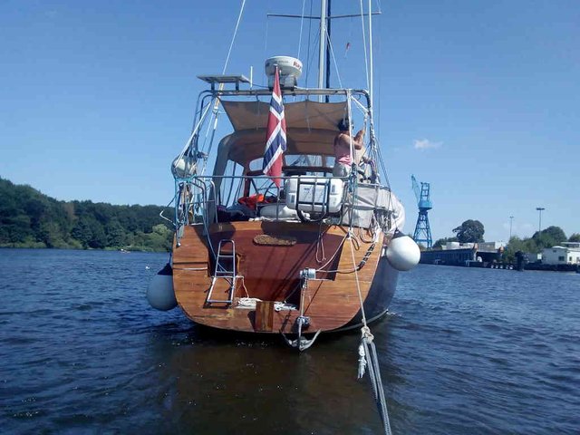
*Photo taken by tobixen - position: geo:54.311778,9.697541 - 2018-07-27 14:24:30 localtime - CC BY-SA 4.0 - full quality
Selected photos available in original quality on IPFS QmVmUnumEb3bH6JuRsXPTtAvEcVXCMZ7FzBFdTq1z5haj1. All photos taken available in original quality on IPFS QmNStDr1FA8igke6XaFyF8siQJ7ZCaciGtkoSVji1FyTvb. The CC BY-SA 4.0 license applies on both photos and article
Wow. That was some trip @tobixen and great information for anyone wanting to do it themselves.
Do you see many kayakers in the channel or is it mostly bigger boats that use it?
I was surprised to read:
Although we took a boat trip from Budapest a couple of years ago and I was surprised to find that once you moved away from the towns it all go pretty samey. It was still nice and relaxing though but then we weren't navigating the boat! 😁
Right, at the open sea we don't need to spend much efforts on the navigation - it's just to enable the autopilot and look out every now and then that we (still) aren't about to collide with anyone or anything - but following the channel we actually have to sit by the rudder most of the time. We should generally stay as far to the starboard as possible, but not too close to the edge. Well, I put on the depth alarm to warn us if we were approaching the boundaries and since the channel is mostly straight it was possible to use the autopilot sometimes. However, the auto pilot cannot be trusted. With much thrust on the engine, should the auto pilot suddenly shut down unexpectedly, the rudder tends to turn over rather fast - if one isn't right nearby the rudder when that happens the boat can crash directly with the embankment. We were once witnessing a rescue operation in Oslo where this probably had happened with a bigger commercial traditional sailing ship (or, "party boat" as I like to call them, as they can be chartered and otherwise transports tourists, and never set sails). We didn't use that much power on the engine, and I did sometimes leave the steering position to stand out on the deck.
We had a small incident by one of the sidings. I was sitting by the rudder, had enabled the autopilot, had ensured the course was good for a full kilometer (past all the siding area), sat reading the map without paying much attention. My wife was also sitting in the cockpit without paying attention. After one or two minutes while I was deeply concentrated in the paper map ... bang! Our starboard side had crashed with the first of those poles in the siding.
Luckily, on this channel crossing we got a helping hand ...
Glad to hear your small incident wasn't too bad @tobixen. It sounds like you have to know what you're doing in that channel. Not for the inexperienced I would think.
I'm not even sure it's legal to go through the channel with a kayak. The boat to the left here is the smallest thing I've seen in the channel:

I did wonder about that @tobixen. It looked like it might be a bit dangerous for little boats. My partner is a keen kayaker. That's why I asked? 😁
I think it should be pretty safe to go through the channel with a kayak - certainly much safer than to go around Denmark with a kayak :-)
The rule is that one should go by engine through the channel, I suppose that excludes kayaks. There is also rules that one is not supposed to stop anywhere, or take boats in and out of the water along the channel. I believe if I went through the channel in a Kayak, I would have stopped and enjoyed a break together with some of the biking tourists :-)
How you have time to write some of the longest Steemit posts out of everyone I follow is beyond me. Nice photos and very detaild knowledge sharing. I feel like I could sail trough the Kiel channel now after reading this, even though I have never tried anything like it before. Keep it up @tobixen!
I don't, that's why I'm lagging behind with ~2 weeks now :-)
Congratulations, Your Post Has Been Added To The Steemit Worldmap!
Author link: http://steemitworldmap.com?author=tobixen
Post link: http://steemitworldmap.com?post=the-kiel-channel-nord-ostsee-kanal
Want to have your post on the map too?
Wiw sir. Amazimg things that you shared. Kiel is a beautiful place to visit. We also have kiel in pakistan. I upload a picture of kiel in last. I think you enjoyed alot. Awesome weather. Sea side. Clean roads. Beautiful building. On a ship. Everything is perfect and wonderful. And i remebered your last visit to kiel. And i am very happy to find that kiel is so beautiful place. I wish to visit here once in my life. Thanks. You entery is wonderful. Stay blessed. And wish you good luck
Oh dear it takes 2 minutes to loading the page. Beautiful place. Amazing ohotography. I like the all photos that tou shared. 3 time in a year cisiting kiel. Nothing is greater than that. Have a nice day. Splended photography.
Really? This time I tried something new - I compressed all the photos (except the first two pictures) down from around 1.2M to around 64 kb to make it fast loading the page.
Wao such a wonderful place...Amazing photography....beautiful views....very exellent lake....so clean water....many ships and boards in their.....The kiel canal is a 98 kilometre long freshwater canal in the German state of Schleswig Holstein...everything is so Amazing....I am totally impressed for your great post....thanks for sharing dear..
Hiya, just swinging by to let you know that this post made the Honorable Mentions list in our daily Travel Digest. Please drop by to check out all the rest of today's great posts and consider upvoting the Travel Digest if you like what we're doing.
Great post. So many great photos!
And most importantly useful and necessary advice for travelers .
Very grateful.
I've seen so many beautiful ships!
Found out all the details!
Now a real connoisseur of these places ))
And all this thanks to your story, @tobixen
Exciting journey and new pleasant achievements!
Thanks for the great photos.
What an amazing journey Tobixen, thank you. It is all new to me.
looks busy - even that it might be a bit boring passing it.
"In all the locks there are wooden floating platforms along the edges. That means the fenders need to be ridicolously low, take them down until they touch water and then continue lowering them with half a fender-length. Even then the fenders will probably end up on the top of the platform rather than between the platform and the boat."
Here in Czech I have recognized that they have the fenders out all the time, I dont know why - as you know in Norway seeing this it basically means that it is people with lack of knowledge, or dårlig sjøkunnskap in Norwegian.
Safe travels mate, it is interesting to follow your posts,
I'm a bit lazy taking in the fenders myself sometimes.
When traveling inland and there aren't many waves and not much keeling, there is only aesthetic reasons for taking them in, no practical reasons. Likewise, sometimes I'm going directly from a harbour to an anchorage, planning to return to the harbour again next day, and I often leave the fenders out - but it's very ugly.
But no, we didn't go through the channel with fenders out :)