Cool things we do with Satellites #5 : Counting Penguins in Antarctica!
Satellite images such as this help scientists measure the number of Penguins more precisely and more cheaply, but how is it done?
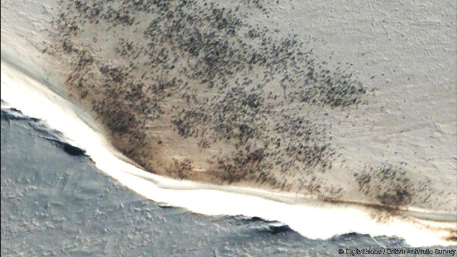
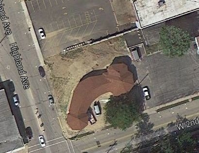
image credit Digital Globe and British Antarctic Survey
There are many good reasons why we’re interested in knowing the number of Penguins on our planets southern-most continent. One is to see how melting ice caps due to climate change affects biodiversity. Another is to see if increasing fishing in nearby waters has an effect on the population, as taking more fish out of the oceans obviously reduces the penguin's food supplies.
However, manually counting penguins can be a tedious and expensive task, let alone a cold one. Especially if one has to periodically travel to Antarctica to carry out the research! The Penguins do not make it easier for marine biologists, by usually breeding in inaccessible areas with down to minus 50 degrees Celsius. Luckily, there's a satellite application for that! So how then can satellites, flying more than 250 000 meters above the surface of the earth at more than 25 000 kilometres an hour be of any help? Surely individual penguins are too small to be seen from space? True. Or, at least true for the satellite images that are free and open to use for researchers, entrepreneurs and open source projects worldwide. So how do they manage to find the different flocks?
Hunting Penguin Poo
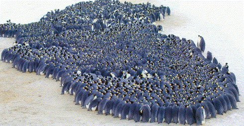
As you may know, Penguins are a social and collaborative species. In order to stay warm they’ll group together in a circle to exchange body temperatures and guard against the cold. As a result, they create neat little circles whose size grows with the number of penguins.
Not eager to leave the flock and give up their warm spot at the centre, the penguins are happy to leave a large amount of poo on the ground where they are standing. Over time, this turns the area that the flock occupies increasingly brown. An inconvenience surely for those trying to study the penguins on the ground, but very useful for those using satellite images. Thanks to the poo, computers can quickly identify a penguin flock from a series of satellite images covering the entirety of Antarctica and provide a map of where the different penguin colonies are pinpointed! Researchers may then purchase High-resolution images specifically for these regions to begin counting the size of each flock and study them more closely!
But the poo also provides a different form of assistance. You see, different species of penguins leave waste with slightly different chemical compositions. As imaging satellites carry sensors sensitive to light in many different parts of the electromagnetic spectrum, one can easily differentiate between different chemicals. Researchers may then determine and differentiate the different species of birds!
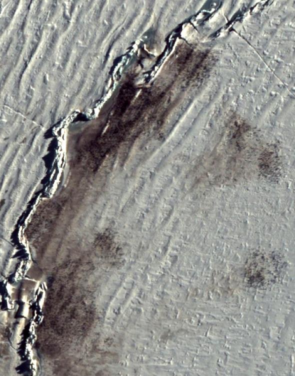
Penguins and Penguin poo seen in a high-resolution satellite image by Digital Globe
Interestingly, the researchers using satellite imagery found the number of Emperor Penguins to be about twice as many as was previously thought! Why? There could be a few reasons. Satellites, providing full coverage of every corner of the continent, may have been able to find penguins in areas not explored otherwise. Or perhaps previous researchers decided to call it a day early when their lips started freezing off? In any case, the British Antarctic Survey notes that out of the 38 flocks they have mapped with satellites, 10 were areas that they were not familiar with before.
I thought this use-case was pretty interesting as it goes to show how satellite imagery can add convenience to users very far from the traditional industries using earth observation data. So if any of you steemians would like to spend an afternoon counting penguins in Antarctica, you can try downloading an image from the Sentinel Data Hub here. Please do inform me should you manage to spot any. Happy satellite hunting!
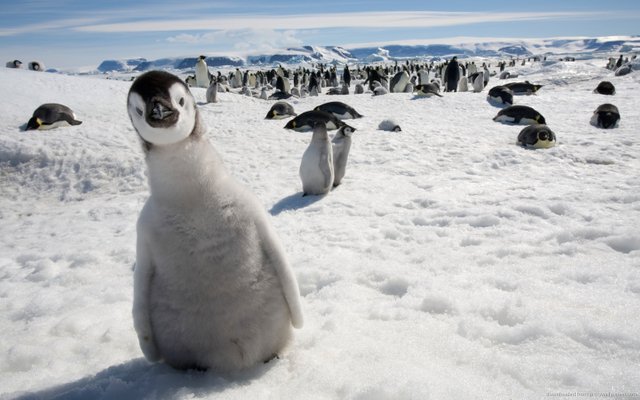
Many marine biologists and Penguin-fans are curious to know how the penguins are doing, including this young lad
Image source
All information beyond the authors own knowledge stems from the paper “Assessing penguin colony size and distribution using digital mapping and satellite remote sensing” which you can access here as well as information shared by the British Antarctic Survey, which you can read here.

If you like to find good science content on steemit, make sure to follow and support @steemSTEM !
Are you a scientist and looking to write content related to science, technology, engineering or mathematics on steemit? Make sure to visit the steemSTEM steemit.chat group to engage with other steemians who love science!
steem on!
@fredrikaa
I'd prolly do something very stupid with it, like find penis shaped building...
Like this one? :P
Aaaaaaaaaah, made my day!!!!
Those are definitely inventive ways to use our technology! I've never thought I would ever say this in my life but do you know if are they measuring the ratio penguin to poo to estimate how much are they eating? :)
I know! I mean if you tell people "what would you look for if you could see any place of the world once per week?" I'm sure you will get many different answers! So we'll probably see many new use cases being made :)
Hahaha, I have no idea :P
Anyway thank you for sharing the news, I enjoyed reading it 😀
Counting bird poo... Science!
Nice post @fredrikaa
Thank you man!
haha yeah maybe I should have finished it with a "it's science!!" meme ;p
Poo imagery! That's lovely :D
Is it used for other species too?
No idea. I'm not sure if it makes as much sense for other species.
I mean,
I doubt it makes sense to replicate the exact same methods for other species. However, other species may leave other marks on the landscape which satellites can monitor to tell researchers something useful. My guess would be beavers or something like that :P
I was indeed meaning, using satellites in general and not tracking other species like if they were penguins :D Thanks for the answer :)
Wow, fascinating. I never thought about locating animals by observing their poop from space. Ha!
Well, who would have? :P
It's mind blowing how much image data we are now collecting globally. It's difficult to imagine how many different use-cases there can be. Expect to be surprised again!
For tomorrow I will prepare something seriously scientific and seriously fun about this topic (yes, penguin poop). Thanks for the idea. I used to play with multispectral images, FTIR and fluorescence mainly, it's incredible what can be done once we obtain the image with several different sensors.
sounds interesting! I'll be sure to check that out.
And yes, you really get to understand how limited our eyesight is and how much more there is to the world than what we can see. Having a global overview also in multispectral images provides the opportunity to see changes that we would otherwise fail to notice.
Wow! This is really cool,it just makes thier work easier
A lot! I'm sure it's more convenient in a warm office with some hot drinks rather than out there in -50 C
^^
Thanks again. I love it when you share the intricacies of satellite data. It proves they really exist and there are people that actually believe satellites don't exist. I've shared with the flat earth society. Should be funny to see the comments of people still trying to deny they exist, despite such overwhelming evidence.
You welcome! I enjoy writing these stories too :)
oh you did? Damn I suppose I'll have to embrace myself for the shitstorm then ^^
Lol. Never knew poops can be observed with satellite
If the pile of shit is large and wide enough, sure!
Wow, great images and very informative post.
It's actually a really smart usage of our technology if you think about it! Only downsize is... no cute Penguin pics :'(
It sure is clever I agree!
Yeah I wouldn't substitute it 100% for the ground-based observations if that is necessary to take pictures like the last one I shared in the post :P
Precisely! Penguins were my favorite animals when I was a kid