Fieldwork Experience: 2D Flood Height and Extent Validation
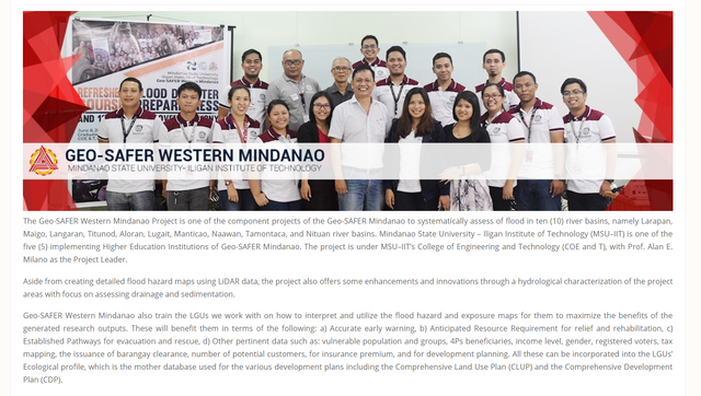
The researchers from Geo-SAFER MSU-IIT team under the DOST or Department of Science and Technology are assigned to generate a detailed 2D flood map ithrough LiDAR data in the ten (10) river basins in the Western Mindanao, Philippines.
A screenshot in the Geo-SAFER website.
The generated map is then validated and example of this is a flood extent and flood height validation. Some questions will be asked to the resident of the area. The collected data from the validation and the data generated from the software used by the Flood Modelling Component will be compared to know if the discrepancy is high or low.
There are three teams for this project, the Data Processing Team, the Field Survey Team and the Flood Modelling Component.
The Data Processing Team is tasked to edit, mosaic and calibrate the DEMs of the Digital Elevation Model of the floodplain and the river basin given by the Flood Modelling Team. The Digital Elevation model is divided into two: the Digital Terrain Model (DTM) and the Digital Surface Model (DSM). The DPT is also assigned to extract and attribute features like the buildings, water bodies, bridges, and roads.
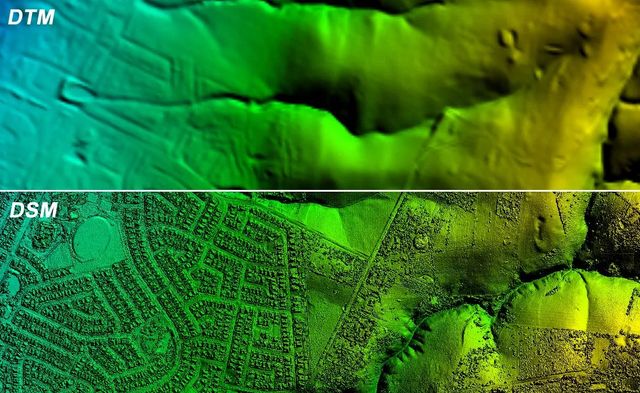
Image Credits: GIS Resources
Source
DTM is used in digitizing water bodies, roads and bridges while the DSM is used when digitizing building, can also be used to digitize bridges and roads, depending on the clarity of the model.
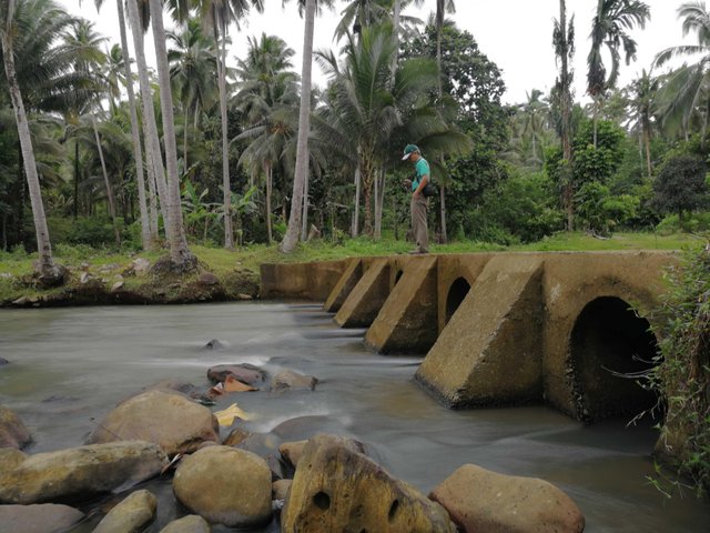
The extracted features from the DPT are validated by the Field Survey Team. The collected data will be given back to the DPT for the Feature Attribution. The Field Survey Team will also do the Bathymetric Survey and the collected points will be given to the DPT again for Bathymetric Burning. The Flood Extent and Height Validation is one of their tasks as well. The FST is also dependent on an event or raining event and the data will be given to the Flood Modelling Team.
Source
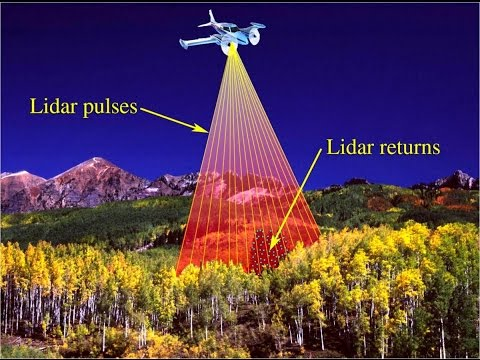
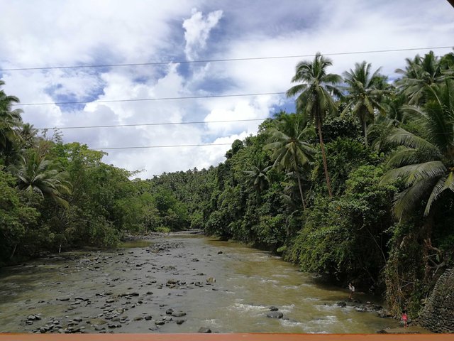
Since the LiDAR technology cannot penetrate fully to the water body, then a bathymetric survey is conducted to measure the depth of a water body.
All the data from the DPT and FST will be given to the Flood Modelling Team. A separate software, HEC-RAS, and HEC-HMS are used to process and to generate 2D flood maps. Computation for the percentage error and further analysis are done once the DPT and FST are done in their works. If the FMT see some huge discrepancy or error, there will be another set of validation needed to be done.
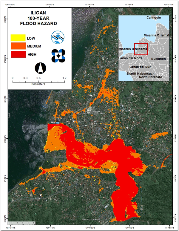
Sample flood hazard map. Credits to UP Dream.
Source
All in all, the three teams are interconnected with each other. One cannot proceed if the other one is not done with the task given.
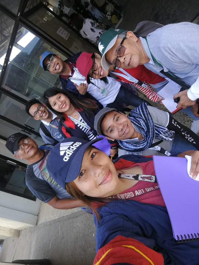
Since the Field Survey Team is short-handed, the Data Processing team were instructed to help the FST by conduct ing the 2D Flood Extent and Flood Height Validation. The DPT which composes of four Research Assistants and the head the Science Research Specialist, together with the head of the administration office and the Chief Senior Research Specialist is instructed to conduct such validation in the three river basins. A Research Associate from the Field Survey Team was added to guide the researchers who spent most of their time in the office.
OBJECTIVES:
To validate the accuracy of the flood map generated by the Flood Modelling Team.
To record the data gathered, a sheet is provided for the tabulation of data.
To measure the height and validate the extent of the flood during an event specified.
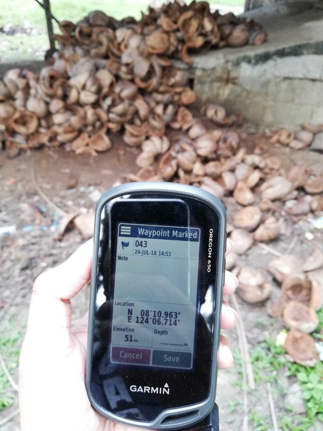
To mark and save the way-points in the GPS. The coordinate system must be in DD or Decimal Degrees.
SCOPE AND LIMITATIONS:
The researchers are limited only to gather and validate data to 120 points only, 30 points for each water level: High, Medium, Low and Not Flooded.
THE RIVERS BASINS AND THE MUNICIPALITIES
- Larapan River Basin - Linamon and Kauswagan, Lanao del Norte
- Aloran River Basin - Panaon, Jimenez, Oroquieta and Aloran, Misamis Occidental
- Langaran River Basin - Lopez Jaena, Plaridel, and Calamba Misamis Occidental
GROUPINGS
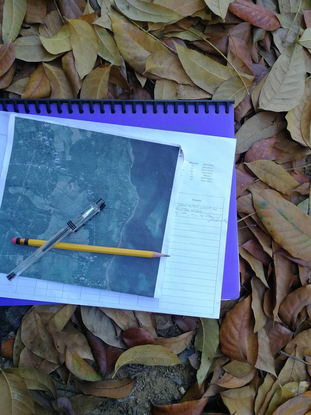
The team is composed of eight (8) researchers which are divided into 4 groups composed of two members. Each group is given a map of their designated barangays and a GPS with marked points loaded in it. The marked points are numbered and named according to the water level extent generated: H for High, M for Medium, L for Low and NF for Not Flooded.
QUESTIONS:
The event chosen by the Flood Modelling Team is the event happened on the month of December 2017 caused by Typhoon Vinta. The researchers will ask questions to the resident of the area. If the marked point is an establishment or a church or an abandoned building, a witness will do or the researcher can ask the neighbor instead.
The following are the questions to be asked:
- Is your house flooded during the Typhoon Vinta on the month of December 2017? If yes,
how high or low the water is? - What time the event happened? Morning, Afternoon or Evening?
DAY 1: LARAPAN RIVER BASIN
The Larapan River Basin covers two municipalities, the Municipality of Linamon and the Municipality of Kauswagan.
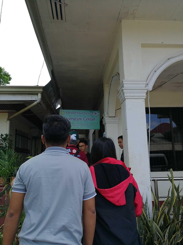
Day 2: ALORAN RIVER BASIN
DAY 3: ALORAN RIVER BASIN
The Aloran River Basin covers four municipalities, the Municipality of Aloran, Municipality of Panaon, Municipality of Jimenez and the Municipality of Oroquieta.
Day 4: LANGARAN RIVER BASIN
The Langaran River Basin extends from Lopez Jaena, Misamis Occidental to Plaridel, Mis.
Occ. to Calamba Mis. Occ.
PROBLEMS ENCOUNTERED
- Uncooperative Respondent.
- A sudden change of weather, from the scorching heat of the sun to a rainy weather.
- The respondent doesn’t remember the event.
- The GPS is not responding because of the obstacles like the rain, the trees, and the clouds.
CONCLUSION
The scorching heat of the sun adds up to the difficulty of this work. Walking in 10-200 meters is acceptable but walking up to 600-700 meters under the heat of the sun is like a torture. Since my buddy is our Chief, we were escorted by the van, but heat and then air-conditioned van then heat again might cause sickness due to a sudden change of temperature. It’s a big NO-NO to get sick while on a fieldwork. With that, choosing the torture road is a good idea but definitely a tortured one.
Water is the key so enough intake of water is necessary and also patience just to survive this fieldwork. Rain or shine, you have to work your ass off because of the deadline. Compared to my work in the office, fieldwork is a tiring work to do but still can be considered as a good and fun experience.
🌸 K N E E L Y R A C 🌸
Hi everyone!! I encourage you all to support and vote @steemgigs, @precise, @blocktrades, @curie & @ocd-witness as your witness. Just type the witness' name one by one on the first box.
CLICK ME TO VOTE


This post was spotted by @theluvbug and has received a 100% upvote and a resteem. If you would like to possibly receive future support from @theluvbug then please make use of the #theluvbug tag.
I AM
Spreading the STEEMIT LOVE with upvotes and resteems of AWESOME Steemit content. Use #theluvbug to get my attention :)
......
FOLLOW ME ON TWITTER
Congratulations, your post had been chosen by curators of eSteem Encouragement program. Feel free to join and reach us via Discord channel if you have any questions or would like to contribute.
Also,
CREATING YOUR PROFILE IS EASY! JUST FOLLOW THE STEPS HERE ☜(ˆ▿ˆc)
You can trade your earned credstars for SBD!