🌏 Teaching geography and maps = Activity 🌏
Geography can be undoubtedly didactic. Gone are the days when it was synonymous with a boring list of rivers learned by heart.
To make geography more integral, to put the world in context, there is a series of games that undoubtedly fulfill this purpose. In recent years they are increasing their offer and improving their elaborations.
Through this political world map, children can become familiar with the different countries and, above all, with the countries and their capitals. You can teach your children or students through this map that there are two types of borders: natural and artificial.
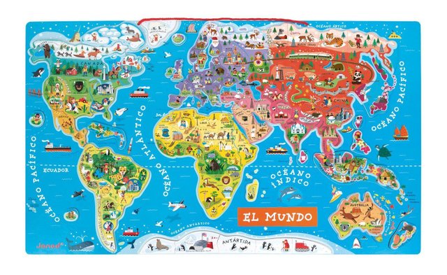
Children's magnetic world map
This children's magnetic world map certainly has the ability to entertain while decorating any child's room to perfection. It is a caring wooden toy, focused on children from 7 to 12 years old. Each magnetic fragment (there is a total of 92 pieces) represents a country or a region of the world with its name, its capital and an illustration that characterizes it.
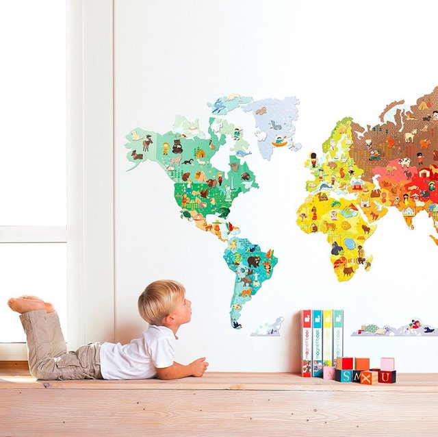
Children's mural world map
With this adhesive magnetized mural of the world, you will know the planet in a totally different way.
The map works in the following way: the continents are pasted on a smooth wall (do not suffer for it) and then the small ones (it is recommended that they are older than 7 years old) can be placed on the different animals to make the world a true Noah's Ark
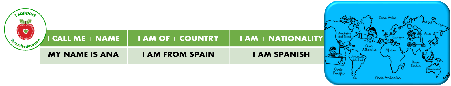
ACTIVITY: MY NAME IS
Children from 6 years old.
Necessary material
Photocopies of the cards with nationalities.
A great globe of the world.
Papers and/or colored pencils.
Reinforcement sheet.
✅ Start the class with the name of the teacher or teacher and write on the board What is your name? My name is Ana
✅ Walk around the class asking each child using the formula on the board.
✅ To continue the previous activity, you can ask the children to form pairs so that they ask each other the same question.
✅ Provide each member of the group with a photocopy of the material with maps and nationalities. You can always suggest that you color them to your liking.
✅ Ask them to read aloud the countries and nationalities that appear. If it is possible and appropriate, indicate on a world map the location of the country of the boys and girls present in the classroom.
✅ Ask the countries where they come from or they or their parents.
✅ Call attention at this time on how the different nationalities that are highlighted in the material are formed. It is not advisable to insist too much because the gentilicios are formed in a random way.
✅ To practice orally and immediately, say a country of those present and ask them to stand up and say their nationality.
✅ To practice the third person if considered appropriate, you can ask them to say, having given the example previously: I am Moroccan and my partner is Ecuadorian.
✅ To finish, hang the drawing of the world or project it.
✅ Give colored papers for each person to draw a person who says: Hello, my name is __________ (name) and I am from ___________ (country); I am ____________ (nationality). You can start the teacher or the teacher.
✅ Finish hitting all the characters in the world with blue-tack: this way we will have a real and intercultural world.
✅ Work another day with the cards of different countries to form the male and female.
You have been upvoted by the @sndbox-alpha! Our curation team is currently formed by @jeffbernst, @bitrocker2020, @jrswab & @teachblogger . We are seeking posts of the highest quality and we deem your endeavour as one of them. If you want to get to know more, feel free to check our blog.