Hike # 6 : Climbing Ingleborough
It was time for me to take on one of the big boys, or at least the local ones. @bingbabe climbed all three of the Yorkshire Three Peaks just two weeks ago and I had yet to do a single one.
Source
This was to change, and seeing as iFootpath has a walk named ‘Climbing Ingleborough’ which incidentally is one of the three I thought I would have a go.
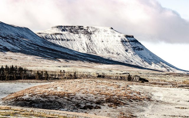
Ingleborough (723 m or 2,372 ft) is the second-highest mountain in the Yorkshire Dales. It is one of the Yorkshire Three Peaks (the other two being Whernside and Pen-y-ghent), and is frequently climbed as part of the Three Peaks walk.
Last month I had a go at climbing Pen-y-ghent and failed, so it was with great expectations that we set out on yet another gloomy day. Where is the sun when you want it?
So what do you do on a Monday morning; Go to work perhaps? @slobberchops went mountaineering and though Ingleborough didn’t look snowy and formidable like in the cover picture it was still quite a daunting project for me to climb this mountain.
This particular hike is described here.
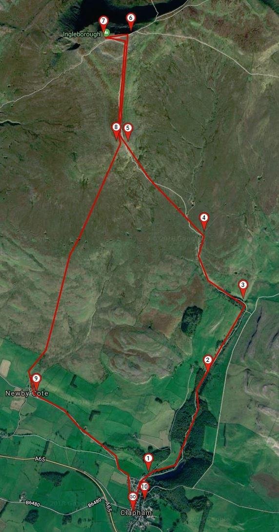
As I have mentioned before, I really don’t like paying to park my car. The walk started in Clapham which is a sleepy village but boasts a massive National Parking paid car park.
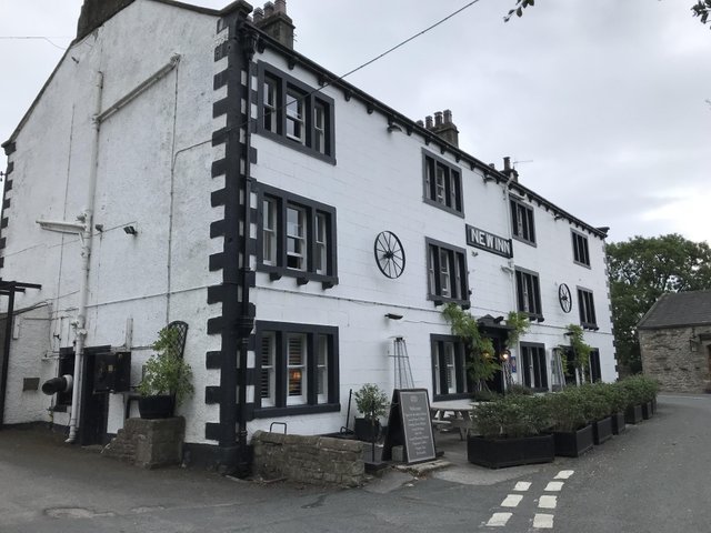
Well I’m not paying the stupid car park fees! We got there quite early and even so there was only a single spot left in the New Inn pub car park, perfect.
A walk through the village took us up to Ingleborough trail entrance. Some of the houses have been discarded and appear boarded up. Hard times comes to some I suppose.
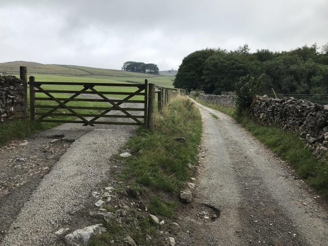
Things went wrong from the start with the map telling us one thing, and common sense another. We avoided the trail only to find ourselves walking up a farm track which was the wrong way, damn this guide.
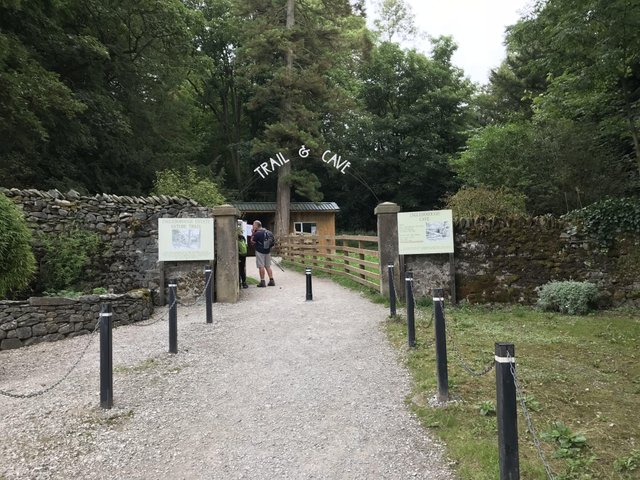
As a consequence we missed Ingleborough Trail and all its sights. It will be something to revisit in the future I suppose.
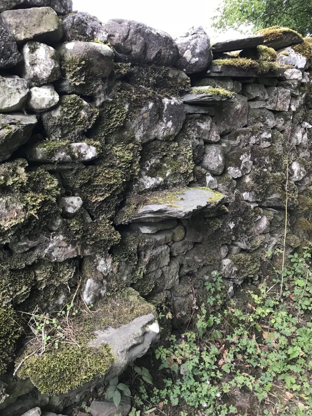
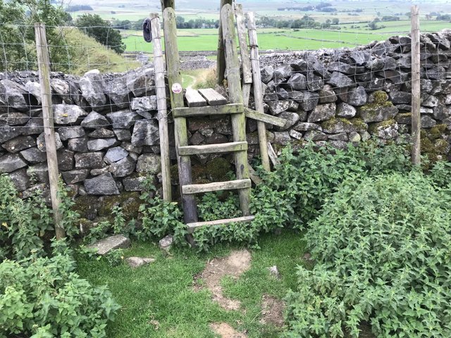
This wall had stepping stones with heavy moss attached. Was it a public footpath? I don’t think so; the other side had heavy barbed wire.
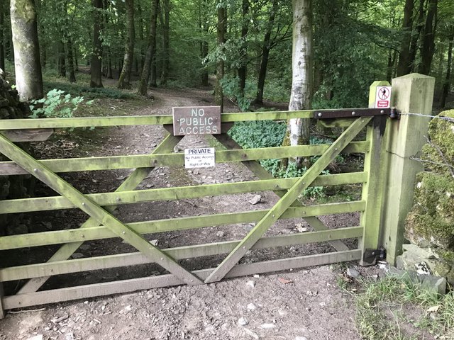
Our walk up the footpath that edged along Ingleborough Trail was full of ‘No right of way’ signs. Is this to stop people going on the trail without paying? This wasn’t the case with us, as at this point I was sure we were on the correct path. Wrong!
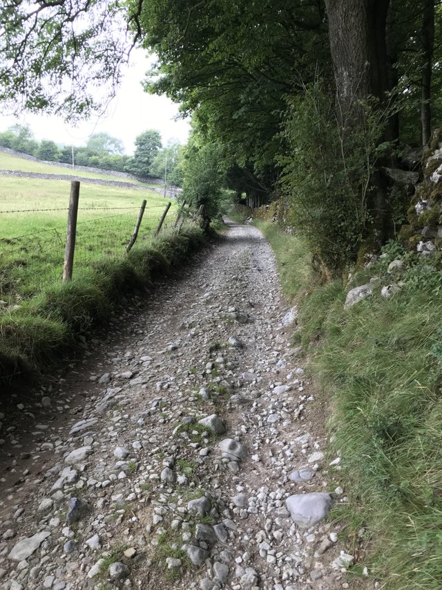
The heavily wooded area to the right of these pictures is where we should have been.
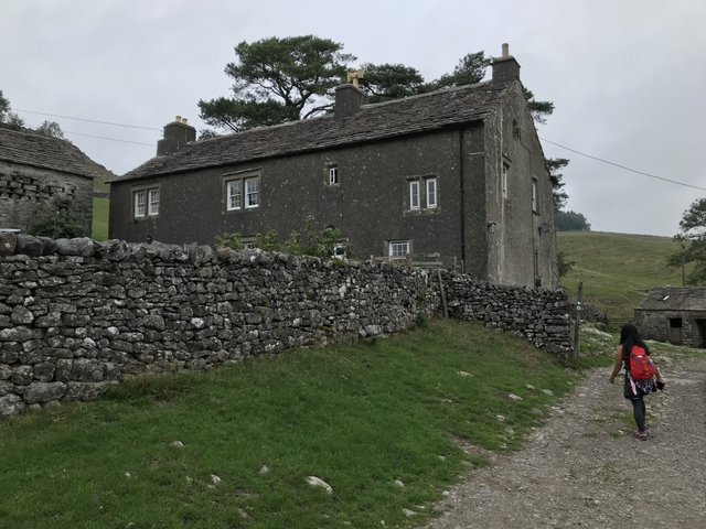
As we approached this farmhouse there was a chorus of dog barks. @bingbabe was getting a little nervous and had visions of a flock of German Shepherds attacking us. It didn’t happen and they were locked away.
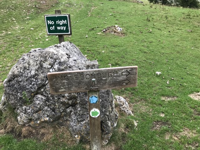
On the far side of the farmhouse, we saw a sign for Ingleborough Cave. At last the right way!
Ingleborough Cave (formerly known as Clapham Caves) is a show cave close to the village of Clapham in North Yorkshire, England adjacent to where the water from Gaping Gill resurges.
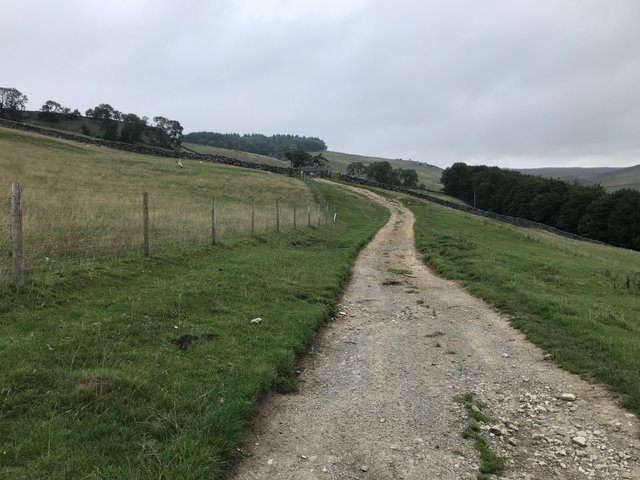
We could see at this point when re-joining the path our mistake and what we had potentially missed by bypassing the trail. Oh well, the cave was ahead though we had no intention of visiting it today.
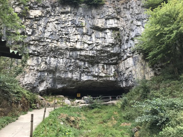
As it happens, it was closed and there were several people waiting for the 10am opening time. We continued on toward Trow Gill.
The trail was deserted as we left the cave, and within another half mile of walking we could hear complete silence.
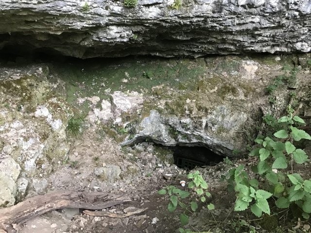
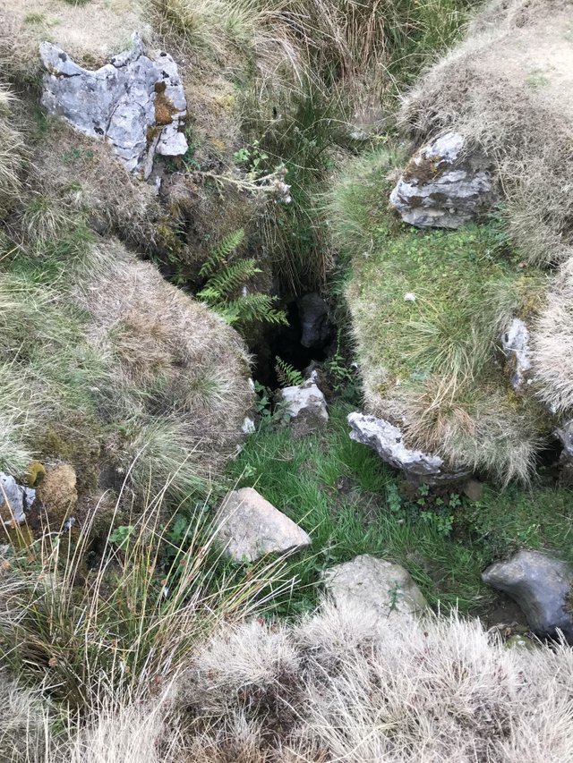
I noticed what looked like a cave off the beaten track and went to investigate. Its was a hole in the ground, one I didnt fancy getting too close too. Despite it's tiny looks, this is large enough for a man to fall down. (note the paper cup and its size).
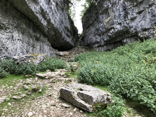
We entered the ravine named Trow Gill which was impressive yet and at the same time quite nettle ridden.
This place could be a great hideout for bandits in ancient times! I play far too many RPG’s for my own good and my imagination runs away with me at times.
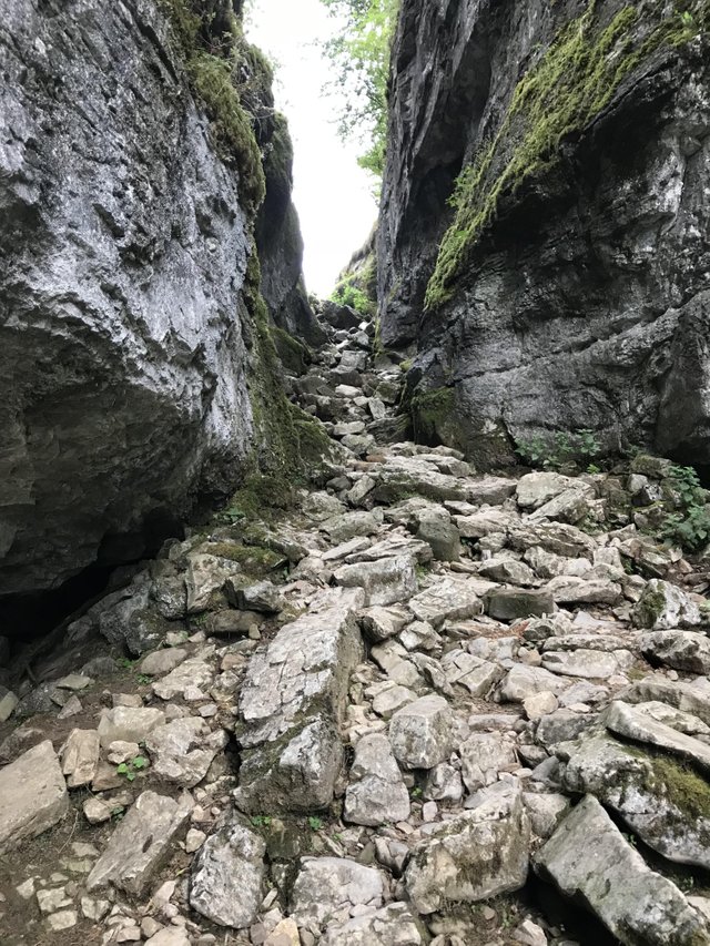
The ravine got narrower and narrower and we climbed out via a passage with very uneven stones which were well worn doubtless due to many walkers over time.
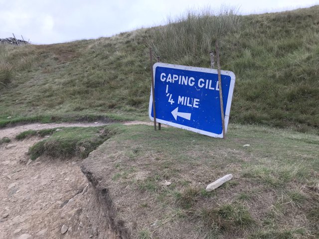
Next was Gaping Gill which is a massive underground chamber. We passed by it and noticed several deep holes in the ground with warnings.
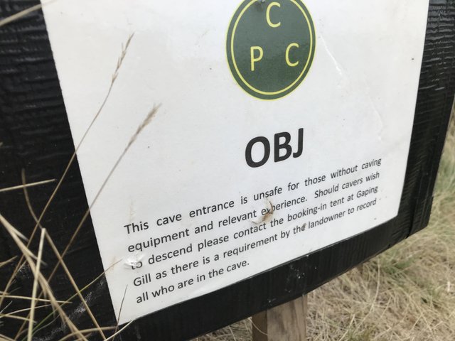
This is pot-holing country and dangerous for anyone going near these. Fall down this and it’s quite probably death.
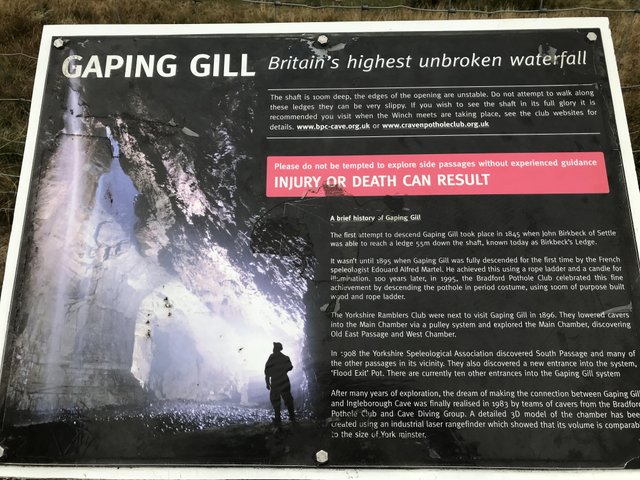
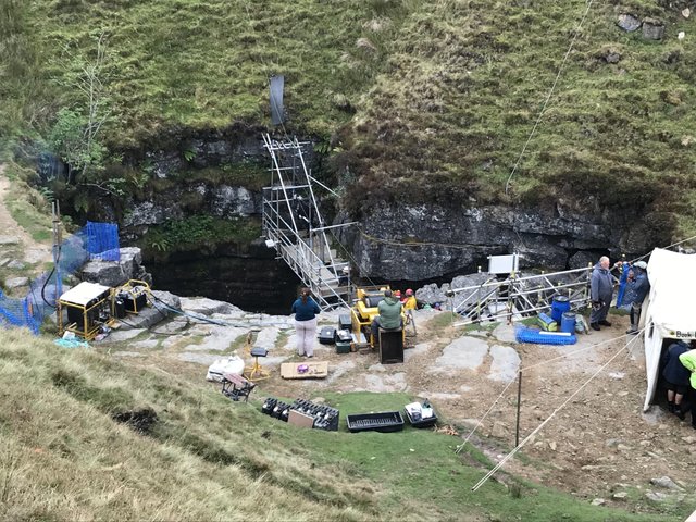
The Gill had many tents camped around it, these people do have enthusiasm! A winch was letting people down the 100m drop to the cavern below. It’s usually just for pot-holing clubs but the public can try it at times.
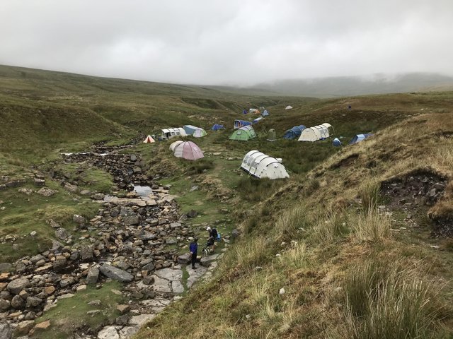
We made a mental note to descend in the future, as it’s being offered soon at £15 each. Ill have a go at that.
Gaping Gill (also known as Gaping Ghyll) is a natural cave in North Yorkshire, England. It is one of the unmistakable landmarks on the southern slopes of Ingleborough – a 98-metre (322 ft) deep pothole with the stream Fell Beck flowing into it. After falling through one of the largest known underground chambers in Britain, the water disappears into the bouldery floor and eventually resurges adjacent to Ingleborough Cave.
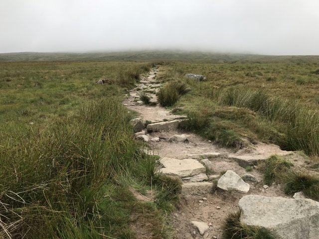
Leaving this big hole in the ground we could at last see the mountain or part of it. The mist and fog was covering most of it, and the uphill climb was about to start.
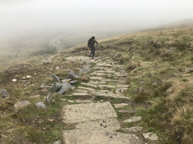
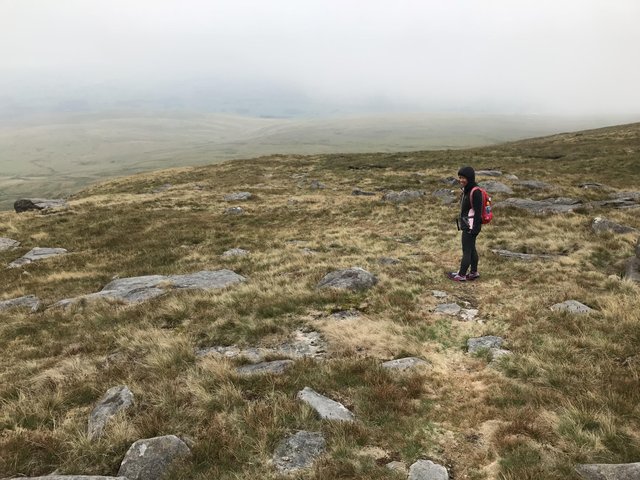
The path seemed to go on forever, getting steeper but not so steep to become a scramble. I had to take it easy as I’m not used to mountaineering, but I managed quite well I thought.
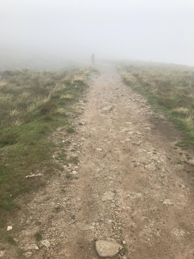
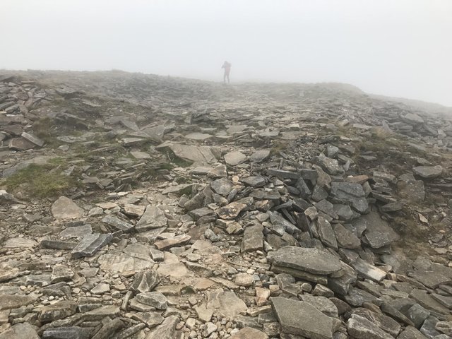
The mist encompassed us, it got a little windy and I was feeling decidedly colder. At times I could barely make out @bingbabe in front of me, so thick was the cloud.
I thought we had reached the summit at this point but I was wrong. More uphill was to come and by the time we did reach the top my hands were very cold and my hair soaked.
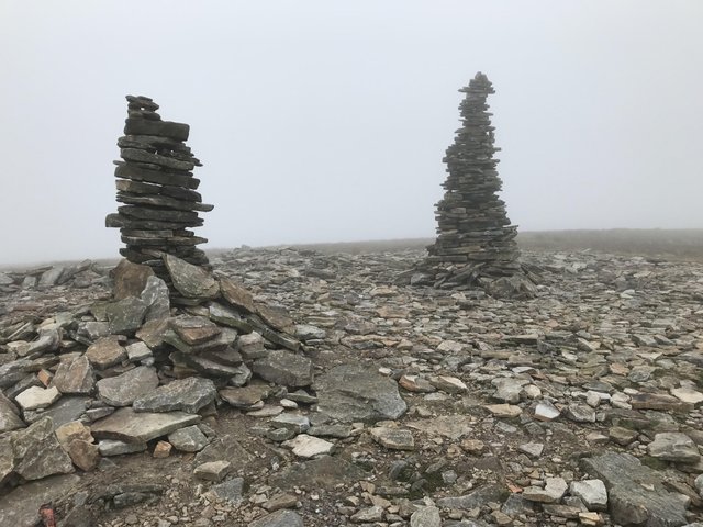
Now I know what it’s like walking in the clouds. The GPS took us to the true summit point where there is a stone pillar and shelter. We could hear some cheering and clapping through the clouds, though we couldn’t see anything. Then it turned to chanting.
We followed the chanting and found a bunch of people clustered around the mountain top stone all cheering and then chanting. Was this a bunch of cultists we had happened upon?
The didn’t seem to want to move away and there were other hikers who wanted a picture of the stone, through the clouds were quite dense and there wouldn’t be a whole lot to see.
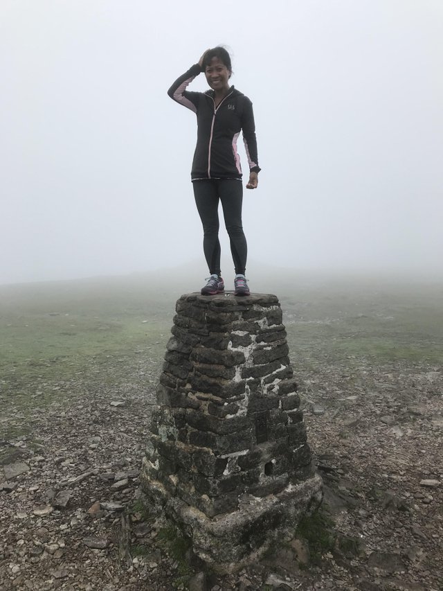
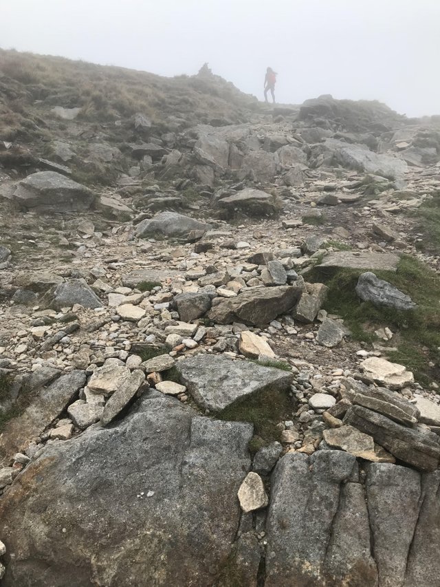
They moved away after some time and @bingbabe hauled herself up on the stone pillar drawing ‘Ohh’s and ‘Ahh’s’ from the cultists. I wasn’t sure if she was going to be offered up as a sacrifice at this point, but then realized there were too many witnesses about for this to be feasible.
The downhill trek was unremarkable, backtracking partly the way we had come. We still couldn’t see a thing, and I vowed never to climb if the weather was crap again.
The trail parted and we started descending down stony paths and undulating hillside, sometimes quite steep. On one hand, the clouds may have stopped my vertigo as I simply couldn’t see these huge drops next to me and suffered next to none.
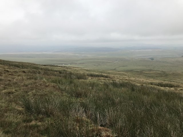
The clouds finally parted and we had a solid 2 mile stretch of downhill to navigate on what seemed like an almost unknown trail. The path was barely distinguishable at times and we saw nobody for the best part of an hour.
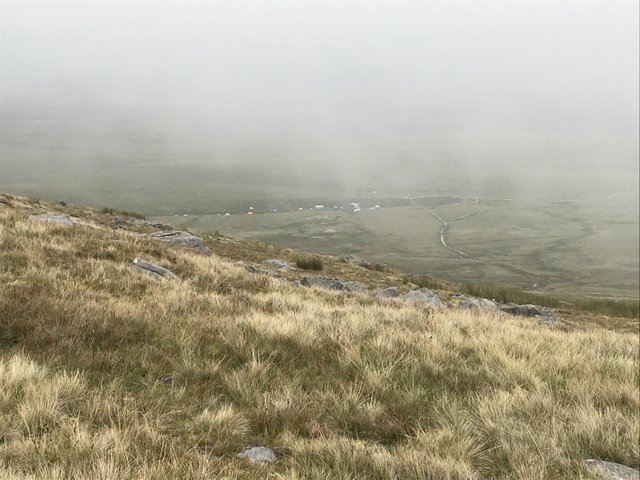
We had some decent views of surrounding countryside including the tent people at Gaping Gill amongst others.
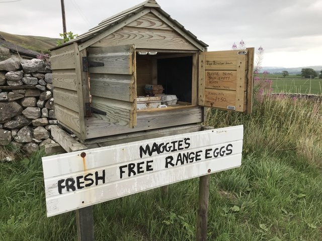
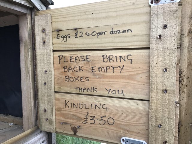
More dog unfriendly stiles finally brought us to a run-down farm and ‘Maggie’s Fresh Free Range Eggs’. Leave £2.40 and grab a dozen eggs. It’s all based on trust of course,
and is one of those great British quirky things we have.
We only wanted 6 eggs so left £1.20 in the lock box. As for bringing the empty box back, that may be a little more difficult.
Another walk of a mile or so on the roadside brought us back to Clapham. After almost 9 miles of walking an climbing, we needed a cup of tea and sought out ‘The Croft Café’.
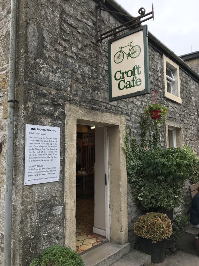
It really was the best tea I have tasted in a long time. I enquired about the type of tea and was informed ‘Tetley’. Nothing special about that then! The owner told me ‘it’s the water in these parts, it makes all the difference.’
This was a tough hike, the most gruelling I have done so far yet I felt I managed it quite well. No DOMS today either. I must be fitter than I look. If I learnt anything by this experience, it's don't hike unless it's sunny, unless you want to miss all those lovely views.
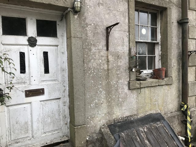
I spotted this abandoned house in the centre of the village and couldn’t resist this shot. I think its looks better in black and white, what do you think?
All photographs were taken by myself except for the cover one which has been sourced from wikipedia.


If you found this article so invigorating that you are now a positively googly-eyed, drooling lunatic with dripping saliva or even if you liked it just a bit, then please upvote, comment, resteem, engage me or all of these things.
I have a good friend that occasionally drags me out into the desert to look for and catalog Elephant Trees. The damn things are quite rare, and no self respecting Elephant Tree would dare be found on a level spot. The seem to like really steep, rocky canyons.
The dog and the friend both love it, so I muddle along.
It's a great story, particularly about missing the trail. A nice recovery and a trip to the top that you won't soon forget I think.
I don't think I would dare do it in AZ, lots of nasty snakes and other insecticides in those canyons.
Missing the trail sucked, I tell you. We will be back to do the trail and cave someday.
Wow! A great post! Marian and I entered a ravine near the Cullinin diamond mine and it had a lovely little stream flowing through it. Very high cliffs either side and as we rounded a bend we saw a little pool with a cluster of big rocks at the end. So we approached through a narrow passage and up on the rocks pops a baboon with a baby. We stopped in our tracks as baboons are very dangerous and with babies they are worse. The next moment, high up on the cliff side a male baboon let's out such an angry scream that it still troubles me. It felt like forever as we slowly inched our way backwards. As you can see, I am still alive to post this! Blessings and upvoted! Thank you also for the support on our charity page!
Thanks and also for the insight into baboon behaviour. We don't have such animals here, and its probably just as well. I haven't seen any outside Africa on my infrequent visits.
You've got the bug! (I'm coming to this a bit late, as you cannot imagine what's been going on in my life recently…)
Well done on getting to the top in those conditions :)
"No Public Access" - that's something you don't often see when walking in Scotland. We do get signs warning us that we're entering someone's private residence though. Very sensible to put up a signpost indicating the correct way.
There's a website called walkhighlands.co.uk that has guides for all the most popular hillwalks and many of the flat walks in Scotland. It's absolutely brilliant. Each walk has a map that you can download, and in my experience they only very rarely have mistakes. There's a huge community for this website so people report when things are changed or go wrong and you can also read individual walk reports for each walk. Definitely recommended for next time you visit Scotland. I'm not sure if there's an English equivalent.
LOVE the honesty box! I've seen a couple of them on a popular trail near where I live offering ice creams and soft drinks. The photos look lovely, even the misty ones. Very atmospheric and "Wuthering Heights".
My back was feeling it after this, there was no scrambling but I have now experienced it with the latest one. I have learned not to hike when the weather is crap, it doesn't do it justice. Whernside is the next target.
I'll see if I can find something similar to walkhighlands.co.uk. @bingbabe is muttering about doing Skafell Pike now, I really don't know.. I like doing these but they are terrifying too.
I did Scafell Pike last year with a scrambling group. I don't remember any steep bits... actually now that I think about it, there was one scrambly bit, which I loved. It wasn't over a big drop or anything, but it was surprisingly technical for such a popular walk! I can't remember what guides our leader used - they were good, but not as good as walkhighlands. Ah - found it! I used a Harvey map too :) Enjoy Whernside!
Congratulations! Your high quality travel content caught our attention and earned you a reward, in form of an upvote and resteem. Your work really stands out. Your article now has a chance to get curated and featured under the appropriate daily topic of our Travelfeed blog. Thank you for using #travelfeed
Learn more about our travel project on Steemit by clicking on the banner above and join our community on Discord
Thanks @travelfeed :)
Hiya, just swinging by to let you know that this post made the Honorable mentions list in the Travel Digest #288.
Please drop by to check out all the rest of today's great posts and consider upvoting the Travel Digest if you like what we're doing.
Thanks!
Congratulations! This post has been chosen as one of the daily Whistle Stops for The STEEM Engine!
You can see your post's place along the track here: The Daily Whistle Stops, Issue 221 (8/09/18)
The STEEM Engine is an initiative dedicated to promoting meaningful engagement across Steemit. Find out more about us and join us today.
Thanks for the virtual hike! I loved seeing the landscapes. They are so different than what I have seen so far.
More coming soon, good to hear you liked it.
Great pictures! Although the weather wasn't the greatest and you took the wrong way at first, it still looks like you got to take in a lot of great sights. It's very cool that you have mountains like this so close to where you live. We have to drive several hours if not days to get into anything like this where I live! We do have some awesome forests and beaches though.
They are not so close! around 45 mins drive. We did another today, but Im too knackered to write..
😀 I drive 30min one way to work each day, so 45 isn't terrible but not as close as I had assumed. I can only imagine how tired you must be. I am still recovering from my illness.
What an adventure and thanks for taking us along, I hope if you do go back and go downinot the cavern you do another post I would love to see that
If a cup of Tetley can be that good, then the walk must have been a tough one. It certainly did look like a challenging walk