Visiting and Mountain biking Lake Tahoe California
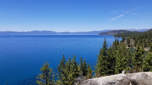
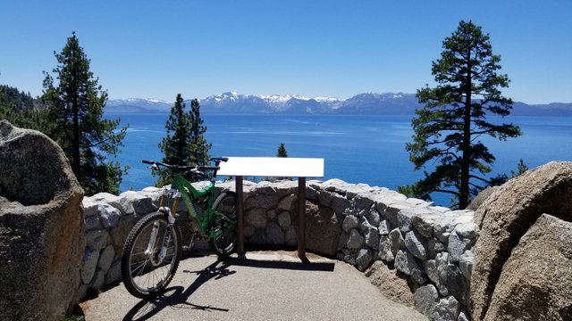
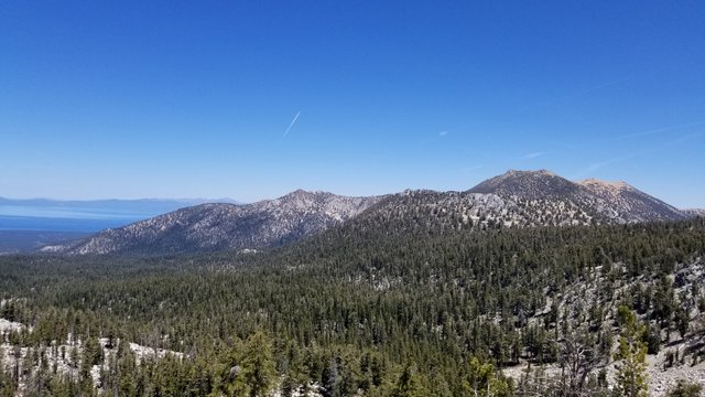
Hello all, this is my last mtb ride while visiting Lake Tahoe, CA. On the drive down from Ashland, you start climbing highway 50 after Carson City, NV and once you crest the spooner summit, you start descending down towards the lake and you will see a small turnout for Logan Shoals Vista point. So here is a few shots at that location:
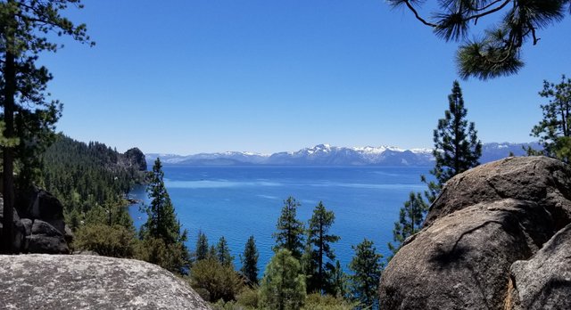
Looking to the north towards Tahoe City
I had my mtb on the rack and did not want to leave it, so I road it down. The plaque shows the various mountain peaks that you see across the lake. (The western side)
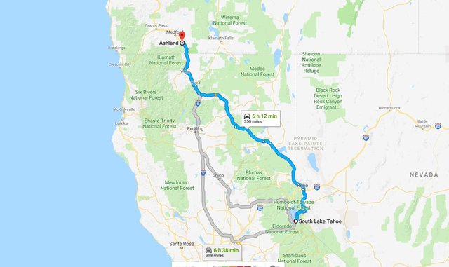
Here is the route that I took driving from Ashland Oregon to South Lake Tahoe. It was about 6 hours and 350 miles.
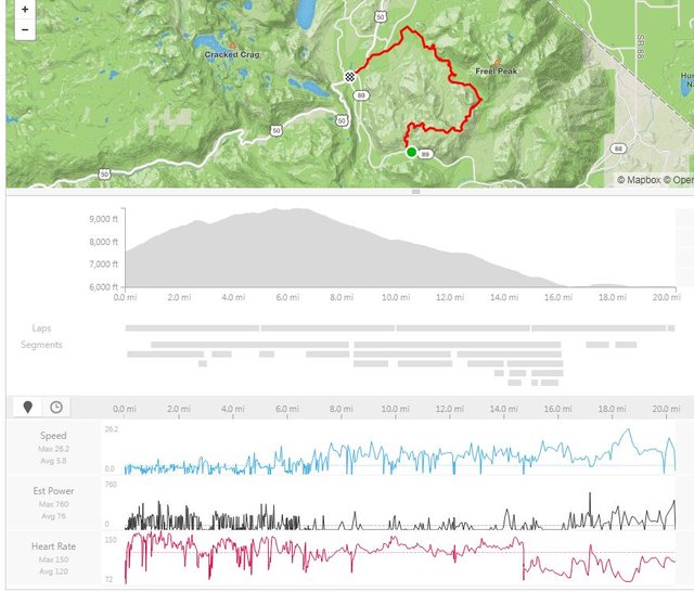
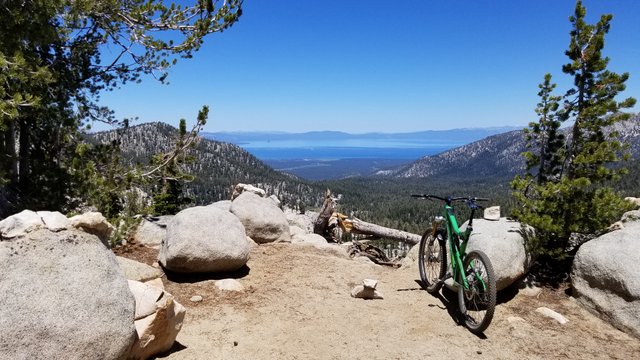
My ride was on the Tahoe Rim Trail, Armstrong and Corral. There are YT videos of all of these trails in case your interested in the terrain. 21 miles and 2100 feet of climbing. I started off for the first 3 miles and met a few other mtb'ers that gave me a lift to luther pass which cut out about 1000 feet of climbing. I really needed that as the elevation makes it tough to climb. Luther pass is about 7,700 ft in elevation.
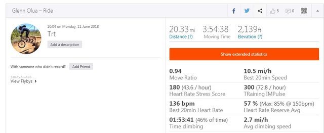
GPS data is from a Garmin Vivoactive HR and uploaded to strava
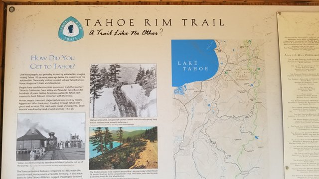
If you ever in Lake Tahoe and want to go on a hike, you will probably see trail signs like this one. The TRT or Tahoe Rim Trail. It's a trail that almost circles the lake.
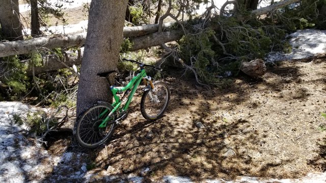
Right off the bat, there is some rather steep and technical climbing. A lot of these efforts really takes a lot of energy and you get tired quite fast.
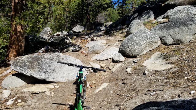
There was still snow on the trails above 8600 feet or so. I probably hiked my bike through about 10-15 of these sections.
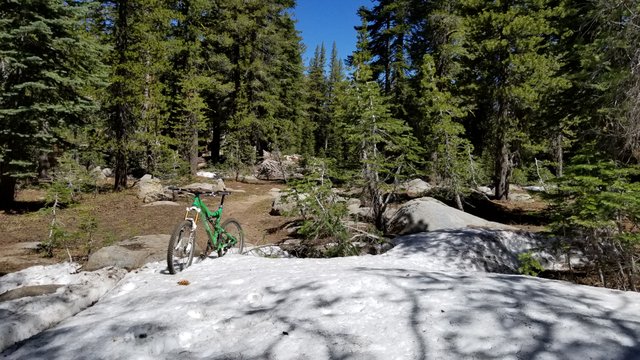
There were high winds the other day which blew down some decent sized trees to make your way around as well.
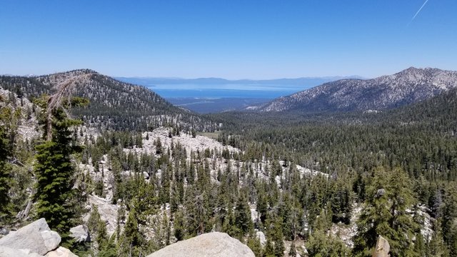
Starting to get Tahoe views, some of the rewards for your climbing efforts.
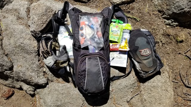
My camelbak and some of the stuff that I take. 70oz of water, food, tools, pads...
Have you ever heard of the Heavenly Valley ski resort? It's on the other side of that mountain.
More Tahoe views!
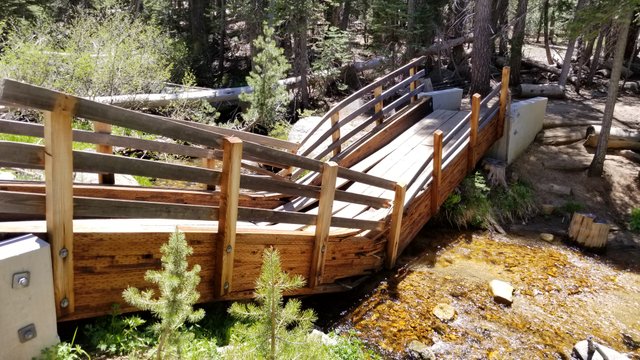
On my way down, I crossed this broken bridge. I don't think it could hold the weight of a full snowpack and collasped.
So I highly recommend visiting Lake Tahoe if you have never been here before. It is affordable as there is a lot of camping (which I have done a few times before) and there are quite a few inexpensive places to stay. You can even check out Air BNB. There are so many activities that you could do from swimming, hiking, cycling or just relaxing and watching movies!
Looks awesome I definitely want to make a trip down to Cali one of these summers and explore! Looks epic especially with your bike.
No clue why but I've always been terrified of Mountain Biking. Such a lethal sport I feel like. I'll stick to Drone flying and playing tennis.
You will enjoy your visit to Calif as there are a lot of places to see and go. I used to play a little tennis, but switched to cycling as you do not need another person to 'play'. Your right about mtb, it is very dangerous and you can get injured very easily. (Like broken bones)
I assume, besides the food, water, pads and tools, you must be wearing a decent amount of warm clothing? How much weight do you end up carrying. While climbing steep sections my back always hurts because of the heavy camelback. And i would only carry water.
As far as clothing, I just wore a thicker cycling jersey so I can put things in the rear pockets and mtb shorts. Even through you see snow, the weather was about 67*f.
I'd say that I end up carrying about 8-10 pounds, plus the 30 lb bike. So when you add it up, 40 extra lbs hiking up a 15% grade (when I could not make a technical climb) at 8500 foot level. I will tell you that it was pretty tough.
Again, amazing photos and location! I should start booking some flights!
Thanks for the complement, 'real' mtb'ers should definitely make a stop here and in Oregon.
Beautiful pictures. Seems great fun!
Thanks for sharing
Your work has been great but it is a lot of hard work. It's definitely a beautiful place to have your picked pictures beautiful
thank you for sharing the journey with us
Thanks for visiting the blog. And you are right, some of the photos are at very remote locations high in the sierra mountains, it is even hard to hike. But if you visit, you can drive to vista points and do not need to expend a lot of energy cycling or hiking.
Very beautiful photos. Very well made places for relaxation. Traveling on a bike is good for health, gives a lot of energy and energy for later life!
Nice scenes and amazing photography. I really enjoyed to see it.
It's great to see the great place. Thank you for sharing the journey
@fatema105 - You may not realize that "enjoyed your photo" is considered to be spam, you used 40 similar phrases in your last 100 comments, and the Steem Sincerity API shows a 72.30% spam score. Learn why this is spam and a few better ways to earn the support of the community when commenting.
@glennolua - You can remove this comment and everyone can whitelist me from appearing in future posts.
You got a 2.63% upvote from @postpromoter courtesy of @glennolua!
Want to promote your posts too? Check out the Steem Bot Tracker website for more info. If you would like to support the development of @postpromoter and the bot tracker please vote for @yabapmatt for witness!