Wildcamping the West Highland Way, Day 3
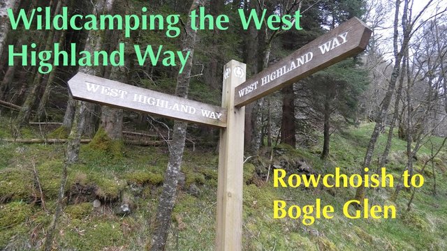
This was the last leg of my 3-day trek, and it would take me to the halfway point of the West Highland Way – IF I managed to get there in time!
Having had a good night's sleep in my tent at Rowchoish, and having bathed my feet in Loch Lomond the day before, I felt quite energetic. My feet felt great.
It wouldn't last of course, but it was a good start!

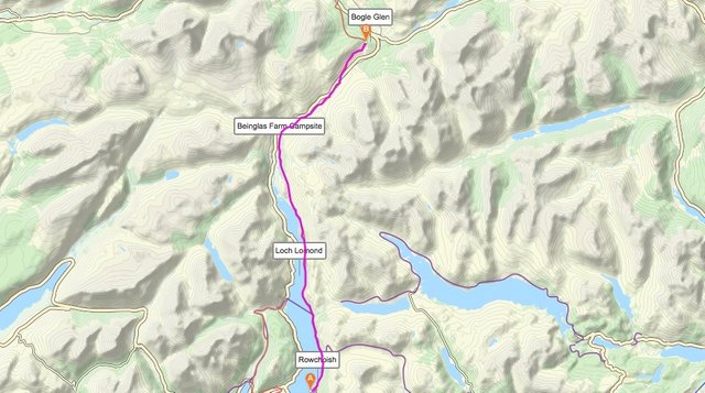
Map showing the route I took along the West Highland Way from Rowchoish to Bogle Glen, near Crianlarich. Click here for a more detailed view.
By the time I'd packed up my tent, had my breakfast porridge and coffee and filled up my water bottle from a small waterfall nearby, it was not yet 8am, so I was able to enjoy a few more hours of solitude as I walked.
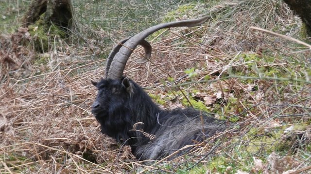
I passed a couple of wild goats, and they were not the slightest bit bothered by my presence.
I've never been this close to a wild goat before. They usually run off as soon as I reach for my camera!
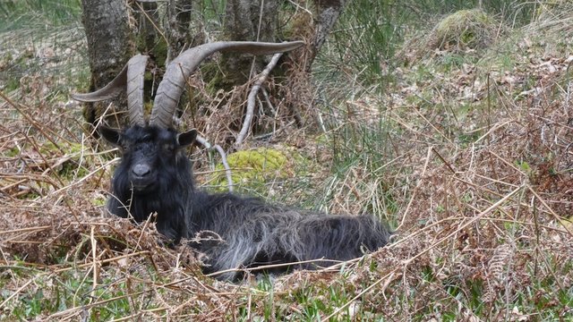
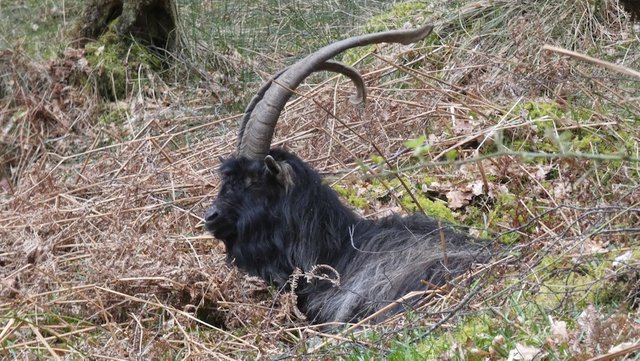
Actually my presence just sent him to sleep.
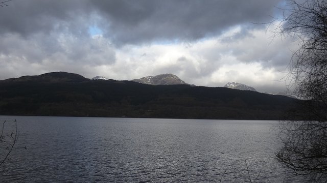
The "Arrochar Alps" were peeking over the hills across Loch Lomond. Despite the dark grey clouds, the weather was unusually warm for the time of year.
I passed some very isolated cottages along the way. At Cailness, there is a memorial to a man called Bill Lobban, who sadly lost his life in 1975 while trying to rescue a student who had fallen into the river when it was in spate, and had been swept out to Loch Lomond. The student was later saved.
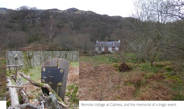
The text on the memorial reads: "In loving memory of Bill Lobban. Died 23rd November 1975. He made the supreme sacrifice in saving the life of a friend."

The Inversnaid Hotel, about 4.5km north of Rowchoish, is a spot where you can enjoy a coffee or a meal, and walk to the waterfall. It was 9.30am when I arrived, and I'd already had breakfast, so I just took a couple of photos and chatted to a couple of men who were wildcamping nearby.
A note about camping ...
Wild camping is not permitted in certain parts of the Loch Lomond and Trossachs National Park during the summer months. This website details the areas where wildcamping is and is not allowed.
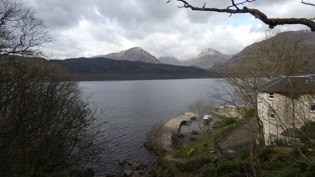
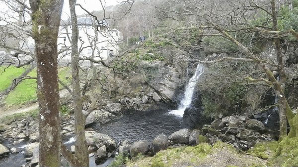
The Inversnaid Hotel was built in 1790, and distinguished guests included Queen Victoria, the author Sir Walter Scott and the poet William Wordsworth. The waterfalls which cascade down from Loch Arklet, at an altitude of 150m, are a dramatic sight when in spate. They were relatively subdued on this visit.
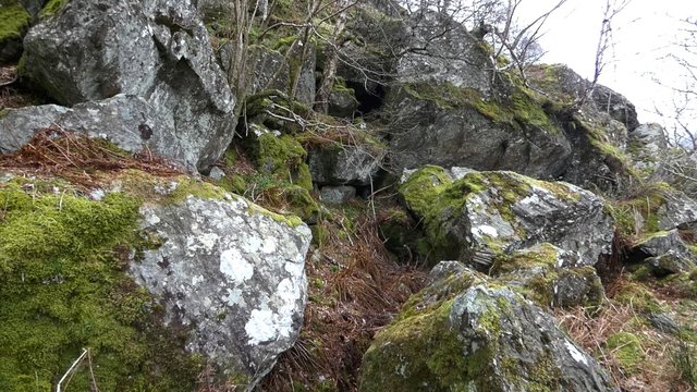
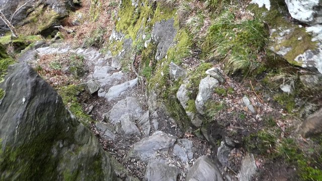
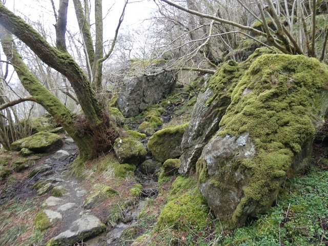
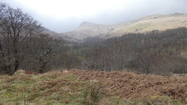
About a kilometre north of Inversnaid, the path becomes very rough and rocky. At the same time, the terrain becomes really interesting, running close to the lochside, with enormous moss-covered boulders and high rock walls. I just slowed down, took my time and enjoyed it.
The path skirts the right side of these boulders, in a series of rocky steps.
Kings and outlaws
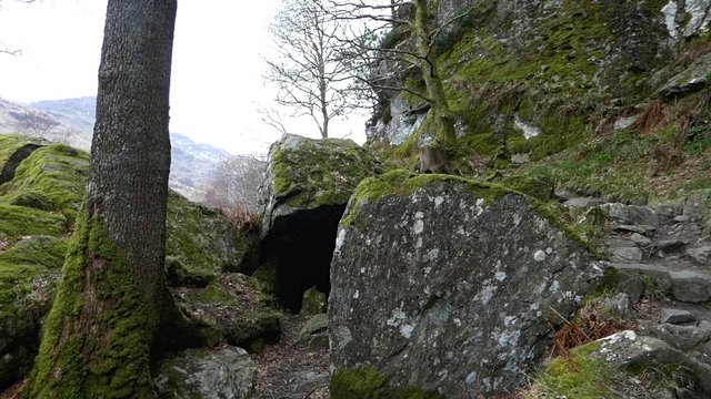
A mile north of Inversnaid is a bouldery enclosure known as "Rob Roy's Cave". Whether the famous outlaw ever actually visited the cave is uncertain – it was also said to be one of the hiding places of Robert the Bruce, a few centuries earlier.
Rob Roy's Cave, just north of Inversnaid.
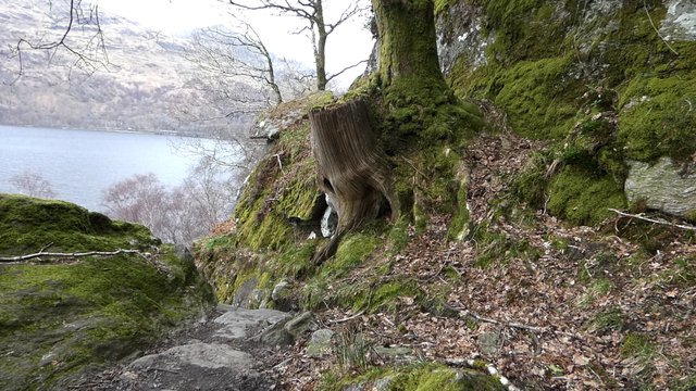
The terrain in this section of the walk is particularly beautiful, but care needs to be taken while walking here.
This steep rocky path leads down from the tree trunk above.
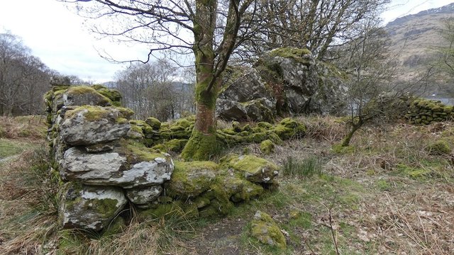
I passed more ancient ruins, which made me wonder what it must have been like to live in this area, hundreds of years ago.
After a while, the path got much flatter and easier to walk on. Views of Loch Lomond opened out, and I spotted Island I Vow, an island I visited years ago, when I was a volunteer with the Loch Lomond Rescue Boat.
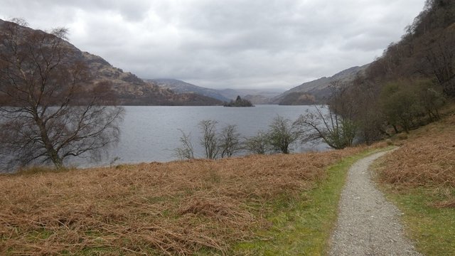
Island I Vow can be seen in the centre of the photo.
Island I Vow is a magical little enclave, with ancient yew trees and a ruined castle. William Wordsworth visited the island in 1814, and was inspired to write a poem about a hermit he encountered there.
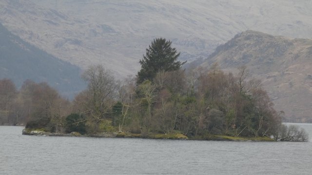
Close-up photo of Island I Vow.
Shortly after this, the route becomes rough and rocky again.
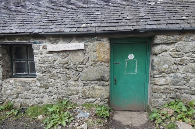
Bothy
Lunchtime was approaching, and I was starting to get hungry. I decided to stop for lunch near Doune Bothy. I actually spent a night in this bothy several years ago, when I was doing volunteer work with the Loch Lomond Park Rangers.
We did some work to repair the path. The work we did has mostly been eroded by thousands of boots and lots of rain.
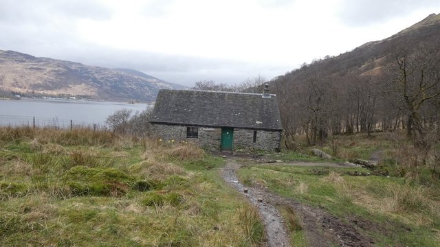
Doune Bothy, on the shores of Loch Lomond.
Trekking misery
Beyond the bothy, as the path started to flatten out again, becoming much easier to walk on, I was overtaken by the first trekkers I'd spotted all day. They were two pairs of lads, walking very fast and carrying small daypacks.
They looked absolutely miserable!
I can understand why people find this section of the walk so uncomfortable. If you try to go fast (and you're not a fell-runner) it must feel like hell! But if you slow down and enjoy the surroundings, it's an absolute joy.
In the end I decided not to stop for lunch at Doune Bothy, as the ground was quite boggy. Instead I found a small beach at the shore of Loch Lomond, where I sat down, took off my boots, dipped my feet in the freezing water, and ate my lunch. The weather was warm, and it felt like bliss.
As I was sitting eating, some more trekkers charged past at a brisk pace, with faces like thunder! Maybe they were trying to keep to a tight schedule.
Having refreshed my feet and my appetite, I got on my way once more. I was finally approaching the northern tip of Loch Lomond, which is 36.4km (22 miles) long, and is the largest lake in Great Britain by surface area.
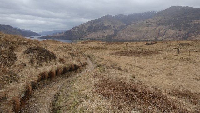
The view back down Loch Lomond from just beyond its northernmost point.
By now the path was well-surfaced, and easy to walk on. I was starting to get tired again, and was looking forward to another half-pint of Guinness at Inverarnan.
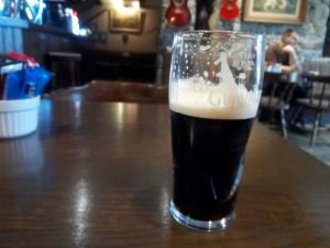
Refreshment at Beinglas Farm.
I was initially intending to cross the river and visit the Drover's Inn at Inverarnan. This is highly recommended if you're not averse to being surrounded by stuffed animals!
The Drover's has a lot of character, and is usually pretty busy. But it would have involved a detour of about a kilometer. I decided to pop in to the bar at Beinglas Farm Campsite instead, as the West Highland Way path goes right through it.
While there, I spoke to a friendly American trekker, who had walked all the way from Rowardennan that day and was hoping to reach Crianlarich by evening. That was five or six kilometres more than I had walked that day. He was exhausted, and ordered fish and chips.
Later that day, I met another walker who said he had met the same guy, and that he'd decided to take the bus to Crianlarich instead. I respected his decision! If he'd continued walking to Crianlarich, he would have covered about 33km that day, over the roughest ground on the West Highland Way.
And having visited some of the more northerly parts of the West Highland Way, I would say that the section from Inverarnan to Crianlarich is probably the least interesting part of the whole walk.
The skies were getting significantly darker as I walked on. I was lucky though – the first rainfall I'd encountered during my entire trek did not occur until later that night, when I was in my tent.
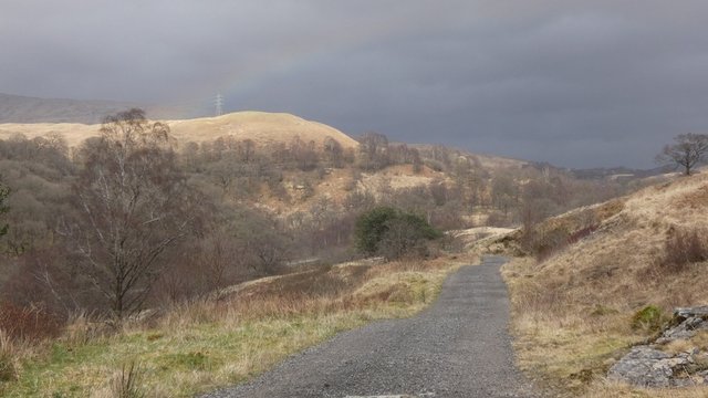
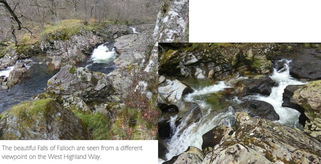
The Falls of Falloch are usually visited from a car park on the A82, but you get a completely different perspective of them from the West Highland Way path, which traverses across a hillside above the road at this point.
Shortly afterwards, the West Highland Way path crosses under the railway and then under the A82, climbing up the hillside on the other side of the road. I was now looking for a good place to camp, but the route was going through farmland with sheep everywhere and a lot of tussocky, wet ground.
I started to wonder if I'd find anywhere to camp before reaching the town of Crianlarich, from where I was planning to take a train back to Glasgow the following day.
Bogle Glen
At last I found the perfect spot, at a wooded area known as Bogle Glen. The name didn't fill me with confidence, as "bogle" is an old Scots name for a spook or a ghost. But it seemed like a pleasant spot, and if I needed to run away from anything, the town of Crianlarich was just a kilometre down the hill!
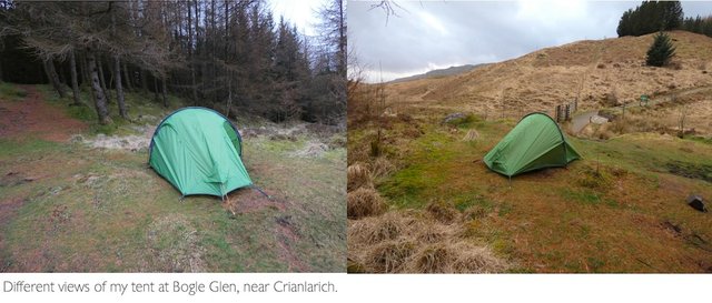
I had another great sleep that night – which isn't really surprising, as I'd covered a distance of 27.5km that day, with an elevation of 646m, taking me 9 hours and 47 minutes (including a break for lunch and a stop for Guinness).
The only weird sound I heard was a load of loud croaking from a nearby burn early the next morning. It was breeding time for the local frogs.
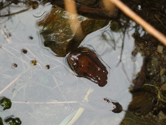
Most of the frogs scattered as I approached, and I only managed to photograph one of them. The light reflected on the water gives it a bizarre white sheen.
Heading back home
The following day I got up early and took the train from Crianlarich back to Glasgow. This is a beautiful journey, which passes close to hills and mountains, giving views that you don't get from the car.
I'm looking forward to doing the northern half of the West Highland Way sometime, maybe carrying a smaller and lighter tent – and maybe next time I will eat out in pubs or restaurants. I might even use a bag-carrying service.
There are also other trails in Scotland that I would love to do.
I would also take the Harvey map which details the entire West Highland Way and the immediate area around it, instead of taking three bulky OS maps.
If you're planning to visit Scotland and you enjoy walking, I would highly recommend the West Highland Way. And make sure you factor in enough time to really enjoy the walk!
Other posts in this series:
Wildcamping the West Highland Way, part 1 (introduction)
Wildcamping the West Highland Way, Day 1
Wildcamping the West Highland Way, Day 2
Posted from my blog with SteemPress : http://ramblingandscrambling.co.uk/walking/wildcamping-the-west-highland-way-day-3/

.gif)

WOW that goat did let you get some close in shots how cool is that
I have really enjoyed this series such an amazing mix of scenery and history and the feeling of having done all this living off mostly what you could carry must be amazing
Thanks @tattoodjay! Really glad that you enjoyed the posts - just as I really enjoyed doing this trek!
It was good to know that I could live for three days on what I carried on my back. It was a great experiment, but I don't think I'd carry quite such a heavy load in future. It's not great for the muscles and joints!
And that goat... :D
I remember doing similar hikes back in my 20s and 30s, I couldn’t do it now but it is such a great feeling ad after each one you reevaluate what you need to carry to get just the right balance between weight and necessities
Another great adventure! I really admire your bravery!! That was so cool how the goat didn’t move and you were able to snap some photos. I really loved the waterfall and history of the hotel. Thanks for giving us history as you journey along these adventures! I enjoyed reading and viewing the photos :)
Thanks @crosheille! Really glad you enjoyed my post and the historical references. I'm fascinated by the history of these places.
You’re welcome ;)
Congratulations! This post has been chosen as one of the daily Whistle Stops for The STEEM Engine!
You can see your post's place along the track here: The Daily Whistle Stops, Issue 476
Hiya, LivingUkTaiwan here, just swinging by to let you know that this post made into our in Daily Travel Digest 512.

Your post has been manually curated by the @steemitworldmap team. If you like what we're doing, please drop by to check out all the rest of today's great posts and consider upvoting and supporting us.
Congratulations, Your Post Has Been Added To The Steemit Worldmap!
Author link: http://steemitworldmap.com?author=natubat
Post link: http://steemitworldmap.com?post=wildcampingthewesthighlandwayday3-kkyl0p6b4e
Want to have your post on the map too?
Congratulations! Your high-quality travel content was selected by @travelfeed curator @for91days and earned you a reward, in form of a 100% upvote and a resteem. Your work really stands out! Your article now has a chance to get featured under the appropriate daily topic on our TravelFeed blog.
Thank you for being part of the TravelFeed community!
Learn more about our travel project by clicking on the banner above and join our community on Discord
Hello!
This post has been manually curated, resteemed
and gifted with some virtually delicious cake
from the @helpiecake curation team!
Much love to you from all of us at @helpie!
Keep up the great work!
Manually curated by @enchantedspirit.
Haha you presented another series of sheep pictures, awesome. Your blog is super and I am a bit jealous of your adventures. On the other hand it motivates me and I will figure out a way to do something similar in the near future.
Cool to found you here on this platform.
Cheers,
Max
I just like furry creatures :D
Glad you're enjoying my blog, and I hope it inspires you to have some great adventures!
This is an amazing walking experience! Would love to go camping one day!
This reminds me of my walk in Skye many years ago!
Good old days for me!
Posted using Partiko iOS
Thanks @kaminchan! Glad you enjoyed it. I can definitely recommend camping :)