JAPAKEH XX: The 20th Aceh Tracker Expedition to Mt. Buntul Gading (Day -1)
ABOUT JAPAKEH
JAPAKEH is a series of expeditions to explore the peaks of Aceh. This expedition began to be implemented in 2012 to build a positive image of the Aceh mountainous region to the Indonesian and international community after the long civil conflict in Aceh. Apart from that, JAPAKEH activities also aim to collect visual information on natural landscapes, hiking routes, and documentation of biodiversity as well as as a stimulant for research and science. This is also an adventure sport as a form of achievement for the younger generation who prioritize visual recording along the route.
As time goes by, this program continues to develop to collect information on various types of rare and even endangered flora and fauna. Apart from JAPAKEH as the main activity, the Aceh Tracker Institute also has a structured and systematic training program to train its members in carrying out outdoor adventures. These activities are also closely monitored and have a monitoring team capable of carrying out rescue operations with a small team. The qualification that the monitoring team leader must have is to have 1000 hours of independent (solo) activities and a minimum of 10,000 hours of being in the various areas, terrains, and jungle including the ability to perform rock climbing, caving, canyoning, vertical rescue, white water rafting, which is calculated based on the number of days in the similar expedition.
The qualifications are made in such a way as to be able to form a team that is truly expert and has good qualifications in rescue operations and searching for victims and can be mobilized less than 24 hours after the accident report is received by the operations monitoring team.
First day of expedition
Summary of reports to Linge Police, Central Aceh.
This expedition started on March 5 and is planned to end on March 15 with an estimated time of 10 days, if all goes smoothly.
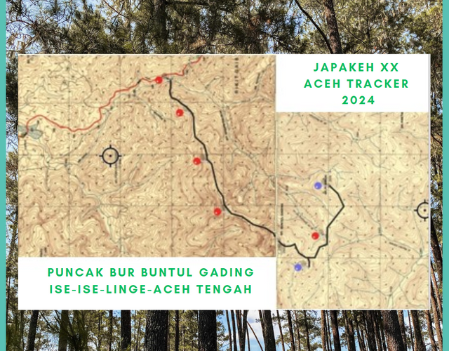
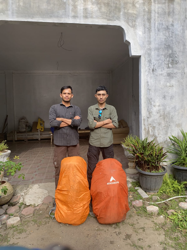
Permission to report, today, Tuesday, March 5, 2024, the Xpdc Exploration Puncak Aceh (JAPAKEH) XX Aceh Tracker Team consisting of Sultan Refi Pobri Fonna and Ridha Safwani departed from the quarantine place located at Matang Glp. Dua towards the start point of Ise-Ise Village, Central Aceh uses motorbikes. The targets achieved in this expedition are Bur Buntul Gading (2501.2 MASL /T.3162), Pucoek Simpang Tiga (2275 MASL ), and Bur Penimun (2200 MASL), MASL is meters above sea level. This expedition will be monitored directly by the D-Track Aceh Tracker unit coordinated by El-Nailul (as in the attached document). All forms of reports and communications will be submitted by the D-Track team coordinator. El-Nailul. Greetings El-Nailul
D-Track, which stands for Division-Tracker, is actually a monitoring and rescue team that the one will perform and plan a rescue mission when there is an accident occurs in the wild. The members of this team consist of a Medic expert, a Navigator Expert, a Logistics expert, a Radio Communication Expert, and a Tracker Expert, even though it looks like there are so many members in the team, the fact is the team only consists of 3 senior members.
I made a summary of the activity report to the Linge police as a form of coordination with them and also sent photos of the two team members in the field. Monitoring began to be actively carried out and all important information was reported regularly until the team arrived back at the base camp.
On the other side
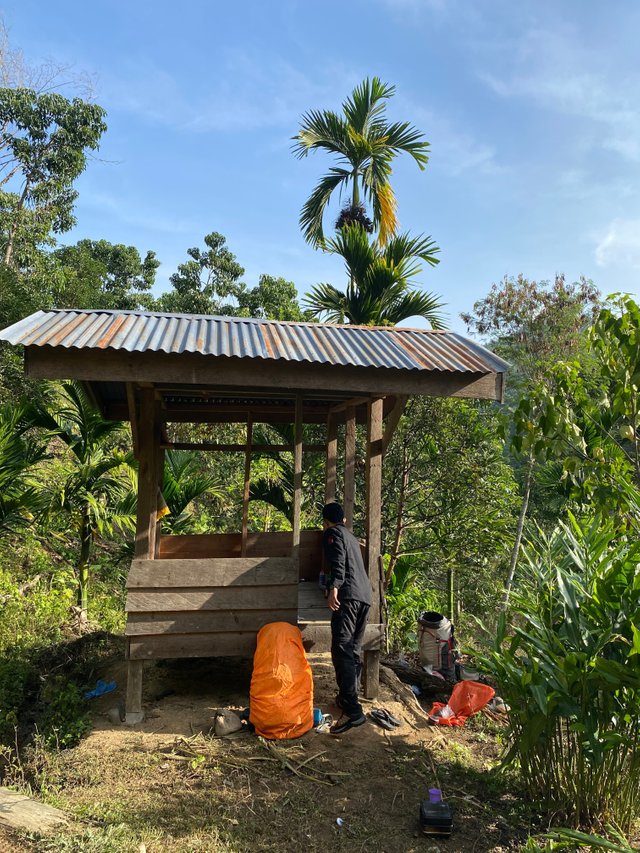
The team arrived in Ise-Ise village, Central Aceh in the afternoon before sunset and went straight to the village head's house to report their arrival and stopped for 1 night before heading to the starting point. After going through an interview with Reje (Traditional Leader) who is also the local Village Head. Based on Reje's advice, the team decided to replot the route from the original start point because visually the route to be traversed was quicker and easier using the pine tree route that residents often pass by.
The last report I received on Maret 5, 2024:
The team arrives and will stay overnight in Ise-ise and the next morning will proceed to the start point. The team is in good health condition. Logistics and equipment are good and set.
Local residents and culture: Local residents of Ise-Ise village are farmers and very hospitality welcome our team. The responses to our conversation are good and provide additional information willingly. The head of the village provided us some advice to re-plotted our track to camp-1 through the normal road which crosses the pine trees ridge
Re-opening the map and checking team position on the topographic map, I just need to check which ridge they were talking about since they cannot send any foto, only coordinate.
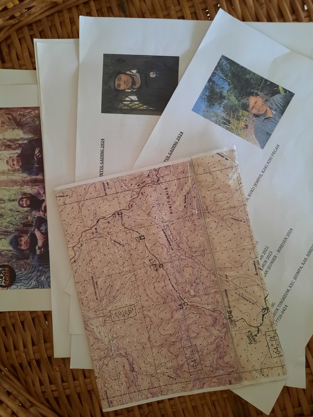
Expedition data include:
A set of topographic maps, Esar (Explore Search and Rescue) briefing reports, personnel records, logistic lists, equipment lists, marking signals they will use during operation, and a set of communication codes.
Let's see the next day...
Best Regards
El-Nailul
Upvoted. Thank You for sending some of your rewards to @null. It will make Steem stronger.