West Coast Trail - Hike of a Lifetime
-One of the World's Best Backcountry Hiking Adventures
So by going on this trail, you are really part of a small group of hikers that have the privilege to experience this breathtaking hike, its history and nature.
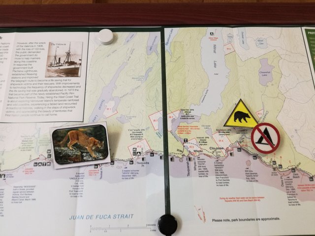
The trail is located in the Pacific Rim National Park Reserve with parts going through Pacheenaht, Ditidaht, Huu-AY-Aht First Nations land. Strict regulations apply: the West Coast Trail is open from May 1st to September 30th and it is closed for the remaining part of the year.
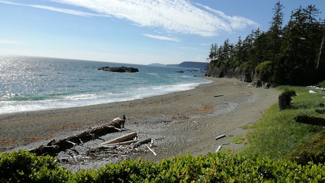
The West Coast Trail is rated as one of the best hikes in the world. It’s 75 kilometers long and lays on the western coast of Vancouver Island in British Columbia, Canada.
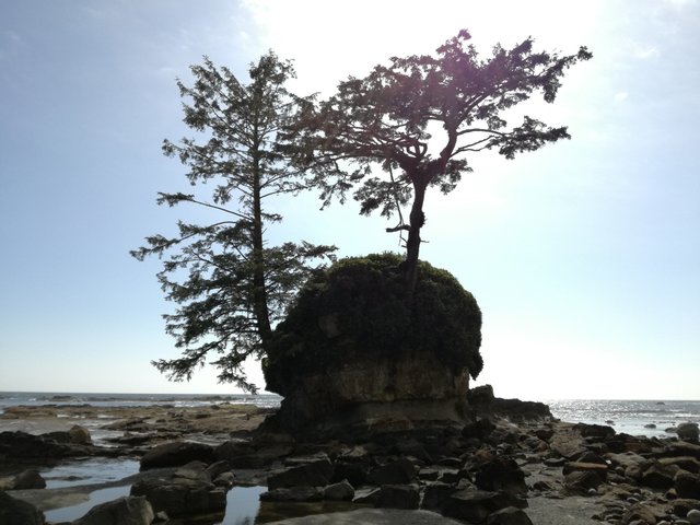
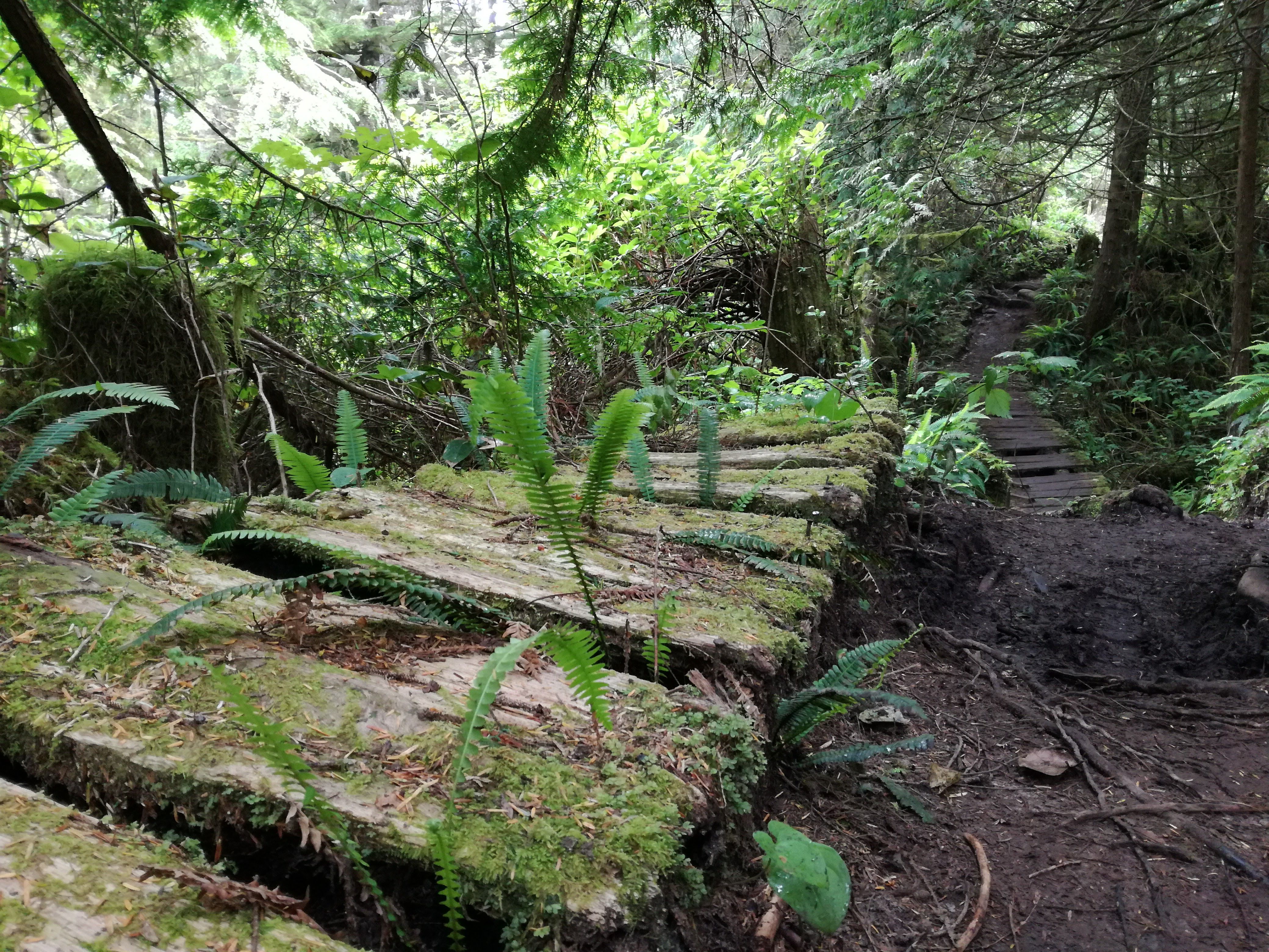
The trail goes through beautiful, old rainforest with some parts along the beach. Wildlife is abundant: the area is inhabited by cougars, bears, otters, elk, deer, sea lions etc.
Only about 65 people are allowed each day, and 7000 people in total each year.
Booking
Reservations to get on the WCT start in January each year. But permits book out very fast. It is possible to get on the trail through standby (as we did). It is easier than I thought, but certainly it varies depending on the day or month.
Just show up at one of the WCT Information Centers (Port Renfrew, Nitnat or Bamfield) early in the morning. If you don’t get on the trail right away, try the following day. Otherwise, do the Juan de Fuca Trail, which doesn’t require a permit.
Small groups (2-3 people) have better chances to get on the trail via standby.
Permit cost
is 160 CAD (incl. tax), with two boat crossings included in the price.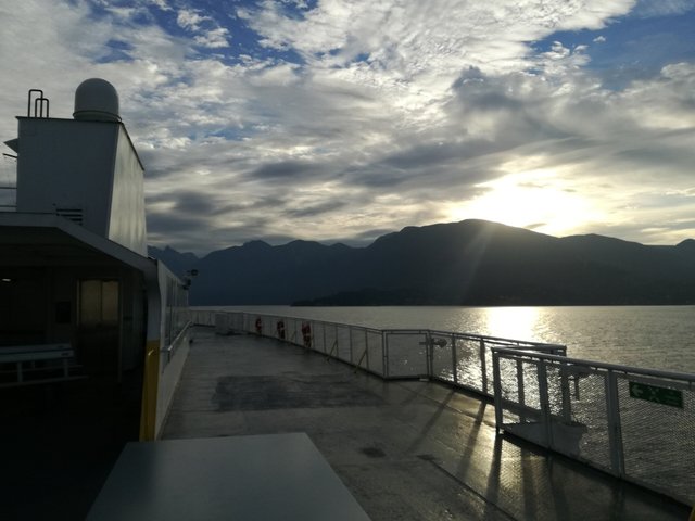
DAY 1 ~ Vancouver - Port Renfrew - Camper Bay (13 km)
4:45 A.M. - Wake up call and a few last-minute organizational chores, such as packing food from the fridge into the cooler. By 5:15 A.M. we’re on the road with fresh coffees, heading towards Horseshoe Bay to catch the ferry to Nanaimo on Vancouver Island.10:15 A.M. - After 1h 40min on the ferry and 2h drive, we arrive in Port Renfrew. Unfortunately, we’re 15 minutes late for the 10 o’clock orientation and the WCT Information Center (Registration Office) is closed for one hour. We patiently wait in front of the office and hold the first two spots to get in, as more people for the “standby” arrive.
By 11 o’clock the doors opened again and we quickly learned that there is only one more spot for standby available (7 people were signed in already).
Luckily, after some consideration, the information center’s workers let us on!
2:00 P.M. - For everyone getting onto the WCT, the 1-hour orientation is obligatory. You can either attend the one at 11 A.M. or the one at 2 P.M. The orientation is very useful. You learn about conditions on the trail, up-to-date wildlife information, how to read tide charts, what to do in case of tsunamis etc.
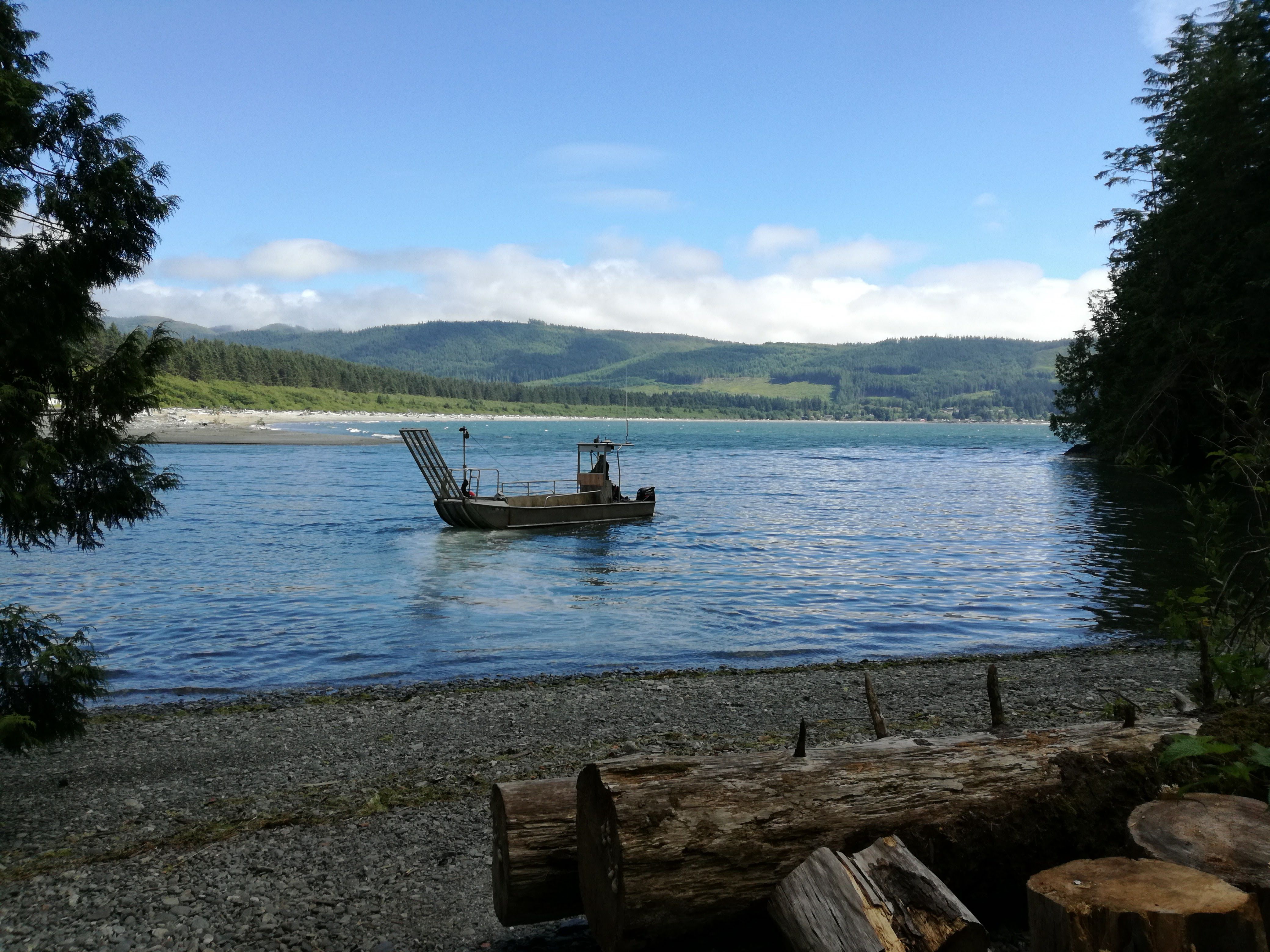
3:30 P.M. - We catch the last boat across the river and get dropped off at a small beach.
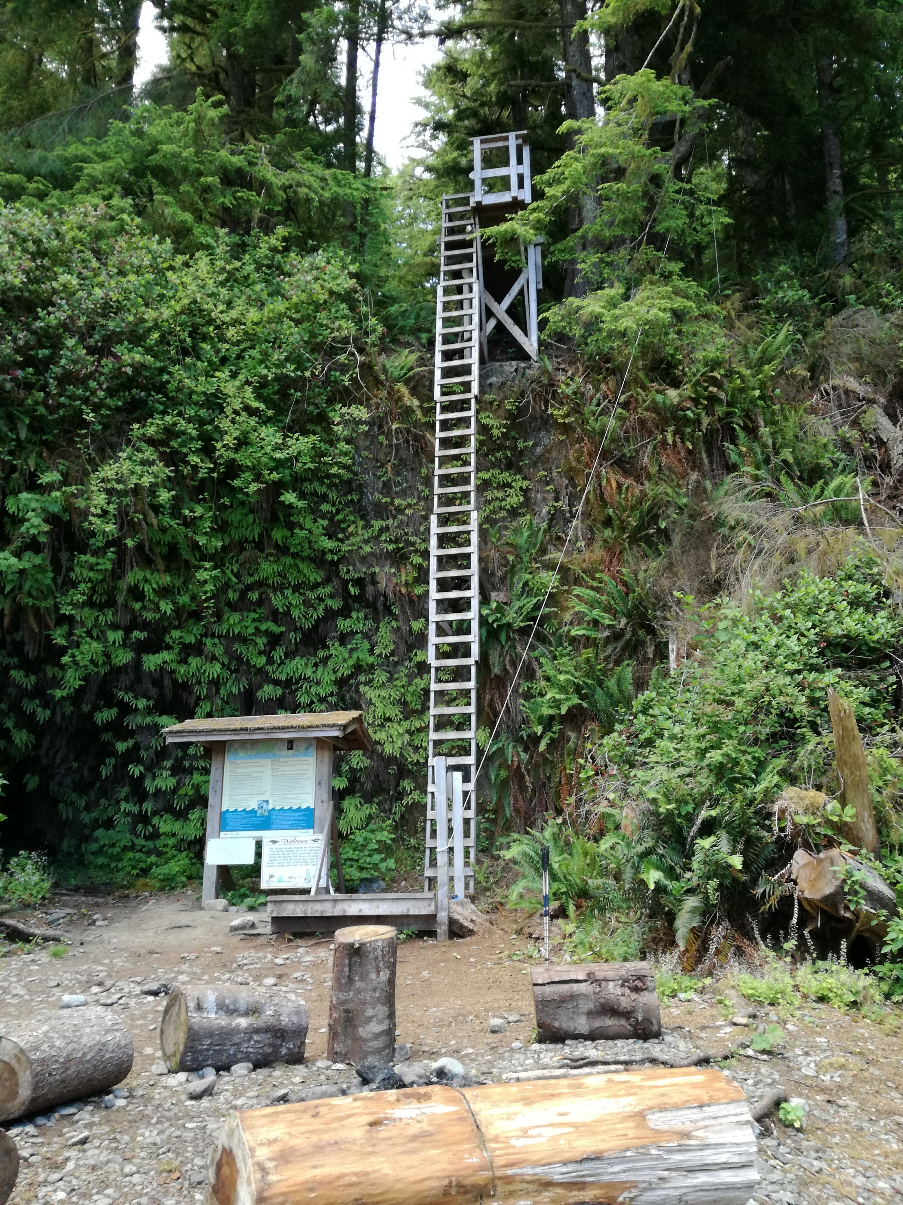
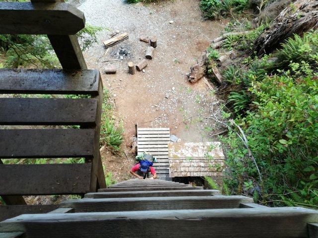
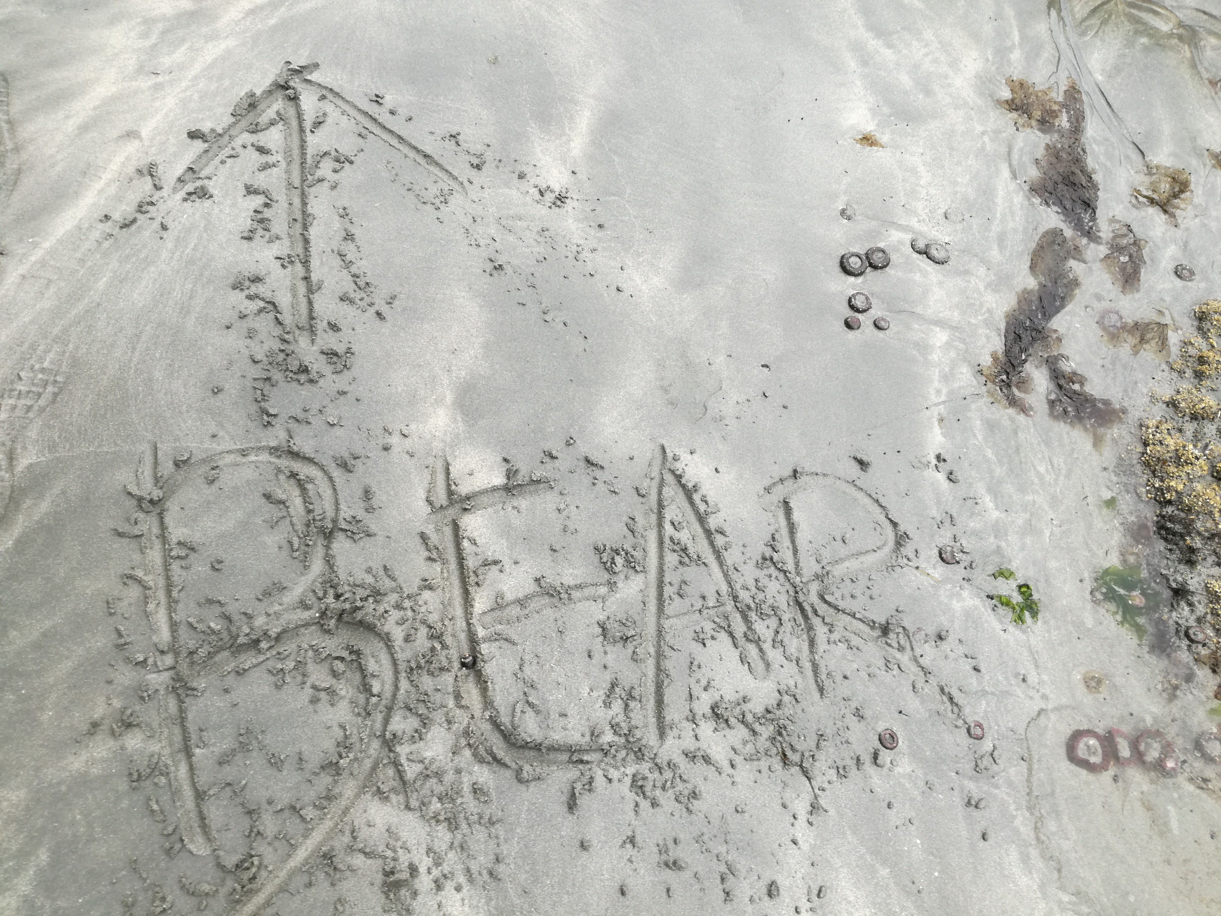
What do we see?
A 50-foot ladder at an angle of about 45 degree! I honestly did not expect such a start to the hike. And with my fear of heights this is a tough task, but with control and support from my hiking buddy, I handle it well.
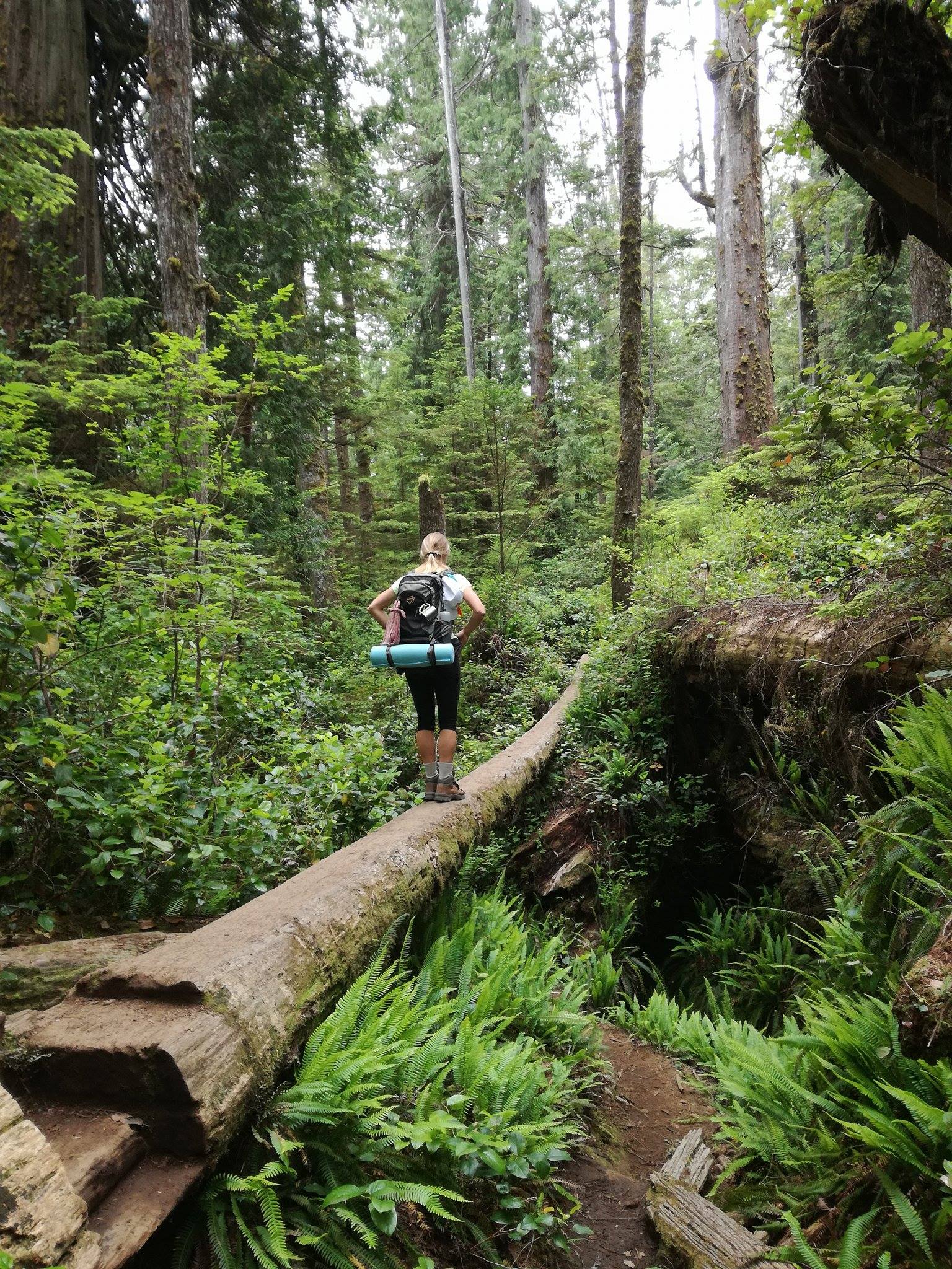
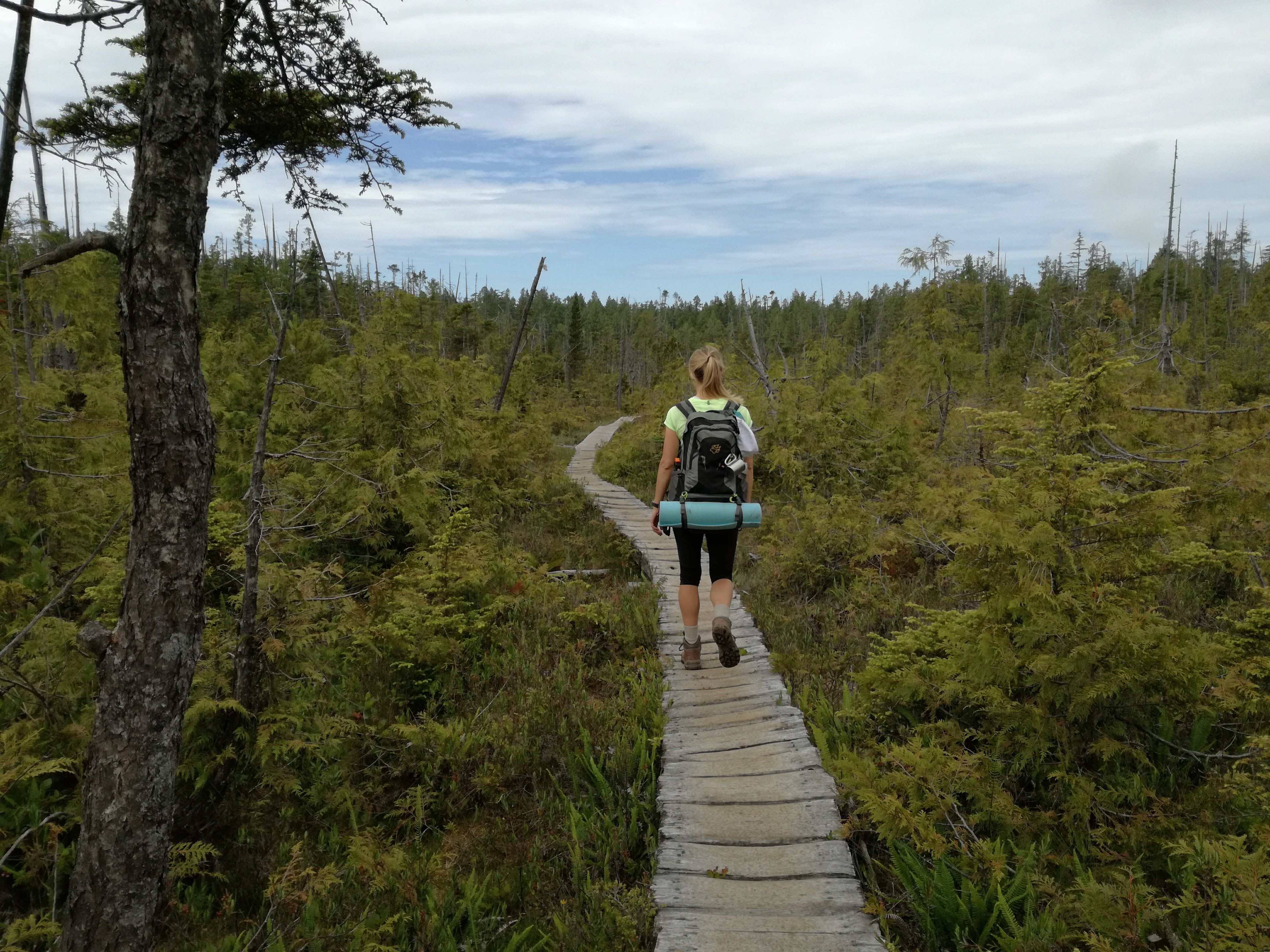
This day we hike 13 kilometers to Camper Bay Campsite. It’s a tough, constant up and down walk through thick forest.
Our backpacks are heavy and as our bodies are not yet accustomed to the weight, we can feel it with every single move. But with time I get into some sort of trance and feel that I have united with my backpack into one.
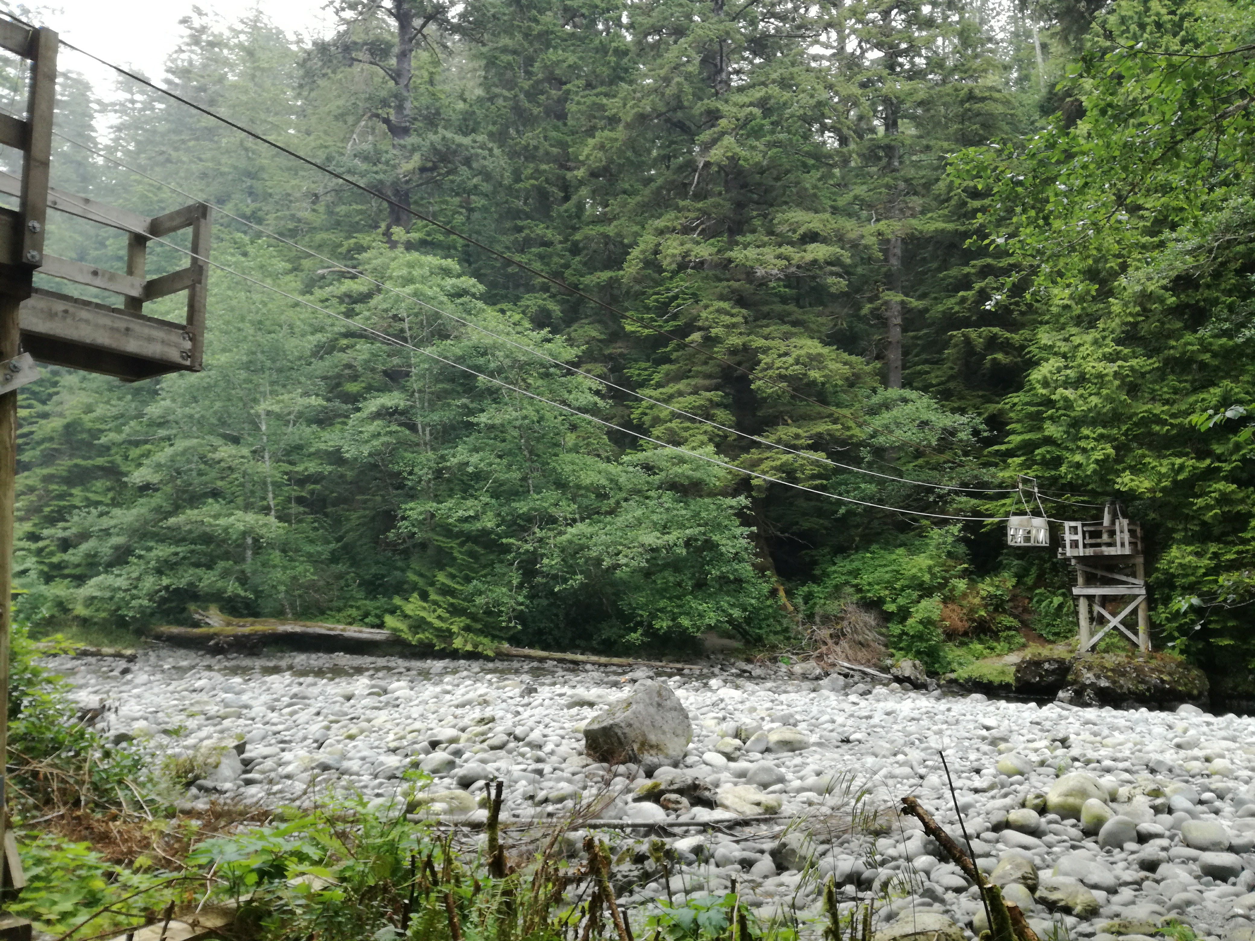
First Cable Car Crossing
After five hours of constant hiking, we arrive at Camper Creek where we have our first cable car crossing. Uncertain of the construction’s stability, I throw my backpack in and get in myself, too. My partner follows steps and lets go off the rope!!
I freak out and almost have a panic attack, convinced we’re falling.
But soon enough after we hit the low point and the ropes take us up again. We have to pull ourselves up on the ropes for the last part. At this point, I’m happy to get out.
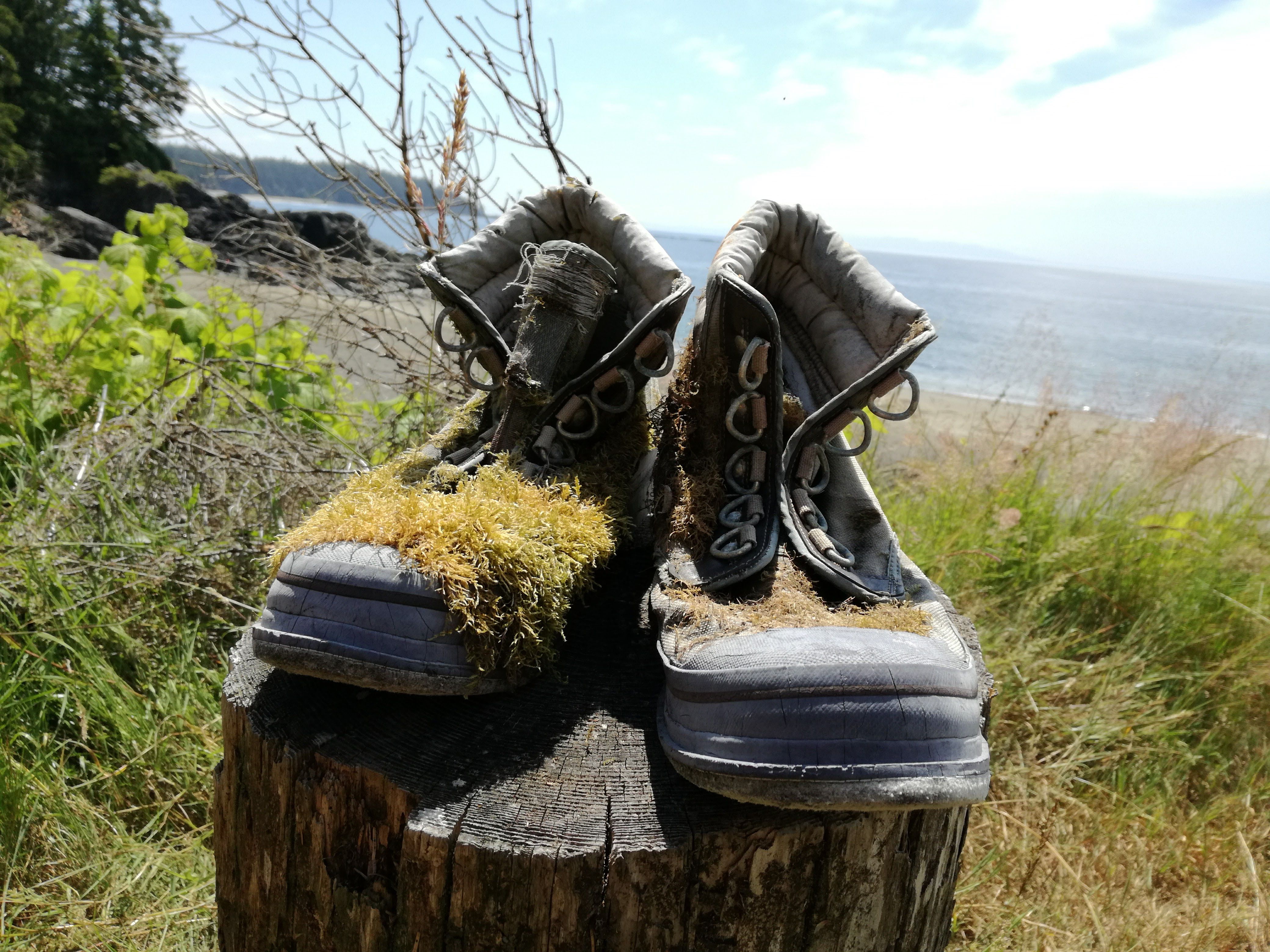
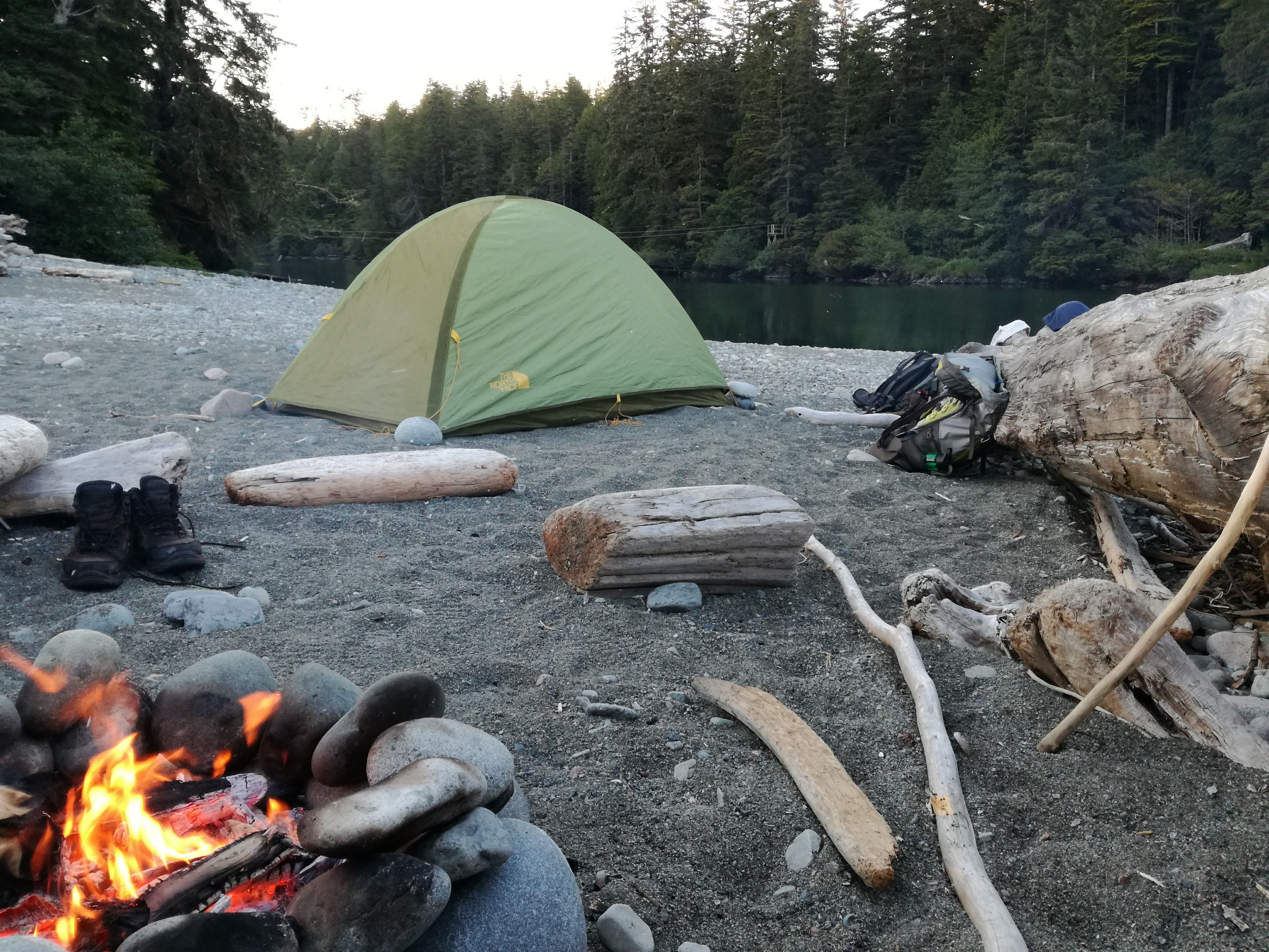
The campsite is full with people, but we manage to find a spot for ourselves. Exhausted, I take of my hiking books and cool off my feet for the first time in the Pacific.
DAY 2 ~ Camper Bay - Carmanah Creek (16 km)
After a late finish the first day, we take our time in the morning. By the time we pack our bags and leave Camper Bay at 11 A.M., everyone else is gone.
I feel surprisingly good, my body is sore but as we continue on the trail, the blood starts flowing again. We take on a high pace and pass a few other travelers. The path flattens out a bit and opens up. We go through a forest area that looks like it might have been devastated by a tsunami or strong winds.
Remember!
If you feel the ground shake or if the water in the ocean suddenly goes out, head for high ground and follow the tsunami escape route. But the chances of a tsunami occurring are very slim.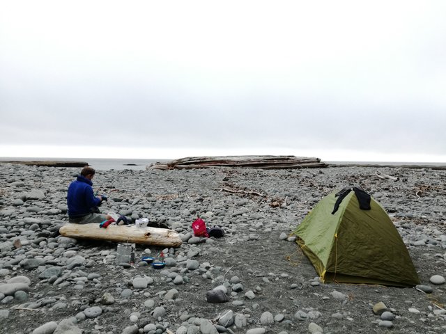
After 9 kilometers (which is the 53-kilometre mark as we’re going “backwards”), the trail leads us onto the beach. But because we’re late and the tide is high, we’re unable to go along the beach.
I’m tired and want to rest by Walbran Creek.
So we take a break, have a snack, fill up our water bottles and treat it with purification tablets. We discuss whether to wait for the tide to go down or to go inland.
Our eagerness to hike takes us inland.
After two kilometers we’re back on the beach and stay on it till reaching our next campsite at Carmanah Creek (46 km).
Just before reaching the campsite I meet a German hiker in his 50’s. He tells me that he’s doing the trail for his second time after 25 years. The first time when he hiked the WCT, he was a student who came to Vancouver for the summer on something like the Working Holiday Visa.
Has the trail changed over the years?
He recalled that back then, his gear was heavy and he was totally unprepared, but it was the best hiking adventure he’s ever done. But he said the trail hasn’t changed after all these years, which is a really good sign that it is well preserved.
Burgers @ Chez Monique
Chez Monique, the famous burger bar on the trail, is just 15 minutes away from our campsite. While I set up the tent and make a campfire, my partner sets out to get us burgers (20$) and beers (10$).
A delicious reward after a long day of hiking!
We head out early this morning. Our first stop of the day comes just after 2 kilometers, when we arrive at Carmanah Lighthouse, the Canadian Coast Guard Light Station.
The West Coast Trail was originally called the Dominion Life Saving Trail and was built to rescue survivors of over 480(!) ships that crashed on this coastline in the 19th and early 20th centuries. The stretch of ocean here is therefore called “The Graveyard of the Pacific”…
In late 19th century, a telegraph line established communication between west coast villages and lighthouses, in hopes of saving mariner lives.
After a short stop at the lighthouse, we continue on the WCT.
Note:
It is important to talk with each other along the trail, especially when you’re travelling in smaller groups. It gives wildlife, such as bear, notice that you’re in the area.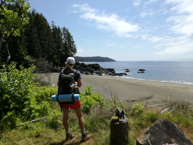
Tsusiat Falls - A Highlight for Many
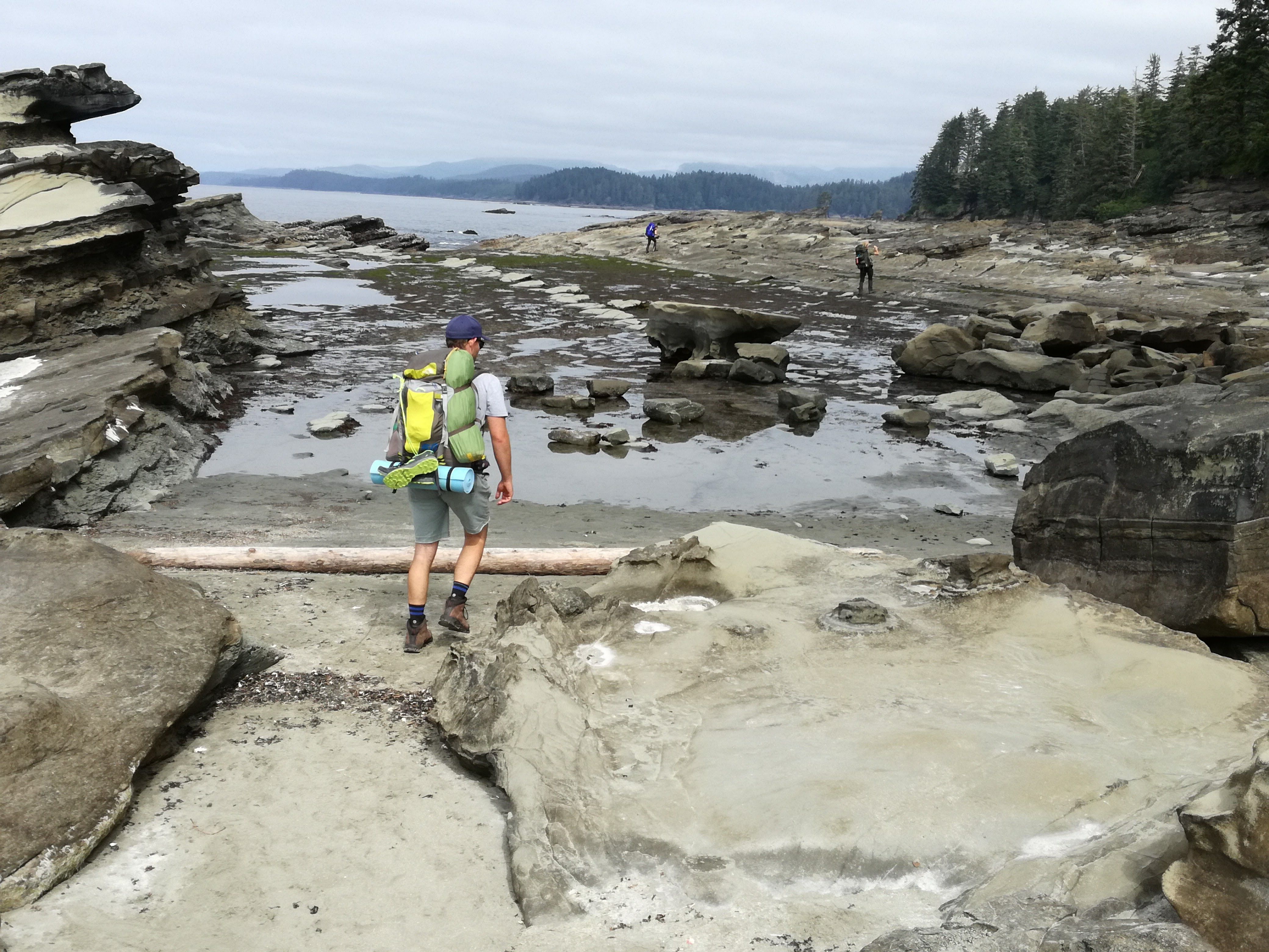
A huge part of day three takes us along the beach, which is rough and rocky. With each step, I sink in the sand. I try to find firm ground. While the tide is low, we move towards the water and walk on rocks, careful not to slip.
At the 31-kilometre mark, we arrive at Nitnat Narrows. While we’ve been hiking alone all along, occasionally passing people, the Crab Bar here attracts hikers for longer breaks and food. We meet travelers from the U.S., UK, Germany and of course, British Columbia. For us, this place is just a short break.
We want to get away from civilization.
So we jump onto the boat, show our permits and cross the Narrows in just two minutes.
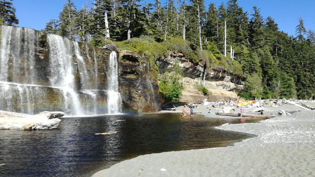
I am excited for the next highlight - Tsusiat Falls! Without a doubt, this is the most popular stop along the West Coast Trail. Flowing from the forest on a bench land high above the beach, the waterfall cascades down a cliff onto the sand and into the ocean.
It’s a stunning view, one I have never seen before.
The campsite is busy, obviously everyone is here. But from the last two nights we learned that people attract mice.
Important! Make sure to keep all food in bear caches or hang them in the trees. Keep your backpacks at least 10 feet away from your tent. Otherwise, mice will come and snoop around the tent at night!
So we decide to leave this incredible place and continued for another two more kilometres to Klanawa River Campsite. Only two other tents are set up here, making it very peaceful and beautiful. Definitely worth it.
Day 4 ~ Klanawa River - Bamfield (23 km)
At night we are woken up by rain and get out to hide our hiking boots and backpacks. By morning the rain stops but clouds cover the sky until about 11 A.M. each day. Then the sun comes out.
We are really lucky with the weather!
The West Coast sees rains for 80% of the year. Most hikers who do this trail actually go through mud and rain.
Note:
Taking appropriate rain gear is very important (even if the forecast is sun)!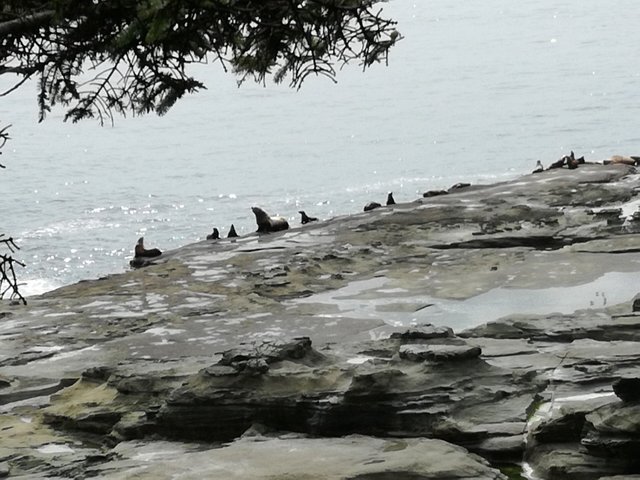
The Last Stretch
For this day we plan an easy hike of 11 kilometers to Pachena Campsite. But early in the morning, I know we’d keep going and finish the trail on this day.
It seems like once we start hiking, we don’t want to stop.
The last part of the trail is relatively flat and therefore easy. It takes you along a path 60 feet above sea level with breathtaking views of the coastline.
We spot elk and deer twice on the beach. The elk don’t move and observe us while we pass them at a safe distance. The deers, on the other hand, ran away into the woods.
At the 9 kilometre mark there’s a lookout point for sea lions. They lie on big haul out rocks and you can hear and see them clearly. It is pleasant to watch them in their natural habitat.
Around 4 P.M. we finish the West Coast Trail!
I feel happy to be part of such a small group of people who gets to experience this amazing trail each year. I’m tired but through my mind goes an idea to come back here again one day and do it again.
Maybe in 20 years…but hopefully sooner.
FOLLOW ME
Steemit: https://steemit.com/@thisisjhonny/
Facebook: https://www.facebook.com/Travelpoppies/
Website: https://travelpoppies.com
Awesome photos!
Thanks!
This is awesome, and I'm going to do it one day! Thank you for sharing, as I didn't know about this hike before!
It's an amazing hike, highly recommended!