Scaling the Three Peaks of Mount Tres Marias: A Travelogue of the Enchanting Rainforests of Biliran Island
I have been climbing mountains for eleven years now. I started when I was sixteen and since then, I have always believed that the tropical rainforest is my home. Today, I am going to tell you the story of my three-day encounter with the enchanting rainforests and the majestic peaks of Mt. Tres Marias.
|
Photo owned by Xaydtrips |
Mt. Tres Marias is a mountain range in the northwest part of the island province of Biliran in Eastern Visayas, Philippines. It is a hilly mountain range covering the town of Almeria, with three prominent peaks from whom it owes its name. The three Marias have been the object of interest of Filipino hikers. In the recent years, climbers have been frequenting the third peak, the most famous of the three, and the only one who has a name, the Naliwatan Peak. However, the first two peaks have remained unscaled in the last four years because of its distance and difficulty of access.
Day Zero: Travel and Pre-climb
When I was first invited to join this climb, I was told to make sure I was physically ready to take on long steep hikes and that I should have self-sufficient gears. I doubted myself a bit because the last time I did a multi-day major climb was two years ago and I wasn’t very sure I still know the discipline well. I spent my weekends traversing the hills in Cebu because as they always say, “the only training you can do for mountaineering is mountaineering itself”.
|
Photo owned by Xaydtrips |
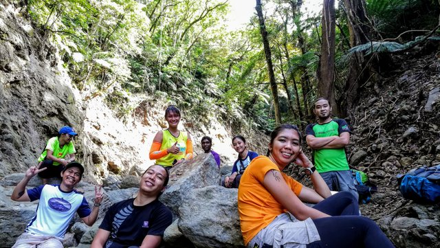
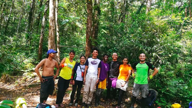
We left Cebu on a Friday night, almost missing our boat by a sheer five minutes, and then arrived at Naval, Biliran early morning. We went straight to the house of our climb organizer, Sir Kyle and there we realized we were only a small team of eight people. Two people missed our boat from Cebu and three more cancelled because of health reasons. It didn’t start out quite well for us but I knew that a small team like this should be kept in close distance while on the trail so everyone should have the same pace.
Day One: Peak One
From the Jump-Off to Mapuyo River
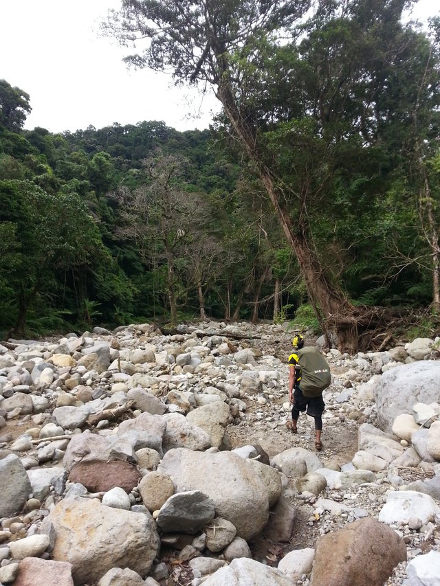
We travelled from Naval to a town called Almeria through high-powered motorbikes that are often used to scale up mountain roads. Locally known as habal-habal, the motorbike took around 45-minutes to the very end of the paved road where we had to walk about half a kilometer of damp earth.
|
Photo owned by Xaydtrips |
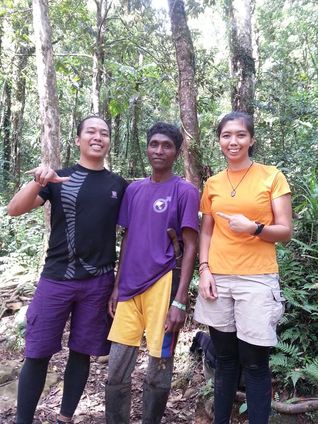
Biliran was hit by the Tropical Cyclone Urduja days before Christmas last year. Aside from its damage to life and properties, it also eroded a big part of Mt. Tres Marias. The paved road was supposed to have reached the tribal settlement already but because of the typhoon, the road construction work was delayed and had to be restarted later. We walked all the way to Sitio Palayan and stopped at the tribal settlement of the Mamanwas. Our trail master was none other than the tribal chieftain, a dark-skinned, middle-aged man in his high-cut boots and jungle knife.
Our climb officially started as soon as Sir Jay-R, the Mamanwa chief, was ready to guide us through the trail. The second man on the trail is usually regarded as the pace-setter and I was afraid to take on that big role. I was the third man in line as we walked through a levelled path before entering the thick forest line. This time the trail started ascending and we had to work hard in warming up our bodies.
|
Photo owned by Xaydtrips |
The start of the hike is usually the most difficult part since the body has not yet fully adjusted to the strenuous activity. We started walking around a wall on the mountain where there is absolutely zero breeze. It was almost suffocating being air-hungry in a place where the air is barely moving. My face was covered in sweat and I feel like I could give in to the weakness any time. But it was too early to give up, I kept convincing myself I was here because I wanted to reach new summits and be one with nature again. The thing is everyone is surrounded with the same elements that I was in so almost everyone is just as exhausted already.
We had one quick stop just to recover from the racing heart rate and two minutes later, when we resumed the hike, I decided I wanted to be the person following our guide, Sir Jay-R, and be the pace-setter. This time, I started talking to him. That was actually the first time I learned that they were a minority Mamanwa tribe in Biliran. I told him stories about my encounter with the Mamanwa tribe in Samar and he was excited to tell me that he frequently visited them and that the chieftain was his brother-in-law. The conversation made the hike a lot more comfortable and I almost forgot about the exhaustion I was experiencing earlier. This time, I was walking in a better pace and have fully adjusted to the ascending terrain.
|
Photo owned by Xaydtrips |
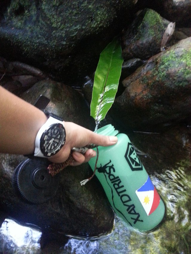
After one and a quarter hour’s walk, we stopped at a river called Mapuyo to rest. We stayed there for a while to make sure everyone had arrived and that we have regrouped. Some guys went to refill their water bottles with fresh spring water while I looked around for wild animals – Tres Marias is known for the presence of vipers and albino frogs.
Twenty minutes later, we started walking again. Sir Jay-R would mention the names of the trees and plants that we would pass and it helped a lot in making me cope up with the short but steep ascents. “Daquit” or “dalaquit” was how they would call the large baletes or rubber trees.
|
Photo owned by Xaydtrips |
Ascent to Peak One
We reached another part of the same Mapuyo River, this time a bit upstream from where we rested earlier. It was half past eleven and we were ahead of schedule. After a quick lunch, we put our packs on one side of the river and started hiking up to the first summit. Two members of our team, Jessie and Niel, stayed behind to watch over our stuff and to take some time to look closely into the wild fauna inhabiting the river.
We started twenty minutes past twelve in the all-assault trail. I carried only my water bottle and camera phone with me. It was undeniably steep but I think my training paid off. I managed walking in long segments able to block the pain and resting only for a few seconds to hydrate or to drive the heart rate back to normal. The trail was long and growing steeper and steeper as we go. I was still entertained by our guide with stories from the Mamanwa tribe and other indigenous people’s group that he knows of. It wasn’t only a physical task for me but was also a great opportunity for cultural enrichment.
|
Photo owned by Xaydtrips |
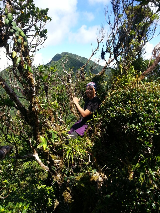
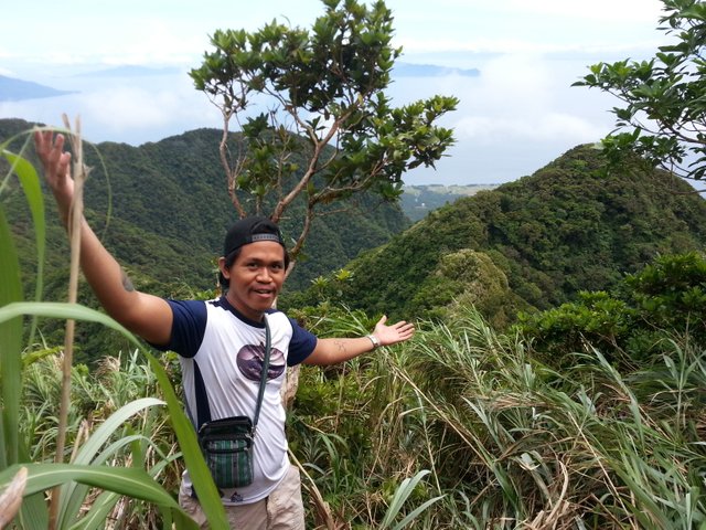
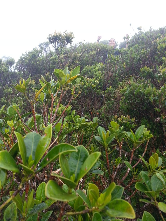
Before scaling the final assault to the summit of the first peak, the trail opened up into the sun and through a path made by naturally tangled grass and branches that was less than a meter wide. It was soft like a trampoline and the narrow width made it one of the scariest part of the trail. The view of the rest of the mountain range seen from that point was lovely but the knife-edge ridge stirred up the acrophobic in me. We resumed the hike and finally reached the top with a surprisingly short hike time of one hour and thirty minutes from when we began after lunch.
|
Photo owned by Xaydtrips |
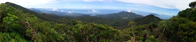
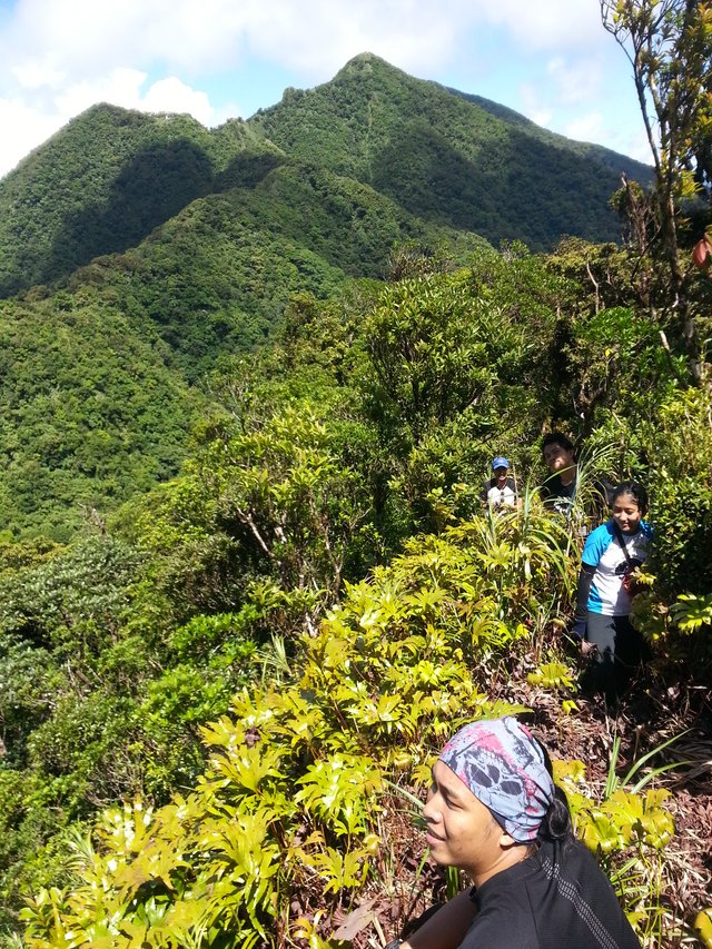
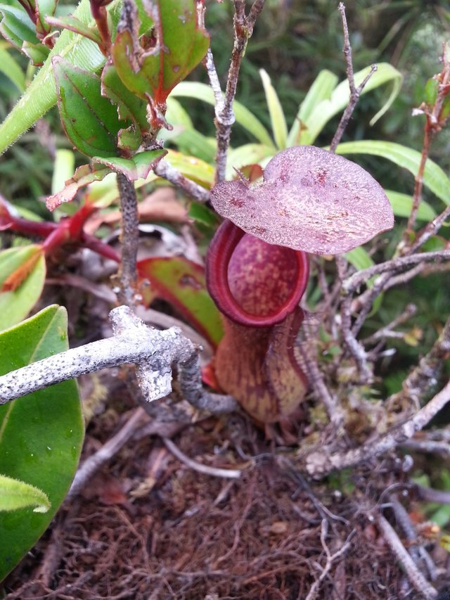
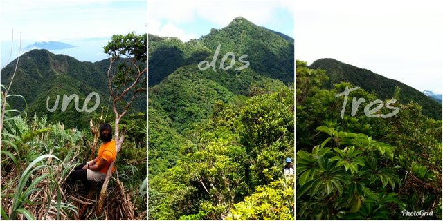
The summit wasn’t a big place. It was simply the highest point covered in trees and grass so we had to take turns to see the view. The summit is covered in short mossy trees and pitcher plants that thrive only in colder climates. This only means that Mt. Tres Marias remains to be a dense rainforest devoid of human visitors for years now. The peak treated us to a view of the lowland communities and some islands further out into the sea to the north. Towards the south, we can see the second peak inviting us to come visit her too.
|
Photo owned by Xaydtrips |
Half an hour later, we started our descent in an agile but careful manner. The descent is surely less exhausting than the ascent but it gives hikers a higher risk of injuries. This is because in every step, the weight is transitioned to one foot and if not properly balanced might cause someone sliding straight down or injuring the knees or ankles. That is why I always go down at a very controlled pace.
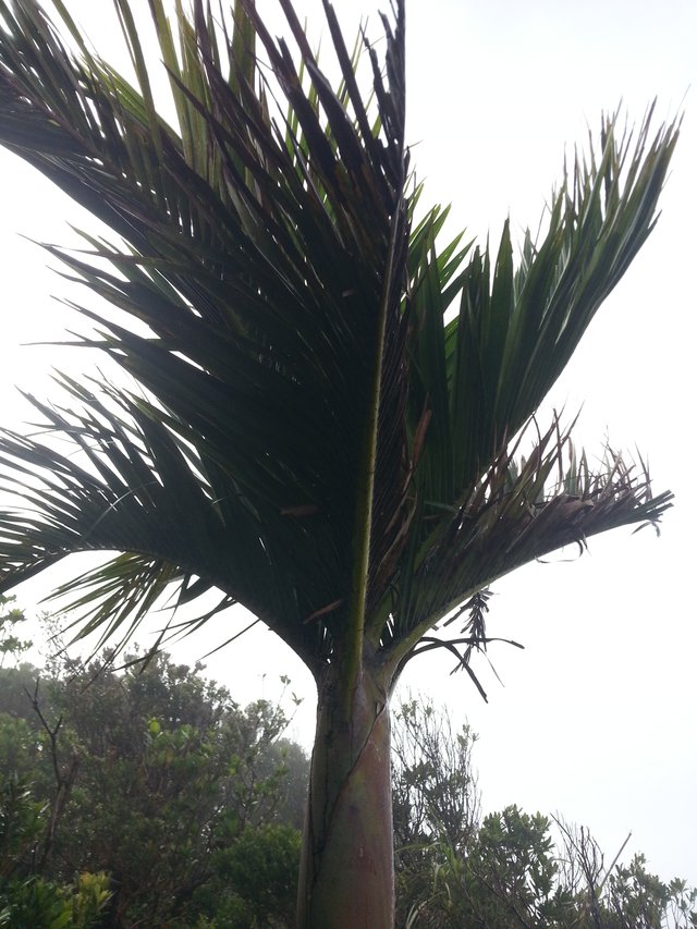
On the way down, Sir Jay-R told me a few things about the forest. He told me about a sacred palm tree, the kind that only grew in altitudes similar to the summit. He also told me that as Mamanwas, they have known how to read the language of nature. He said that he can tell whether each climb would be a good one or one that will be struck by harsh conditions like rain or storm simply based on the sounds made by birds. He also told me that we were lucky we had a great weather on the way to the summit and that since the last climb in 2014 and the last exploration in the past week, there has been no clear view or sunny skies in the summits of Tres Marias. I asked him what the birds said about our climb today. The tribal chief stopped, turned around to give me a smirked smile and a soft chuckle without giving me any answers. What the birds said about our climb that day, I still do not know.
|
Photo owned by Xaydtrips |
One and a half hour later, we reached the river crossing and Jessie told us we were earlier than expected. That means we would arrive at our first campsite with sufficient daylight to set camp.
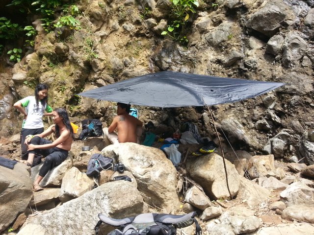
First Night's Campsite
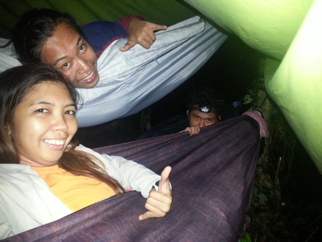
We did arrive at our first campsite early. It was only forty minutes past four in the afternoon and we had plenty of time to properly fix our hammocks and shelters around trees. We have been previously instructed not to bring camping tents because of the lack of camping ground. It was true. There were roots everywhere and not even a small patch of vacant ground would be available for pitching a tent. In this dense rainforest, there was flora growing everywhere.
|
Photo owned by Xaydtrips |
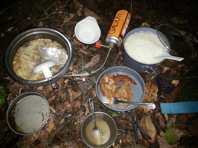
I made a three level hammock set-up with Ray, my partner, and Errol, my classmate from engineering school. It was a bit crowded but we made ourselves fit into one big shelter just in case it rained. Truly, only minutes after everyone has stably pitched their shelters, the heavy rain came pouring. The thing about rainforests is that even if it is sunny down in the city, the forest seems to have control of its own weather. There was thunderstorm and everything outside of our shelters were now soaking wet. While waiting for the rain to pass, we crunched inside the common shelters and started preparing dinner. The rain didn’t last very long but the sun was now gone. Lit with our headlamps and torches, we started consuming our outdoorsy dinner of pork soup and dried fish. It was a hearty dinner and a great treat for a day of strenuous hiking.
|
Photo owned by Xaydtrips |
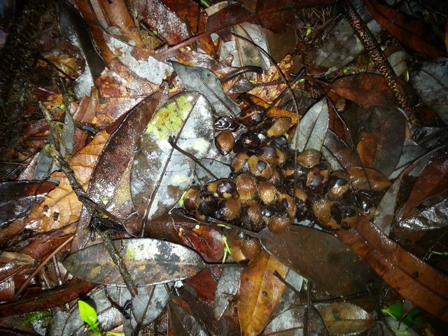
After the savory dinner, we resorted to a few shots of brandy and doing rounds on introducing ourselves to the team. It was the first time we actually talked about who we are, our experiences, how we felt about the first day of the climb, and how we wanted the remaining two days to be. It was a great exchange of stories from the outdoors and finding out we weren’t really strangers to each other. When the weather was calm and the brandy started to kick in, we decided to call it a day. However, after the long fulfilling day of trails and assaults, we were in for a final treat. Sir Kyle asked us to turn off all torches and headlamps and to focus our eyes on trunks of trees and the layers of dried leaves on the ground. There we saw the most magical sight of bioluminescent lichens glowing in the dark like a carpet that covered the ground and wrapping around trees. It was out of this world. These bioluminescent lichens are proof of how healthy and diverse these forests are and that is something I loved basking in. I was too scared to take a step from where I stood because of those live glowing lichens but it was time to retire to our hammocks and finally put our exhausted and tipsy selves to sleep.
|
Photo owned by Xaydtrips |
Day Two: Peaks Two and Three
Breakfast, Break Camp, and River Crossing
The next day, we started really early. Breakfast preps commenced at five in the morning, a really unusual time for me to wake up at camp. However, we needed to compress our time because we have decided to adjust our itinerary and pursue the second and the third peak all in the second day. Originally we planned on climbing one peak per day for three days but our climb organizer has decided that our first day’s pace was fast enough for this new itinerary.
|
Photo owned by Xaydtrips |
We started our hike at 7:30 in the morning and it took us about half an hour to reach the crossing point for peak two. We headed briefly to a nearby river where we stopped to rest and to leave our backpacks behind. We started our assault to the second summit at 8:30am. This time, we had the entire team who will go to the peak and our guide assured us that there was no one else on the trail on these parts of the mountain to scavenge on the belongings we have left behind.
Ascent to Peak Two
The trail started out on mostly level ground. There was soft crowing of what sounded like an adult wild hen followed by the peeping of a couple of its chicks. A little later, the crowing turned into clucking and we can only assume that the wild chickens were being chased by a snake or a wild cat. Just moments after that assumption, the wild fowl slung itself into the air flapping its wings to the nearest tree. I never knew chickens could fly so well. Circumstances in the wilderness calls for every species to design its own means of surviving and thriving.
|
Photo owned by Sir Niel Jarina |
Unlike the first peak, the second peak is a little more overgrown with vegetation. Sir Jay-R needed to work his machete to make the trail a tiny bit easier for us. The trail itself still wasn’t easy. It was a steep uphill terrain with soft soil and barricaded with fallen trunks and thorny branches. The overall thrill was brought by both the exhaustion and the extra care taken not to injure oneself. It took us more than an hour to scramble through this assault until we finally arrived at the top of the second peak.
This time there were two viewing decks with much wider room for photo ops. The first viewing deck was overlooking the neighboring mountain of Panamao. Since I arrived at the summit just right after Sir Jay-R did, I immediately snapped a photo of this first view before the fog covered everything into blank white. The second viewing deck was only a few meters away and this time was supposed to give us a view of the first peak, the one we climbed the day before.
|
Photo owned by Xaydtrips |
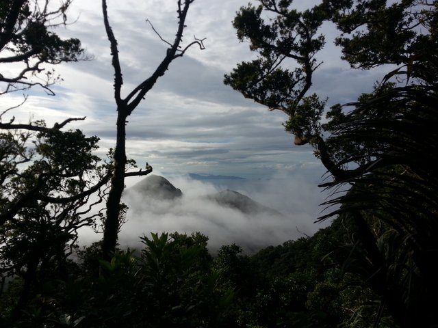
Unfortunately this view was also covered in thick fog and there was nothing to see for the next few minutes but that. I climbed onto a tree branch and stood there for a while waiting for the fog to clear. The branch wasn’t sturdy and the breeze was strong so I was shaking both with fear and with the blowing wind. It was only ten in the morning and the sun wasn’t high up enough nor hot enough to melt the fog away. We were starting to lose hope that we would get a clearing.
A third of an hour later, the fog started moving revealing the tip of the first summit with Maripipi Island jutting out of the blue water far out in the background. It was a sight to behold. Not long after, the fog fully disappeared giving us a few minutes of majestic view of mountain ranges and the sea fading into the horizon.
|
Photo owned by Xaydtrips |
It was now time to go back to the river and I was preparing my knees for the painful descent. There is no other way to go back from that steep assault but to go down with every step catching your weight and putting a lot of pressure and impact on the knees, ankles, heels and toes. These descents are the reason why I get subungual hematoma or the graying of toenails after a climb. But these are all parts of the climb that we have to go through in order to have a holistic experience.
Good thing, Sir Jay-R never got tired of telling me stories about their tribe. This time he told me about the strife they had to endure from their ancestral domains up to the minor settlements they have established in Samar, Leyte, and Biliran. His stories gave me a better sense of the struggle our Lumads have to go through in order to survive in a society that has been heavily Westernized. When we were nearing the river, I remember him telling me, “just as the Badjaos wouldn’t survive in the mountains, we, the Mamanwas, wouldn’t survive in the plain lands and coasts.”
|
Photo owned by Xaydtrips |
We reached the river at exactly twelve noon, after an hour and a quarter’s descent from the second peak. Our backpacks were just the way we left them. We unpacked our lunch and enjoyed the cool water of the river before heading out again. It was half past one when we resumed hiking and we were told we would get to our next campsite in half an hour. I assumed we were walking the entire way without stopping to rest.
Sir Jay-R told me that once we arrive at the campsite, he would leave us there under Sir Kyle’s watch while he will be heading back to their home in Sitio Palayan. I told him he needed to leave early because that would be around three hours worth of walking and that he would only get home after dark. He gave me his classic chuckle and told me that he could backtrack that entire way, including the trail we walked the day before, in just an hour. I thought my pace was already fast enough but that guy there told me he knew the forests too well that even in his heavy boots, he can hike three times faster than my pace. Honestly, I couldn’t argue with that.
|
Photo owned by Xaydtrips |
We arrived at the campsite at exactly two in the afternoon. We stopped to rest and to have a final chat with Sir Jay-R. He wished he could stay with us but since the following day was election day, he needed to head home so he can assist his tribe members in the voting precincts. After one more photo with him, he headed back into the trail that we walked in from and I knew he would be home way before dusk kicks in.
Ascent to Peak Three, Naliwatan Peak
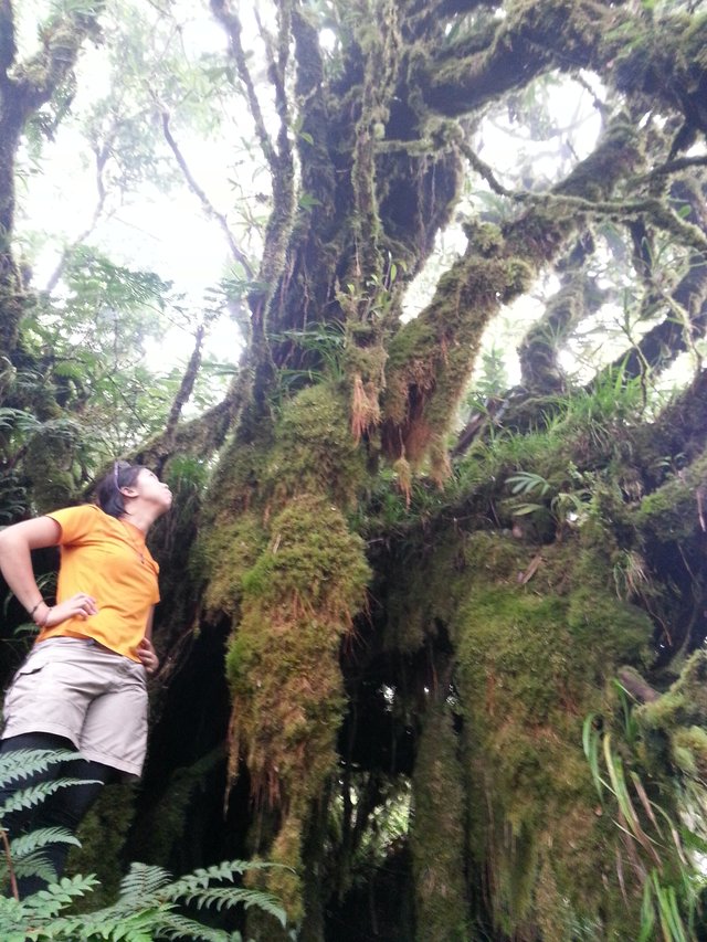
For the rest of us, it was time to do the final peak. Jessie and Rea decided they would stay behind to watch over our backpacks and to start setting camp. Sir Kyle led our way up the third peak, followed by me, Ray, Errol, and Niel. It was half past two when we started walking. The third peak was the only one with a known name, Naliwatan Peak. Its trail was constantly going uphill so it was another good test of endurance. As we were going higher on the altitude the wind started to chill up and the moss on the trees started to thicken. These moss can cover large tree trunks giving us the feel of a fantastical world almost like what you read in fiction books. As we go higher up, the trees become shorter and stubbier, probably because of the climate. It took us exactly 59 minutes to reach the summit.
|
Photo owned by Xaydtrips |
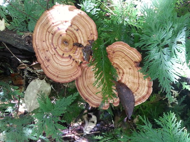
The peak was a point in the forest where you can get a good 360-degree view by climbing on trees. It was dense with vegetation despite being the most frequently visited of the three peaks of Mt. Tres Marias. There were pitcher plants everywhere - hanging on trees or crawling on the ground. I climbed the tree at the center of the peak and positioned myself at its topmost stable branch. On this branch are bits of dried moss and small twigs forming a nest. Sir Kyle told me that this is where an eagle used to live. It was a strong branch and a sturdy nest which were both likely to have served as home to a large bird of prey. I stayed in there for a couple of minutes waiting for the fog to disappear. It didn’t. Instead, it started getting chilly that I had to come down as my fingers were starting to go numb.
|
Photo owned by Xaydtrips |
We thought this would be the perfect climb, that we would get three out of three fog-free clearview on each peak. After nearly an hour of waiting and enjoying the cool breeze at the peak, we decided to go back to camp and accept our fate that it was getting late and the fog would not go away until nighttime. We settled with scaling the summit of three out of three peaks but only getting two of three clearings.
|
Photo owned by Xaydtrips |
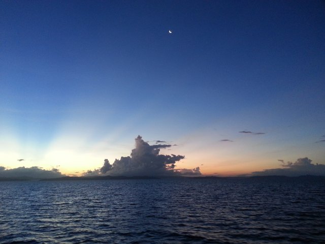
However, because of the dense vegetation, we didn’t notice the fog starting to melt away. Shortly, we reached the “window”, an open part of the ridge just a few meters below the peak. There, a clear view greeted us finally granting our wish of getting a three out of three clearing. It was a fascinating view and a truly rewarding one. Second peak was in plain view, with its foot covered in cottony fog, with a backdrop of the sea and Maripipi Island, which now was a familiar sight to us. The three-peak checklist has been fully ticked and the last two days, despite being gruelling, have been the most fulfilling.
|
Photo owned by Xaydtrips |
Second Night's Camp
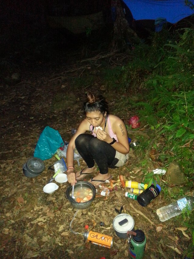
It was now time to run back to camp and treat ourselves to dinner. This time, the campsite was a lot more accommodating since it has been carved out to hold more tents and hammocks over the course of a few years of hiking and camping activity in the area. Ray, Errol, and I were still crunched up in one shelter as we again volunteered our other tarp sheet as the group’s common shelter and outdoor mess hall.
|
Photo owned by Xaydtrips |
I love cooking outdoors and I was especially inspired to cook because of what transpired in the last two days. The boys were treated to a thick pork stew and dried fish - the pork to replenish protein, dried fish to replenish salts, and bits of potatoes and carrots for fiber source. It was a big cauldron of stew, but we were, well, hungry.
After dinner, we finished up on the remaining half of our brandy bottles and continued to the second part of our getting to know each other. Of course, the night couldn’t end without spending moments in utter darkness and silence, and watching the bioluminescent lichens, same what we saw in the first night’s camp, glow from pitch black to bright green as our eyes adjust to the darkness. Once again, the carpet of glowing bits of lichens has fascinated us and has capped the night with a fantastical scene we might only imagine to be happening in our dreams should we not have decided to do this trip.
Day Three: Chasing Waterfalls
River Trekking and Waterfalls
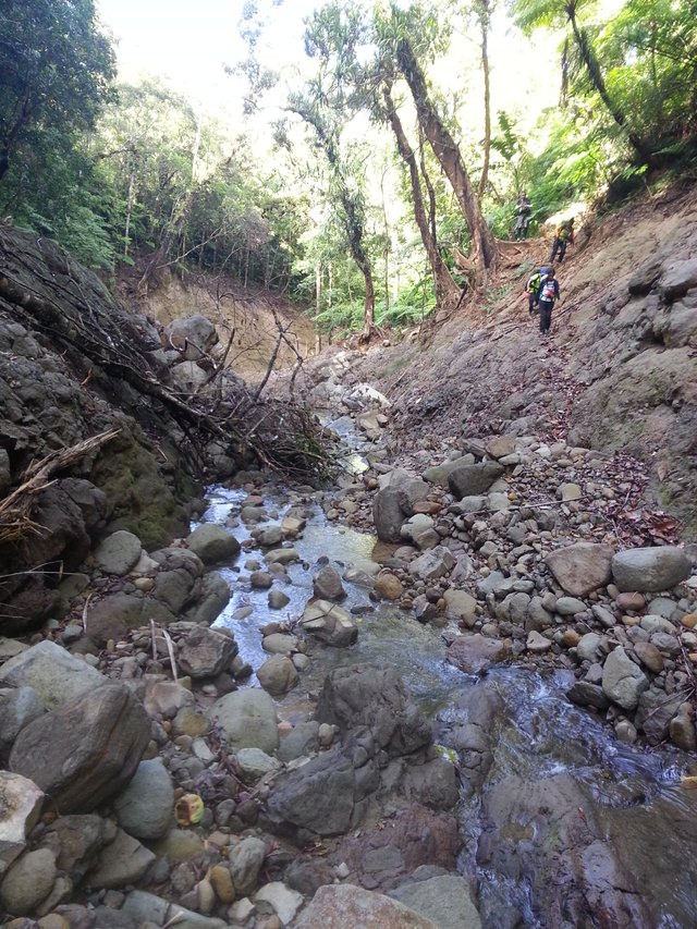
The next morning, we started a little later than we did the day before but still earlier than my usual waking up time. Obviously I was on breakfast chores while the boys started breaking the camp. Since we no longer had to climb any summit that day, we instead had a steady-paced hike along the final stretches of this rainforest and slowly descended to the river lines. The third day was now allotted for river trekking and a visit to the many lovely falls within the Tres Marias range.
|
Photo owned by Xaydtrips |
We visited so many waterfalls on our way out of the mountain range. According to Sir Kyle, he and his team do not take the liberty of giving names to these falls. If there was ever a name to these falls, it would be a visiting outsider who named it and made it known to others. They prefer to leave nature as it is. In a sense, giving these spots a name would make it easy for people to identify and visit the place and somehow, the double-edged sword in being a hiker is in wanting others to experience the beauty of nature too and accepting the fact that not all people will be responsible enough to protect this beauty. Somehow it is better kept a secret.
|
Photo owned by Xaydtrips |
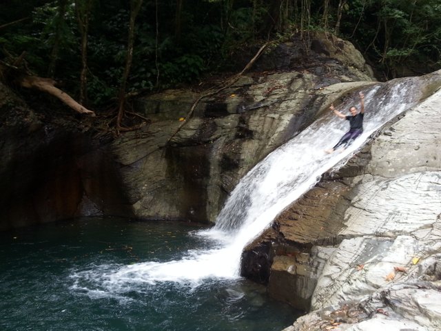
The first falls we visited was a short inclined one. Almost like a swimming pool slide because, well, you can slide down if you wish. Ray always made jumping off cliffs and sliding down waterfalls look so easy and he did it a couple of times before he pulled me out from my cozy ‘jacuzzi’ spot and decided it would be fun for me to try the slide as well. I thought it was fun at first but when I stood at the top of the waterfall and watched the raging water pour to the bottom, I decided I won’t do it because I want to go home alive. Ray, of course, wouldn’t let me go that easy. He literally put me on the edge of the cliff and somehow gave me momentum to start sliding down. I must admit it was scary but fun! In a few moments, I splashed into the water down below and I loved the experience. The pool it created at the bottom made for a perfect swimming and bathing area where we dipped for a while until we saw a floating body of a dead cloud rat and decided it was time to go.
|
Photo owned by Xaydtrips |
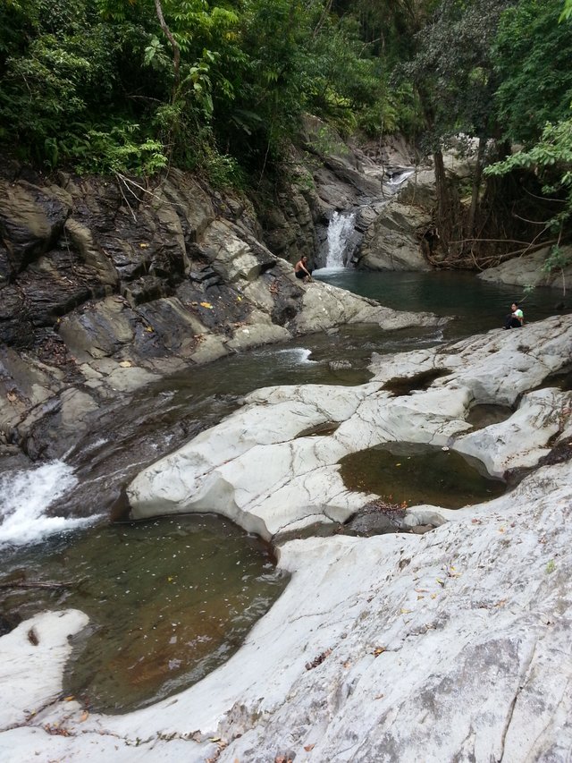
The next few falls we visited were way taller and narrower. The single-drop waterfalls made for exquisite photos, if only I owned a more a complex camera. There were a couple more falls and pools we stopped by on the way, a lot of them with evident erosion from the Urduja typhoon last December.
|
Photo owned by Xaydtrips |
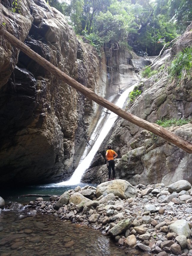
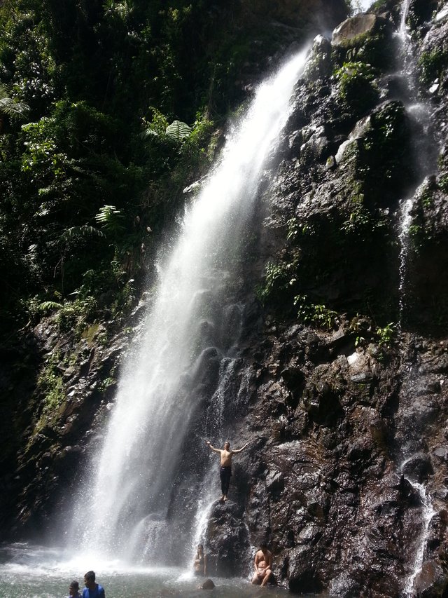
Ulan-ulan Falls
It was almost lunch time when we reached the last waterfall we were to visit that day, the Ulan-ulan falls. The word “ulan” which is Filipino for rain, is such a common name for waterfalls. In fact, I have visited two waterfalls of the same name in the last two years. This Ulan-ulan Falls is particularly famous in Biliran because of its majestic single drop falls and its being easily accessible from Brgy. Sampao in Almeria.
|
Photo owned by Xaydtrips |
That day was a national holiday because of the local elections and so there were more people spending the day at the falls than usual. It was our first encounter of a big crowd in the last three days of hiking and camping deep in the forests of Tres Marias. I took a half kilogram of penne rigate from my backpack and started cooking this nice piece of pasta as a treat for our awesome three day hike. Yes, I had to carry that much stuff in my backpack because I knew at some point we deserved this reward. Paired with slices of spam, this pasta was a real delight as we ate in the mist created by the splash of the dropping water. After lunch, we bathed under the bearably cold water of the falls, hoping the strength of it would wash off three days worth of mud and sweat. I stayed in the water long enough to think it did before finally packing up for the final descent.
|
Photo owned by Xaydtrips |
Homebound
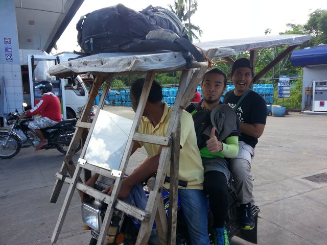
The last part of the trail was through the barangay roads of Sampao. It took us less than half an hour to finally reach the community and treat ourselves to a nice cold bottle of Coca-cola. Not long after, we searched for motorcycles who would take us back to Naval. Apparently, most of the motor-taxis were on a holiday or were in the voting precincts, so we just sat there in a town shed and chatted with the local women until we had enough motorbikes for everyone. On our way back, a viper swiftly crossed the road just before our motorbike would accidently hit him. I wish I had encountered vipers or cobras first-hand during the three-day trek but I guess my luck was fully allocated for successful summits and beautiful clearings.
We reached Naval half an hour later and we had to hurry to head to Ormoc where we will catch a ferry back to Cebu. I had to catch enough sleep in the ferry so I could go back to work the next day. Everything happened so quickly from there but not quick enough for me to forget how majestic and how fantastical the world was within the ranges of Mt. Tres Marias.
|
Photo owned by Xaydtrips |
Eternally Grateful to Mount Tres Marias
I owe Mt. Tres Marias, its peaks, and its waterfalls another great adventure that I will always carry in my heart. It has provided me an avenue to test my strength, a way to push my limits farther, an opportunity to climb with an awesome team, and a rare chance to witness nature’s artwork and magic. I am still in awe at this majesty and this feeling only convinces me that we, humans, should pay the highest respect to nature and urge ourselves and everyone around us to always protect the environment so that more and more people have the chance to experience its wonders. I am very much humbled with the beauty that is Biliran Island and someday, I will come back to visit the neighboring mountains of Tres Marias and hopefully finally get my first-hand encounter with the endemic cobras of this province.
|
Photo owned by Sir Niel Jarina |
If you are interested in any hiking and backpacking activity in Biliran Island, please contact Sir Ryan Kyle via his Facebook messenger account.
If you have gone through my story, you will know that Tres Marias is a pristine forest cover and we intend to keep it that way. Please only undertake such activities with necessary training and make sure to pay the highest respect to nature, the local residents, and their culture and beliefs. We are, after all, only visiting.
Cheers to more adventures with the greater outdoors,
Xayd
So intense that I got goosebumps upon scrolling all the way down :D
I think I got carried away by this magical experience that I wrote non-stop. Thanks for dropping by @wdoutjah!
Hahaha I bet you did. Actually I have friends who have been to Tres Marias, I can definitely relate to the influx of excitement you have
Hi xaydtrips,
LEARN MORE: Join Curie on Discord chat and check the pinned notes (pushpin icon, upper right) for Curie Whitepaper, FAQ and most recent guidelines.
Wow! This is very humbling! Thanks @curie
You received a 10.0% upvote since you are not yet a member of geopolis and wrote in the category of "ecology".
To read more about us and what we do, click here.
https://steemit.com/geopolis/@geopolis/geopolis-the-community-for-global-sciences-update-4
thank you very much @geopolis for empowering people like me who continue to write about the natural world.