Discovering your own Archaeological Site : Part 2
Discovering your own Archaeological Site : Part 2
The Natural Environment
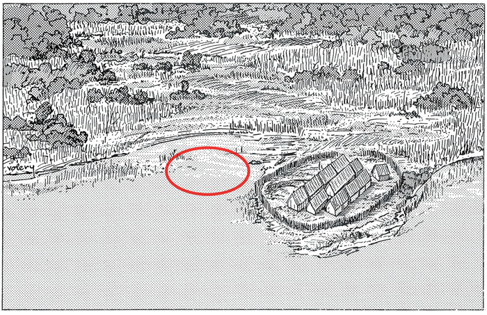
The natural environment aids archaeologists in locating sites in more than one way. For instance, climatic changes led to the discovery of sites on Swiss lake shores that were previously covered with water. During the winter of 1853-1854 a drought lowered the water level of the Swiss lakes to such extent that traces of earlier habitation could be seen on their shores. After the discovery of the first deposit (which was made on the shores of Lake Zurich), the shores of all the other lakes were systematically examined for lake dwellings. Wind and water erosion may also reveal archaeological sites.
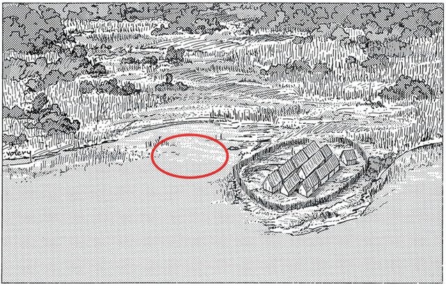
Artist impression of Neolithic settlement on Lake Zurich
Vegetation should be considered when an area is surveyed as variation in plant types may be evidence of artificial disturbance of the soil. Specific plant species are are known to occur where ground has been disturbed in some way. For example, soil which has been artificially disturbed will retain more moisture in a dry climate than will virgin soil, consequently plants which require more moisture to survive will grow there. On the basis of these differences Gertrude Caton-Thompson,for example, was able to discover ancient water furrows in the Fayum (Egypt).
James Denbow, too, based much of his large scale site survey of Iron Age sites in Eastern Botswana on irregularities in vegetation type. He found that sites with large cattle dung accumulations in live stock enclosures are today characterised by dense stands of a specific grass species, Cenchrus ciliaris (blue buffalo grass), which indicates the position of these enclosures . In South Africa the presence of couch grass may, under similar circumstances, be an indication of the fact that the ground has been disturbed and that it may possibly contain an archaeological deposit.

Cenchrus ciliaris (blue buffalo grass)
In Europe and elsewhere what are known as "crop marks" are also an indication of the existence of archaeological deposits. Crops will do better in ground above old water furrows and graves because the topsoil penetrates to a greater depth, on the other hand they will not grow as well in places where foundations of buildings exist under the ground.
Another Suspect: Euphorbia candelabrum
Euphorbia candelabrum is a succulent species of plant in the Euphorbiaceae family. In Southern Africa these trees are very often indicative of disturbance in soils and surfaces as a result of prehistoric (and often archaeological) activities. Thus, one would frequently find archaeological sites where these plants grow and undetected heritage remains might be present in the sub-surface deposits.
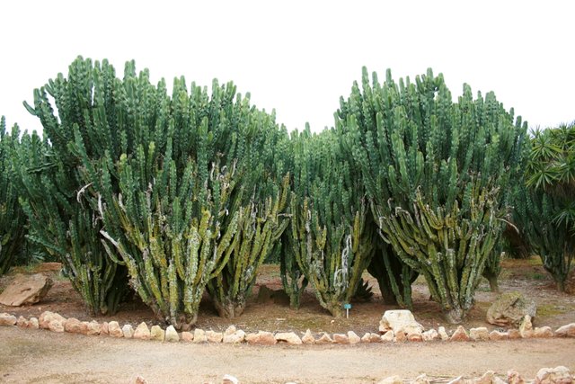
Euphorbia candelabrum
Ground Reconnaissance and Sampling Strategies
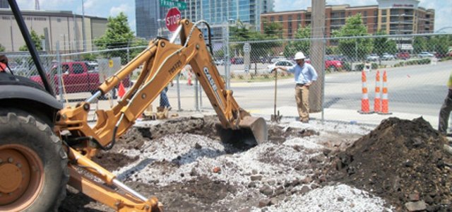
Fixed monuments, such as conspicuous earthworks and stone ruins, are often well known to local people and can be easily located. However, systematic ground reconnaissance is usually the most appropriate way of locating archaeological sites. The need for systematic site surveys has become more urgent as a result of the potential destruction of archaeological remains due to development. Such rescue work, which is referred to as salvage archaeology, requires that as many sites as possible be located and recorded before they are destroyed.
It is also the responsibility of the archaeologist to advise whether construction plans should be postponed or even altered, if finds of importance are made . An example is Foz Coa in North Eastern Portugal where the construction of a dam, which was already advanced, was halted to allow for the study and protection of Palaeolithic rock engravings found in 1994/95.
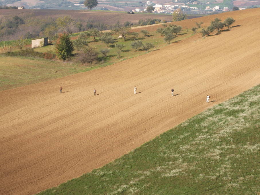
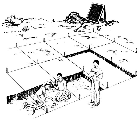
Ground reconnaissance usually involves walking considerable distances although vehicles and other methods of transport may be used. Certain parts of the study area must be selected so (Hall 1996:78). The two sampling strategies used are systematic and random sampling. Systematic sampling consists of setting up a grid of sample blocks over the survey area. Each of each blocks is equally spaced and searched.
Probabilistic Sampling
Probabilistic sampling is sampling strategy not biased by any person's judegement or opinion. Also known as statisical sampling, it includes systematic sampling strategies.
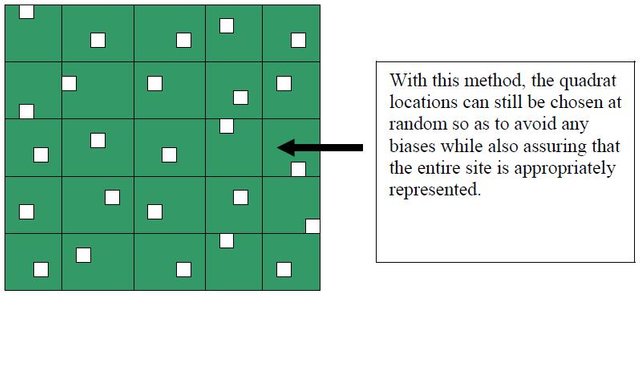
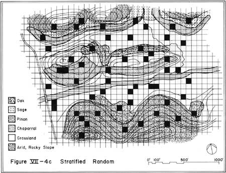
Alternatively, random sampling may be used to determine where surveying should take place. This method entails fixing the coordinates of the sample blocks by drawing them from a table of random numbers. Unfortunately, it easy to overlook important zones in the study area in this way because randomly chosen blocks are not necessarily evenly distributed across the landscape. The result is that many archaeologists make use of stratified sampling techniques. This approach first divides the study into appropriate zones, after which random samples are conducted within each zone.
Systematic Sampling: A grid of sample blocks is set up over the survey area and each of these blocks is equally spaced and searched.
Random Sampling: Random sample blocks are searched. These are fixed by drawing coordinates of the sample blocks from a table of random numbers.
Stratified Sampling: The study area is divide into appropriate zones - often based on the probable location of archaeological areas, after which random samples are conducted within each zone.

References: Renfrew & Bahn (1996:69-70)
Clottes & Lewis-Williams (1998)
Hall (1996:80-81)
Denbow (1979:405-408)
Please Follow me for more on Archaeology and History.
Please check out my other posts:
Discovering your own Archaeological Site : Part 1
Archaeological Sealed Sites and River Deposits : Is it an Archaeological Site or Not? - Part 3
Caves, Rock Shelters and Larger Open-Air Sites : Is it an Archaeological Site or Not? - Part 2
Is it an Archaeological Site or Not? - Part 1
Understanding the Archaeological Record : The Aims and Subject Matter of Archaeology - Part 2
The Aims and Subject Matter of Archaeology - Part 1
Archaeology and the Natural Sciences
Introduction to Ethnographic Analogy and Ethnoarchaeology
The Nature and Scope of Archaeology
The Three - Age System : The Stone Age, The Bronze Age and The Iron Age
The Roots of Modern Archaeology
Significant 18th and 19th Centuries Discoveries in Archaeology
Archaeology as a Profession- Part 2
Archaeology as a Profession- Part 1
To Become or Not Become an Archaeologist? - Introduction to Archaeology Part 2
Please Upvote and Resteem.
Thank You!
I actually do a fair amount of research on some sites through google maps. If you are creative and match up old maps you can still find unmolested mounds in north America from the mound building phase since there were so many.
Join us on #steemSTEM / Follow our curation trail on Streemian
Thank you for this very interesting article. It has been advertised on our chat channel (and upvoted).
The steemSTEM project is a community-supported project aiming to increase the quality and the visibility of STEM (STEM is the acronym for Science, Technology, Engineering and Mathematics) articles on Steemit.
Congratulations @zest! You have completed some achievement on Steemit and have been rewarded with new badge(s) :
Click on any badge to view your own Board of Honor on SteemitBoard.
For more information about SteemitBoard, click here
If you no longer want to receive notifications, reply to this comment with the word
STOPThis post has received a 1.04 % upvote from @drotto thanks to: @banjo.