Terrain of Colorado
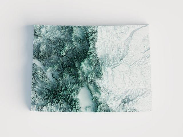
Using digital elevation imagery obtained by the Space Shuttle Endeavour in 2000 over the course of 11 days, this modern relief map of Colorado displays all of the unique terrain of the Rocky Mountains in beautiful detail.
The process involves using QGIS to parse the raw data into a single image file which can be extracted in Blender. The file is then rendered on AWS to produce a stunning 600 DPI print. The image is 2-dimensional, despite its appearance!
How are these produced?
The process of producing the maps take place in 3 separate parts.
Step 1 - QGIS
The first step is gathering the raw digital elevation model (DEM) data. Once gathered, the data is merged together and scaled to the extremes. The data is reprojected to match whatever historic map I'm working with. Once the reprojection finishes, the map is exported.
Step 2 - Photoshop
The exported map (heightmap) is brought into Photoshop and aligned to the historic map. Various modifications are made to the heightmap and then exported for use in rendering.
Step 3 - Blender
The heightmap is used to displace a plane in Blender. Various subdivisions are applied to produce a smooth terrain. The historic map is then used on a material applied to the plane. Light sources are added and a camera is placed above the map. This is when the final rendering is produced.