Mind-blowing! Grand Canyon - An ancient quarry for industrial extraction of Uranium.
According to the title of the article, it is clear that we will be talking about Uranium mining in the US, but not only that.
The material will be much wider. I will show you an evidence of a coverup and intentional distortion of our history. I will try to give you all the search queries that I used so that you can not only check the information yourself, but personally participate in the discovery of new interesting facts.
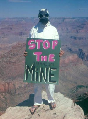
Very soon you will realize that the person in the photo above with the poster "Stop the uranium mine" protesting the discovery of new career developments of uranium in the Grand Canyon, without knowing it, protests like a bee against honey. In fact, it protects the ancient uranium mine from its further development!
One of the rules that I use to search for traces of extraction of resources in an industrial way in ancient times is this: if earlier in one location an ancient civilization extracted a certain resource and the mine wasn't totally exhausted, then other people, no matter how many years later, will return to this place and continue extraction.
Following this rule, you can easily download maps of active modern deposits in any country or region for any interesting element of the periodic table, as well as for any connection of elements, and then simply compare them visually. It's easy, informative, exciting. As a game quest. To search for such maps, we use the search terms:
Map of the mineral resources of US ( Or any other Country)
The map of the mineral resources of the region ( Specify )
Map of Minerals of Russia
The map of the region's minerals ( Specify )
Map of copper ore reserves
Map of uranium ore reserves
Map of bauxite reserves...
and so on. Then click to show the pictures.
By analogy, repeat the search in different languages.
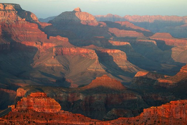
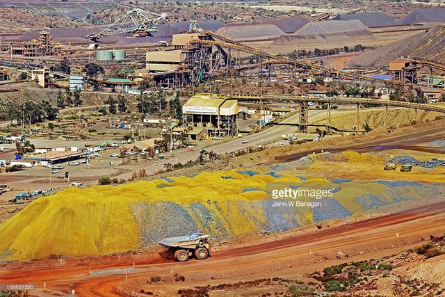
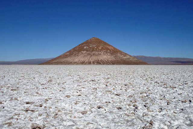
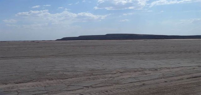
Now I will show you the example of an ancient mine - the Grand Canyon in the USA:
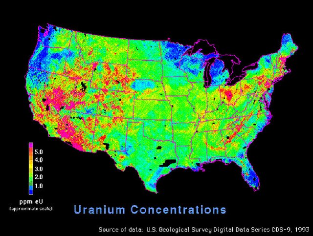
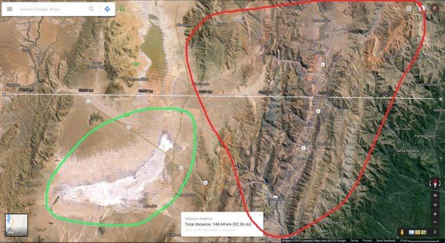
I found a map, which marked areas with high Uranium content by search term "Uranium mining reserves USA":
And the second Map:
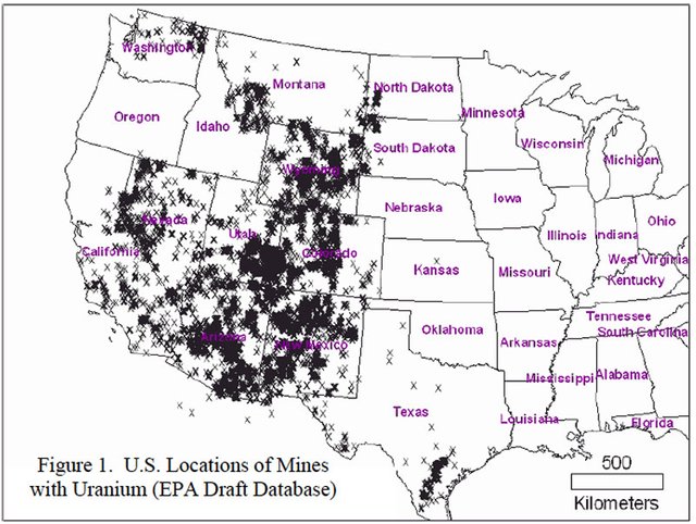
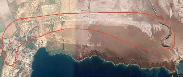
Then I compared those maps with the location of the Grand Canyon:
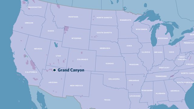
The canyon was in the zone of maximum concentrations of Uranium. Then I narrowed down the search criteria and began reading the material on the request of Grand Canyon Uranium Mining. Also, I found interesting materials. I will demonstrate some of them:
An article under the title: Uranium mining near the Grand Canyon should be permanently banned.
https://intercontinentalcry.org/uranium-mining-near-the-grand-canyon-should-be-permanently-banned/
And a map with applications for Uranium mining around the Grand Canyon from the article:
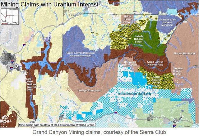
And another Map:
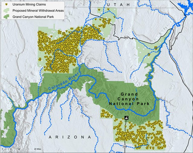
The map clearly shows that uranium mining companies are extremely interested in undeveloped areas around the Grand Canyon.
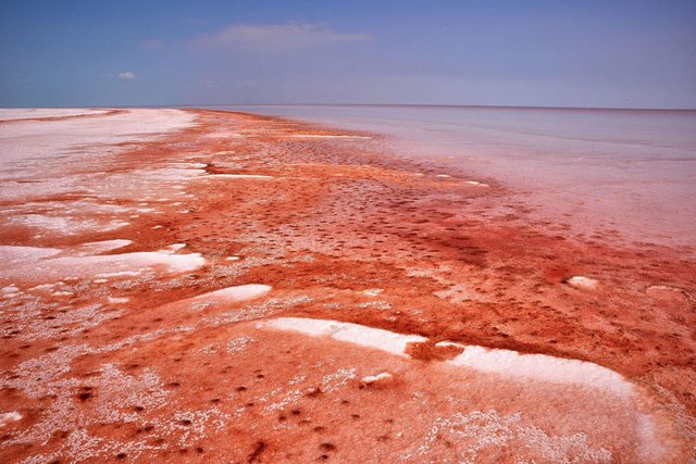
Do you understand what I'm driving at? :) Looks like in the past people had no time to fully extract the entire uranium-bearing rock in this area. They extracted from the most profitable areas, which later became the Grand Canyon.
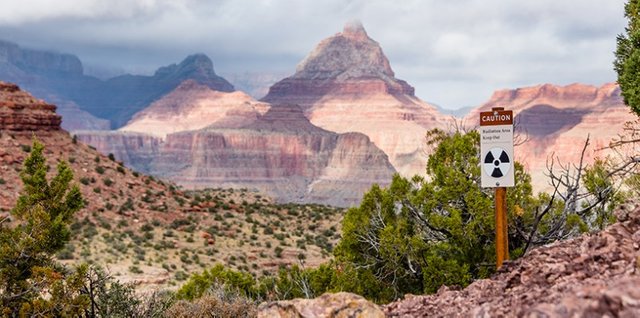
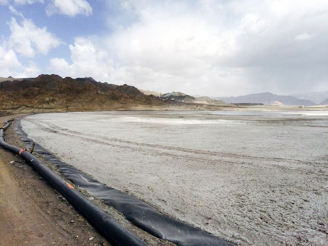
In the area of the "Canyon", there is a lot of radioactive warning signs:
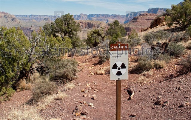
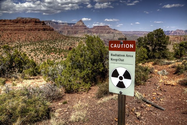
Well, what do you think? Does the story start to play out?
Looks like a long time ago we had a huge amount of uranium in our hands, which could be used for energy and nuclear war!
Are you still interested in official stories about how past generations changed skins of sables to hemp and sailed on wooden galleys and sailing gulls? Probably they changed and swam, but to study this simple life is like studying the history of the Maori people in Australia now, while alongside them are such transnational mining corporations as BHP Billiton, Rio Tinto, Glencore Xstrata and Alcoa.
Using the above example, you can now independently explore the terrain in your area. And thus, by cooperating, in contact with miners, mining, and processing industry workers who know those processes from the inside, you can assemble this puzzle completely. Total recall :)
Now you need to imagine that in front of you is a planet on which it is necessary to develop a full mining and processing industry. You have a limited amount of equipment. The first thing you will start with is the increase in its number. What do you need in the first place? Energy.
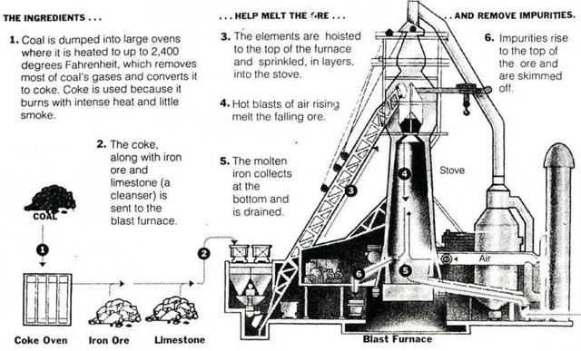
For any manipulation of matter, energy is needed. And then steel. No car or plant can be built without a wide range of different steel grades. And to produce steel, it needs iron ore, alloying additives - chrome, nickel, molybdenum, manganese, etc., coal and flux limestone.
Coal is generally needed for the recovery of any metal oxides. The oxygen atoms in the blast furnace are removed from the metal oxide as a result of the reductive chemical reaction and are attached to the carbon contained in the coal. Limestone and dolomite are used as fluxes in the metallurgical redistribution of ores to form low-melting slags for easier removal of foreign impurities.
"Their wide use in ferrous metallurgy is due to the fact that a significant amount of basic oxides is required for the flocculation of gangue and coke as well as most of the production processes are aimed at removing harmful impurities that can be completely or partially removed from the melt when working on basic slags In order to form the latter, considerable additions of the main flux are necessary, the most important requirement being the low content of silica, alumina and harmful impurities (sulfur and phosphorus). " So you can't do anything without a Limestone.
Here is the scheme for loading the blast furnace. Limestone, coal, iron ore:
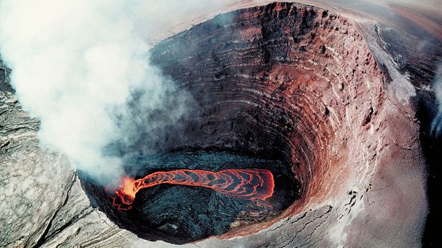
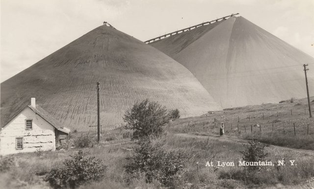
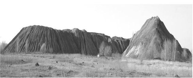
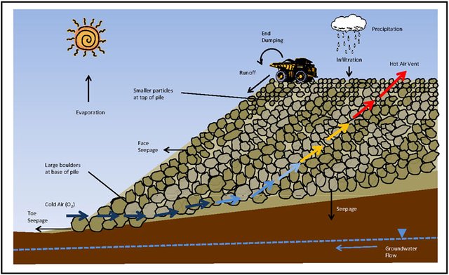
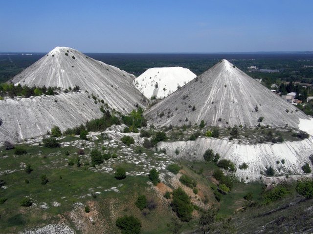
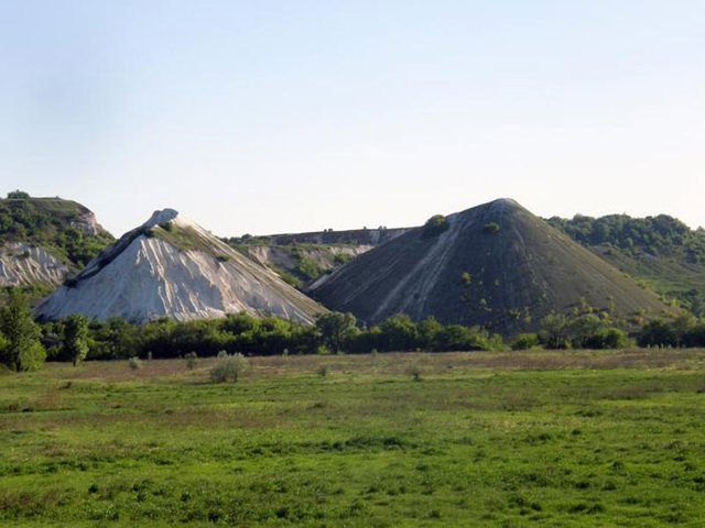
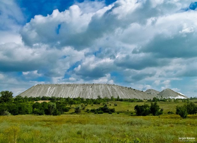
My opinion, all burning cone volcanoes are, most likely, coal waste piles. They contain a decent amount of residues of coal dust and crumbs and therefore such heaps and volcanic waste heaps are very active.
The color of the constituent rock in the Donbas waste heaps and volcanoes coincides. You can try to compare the location of volcanoes with a map of coal basins in different countries.
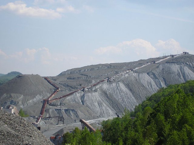
By the way, for the statement that the volcanoes are burning waste tanks came a critical remark that waste heaps cannot have a layered structure inside as in the photo:
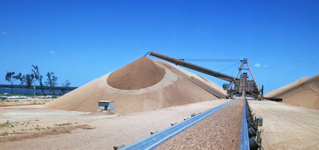
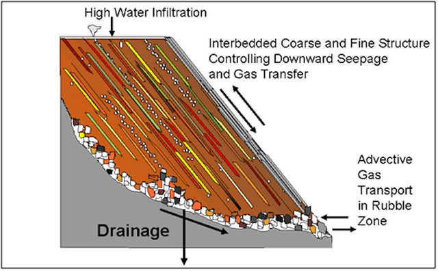
But instead, they should have a uniform structure inside, like an anthill cake. I put forward a counterargument: conical waste piles are poured with the use of conveyor belts, as in the photo:
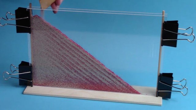
A similar process can be observed in an hourglass. With this method of pouring, layers from different colors of the rock will inevitably form and the layers will be parallel to the surface of the slopes of the Spoil tip. The photo below shows the result of emulation of this process. It is called - stratification:
So volcanoes are basically waste pits. Here is another very clear proof of this statement:
45 years ago in the Donetsk region, there was an explosion of the Spoil tip, which was contributed to the list of man-made disasters in Ukraine. The article is called - "Looking around, I involuntarily recalled the painting" The Last Day of Pompeii ".
Quote: June 10, 1966, at 23.00, a piece of the total volume of 33 thousand cubic meters broke away from the old Spoil tip of the Dimitrov mine of the trust "Krasnoarmeyskugol" in the city of Dimitrov (Donetsk region).
Hot multiton blocks and a loose mass of hot rock slid down to the residential village, piling under themselves a dozen houses with people. After the displacement of the mountain masses from the cavity formed in the lateral part of the 100-meter-long waste toner, as from the mouth of the volcano, there was an ejection of hot ash, dust, and steam, the temperature of which reached 3000 (!) Degrees. The tragedy was first officially acknowledged only 30 years later.
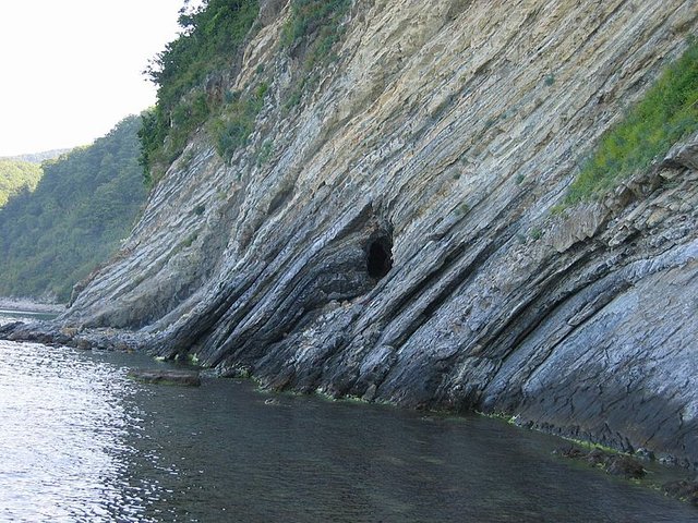
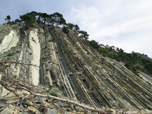
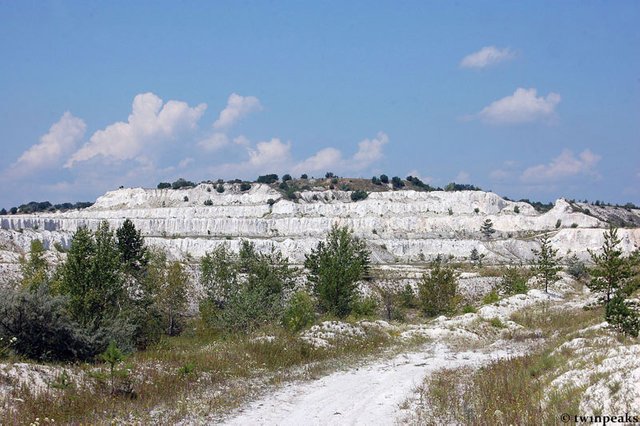
By the way, on the shores of the seas and rivers, one can often see a conical mountain that has collapsed from the water side, consisting of a layered sandstone. Perhaps this is an ancient compressed waste. Examples on the photo:
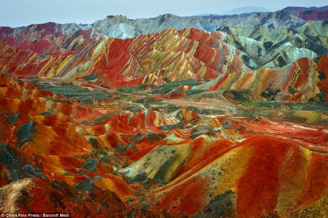
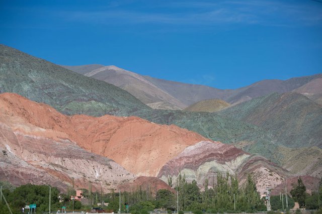
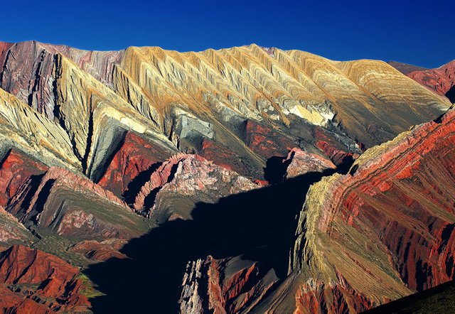
Now let's proceed to the extraction of iron ore. I want to show you some interesting analogies.
Geological park of China - Dan:
I will add the town of Purmamarca, Andes, Argentina
Hornocal Mountains, Argentina
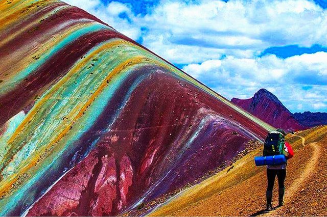
Mountains of Vinicunca, Peru
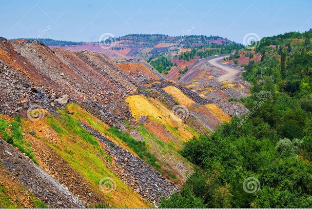
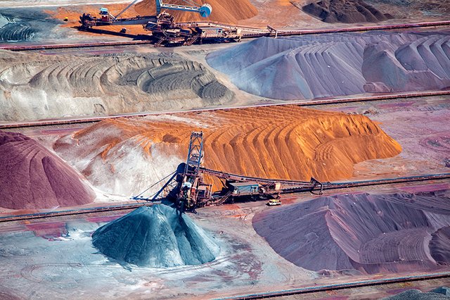
Compare them with the following dumps:
Colorful depleted iron ore dumps
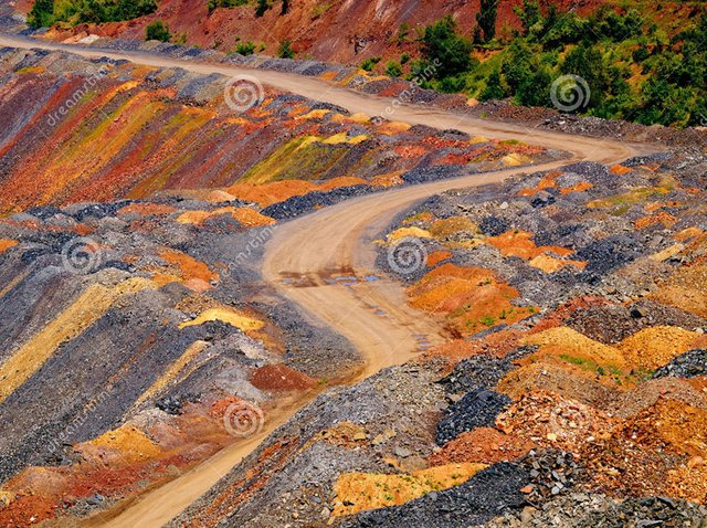
Iron ore
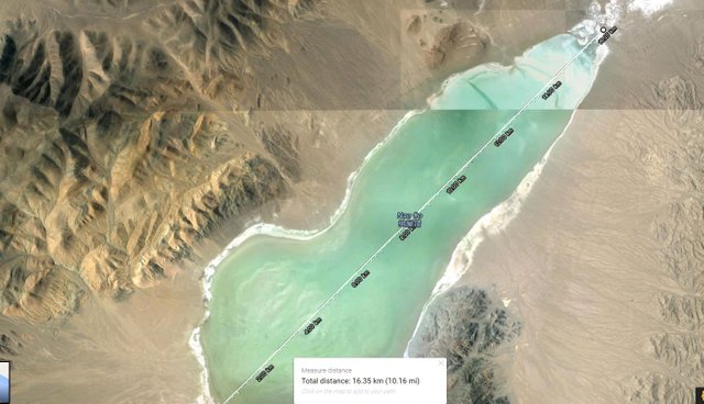
Back to the town of Purmamarca in Argentina. Let's look at a fragment of the Andes mountain chain from the satellite coordinates: -23.654545, -65.653234. Lets take a screenshot of the terrain, width ~ 150 km:
In the screenshot, I circled in red a small fragment of Andes, with a diameter of 100 kilometers. These are colored dumps from mining and metallurgical activities, and it was extracted naturally here, not only iron but the whole Mendeleyev's table. You can bring the camera closer, look at it. And it is better to examine all the Andes at once.
A sure sign of heaps and waste heaps is the erosion of their slopes. It appears under the influence of precipitation. The slopes are covered by the algae. If you see mountains whose slopes are covered with such algae, then these mountains are formed from loose materials.
Photo of dumps with algae:
You should take a closer look at the hills and mountains with such erosion. The shape of the mountains does not matter, especially given the repeated recycling of the dumps.
Layers of different colors in dumps are formed in this way:
Pay attention to the bottom of the salt lake on the satellite screenshot above. I circled it in green. It is called the Salinas Grandes, a length of 45 km. Distance from it to the ocean is 450 km:
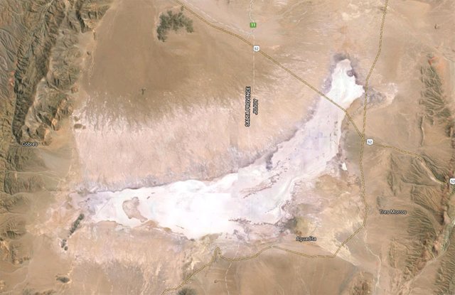
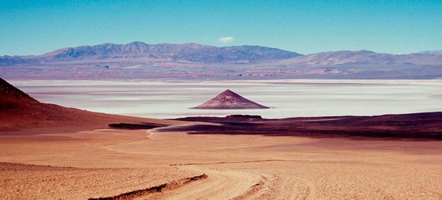
Here are photos of the lake and its surroundings
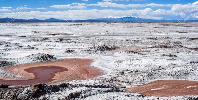
There are two things you need to know about this "lake" (and thousands of similar ones on the planet):
- It is re-mined. Different minerals are extracted.
- And the second thing that is directly related to these types of lakes is as follows:
Methods of chemical processing of ores can be divided into two main groups: acidic and alkaline. As a result of the dissolution of mineral raw materials, the elements of interest and their compounds pass into the solution, from which they are then removed by filters by thickeners and vacuum filters. The remaining brine is discharged into the sludge settling tanks.
Sludge accumulator is the main type of surface storage, which is built by one or multi-stage principle with the creation of a dam, banks, and also a sludge dump. In the sludge accumulators natural processes take place - the accumulation of atmospheric precipitation, the development of microorganisms, the flow of oxidative and other processes, i.e. there is self-healing, but due to the presence of a large number of salts with a general lack of oxygen, the process of self-healing takes tens and hundreds of years.
Google pictures by tag sludge collector, tailings pond or tailings pond.
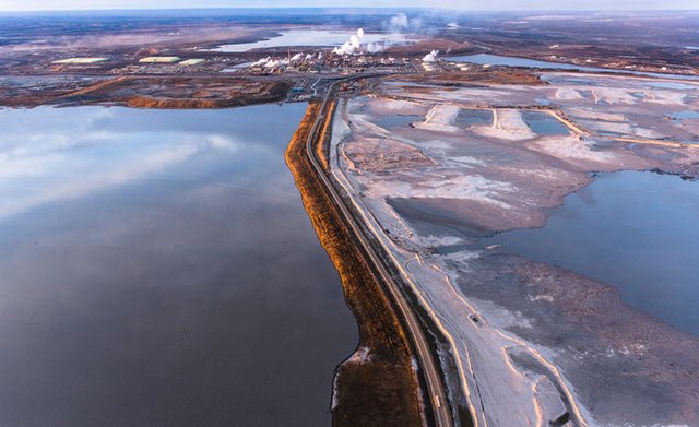
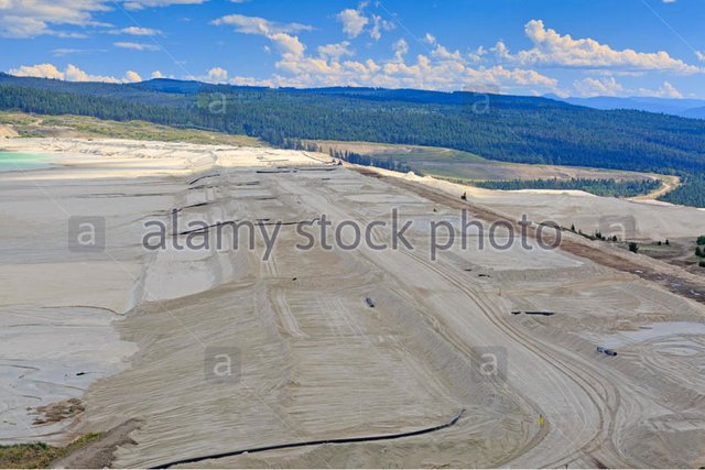
I will show you the photographs of the active sludge accumulators. They accumulate tens of meters of liquid waste.
Tailings pond at Stawell mine
Tailings dam at Tanjianshan. To construct a sludge collector a dam is built. Over time, on the ancient dry sludge collectors, the dam can degrade, lose shape. This will make it possible to give out the object for the saline soils.
Tailings dam The Sierrita Copper Mine
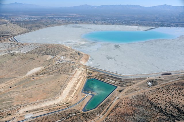
Sludge accumulator - Belaruskali. Future mountains on the horizon and a dried up salt lake.
Alberta Tar Sands Tailings Pond
Tailings Pond Ernest Henry Mine
Highland Valley Copper EYNAKR
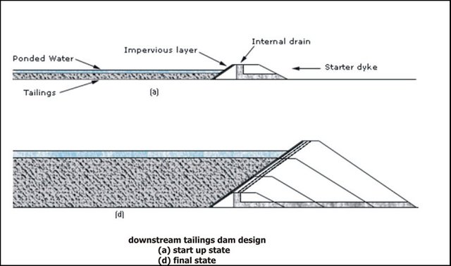
Here is the scheme of the construction of the sludge tank dam.
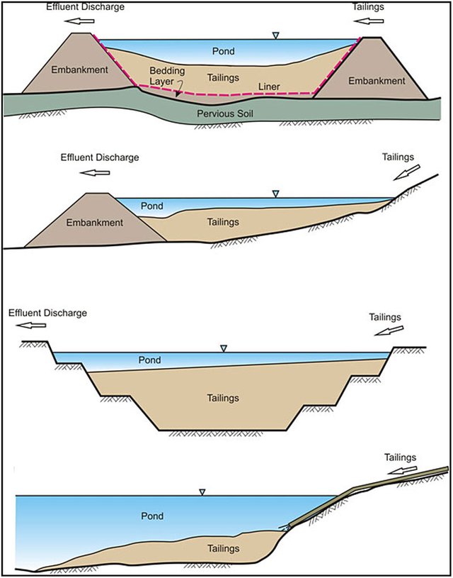
Different types of Sludge tank :
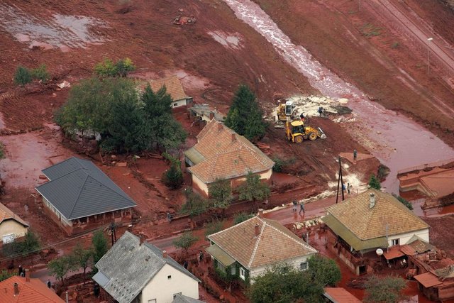
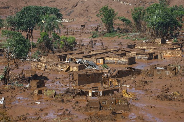
Sometimes the sludge dams break down. And then sludge floods settlements located down the stream:
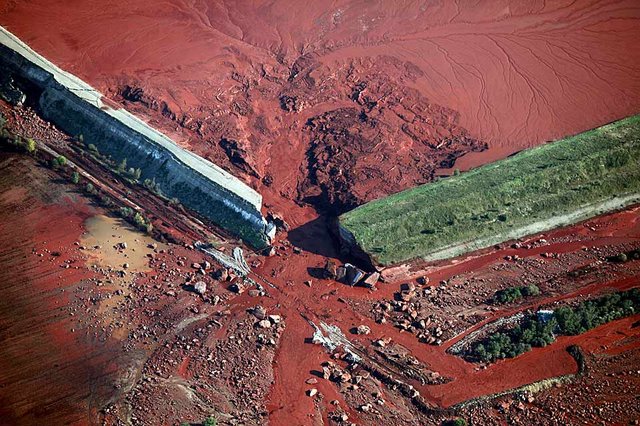
The consequences of the dam failure in Hungary. This is a sludge from bauxite processing. Extraction of aluminum
The consequences of dam failure in Brazil
The Dead Sea, Israel. A huge ancient slime tank. At first, it was a quarry. And after the main resource was extracted, they began to use it as a sludge collector. This is a logical and frequent practice:
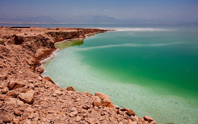
The modern level of water in the Dead Sea has fallen. I think the supporting dam is much higher than the level. Circled in red:
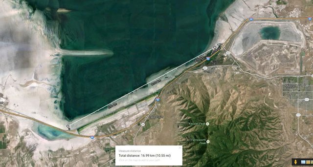
Great Salt Lake. USA. 117 km length:
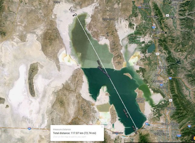
Great Salt Lake. The length of the supporting dam is 17 km:
Tuz Gölü. Turkey. 905 meters above sea level. 75 km length
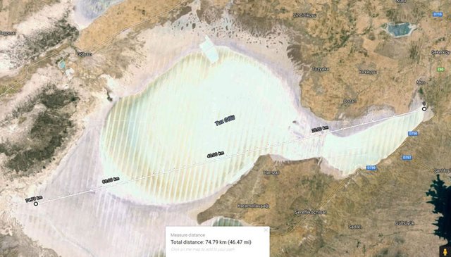
Tuz Gölü. Turkey. 905 meters above sea level. 75 km length
Nau Co Lake, Tibet. The altitude is 4378 meters above sea level. Near it, there are large-scale dumps.
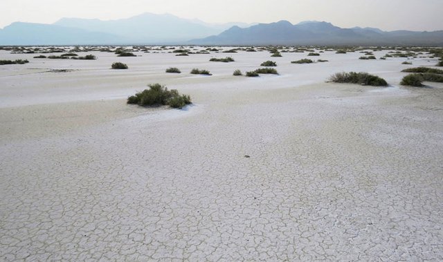
Bonneville Salt Flats, Utah
The Bonneville Desert, about 240 sq. Km is known for the extraction of salt (90% of the total production in the US), as well as other mineral salts, potassium, magnesium, lithium,etc
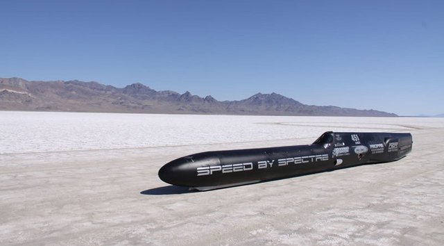
Speed records are made on the surface of dried sludges:
In general, you understand the principle. If you are interested, launch Google Maps and look for white salt spots on the continents, zoom in and search for the remains of dams, next to them you will see dumps with erosion on the slopes. Look at the maps of mineral resources that are mined now in these areas. But it should also be noted that there is a well-founded version of the overlap of salty water with tidal water from the oceans deep into the land, so salt lakes close to the shoreline can be formed for this reason. Therefore, to be faithful, you can begin to analyze salty lakes and deserts located high in the mountains. In Tibet, for example, there are 250 saline lakes.
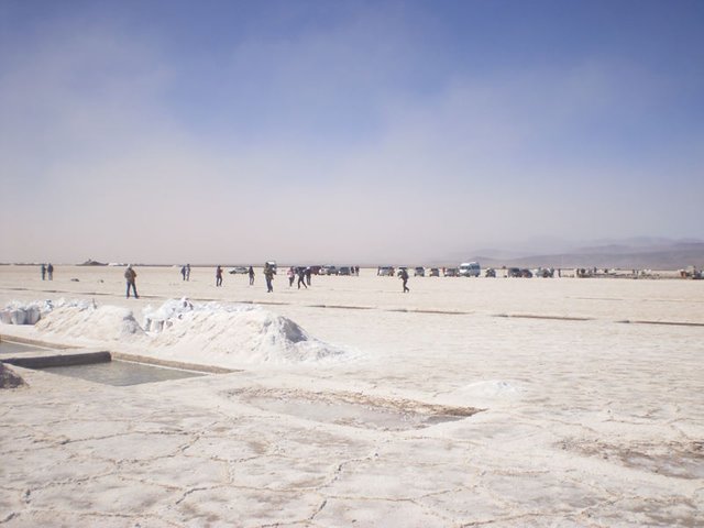
Now we will move on to the extraction of limestone, without which you can not remove the slag from the smelting of metal from ore. Above I showed that a lot of metals were extracted. So, you need a lot of limestone. In general, limestone is widely used in metallurgy, food, pulp and paper, coke, glass, and paint and varnish industry. Let's see some photo materials on limestone mining:
Now type in Google - Shihany of Bashkortostan and click the show pictures. You will see the following:
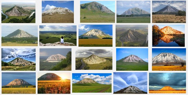
Looks pretty much as previous photos only larger in size, but those are "Natural" according to official information, can you really see the difference?
Now type in Google - chalk mountains and click the show pictures. You will see the following:
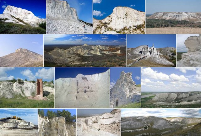
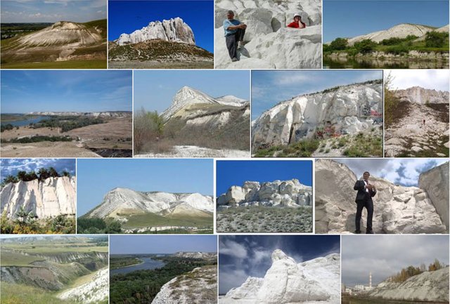
Have you ever seen such architectural and construction solutions on the holy mountains of the calcareous mountains?
In many places, limestone was mined right on the shoreline. This is very convenient, since it allows the shipping belt to load raw materials directly to the dry cargo ship. Here is the photo, the official, old limestone quarry Hedbury Quarry in the UK:
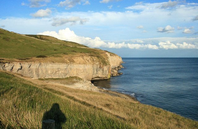
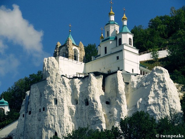
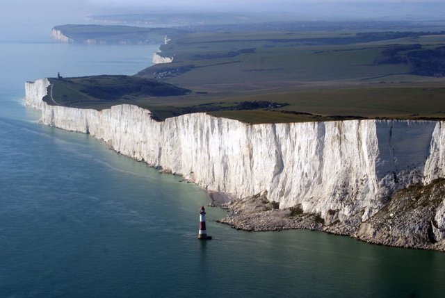
But this huge ancient limestone quarry in the UK already passes by legend as the chalky cliffs of Beachy Head Cliffs:
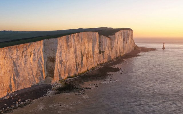
Beachy Head Cliffs, Uk:
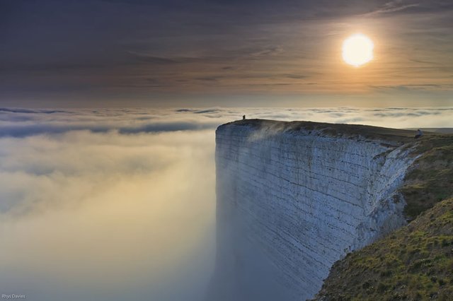
Beachy Head Cliffs, Uk:
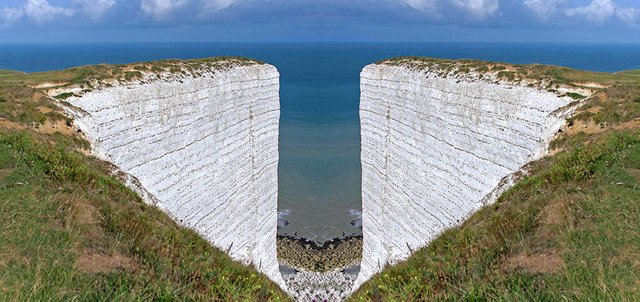
Beachy Head Cliffs, Uk:
Large mining corporations, sometimes "close" their careers according to this scheme:
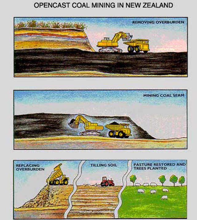
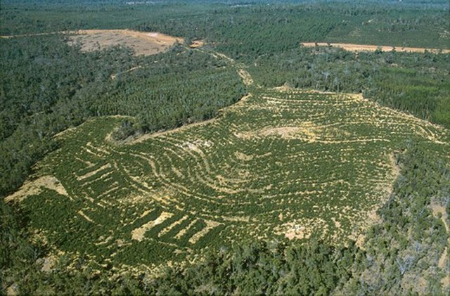
Then "plant" such a greened territory with new people. Who do not remember anything. The procedure for planting the quarries is called Reforestation (re-planting). Trees are planted in the same breed, in parallel rows and trees in the same row are located at the same distance from each other:
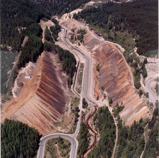
Here is the Mark Creek mine before landscaping - reforestation:
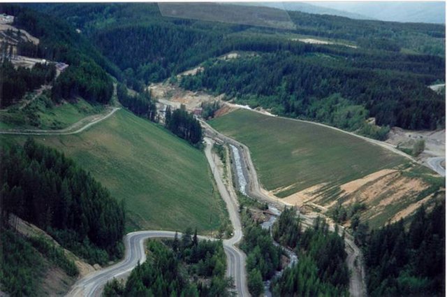
Here is the Mark Creek mine after reforesting
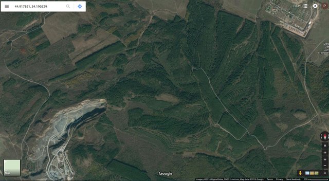
Satellite screenshot of the reforestation of ancient dumps near Simferopol.
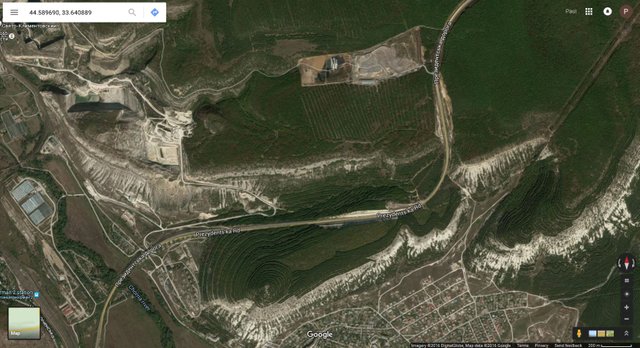
Satellite screenshot of the reforestation of ancient dumps near Sevastopol
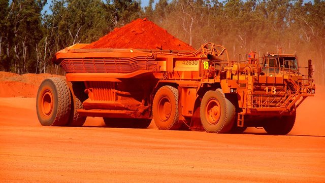
I'll write an assumption about such an important aerospace metal as aluminum. It is extracted from bauxite - the main mineral raw material for the aluminum industry. Looks like clay. Keyword for searching - Bauxite mining. Production scheme:
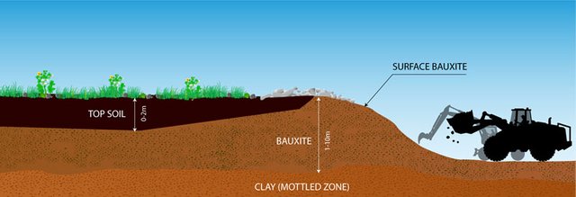
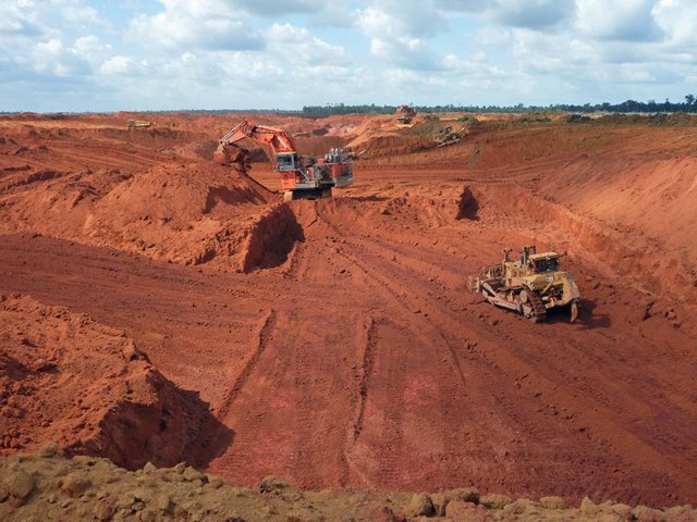
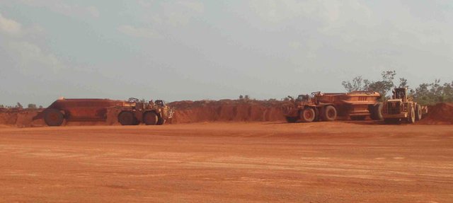
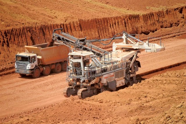
As can be seen from the diagram, the fertile soil goes to the dump. Then, from a large area, a layer of bauxite is removed. Photo of modern production:
Bauxita Paragominas, Brazil
Alcoa bauxite mines
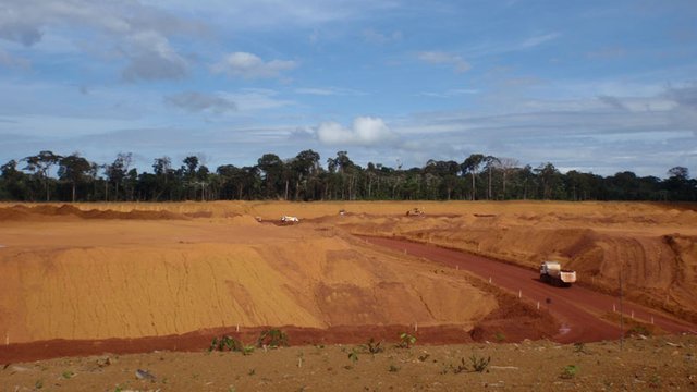
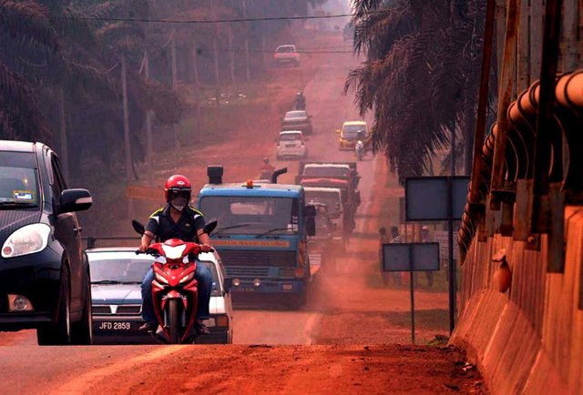
Kuantan bauxite red road:
Rio Tinto's Bauxite Mine at Andoom, Australia
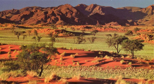
Considering the scale of the metallurgy of the past, which I showed above, the question arises: where did the soil fall in a number of countries in Latin America, Africa, Australia and other countries?
If thousands of years do not disturb vegetation, not even forests, but meadow and Savannah, then a layer of humus is formed. But we see such landscapes in these countries:
Africa
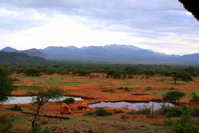
Australia
Brazil
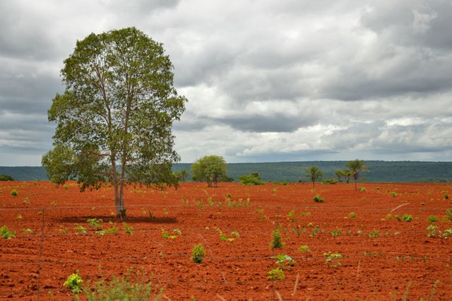
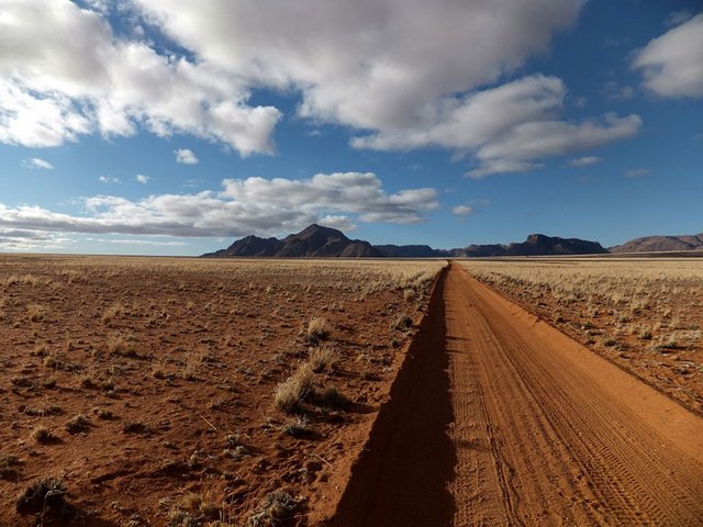
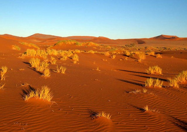
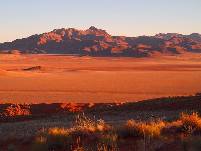
Namibia
Now step back and think for a minute, does this make sense to you? Can you be openminded enough to see what's in front of your eyes and if so, I want You to ask yourself a question. Why do they hide this information about our past? What are they afraid of?
Congratulations @althistory! You received a personal award!
You can view your badges on your Steem Board and compare to others on the Steem Ranking
Vote for @Steemitboard as a witness to get one more award and increased upvotes!