Developing the ingenuity of children | America - (Part 1)
Hello, dear family Steemit! Welcome to our virtual classroom, sometimes we are not aware of how education influences our lives. This beautiful day I bring a very important content for the development of any child. So I invite you to enjoy this class where we can clarify questions and doubts in children about America! A new world, as the Europeans called the American continent, because of its discovery.
America! A new world
A new world
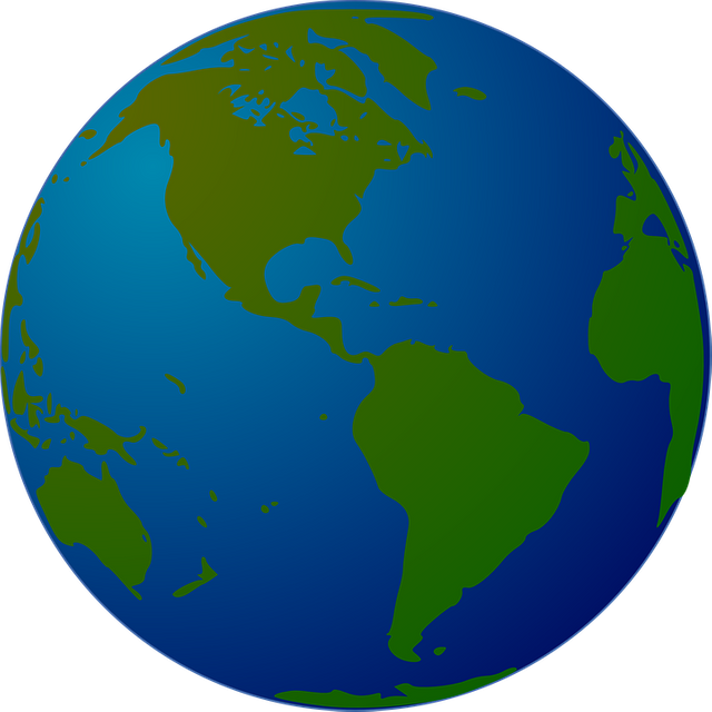
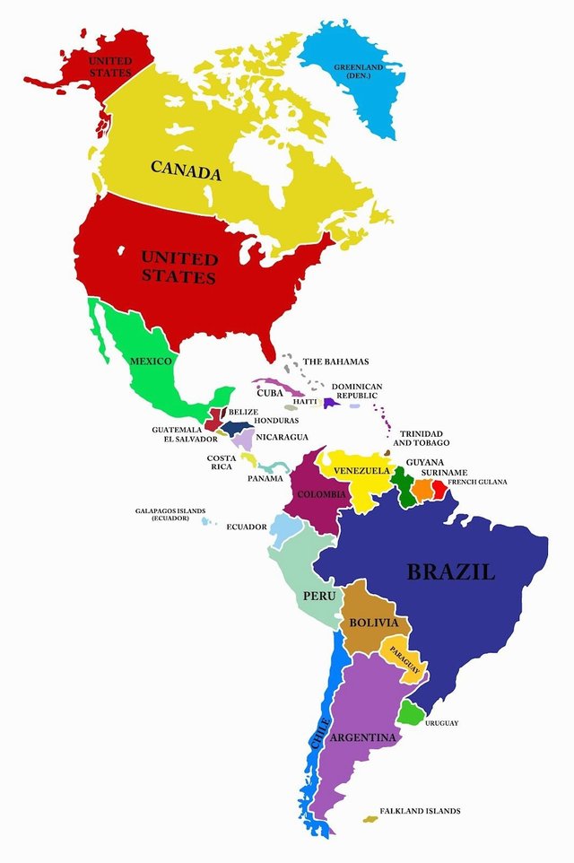
It is a continent formed by two large blocks located between the Atlantic and the Pacific Ocean and united by the Isthmus of Panama, a narrow strip of land that occupies Central America and was formed millions of years ago. It occupies the second place among all the continents, due to its large size, after Asia. Its extension corresponds to 28 # of total landmasses.
The continent is conformed by 35 sovereign nations, in which they are: Antigua and Barbuda, Argentina, Bahamas, Barbados, Belize, Bolivia, Brazil. Canada, Chile, Colombia, Costa Rica, Cuba, Dominica, Ecuador, El Salvador, United States, Grenada, Guyana, Haiti, Guatemala, Honduras, Jamaica, Mexico, Nicaragua, Panama, Paraguay, Peru, Dominican Republic, Saint Kitts and Nevis , San Vicente, Santa Lucia, Suriname, Trinidad and Tobago, Uruguay and Venezuela. It is also accompanied by a Commonwealth and 24 independent territories.
America was populated, first, by human groups from Asia, according to one of the theories that explain the origin of the indigenous settlements. Many centuries later, a new migratory process began that would transform the map of the world.
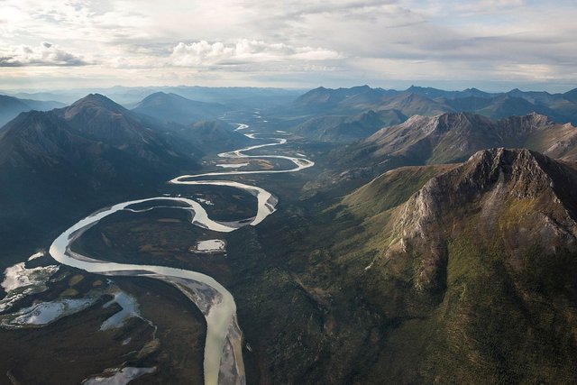
In America abound large rivers, many of them navigable, which are valuable means of communication and transport. The most important basins are those of San Lorenzo and the Mississippi-Missouri in North America, and those of the Orinoco, Amazonas and del Plata, in South America.
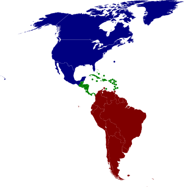
From the territorial and physical point of view, it is possible to differentiate "three Americas":
Why? the name of America?
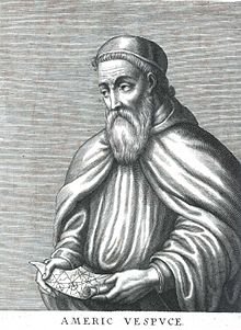
In 1942, Christopher Columbus left Spain to the west; believing that it would reach the East Indians, that is, the Catay (present China) and the Cipango (present Japan). I found lands that were an obstacle to his trip. In turn, the navigator Florentino Américo Vespuccio, travel to the new lands, described them in detail. Taking into account this information, the geographer Martin Waldseemuller, in a work written in the year 1507, proposed the name "Américo Lands". Hence, America.
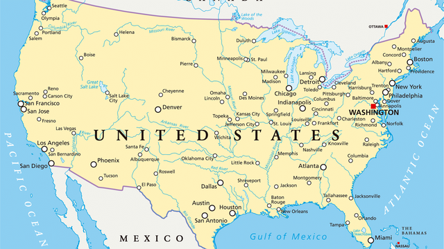
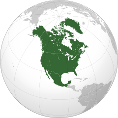
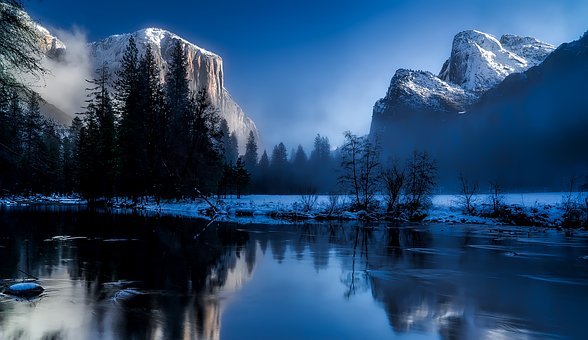
NORTH AMERICA. It is the block that extends from the Arctic Ocean to the Isthmus of Tehuantepec. It presents all kinds of landscapes and animals: from almost polar areas to large deserts. It constitutes. United States It is the fourth largest country in the world. It has 50 states, two of which are separated from the rest: Alaska, In the mountains of Sierra Nevada, in the state of California, grow the tallest trees in the world: the redwoods. You know they can reach 110 meters high!
Numerical data of the American continent.
Numerical data.
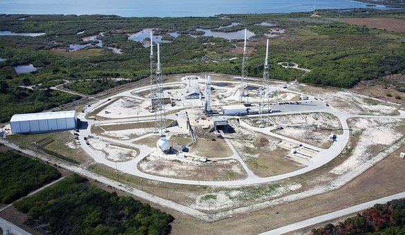
One of the most famous rocket launching centers in the world is located in Cape Canaveral in the state of Florida. From here came the Apollo XI, which took the astronauts who stepped on the Moon for the first time, on July 20, 1969.
You may be familiar with the city of Los Angeles, in California, since there is Hollywood! In addition, it is the second largest city in the United States.
Yellowstone National Park is located in the state of Wyoming. In it you can admire the Old Feithful geyser, an intermittent jet of very, very hot water, that springs from the interior of the Earth. ! Is awesome!
Jazz was born in New Orleans, in the state of Louisiana, around the year 1900; It was the way of expressing themselves of the black inhabitants.
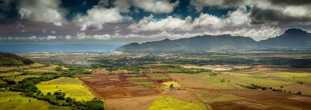
The Hawaiian archipelago belongs to the United States since 1959. It is located in the Pacific, in Polynesia. Its capital is Honolulu and is one of the paradises for surfers.
This archipelago consists of eight islands of volcanic origin. There is the Volcanoes National Park where Manua Loa, still active, can be considered the largest volcano on Earth, with a height of 9km if you consider the base from the seabed.
The United States is the first copper, oil, soybean and corn. Did you know that it is the place where more cars are manufactured?
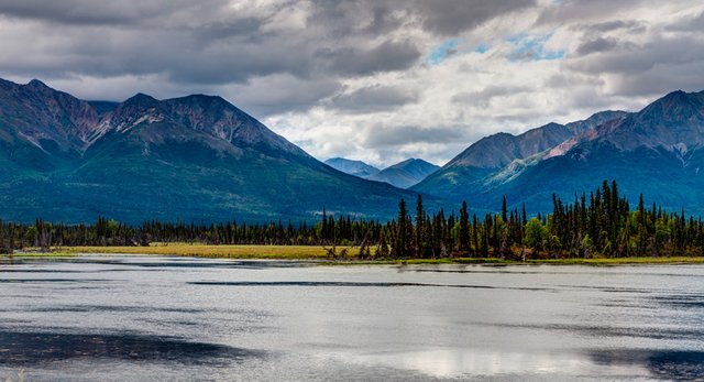
Although Alaska belongs to the United States, it forms with Canada to a region of similar conditions. This region borders the Arctic Ocean in the north, in the west with the Pacific Ocean and with the Atlantic
Alaska is the largest state in the United States. In it is Mount Mckinley, the highest height of the area with 6,194 meters, located in Denali National Park.
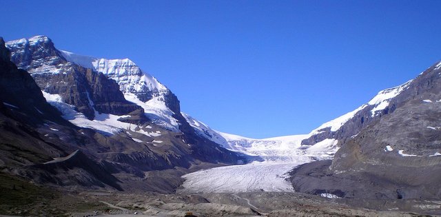
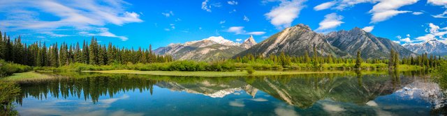
In the Rocky Mountains, in the state of Alberta, is the Jasper National Park, a very beautiful place, especially because of the presence of the Athabaska glacier.
Niagara Falls is a spectacular waterfall of the Niagara River, which comes from the Great Lakes.
The Mississippi River runs through the United States from Minnesota to the Gulf of Mexico and is the longest river in North America. The valley of death is the lowest point, 86 meters below sea level. It is so hot that in 1913 they reached 56.72 ° C!
Did you know…?
MEXICO
country located in North America, bordered on the north by the US and on the south by Belize and Guatemala, on the E with the Gulf of Mexico and on the west by the Pacific Ocean. Mexico has experienced the influence of a rich mix of traditions and cultures. Its landscape is extraordinarily diverse, just a few kilometers separate the tropical coastal plains from high mountains, volcanoes and deserts. The surface of the country is 1,967,183 km2 and is made up of 31 states and its capital, the Federal District.
Numerical data.
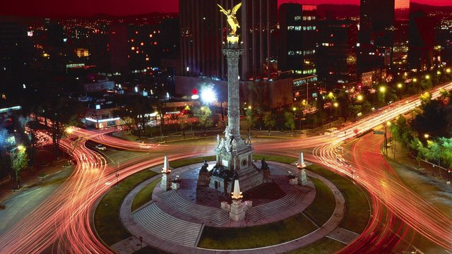
Mexico City is the industrial center, culture and national communications, as well as one of the most vertiginous growth cities in the world. One of every five inhabitants of the country lives here.
The monarch butterfly travels long distances to escape the winter and the strong heat. Canada comes year after year to the forests of Mexico to reproduce and take refuge from the strong winter.
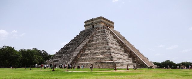
Two of the most important cultures that developed in prehispanic Mexico were: the Mayas and the Aztecs. The Mayans built stone cities and rich temples; They knew a lot about mathematics and astronomy. The Aztecs were fine artisans, builders of stepped pyramids and the founders of a great empire, the Mexica empire.
Did you know…?
CANADA
Canada, with an area of approximately 10 million km2, is the second largest country in the world and is the fourth largest exporter of wood and pulp. It occupies the northern half of this continent, with Alaska and Greenland. It limits with the Arctic Ocean, to the east with the Atlantic Ocean to the north, to the west with the Pacific Ocean and Alaska and to the south with the United States, with which it shares a border of 6,416 kilometers. It also contains a large number of islands, which form the Arctic Archipelago. Its coastline is the longest in the world with 244,000 km.
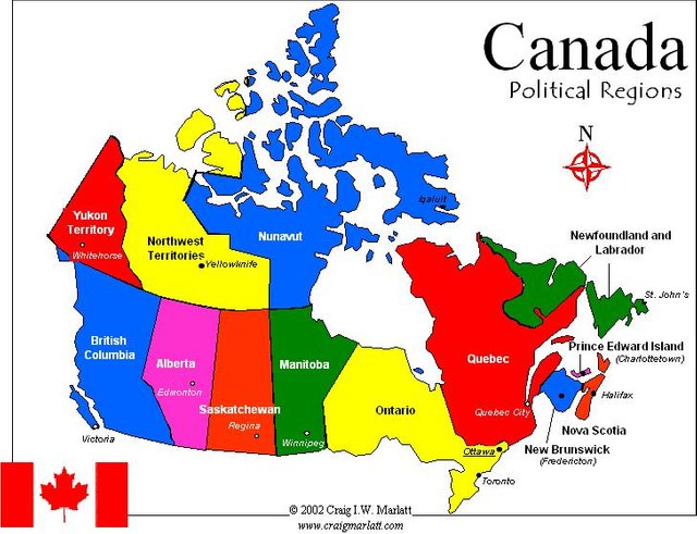
Canada is composed of 3 territories (Yukon, Northwest Territories and Nunavut), and 10 provinces (Ontario, Quebec, Nova Scotia, New Brunswick, Manitoba, British Columbia, Prince Edward Island, Saskatchewan, Alberta and Newfoundland and Labrador).
Numerical data.
The north is the least inhabited area, because the winters are very cold. The population is concentrated in the South, near the United States. This country has many natural resources: trees, fish, oil, natural gas and has a very modern and varied industry. Do you know why Canada is considered the breadbasket of the world? For its great production of oats, barley, wheat and corn.
Canada Ice hockey is the most popular sport in Canada, skiing and skating are also practiced.
In Canada there are numerous lakes, some shared with the United States, such as the Great Lakes: Superior, Michigan, Huron, Erie and Ontario. Also important are the Great Lake of Bears and Slaves.
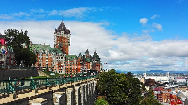
Did you know ... The second French-speaking city in the world is not in France, but in Canada? It is about Montreal (which has more than 3 million inhabitants). It is the largest city in the province of Quebec, whose official language is French.
What are your regions?
It is considered that there are six major regions are the following:
- Appalachian Region. Atlantic Canada.
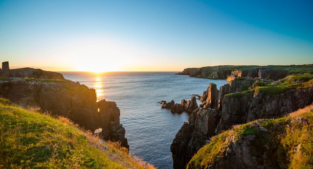
The Appalachian region includes the so-called Atlantic provinces - New Brunswick, Nova Scotia, Prince Edward Island and Newfoundland - and the southeast of the province of Quebec. This region has a moderate relief, which characterizes it. Agriculture and fishing are its predominant economic activities, although mining extraction and the exploitation of abundant natural resources are also important.
source
In this region there are innumerable beaches, parks and forests. Small towns abound, but there are also incredible cities like Charlottetown, Fredericton, Halifax and St.
In Atlantic Canada Music, folklore, seafood and landscapes are different from anywhere else.
- Region of the Lowlands. Central Canada.
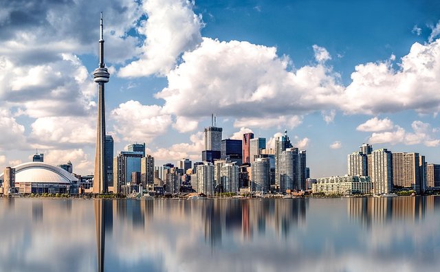
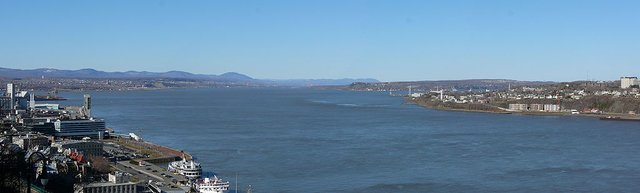
It includes the provinces of Quebec and Ontario, where cities such as Toronto, Ottawa, Montreal and Quebec are located. We also have the Great Lakes and the San Lorenzo River, where the largest amounts of fresh water in the world are concentrated. This region is the most industrialized in Canada, with high fertility in its soils, where agriculture continues to play an important role. In this area, the Rideau Canal is located, the largest skating rink in the world. More than half of the population is settled in this region. - Canadian Shield Region.
This region extends from the northern coast of Quebec, crossing the Hudson Bay, to the Arctic coast of the Northwest Territories. It comprises a good part of the provinces of Quebec, Ontario and Manitoba, and the north-western third of the Saskatchewan. The lands of the Shield are rugged, rocky, with abundant lakes and a great mineral and forest wealth. - Prairie region.
Comprised by the provinces of Manitoba, Alberta and Saskatchewan. In this region, 75% of the country's arable land is located, Saskatchewan is the main cereal area of the country, followed by Manitoba. Alberta is covered by large forests. In this region, there are important mineral and petroleum deposits. - Western Mountainous Region.
It extends from the Pacific coast to the western tip of the province of Alberta and comprises most of the province of British Columbia and the Yukon Territory, which is the highest peak in the country, Mount Logan (5,951) mts). British Columbia is occupied almost entirely by the Cordillera de las Rocosas, composed of parallel chains that extend from north to south, separated by narrow valleys. This region is very forested and its economy is based on the exploitation of its abundant natural resources. In the western region are the famous Rocky Mountains. And, one of the most beautiful cities in the world "Vancouver", with an eclectic mix of ethnicities and influences, many of them Asian - Region of the Arctic Islands. The North.
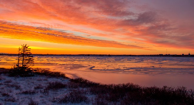
It is located within the Arctic Circle. It includes part of the Yukon Territory, the Northwest Territories and Nunavut; they are very sparsely populated areas, still unexplored. Mining, hunting and fishing are its main economic activities. This region is a striking example of virgin natural spaces that remain in the world. In the North of Canada we can find arctic animals such as polar bears, walruses, seals, white wolves, snowy owls and caribou.
nbsp;

What is the language?
English and French are the two official languages. English is their mother tongue, except in the province of Quebec, where more than the highest percentage of the population recognizes French as their mother tongue. In the rest of the provinces, English predominates clearly. In addition, a good number of languages are spoken, due to the existence of autochthonous groups that still preserve their primitive languages and immigrants.
Did you know…?
CONCLUSION
- The development of industry and technology have put the two countries of Anglo-Saxon America in the first place among those with the highest gross product. The United States is considered the first economy in the world. The Canadian shield is the oldest geological element of Canada, belonging to the Precambrian times. It is formed by crystalline and sedimentary rocks that, due to erosion, have assumed the appearance of a depressed peneplain in the center, occupied by the Hudson Bay.
- Mexico is located by its latitude, within tropical climates. Thanks to the influence of height, it has a temperate climate in the central zone.
Thank you all for joining me in this fantastic and perfect exercise for the development of children, With this fun series of questions and answers, you can have a good time with the little ones in the house, help you in your physical and mental development, allowing you to expand his technique of concentration and observation to help them understand their environment. In addition, they provide us with the necessary knowledge and skills that allow us to protect ourselves against all adversities.

REFERENCES


I invite you to meet the family @ecotrain, where you will find wonderful people, talented and with an incredible human quality! Check out the #ecotrain hashtag to see more high quality items.
........................................................

Make The World A Better Place
........................................................

........................................................

........................................................

........................................................

........................................................
Posted from my blog with SteemPress : http://saracampero.vornix.blog/2018/07/16/developing-the-ingenuity-of-children-america-part-1/
great information girl!
Hi your post has been upvoted by vis4, the LGBT+ curation bot! Come and visit us on Discord
Congratulations! Your post has been selected as a daily Steemit truffle! It is listed on rank 21 of all contributions awarded today. You can find the TOP DAILY TRUFFLE PICKS HERE.
I upvoted your contribution because to my mind your post is at least 31 SBD worth and should receive 266 votes. It's now up to the lovely Steemit community to make this come true.
I am
TrufflePig, an Artificial Intelligence Bot that helps minnows and content curators using Machine Learning. If you are curious how I select content, you can find an explanation here!Have a nice day and sincerely yours,

TrufflePigIf you would like to support the educational community by delegating to @steemiteducation, please click on any of the following links. This will ensure that more teachers are supported on a daily basis.
100SP 200SP 300SP 400SP 500SP 750SP 1000SP 2000SP 3000SP 4000SP 5000SP 10,000SP 25,000SP
Wow, that's a great and elaborate post! And it's only part 1, curious to see what you're going to add in part 2 :-)
Greetings from The Alliance :D
Wow, so much information here! Good job, this was very interesting to read!
excelent articule, congratulations!
This comment has received a 25.00 % upvote from @steemdiffuser thanks to: @steemcaptcha.
Bids above 0.1 SBD may get additional upvotes from our trail members.
Get Upvotes, Join Our Trail, or Delegate Some SP