Fridays for flashback; GIS
Today, I'm flashing back to a training I had some months ago on GIS.
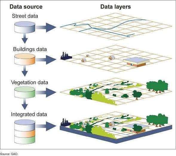
GIS is Geographic Information System
- It is a system of softwares and hardwares used to solve problems.
- It is used to collect spatial information, gives the ability and range of tools to perform analysis.
How can it be used?
- Creating a web application*
A geoform, used to collect data.
Creating a layer which is basically creating a map; you can use any of the following apps.
arcgis.com and developers.arcgis.com
Some key words to note in GIS
- Point is location
- Polygon is building
- Lines
- Integer
Types:
- String is text
- Integer is up to 6 digits/Double is no from 7 digits up.
- Double is easy to avoid flag
It's a beautiful thing to do and I absolutely enjoyed the training!
Thanks for using eSteem!
Your post has been voted as a part of eSteem encouragement program. Keep up the good work! Install Android, iOS Mobile app or Windows, Mac, Linux Surfer app, if you haven't already!
Learn more: https://esteem.app
Join our discord: https://discord.gg/8eHupPq