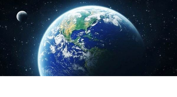
Previous knowledge about the Formation and Evolution of our beloved Planet Earth.

in #geology6 years ago

Fraternal greeting to the entire community, this time I come to give you a summary of how the creation of the Earth was, collecting some classes of the career that I love so much, as is Geography.

From its formation to the present, the Earth has undergone continuous changes, transformations that have taken it from being a place completely inhospitable to the world that we know today, even though some events happened billions of years ago, scientists have achieved unveil the chronology of all these most outstanding events of Planet Earth through Geology.
At first there were great controversies between two opposing ideas, for the moment there was a group of geologists who thought that all the rocks had been formed at the bottom of the seas, this idea was subject by the German Abraham Werner; On the other hand there were the English James Hutton and James Hall who thought that some rocks had at least been formed by cooling on the surface of the Earth, by cooling volcanic rocks or lava. These scientists were called the Plutonists and it was a controversy between two schools, where neither of them were right, but they were right.


https://goo.gl/images/jZvNBe

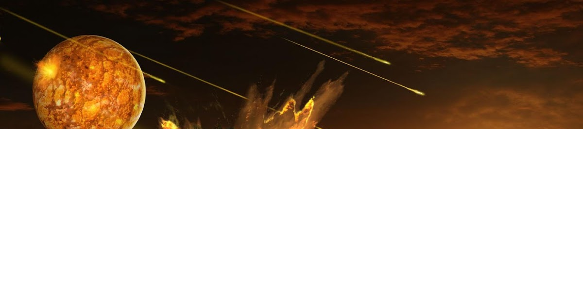
How was the Planet Earth formed?


https://goo.gl/images/tGoXhx

According to Sir Charles Lyell in 1830 he published a fundamental book called Principles of Geology, where he proposes that the processes that are acting today on Earth, ie; erosion, deposition, acted in the past to the same extent. This criterion was called Uniformista or Uniformitarista.
On the other hand were the catastrophe, they thought that the earth had been formed by successive catastrophes and that since the last catastrophe there were no changes on Earth, an example of a catastrophe was Georges Cuvier, with time the Uniformists obviously predominated.
At the same time, an English engineer by the name of Willian Smith came up with the mapping of the surface of England according to the relative age of the layers, this engineer drew the first geological map of England where the different units put the different successive layers and observed that they were characterized by different fossils and discovered which were older and which were more modern, in this way the mapping and a very fundamental breakthrough was originated.

For the nineteenth and early twentieth centuries, there was great controversy about the idea of ​​the age of the Earth, this controversy lasted for many years where the Uniformist Geologists who thought about the slow processes that take to form the Earth, said that the Earth would have that having had millions of years, from there the controversy is unleashed, first by those who read the bible ultra literally and by scientists. In the twentieth century, the development of a unifying theory called Plate Tectonics, is a recent theory that explains all the geological phenomena that exist, as well as the formation of the Earth.


https://goo.gl/images/WTNfwU

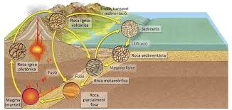
What materials exist on Earth?

The materials found on Earth are minerals and rocks, where the rocks are classified as sedimentary, igneous and metamorphic, they can also be classified according to their history, an example of a sedimentary rock are all those that have formed in the background of basins, bottoms of lakes, bottoms of the sea by separated particles like mud, sand, conglomerate and solidify later. Igneous rocks are those that have been formed by cooling the magma, either inside the crust where intrusive igneous rocks are formed or outside the crust by cooling of lava extrusive igneous rocks are formed. Metamorphic rocks are the product of transformations produced by large pressures or high temperatures on any of the other types of rock.


https://goo.gl/images/4wVfNK

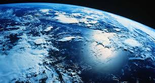
The Structure of the Earth

The Earth is composed of three basic layers that are the crust, the mantle and the nucleus; The crust is very thin and is composed of light rocks with high silica content (felsic rocks). The mantle is also composed of rocks, but these rocks have little silica content, which is why they are called mafic or ultramafic rocks. The core of the Earth is composed of two layers, the outer layer completely liquid and fluid and the inner core completely solid, composed of iron and nickel.
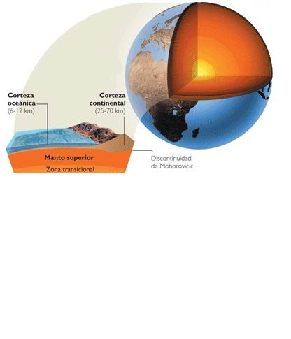
The crust of the Earth is formed by the continental crust and is where the continents are located, this crust is thicker between 30 and 50 km thick and is formed by very light rocks. The oceanic crust is thinner than the continental one between 5 and 10 km thick and is formed by denser rocks. Both the continental crust and the oceanic crust together with the most superficial layer of the mantle form what is called Lithosphere, of great importance since the plates that form the earth are not formed only by crust, that is to say they are lithospheric plates that cover the crust plus the upper layer of the mantle, between the lithosphere and the asthenosphere occurs a discontinuity that causes the plates to slide.


https://goo.gl/images/WEv6W2

Alfred Wegener meteorologist, formulated in 1815 the theory of plate tectonics through the drift of the continents, he formulated that at some point in the past all the continents had been united in a great continent which he called Pangea, and was based first in the coincidence of the contours of the coasts, but also had Paleoclimatic evidences, for example the study of the glaciations of the past observing glaciations in South America and in South Africa and by the direction of the ice the theory fitted much better if the Two continents were united. I also use Paleontological evidences through the distribution of living organisms that were found on two continents (Cynognatyhus, Mesosaurus, Glossopteris)


https://goo.gl/images/7W3hjE

Another theory of the formation of the Earth is formulated through the expansion of the ocean floor, not only data from the continents existed, after the Second World War it was possible to make a map of the ocean floor and most of the scientists thought that logically the greater depths were going to be in the center of the oceanic bottoms and it was not thus, in the center of the Atlantic parallel to the coasts of both sides of the Atlantic a dorsal exists that is an elevation composed by a central valley and two parallel elevations throughout the entire Atlantic Ocean and likewise occurs in the Pacific Ocean.
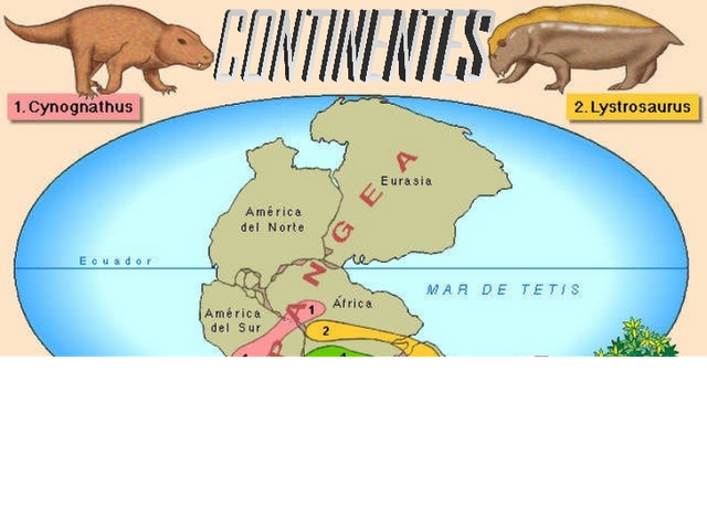
There were moments in the history of the Earth in which the poles were as they are observed today, and moments when the poles were reversed, this led to a study of Paleomagnetism of the rocks of the ocean floor, perpendicular to the oceanic ridge it was observed that the rocks closest to the dorsal had magnetism coincident with the current, then there was a strip of reverse magnetism and another of normal magnetism, but it was also observed that it was symmetrical with respect to the large oceanic ridges, that is, both sides of the dorsal the normal and reverse magnetism bands were totally symmetrical, this allowed us to think that what was happening was that the rocks that were in the center of the dorsal are the most modern, and that as we move away from the dorsal the rocks are the oldest and give an idea that the ocean floor expanded and that the magma that rises in the center of those ridges solidifies and moves. and moving away from the dorsals gradually. This theory was proposed by Harry Hess, then it would only be to join the theory of the drift of the continents and reach the theory of plate tectonics, where basically the lithosphere is fragmented into discrete plates and that these plates move relatively with respect to the others.
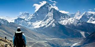
There are margins of the plates where the plate is produced or grown by the production of new bark, which would be at the oceanic ridges and there are places where the plates collide in different ways creating mountainous chains, such as the Himalayas, a mountain range formed by the collision of plates; the plates can also get under each other forming what we call subduction.

Himalayan mountain range


https://goo.gl/images/3yzjiF

Nowadays the movements of the plates can be measured through satellite link, gps. The plates are moving at a rate of millimeters or centimeters per year, making the polarization of the distances is observed effectively that they are moving at the right speed so that in the Permian all the continents would have been united in a Pangea, with this was claimed perfectly Wegener's theory already with modern knowledge and techniques.

@luisport

Sort:  

Hi, I am a big fan of geology content and am looking forward to read more from you.
But it would be nice if you could source your information and double check if your images are copyrighted.

Hello friend, the images are from google, each of them has its respective source ...

Coin Marketplace

STEEM 0.28
TRX 0.13
JST 0.032
BTC 61219.98
ETH 2927.64
USDT 1.00
SBD 3.66