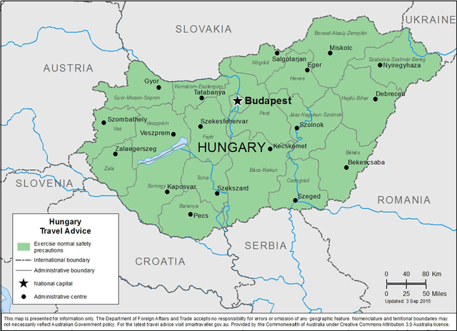
Hungary : Magyarország
ungary's geography has traditionally been defined by its two main waterways, the Danube and Tisza rivers. The common tripartite division of the country into three sections—Dunántúl ("beyond the Danube", Transdanubia), Tiszántúl ("beyond the Tisza"), and Duna-Tisza köze ("between the Danube and Tisza")—is a reflection of this. The Danube flows north-south right through the center of contemporary Hungary, and the entire country lies within its drainage basin.
Transdanubia, which stretches westward from the center of the country toward Austria, is a primarily hilly region with a terrain varied by low mountains. These include the very eastern stretch of the Alps, Alpokalja, in the west of the country, the Transdanubian Mountains in the central region of Transdanubia, and the Mecsek Mountains and Villány Mountains in the south. The highest point of the area is the Írott-kő in the Alps, at 882 metres (2,894 ft). The Little Hungarian Plain (Kisalföld) is found in northern Transdanubia. Lake Balaton and Lake Hévíz, the largest lake in Central Europe and the largest thermal lake in the world, respectively, are in Transdanubia as well.
The Duna-Tisza köze and Tiszántúl are characterized mainly by the Great Hungarian Plain (Alföld), which stretches across most of the eastern and southeastern areas of the country. To the north of the Plain are the foothills of the Carpathians in a wide band near the Slovakian border. The Kékes at 1,014 m or 3,327 ft is the tallest mountain in Hungary and is found here.

Phytogeographically, Hungary belongs to the Central European province of the Circumboreal Region within the Boreal Kingdom. According to the WWF, the territory of Hungary belongs to the ecoregion of Pannonian mixed forests.
Hungary has 10 national parks, 145 minor nature reserves, and 35 landscape protection areas.