🚨TROPICAL STORM RAMON (EASTERN PACIFIC)
BULLETIN
Tropical Storm Ramon Intermediate Advisory Number 3A
NWS National Hurricane Center Miami FL EP192017
700 PM CDT Wed Oct 04 2017
...RAMON BRINGING HEAVY RAIN TO THE COAST OF SOUTHERN MEXICO...
SUMMARY OF 700 PM CDT...0000 UTC...INFORMATION
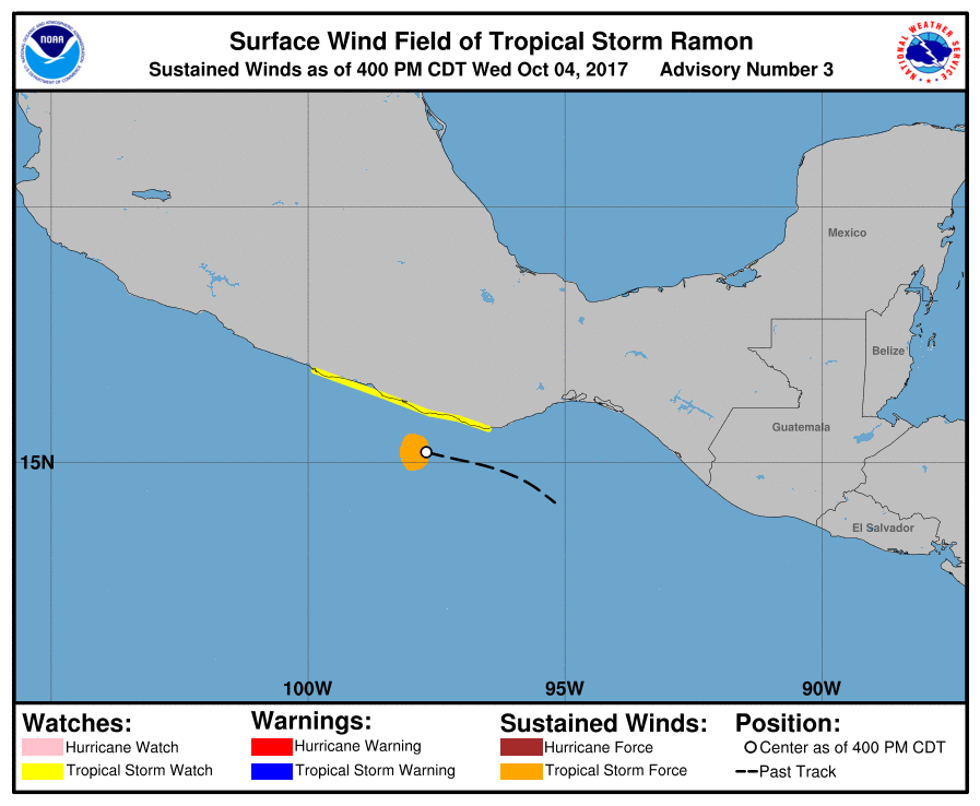
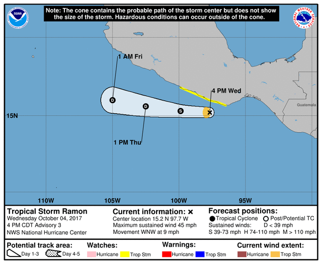
LOCATION...15.1 N 99.0W
ABOUT 90 MI...140 KM SSW OF PUNTA MALDONADO MEXICO
MAXIMUM SUSTAINED WINDS...40 MPH...65 KM/H
PRESENT MOVEMENT...W OR 275 DEGREES AT 12 MPH...19 KM/H
MINIMUM CENTRAL PRESSURE...1002 MB...29.59 INCHES
WATCHES AND WARNINGS
CHANGES WITH THIS ADVISORY:
None.
SUMMARY OF WATCHES AND WARNINGS IN EFFECT:
A Tropical Storm Watch is in effect for...
- Puerto Angel to Acapulco
A Tropical Storm Watch means that tropical storm conditions are
possible within the watch area, in this case within the next 12 to
24 hours.
DISCUSSION AND 48-HOUR OUTLOOK
At 700 PM CDT (0000 UTC), the center of Tropical Storm Ramon was
located near latitude 15.1 North, longitude 99.0 West. Ramon is
moving toward the west near 12 mph (19 km/h), and a general westward
motion is expected over the next couple of days. On the forecast
track, the center of Ramon is expected to move parallel to, but
remain offshore of, the coast of southern Mexico.
Maximum sustained winds have decreased to near 40 mph (75 km/h) with
higher gusts. Ramon is losing organization, and weakening is
forecast to continue during the next day or two. The cyclone is
expected to dissipate by Friday or sooner.
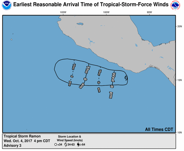
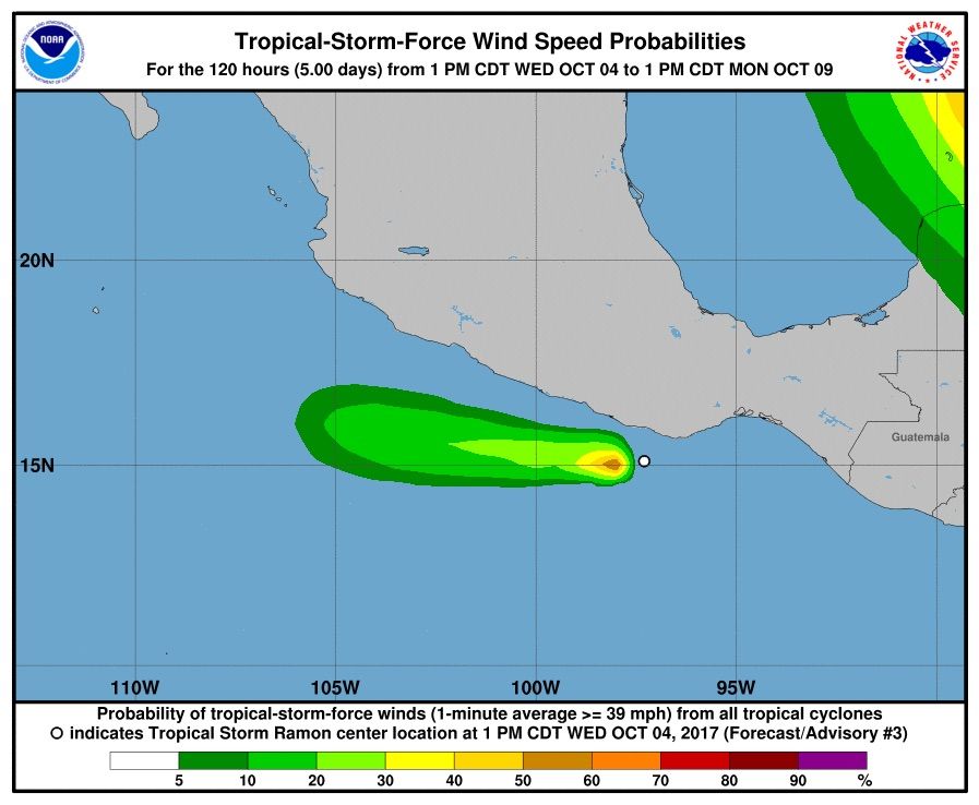
Tropical-storm-force winds extend outward up to 35 miles (55 km)
from the center.
The estimated minimum central pressure is 1002 mb (29.59 inches).
HAZARDS AFFECTING LAND
RAINFALL: Ramon is expected to produce rainfall amounts of 1 to 3
inches with isolated maximum amounts of 5 inches over the Mexican
states of Oaxaca, Guerrero, and southern Michoacan through Thursday,
with heaviest amounts occurring near the coast. This rainfall
could cause life-threatening flash floods and mudslides.
WIND: Tropical storm conditions are possible within the watch area
through this evening.
NEXT ADVISORY
Next complete advisory at 1000 PM CDT.