🚨 TROPICAL STORM RAMON (EASTERN PACIFIC)
BULLETIN
Tropical Storm Ramon Advisory Number 2
NWS National Hurricane Center Miami FL EP192017
1000 AM CDT Wed Oct 04 2017
...TROPICAL STORM WATCH ISSUED FOR A PORTION OF THE SOUTHERN COAST
OF MEXICO...
SUMMARY OF 1000 AM CDT...1500 UTC...INFORMATION
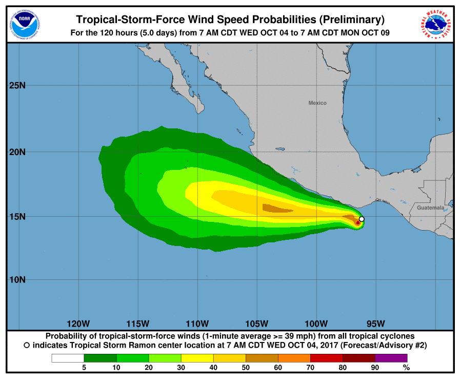
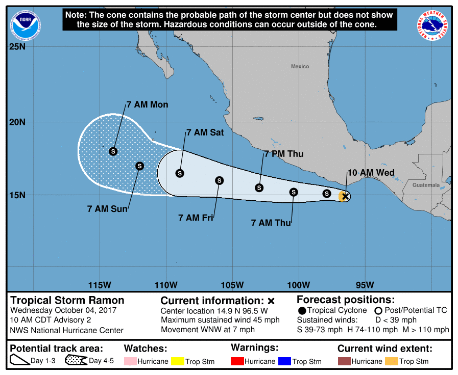
LOCATION...14.9N 96.5W
ABOUT 55 MI...90 KM S OF PUERTO ANGEL MEXICO
MAXIMUM SUSTAINED WINDS...45 MPH...75 KM/H
PRESENT MOVEMENT...WNW OR 285 DEGREES AT 7 MPH...11 KM/H
MINIMUM CENTRAL PRESSURE...1002 MB...29.59 INCHES
WATCHES AND WARNINGS
CHANGES WITH THIS ADVISORY:
The government of Mexico has issued a Tropical Storm Watch from
Puerto Angel to Acapulco.
SUMMARY OF WATCHES AND WARNINGS IN EFFECT:
A Tropical Storm Watch is in effect for...
- Puerto Angel to Acapulco.
A Tropical Storm Watch means that tropical storm conditions are
possible within the watch area, in this case within the next 12 to
24 hours.
For storm information specific to your area, please monitor
products issued by your national meteorological service.
DISCUSSION AND 48-HOUR OUTLOOK
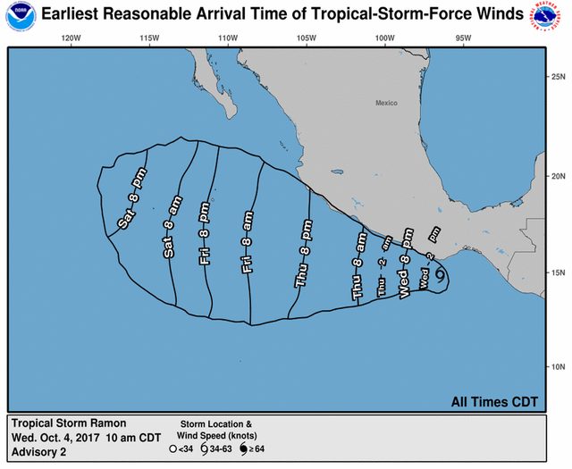
At 1000 AM CDT (1500 UTC), the center of Tropical Storm Ramon was
located near latitude 14.9 North, longitude 96.5 West. Ramon is
moving toward the west-northwest near 7 mph (11 km/h) and a
generally westward motion with some increase in forward speed is
expected over the next couple of days. On the forecast track, the
center of Ramon is expected to move parallel to, but remain offshore
of, the coast of southern Mexico.
Maximum sustained winds are near 45 mph (75 km/h) with higher gusts.
Only slight strengthening is forecast during the next 48 hours.
Ramon is a small tropical storm. Tropical-storm-force winds extend
outward up to 35 miles (55 km) from the center.
The estimated minimum central pressure is 1002 mb (29.59 inches).
HAZARDS AFFECTING LAND
RAINFALL: Ramon is expected to produce rainfall amounts of 2 to 4
inches with isolated maximum amounts of 6 inches over the Mexican
states of Oaxaca and coastal Guerrero through Thursday. This
rainfall could cause life-threatening flash floods and mudslides.
WIND: Tropical storm conditions are possible within the watch area
during the next day or so.
NEXT ADVISORY
Next intermediate advisory at 100 PM CDT.
Next complete advisory at 400 PM CDT.
@mrainp420 has voted on behalf of @minnowpond. If you would like to recieve upvotes from minnowpond on all your posts, simply FOLLOW @minnowpond. To be Resteemed to 4k+ followers and upvoted heavier send 0.25SBD to @minnowpond with your posts url as the memo