Βουουινδα ποταμου Εκβολαι
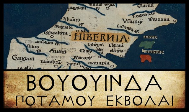
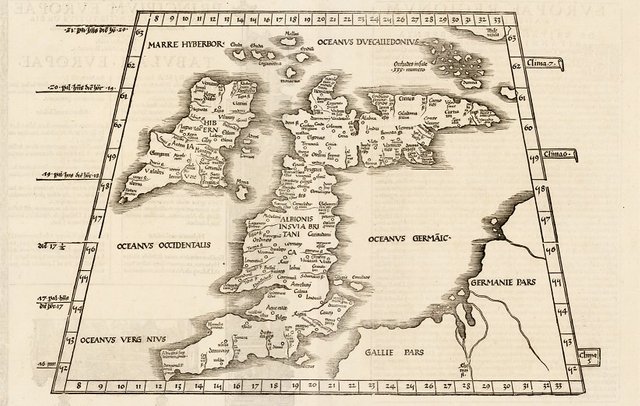
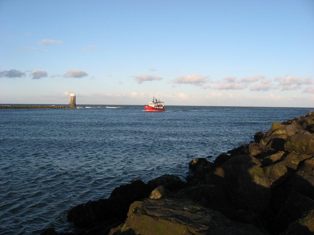
Of all the landmarks in Claudius Ptolemy’s description of Ireland, Βουουινδα ποταμου Εκβολαι [Mouth of the River Bouvinda] is arguably the easiest to identify. Every researcher I have consulted—with one exception—has had little doubt that Ptolemy’s Bouvinda is the River Boyne.
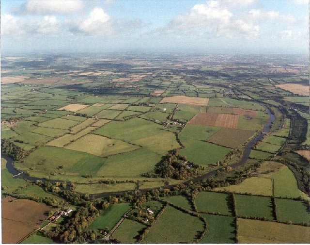
The Boyne is one of the country’s best known waterways. Traditionally, it formed the boundary between the Kingdoms of Meath and Ulster. It was on its banks that the great necropolis of the High Kings of Tara was constructed—the Bend of the Boyne Ensemble—which includes the three megalithic passage graves of Newgrange, Knowth and Dowth. And, of course, it was in the Battle of the Boyne in 1690 that William of Orange defeated James II of England and drove him out of his three kingdoms.
Orthography
In an earlier article, we saw how Ptolemy had recorded the River Modonnos as Μοδοννου Ποταμου Εκβολαι [Mouth of the River Modonnos]. Here Μοδοννου is the genitive singular of Μοδοννος, governed by Εκβολαι. As O’Rahilly noted, however:
These river names are in the genitive, governed by ἐκβολαι [mouth]; but names ending in a are, for whatever reason, left undeclined by Ptolemy. (O’Rahilly 2 fn)
We have already encountered this curious and unexplained practice in the case of the River Οβοκα [Oboka]. Βουουινδα is another example. Darcy and Flynn consistently give the name of this river as Bubindas, which is how one would form the genitive singular of a feminine noun of the first declension in ancient Greek. However, this form does not occur in any of the extant sources of Ptolemy’s Geography, and the authors do not explain how they came to adopt it. They may have taken it from Edward Luther Stevenson’s translation of the Geography (1932), which is generally considered poor and unscholarly. See Aubrey Diller’s Review for further comment.
There are, however, numerous variant readings of this river name in the manuscript sources:
| MS or Edition | Spelling |
|---|---|
| Müller | Βουουίνδα |
| Wilberg | Βουουίνδα |
| Nobbe | Βουουίνδα |
| Vat Gr 191 | Βυβίνδα |
| Σ, Φ, 4803 | Βουβίνδα |
| Ψ | Βούβνιδα |
| L, R | Βουίνδα |
| Π | Βουουίν |
Source: Müller (1883)
Most of these are undoubtedly corruptions, and the correct spelling is easy to determine from linguistic evidence. The curious repetition of -ου- was explained by O’Rahilly, who believed that the explorer Pytheas of Massalia visited Ireland around 325 BCE and was Ptolemy’s principal source for the geography of Ireland:
The name ’Ιέρνη, “Ireland”, had probably been picked up by the Massaliot Greeks, from merchants and from their Celtic neighbours, as early as the fifth century B.C. ... The digamma had disappeared from Ionic as early as the seventh century B.C.; and when Massaliot Greeks first heard the name Īvernā [Ireland], they presumably had no means of indicating the -v- and simply dropped it. Later the Greeks adopted the expedient of representing v in foreign names by ου ... We may take it that Pytheas retained the traditional name ’Ιέρνη ... whereas in dealing with other names previously unrecorded, we find him representing Celtic v by Greek ου, as for instance in ... Bouvinda [Βουουινδα] ... Ptolemy, or some near predecessor of his, modernized ’Ιέρνη into ’Ιουερνία [Ivernia] ... (O’Rahilly 41-42)
There is little doubt, then, that Bouvinda is the original form. And this is good Celtic. O’Rahilly again:
Buvinda is the River Boyne, O. Ir. Boänd (in Adamnan, Boend), gen. Boindeo (L. Ardm. 16 a 2, 16 b 1), Bóinde, dat. Boïnd. These show fluctuation between the ā and i declensions. The original form may have been *Bou-vindā, “cow-white (goddess)”. (O’Rahilly 3)
In Celtic v was pronounced like our modern semivowel [w], as it was in Classical Latin. In later forms of Irish, [v] and [w] are found, depending on the context and the dialect. In Medieval Byzantium, Ptolemy’s Βουουινδα was sometimes written Βουβινδα or Βυβινδα (Vat Gr 191), which gives some indication of how later Greek scholars read the name. Curiously, Ptolemy’s Οβοκα [Oboka] was Anglicized as Ovoca in the 17th century, which was then adopted as a new name for the river that discharges into the Irish Sea at Arklow.
O’Rahilly’s etymology for Bouvinda has been widely accepted:
Βουουινδα (or Βουβινδα) river mouth (Bouwinda 2,2,8) has long been identified with the river Boyne, explained as meaning ‘white cow’, but claims that *Bouwinda was a river goddess who evolved into Boann mentioned in mediaeval Irish texts have fallen out of fashion. (Roman Era Names)
There is no way of knowing for certainty whether the river was named for the mythical character, or the mythical character created out of the river’s name. The compilers of the Dindsenchas—the native lore of toponyms—created many imaginative characters to “explain” how various features of the Irish landscape acquired their names.
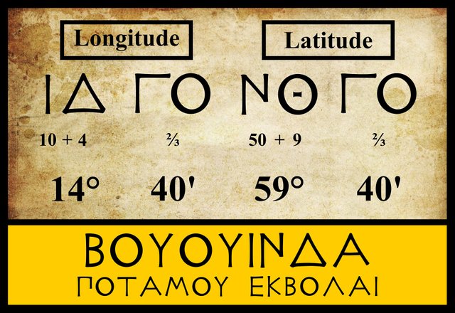
Coordinates
The three modern editions that I am following agree on the latitude and longitude of the Bouvinda. The early Byzantine manuscript Vat Gr 191, however, places the mouth of this river one degree to the south:
| MS or Edition | Longitude | Latitude |
|---|---|---|
| Müller | 14° 40' | 59° 40' |
| Wilberg | 14° 40' | 59° 40' |
| Nobbe | 14° 40' | 59° 40' |
| Bertius | 14° 35' | 59° 35' |
| Editio Argentinensis | 14° 40' | 60° 40' |
| Vat Gr 191 | 14° 40' | 58° 40' |
Vat Gr 191 is obviously in error here, as a latitude of 58° 40' would place the mouth of the Bouvinda south of Eblana, the previous landmark on this stretch of coast.
When I began this research, I was led to believe that Vat Gr 191, being the earliest surviving manuscript of Ptolemy’s Geography that is free from the Byzantine revision, was the most reliable source for the description of Ireland, and that the modern editions’ failure to draw more heavily on it was their weakness:
Müller used numerous manuscripts ... An inadequate classification of the manuscripts resulted in a cumbersome apparatus, citing readings from unimportant copies while omitting many important variants in the principal ones. (Berggren & Jones 52)
That belief, however, is being slowly eroded as I continue my research. So far, I have only looked at six of the sixty toponyms and tribal names on Ptolemy’s map of Ireland, and already I have encountered several errors in Vat Gr 191.
Petrus Bertius, whose edition of Ptolemy’s Geography was published in Amsterdam in 1618, has 35' rather than 40' in both the latitude and longitude. I have also included the Editio Argentinensis, which was based on Jacopo d’Angelo’s Latin translation of Ptolemy (1406) and the work of Pico della Mirandola. Many other hands worked on it—Martin Waldseemüller, Matthias Ringmann, Jacob Eszler and Georg Übel—before it was finally published by Johann Schott in Straßburg in 1513. This edition places the mouth of the Bouvinda in latitude 60° 40', one degree further north than the modern editions.
Louis Francis
The only dissenter from the Boyne-Bouvinda identification that I have come across is Louis Francis, who believes that Ptolemy’s Bouvinda refers to Belfast Lough. To be fair to Francis, he is well aware how unorthodox many of his identifications are:
All of the suggested locations made ... are quite speculative; their only claim to any validity being a spatial relativity in accordance with Ptolemy’s given co-ordinates. It is acknowledged that they are lacking in any other supporting evidence and that, in most cases, they conflict with the locations already assigned by historians. The only argument in their favour is that they agree with Ptolemy’s narrative and assume that he has transmitted the Phoenician data correctly.
Francis believes that the Phoenician geographer Marinus of Tyre was Ptolemy’s source for the geography of Ireland, as Ireland was not part of the Roman Empire.
References
- J Lennart Berggren, Alexander Jones, Ptolemy’s Geography: An Annotated Translation of the Theoretical Chapters, Princeton University Press, Princeton NJ (2000)
- Robert Darcy & William Flynn, Ptolemy’s Map of Ireland: A Modern Decoding, Irish Geography, Volume 41, Number 1, pp 49-69, Geographical Society of Ireland, Taylor and Francis, Routledge, Abingdon (2008)
- Louis Francis, Ptolemy’s Geographia: Books I and II, Distributed by the University of Oxford under a Creative Commons Attribution-NonCommercial-ShareAlike 3.0 Unported License, (1994)
- Karl Wilhelm Ludwig Müller (editor & translator), Klaudiou Ptolemaiou Geographike Hyphegesis (Claudii Ptolemæi Geographia), Volume 1, Alfredo Firmin Didot, Paris (1883)
- Karl Friedrich August Nobbe, Claudii Ptolemaei Geographia, Volume 2, Karl Tauchnitz, Leipzig (1845)
- Thomas F O’Rahilly, Early Irish History and Mythology, Dublin Institute for Advanced Studies, Dublin (1946, 1984)
- Claudius Ptolemaeus, Geography, Biblioteca Apostolica Vaticana, Vat Gr 191, fol 127-172 (Ireland: 138v–139r)
- Edward Luther Stevenson, Geography of Claudius Ptolemy, New York Public Library, New York, (1932)
- Friedrich Wilhelm Wilberg, Claudii Ptolemaei Geographiae, Libri Octo: Graece et Latine ad Codicum Manu Scriptorum Fidem Edidit Frid. Guil. Wilberg, Essendiae Sumptibus et Typis G.D. Baedeker, Essen (1838)
Image Credits
- Ptolemy’s Map of Ireland: Wikimedia Commons, Nicholaus Germanus (cartographer), Public Domain
- Greek Letters: Wikimedia Commons, Future Perfect at Sunrise (artist), Public Domain
- Bend of the Boyne: Wikimedia Commons, Pasztilla, Public Domain
- T F O’Rahilly: Copyright Unknown, Fair Use
- Martin Waldseemüller’s Map of Ireland and Britain (1513): Wikimedia Commons, Martin Waldseemüller (cartographer), Public Domain
- Mouth of the Boyne: Geograph Ireland, © Kieran Campbell, Creative Commons License,

Excellent article,you uphold the ireland hirtory.thnx @harlotscurse
You received a 10.0% upvote since you are not yet a member of geopolis and wrote in the category of "archaeology".
To read more about us and what we do, click here.
https://steemit.com/geopolis/@geopolis/geopolis-the-community-for-global-sciences-update-4
great history dear..
great history dear..
thanks for sharing.
@upvoted
Congratulations for the serious research you have done, revealing some errors in the data collected.
thanks for sharing such great post about ireland dear @harlotscurse
we are learning from you...
I like it..👍👍👍
Very interesting the origin of the names of the rivers, thank you for showing us how beautiful is the geography.
what a great post you shared with us!!
thanks for sharing about @ireland
love you @harlotscurse
@upvoted & @resteemed your post dear..
Great post about the history of ireland..
thanks for sharing with us dear @harlotscurse
We wants more from you..
I appreciate it..👌👌👌👌
Great story, really very best history of ireland.... I thought it was interesting how you tell and develop the story about it! great job...thanks to sharing for your good thought post.. dear....... .... friend @harlotscurse