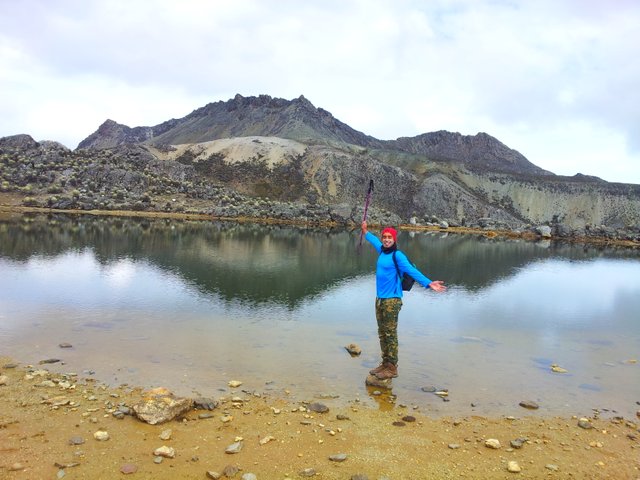
 Los Nevados mountain and its reflection.
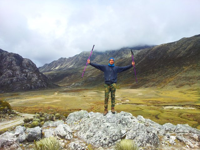
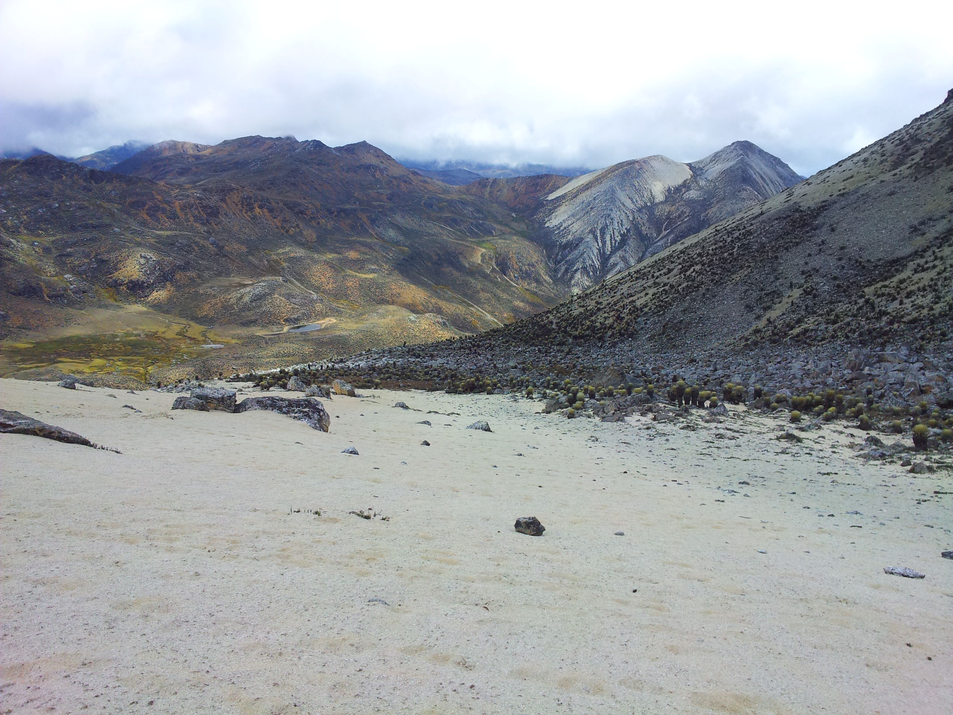
The ascent to Los Nevados mountain, 4700 m.a.s.l. (15420 ft).
¡Hi Steemians!
I have previously published about other high mountain peaks that I have climbed, however, I had not made a story about my first work in this category of mountaineering, wich it's a trekking that demands a lot of breathing, physical and mental training.
According to the blog Derecho y Montaña, a high mountain is considered to that mountainous areas mostly rocky, of unspecified altitude but relatively high. These areas have very specific geographical conditions such as high UV radiation, snow, ice, low temperatures, strong winds, scant but characteristic fauna and vegetation, lack of oxygen, etc .; where if the human is exposed to these conditions, there are risks to health; for example when presenting the altitude sickness.
In Venezuela, in the State of Mérida, we have the Sierra Nevada National Park, whose mountain ranges come from the south of Argentina and end at this point; and La Sierra de La Culata National Park. Both with thousands of mountainous areas and landscapes that are the attraction of many tourists per year, especially those who practice mountaineering. On this occasion, I chose, along with my mountaineering group, to reach the summit of Los Nevados peak as our first climb in high mountain.
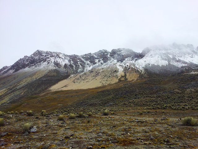 Snowfall on the Los Nevados mountain.
Los Nevados or frequently called Los Caracoles, is the mountain number 8 in altitude of Venezuela, with 4700 meters above sea level. It is located in the Sierra de La Culata National Park in the Piedras Blancas sector. Close to this place, are El Buitre, Mucumamó and Piedras Blancas mountains, so if you have time, enough provisions and weather conditions allow it, you can climb them in the same week.
And let's begin with our adventure:
After moving from Caracas to the State of Mérida in about 9-hour trip that includes a flight and two buses, we arrived at the Mifafí farmhouse at 3650 meters above sea level, where the Experimental Station of the Condor Repopulation and Conservation Center of the Cordillera is located. Specifically where they have in captivity for conservation of the condor species, the condor nicknamed "Combatiente" (Fighter).
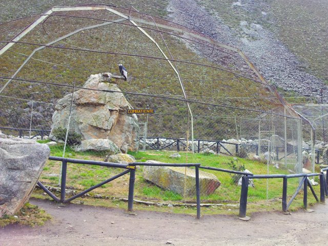 The famous refuge of the condor.
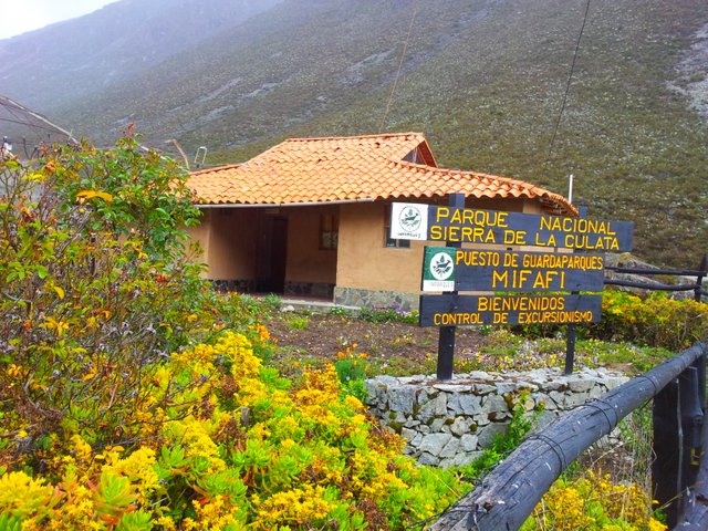
Mifafí ranger's house.
Because in a few hours we reached a height of more than 3500 meters, our bodies had to adapt to the conditions of the environment, which is why the park rangers told us to spend the night in the nearest valley in order to acclimate, rest and avoid altitude sickness. Therefore, we set up camp there to spend the night.
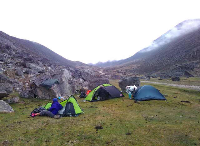 First camp in order to acclimatize.
Next day very early, we picked up camp, had breakfast and paid for some horses to take our heavy backpacks, which were loaded with mountain implements such as sleeping bags, tents, insulators, clothing and much shelter, kitchen equipment and food. In this way we could perform the walk and save energy; since the road to travel that day would be long.
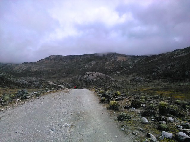
The road has no loss, it is a wide dirt road that follows the course of the entire valley, bordering the Mifafí River.
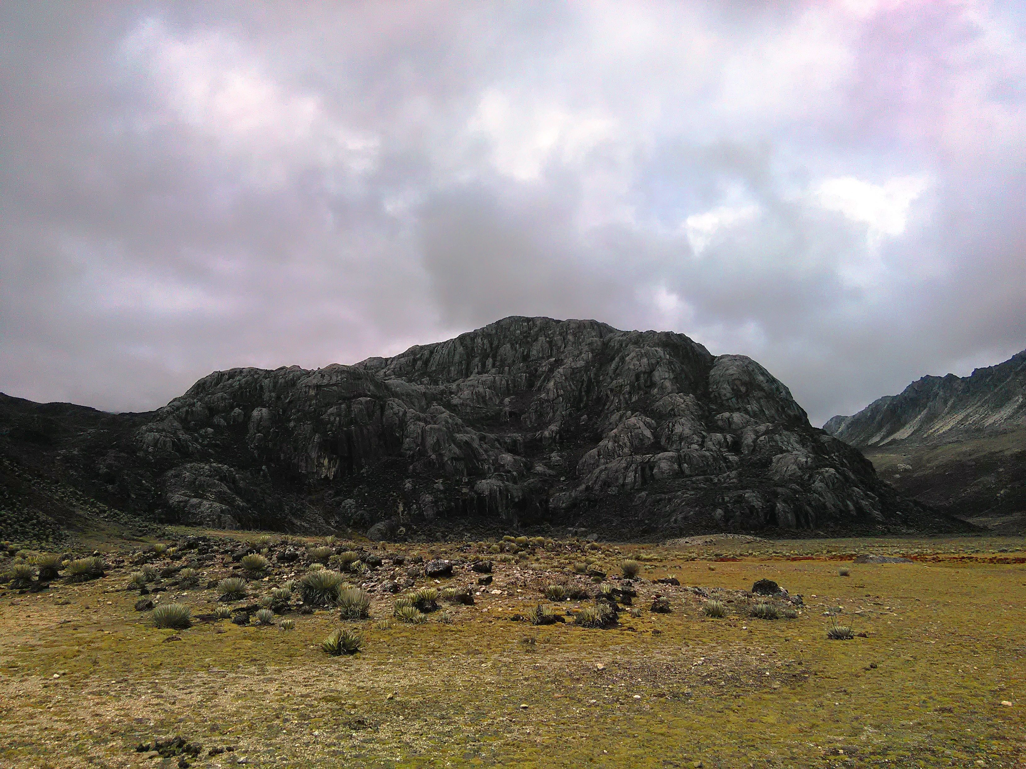
The path at the beginning presents little inclination until the crossing of the river, from this point the degree of the way slope increases and to a few more minutes of walk, the "Domo" appears imposingly, which is a large rock formation.
 The "Domo".
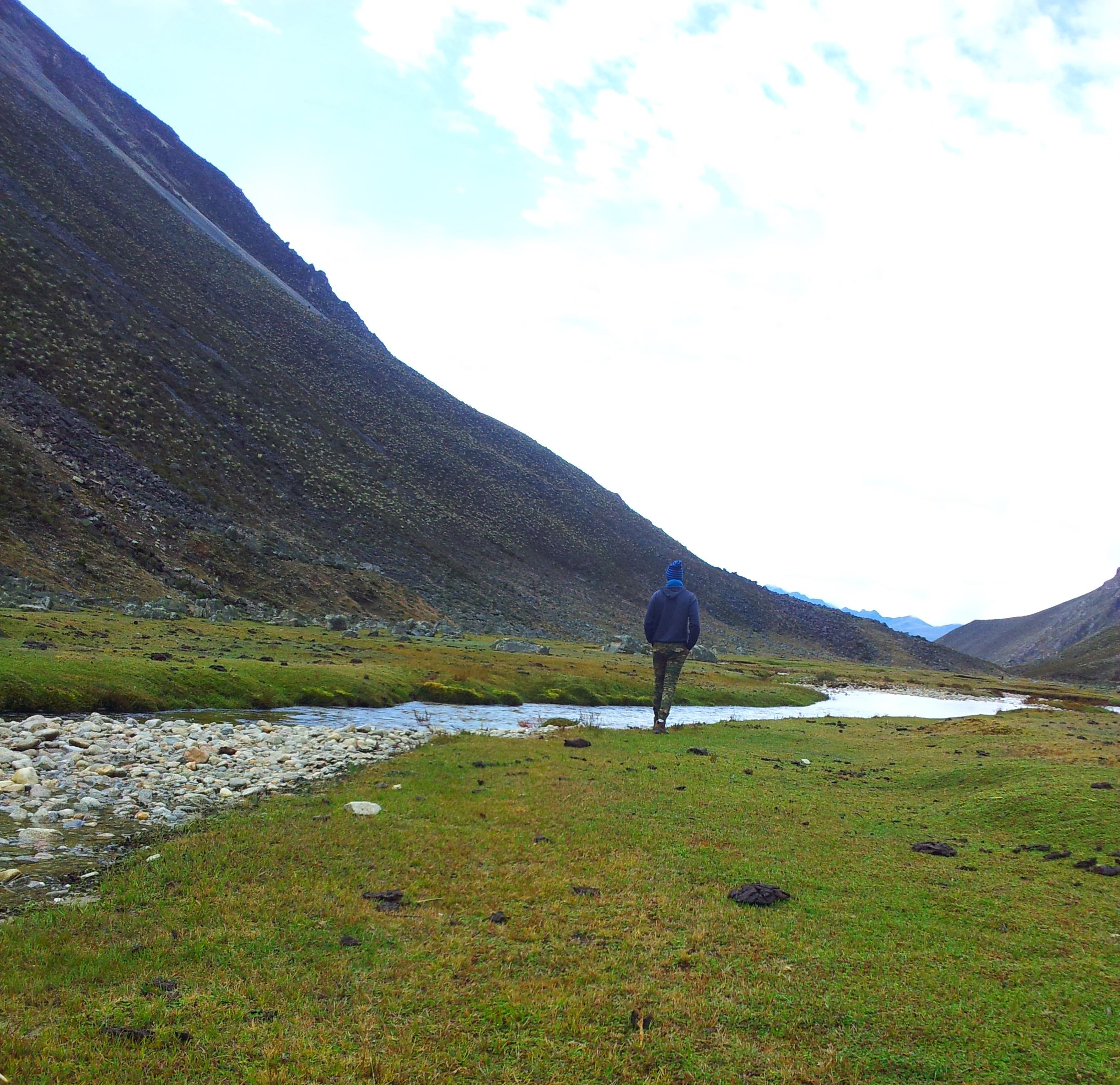
We descended to the valley that is seen in the following photo, we skirt the Dome on the left and immediately begin a constant ascent by an inclined road until we reach Alto de Mifafí place at 4300 masl, where we set up the final camp at the foot of the Los Nevados and El Buitre mountains. It is took us about 5 hours to go from the ranger's house to this point.
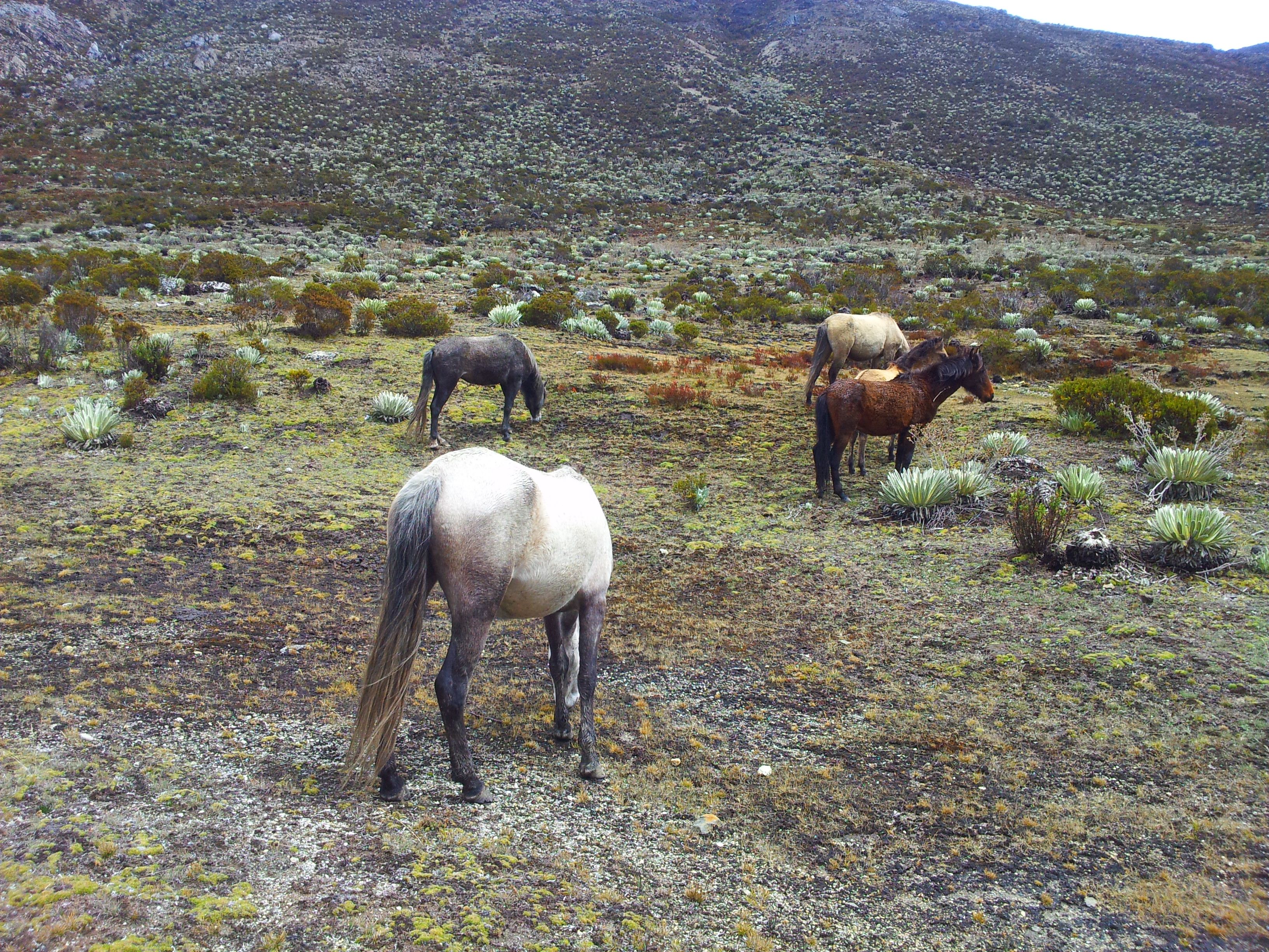
Around us, the vegetation was typical of the andean paramos, with plants such as the frailejón (a kind of tundra) and some shrubberies. A nearby stream provided us with water, and occasionally passed near us some cows and horses, also there were wild dogs looking for hares. It was very cold, between 0-5 degrees Celsius. We set out to rest that afternoon to get ready for the next day.
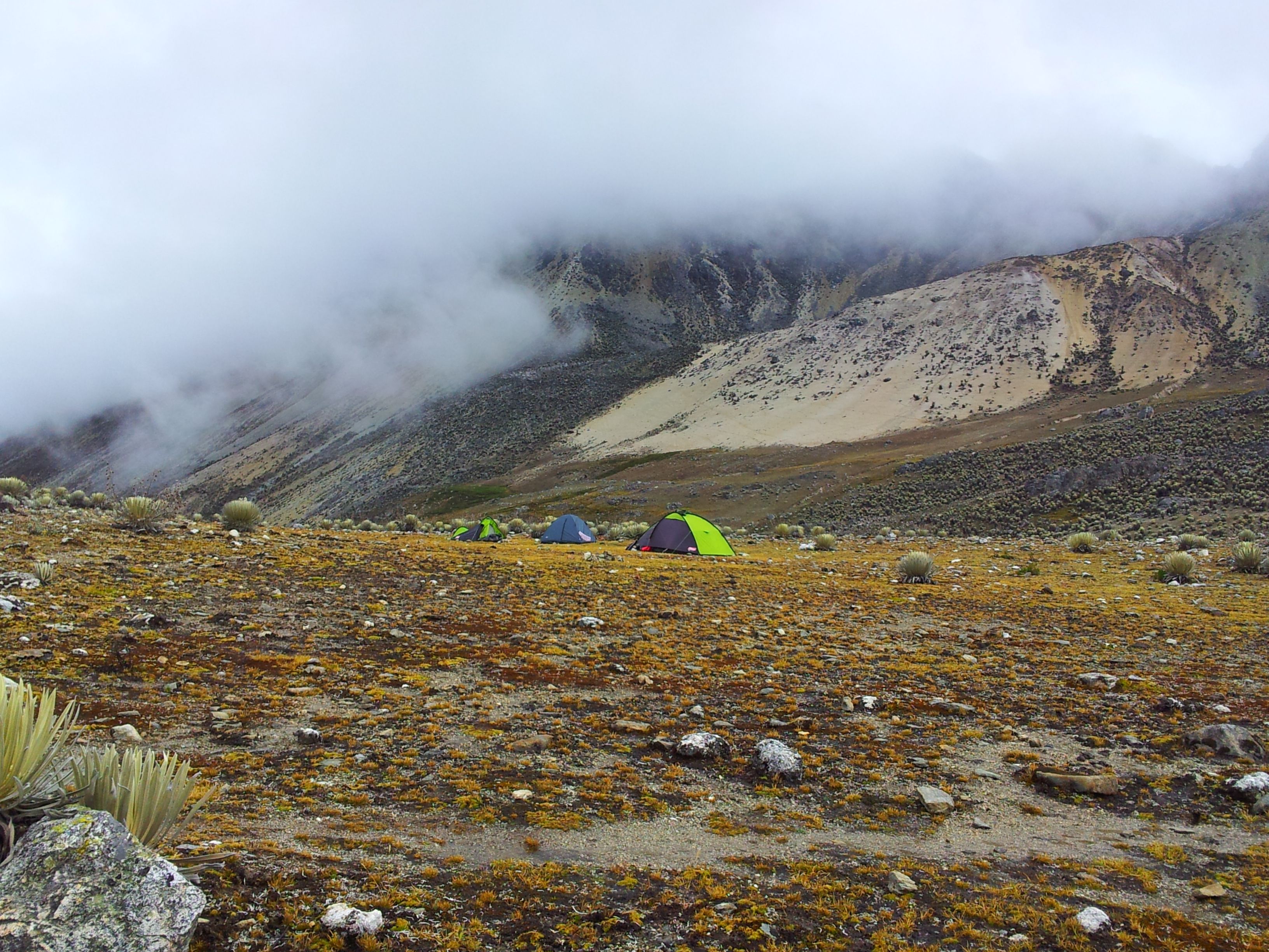 Camp.
Camp.
Next day we woke up very early, prepared a breakfast, drank hot chocolate, put on mountain clothes according to the challenge of the day and wrapped up well. With small attack backpack provided with water and sweets, we started our journey towards Los Nevados mountain top, which we appreciated on the right side of our camp.
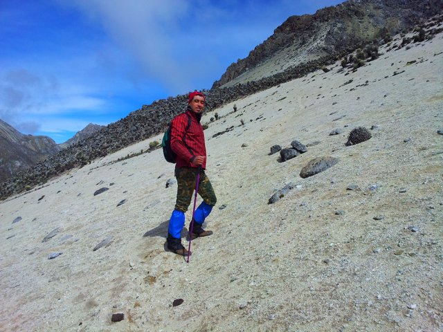
There is no definite path to reach the Los Nevados mountain summit, so we had to observe our objective and make use of the mountaineer's instinct to get it. We started passing among plants of frailejones and crossing a small stream until we came face to face with a wall of sand, which we climbed in zig-zag for more comfort.
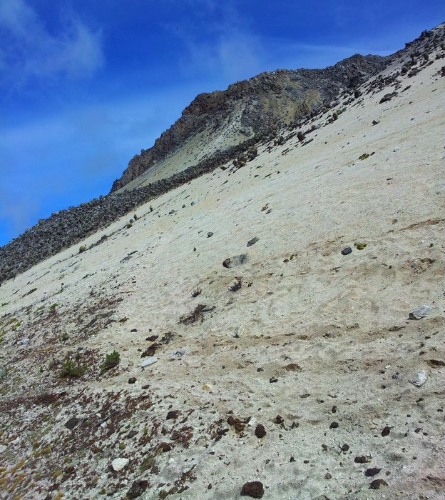
Any step in high mountain is slow, so as not to demand a lot of oxygen by the body, but this particular route is even more so, due to the constant sinking of our boots in the sand. At this time, I began to feel dizzy and lack of appetite because of height.
Translation:
Hi, here I am reaching the summit of Los Nevados mountain, I have already climbed all this you can see. Down there is my camp, it seems to be close but it doesn't. I started to go up at 9:48 am, it is almost 1:00 pm and I still need about 30 minutes to finish. My head hurts a little, I think it's because of altitude sickness. There's not much oxygen. I'm eating sweets and drinking water, so I can reach the summit. Moreover, I do not feel so bad. At this point, I have almost an hour climbing from there below, annoyed because I do not have ropes to climb and that is why I must climb with the help of my hands. This generates a lot of adrenaline, there are sections where I stop to think how to do to overcome them, but it does not matter, I like mountaineering a lot.
Afterwards, we arrive at an area of huge rocks that we carefully passed by until we reach the mountain peak massif . At this time, I still was a little sick, so I stopped to rest for a bit while, breathed, drank some water and ate candies. Later, I continued my ascent with caution.
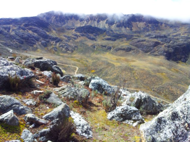 Stretch of rocks after the wall of sand and the sight of what we left behind. You can see in the distance the road to our camp and in front the El Buitre mountain.
From this point, the ascent is very steep, being a wall of rocks which must be faced in free climbing, moreover, there were some stretches of slippery sand. A slip in this part can make someone fall several meters with a guaranteed injury, if he goes lucky. For obvious reasons, of this particular section I do not have my own photographs, however I share this following photo, courtesy of our mountain colleague David Rivas, which points out practically the same line that we follow in climbing in this last section until getting the summit:
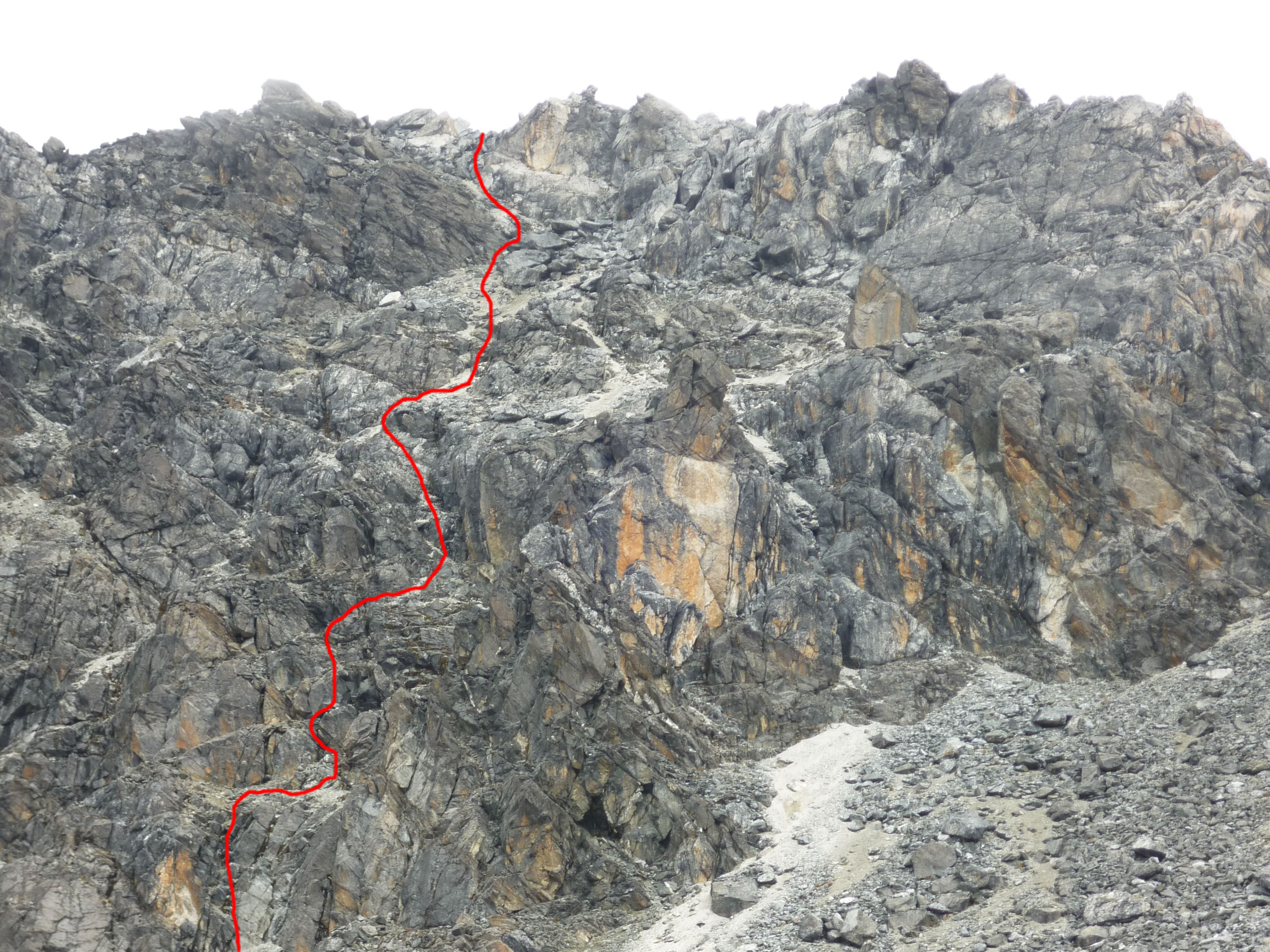 Image source
And finally, after spending almost an hour on the last stretch between climbing and adrenaline, we reached our desired CUMBREEEEEE! (I don't know how the mountaineers shouts this in english when they got the peak of a mountain, maybe "SUUUMMIIIIT? hahahaha) and we got it after 4 hours. At that moment, I did not feel sick anymore. ;)
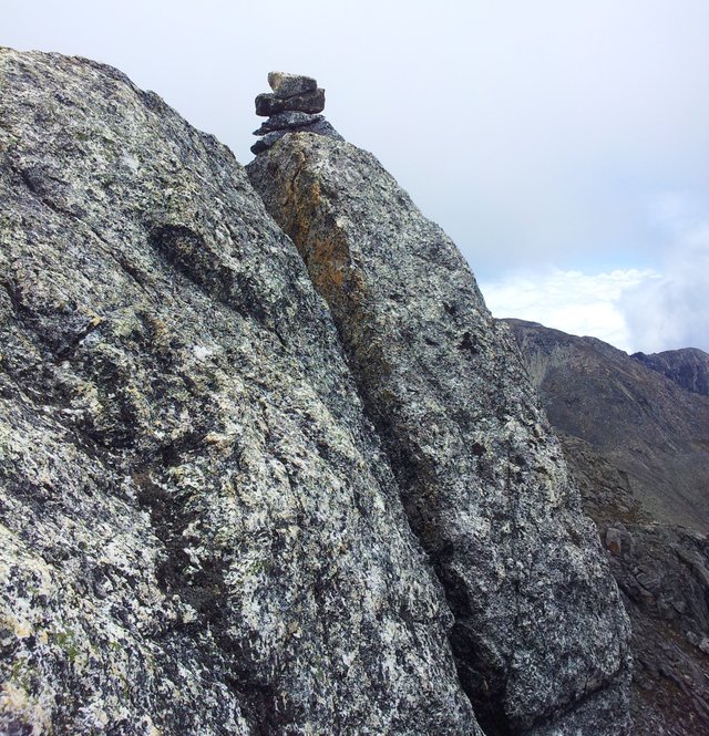 Summit of Los Nevados mountain, 4700 m.a.s.l.
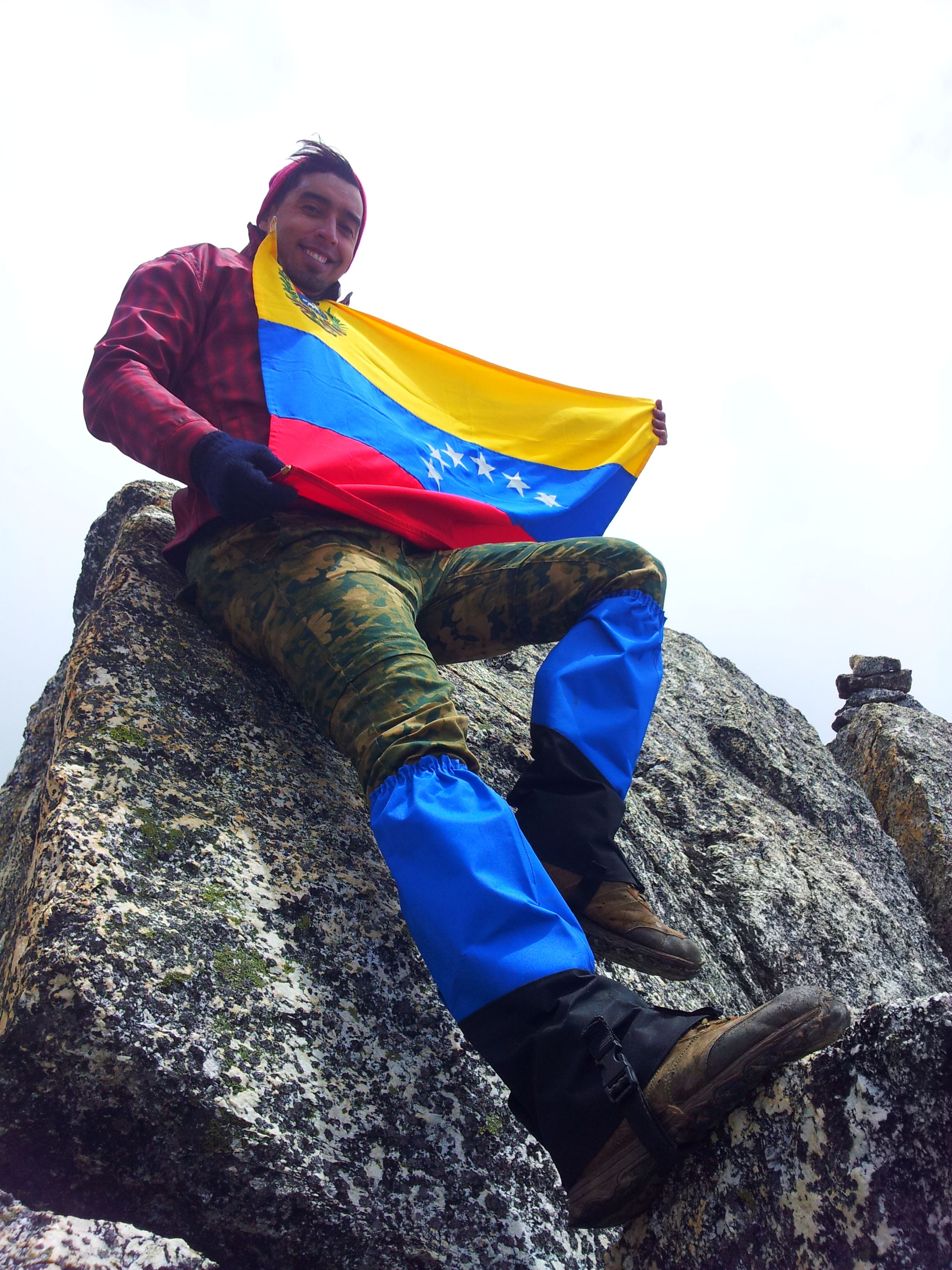 Every mountaineer's habit is to carry the flag of his country to any mountain summit reached.
Translation:
CUUUUUMBREEEE! (SUUUMMIIIIT!)
We are here, in the Los Nevados peak at 4700 m.a.s.l., the mountain number 8 in altitude of venezuela, happy because this is my first ascent to the high mountain.
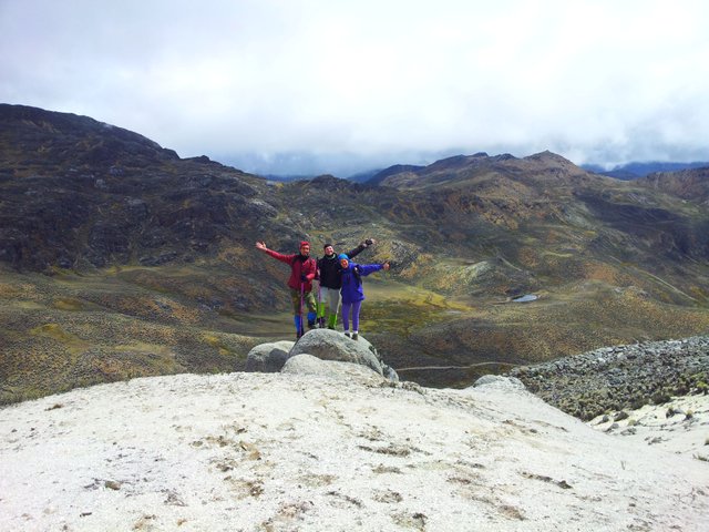
We were only 10 minutes at the summit and then we started to go down, since height could affects us and precautions must be taken.
 On the way back, through the sandy areas, going to the camp. Very happy for the goal achieved.
The route from our final camp to the mountain summit can be seen in this photographic scheme courtesy of David Rivas:
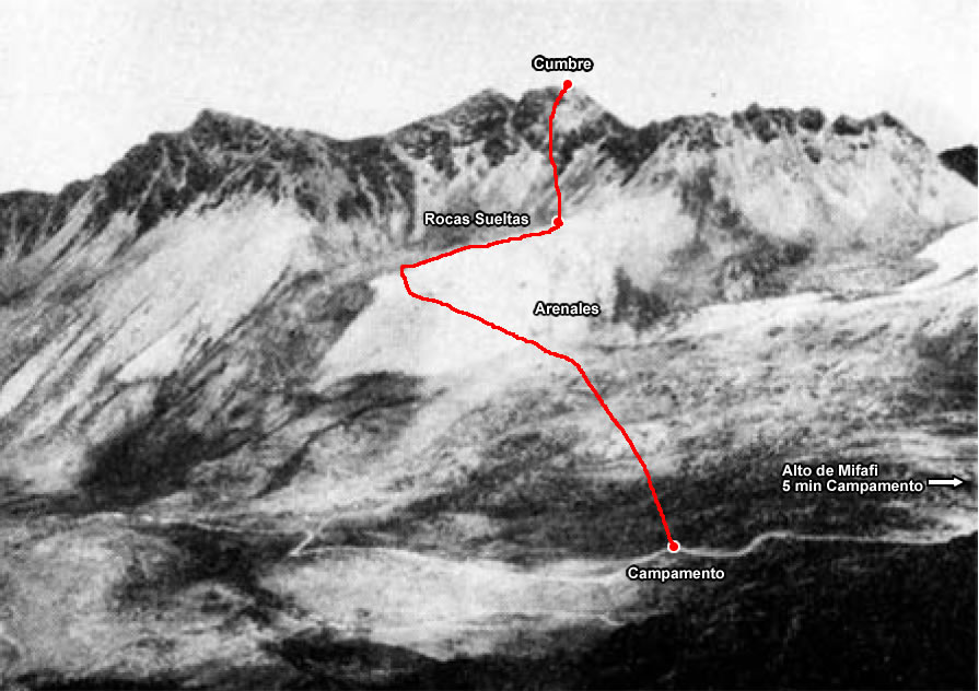 Image source
And the complete route in satellite image from Mifafí roger's house to Los Nevados Peak, courtesy of Omar Quintero.
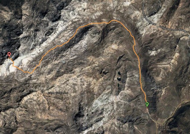 Image source
I thank my fellow mountaineers Alejandro Terrasi
@terralupo, Sandra Hernández and Yolanda Serres for accompanying me on this adventure, and of course thank God and the mountain for protecting us and taking us well.
Original story of @oscardice. The videos and photographs by myself, taken with the Samsung Galaxy Note cell phone, camera, 8.0 MP; except for those photos and maps with their corresponding author referenced. Holy Week of year 2017.
Next, I put the links to other publications by myselft on high mountain climbs that I have made so far, if you want to read them. The first two of them were upvoted by @cervantes witnesss:
Ascent to La Carbonera peak
Ascent to Agua Blanca Sur peak
Ascent to Mucumamó peak
Greetings to all Steemit, see you next post.
"Before the effort, the rocks and the wind, friendship is the essential component in the mountain."
Geyson Millar
muy bien
Gracias!
Esa bajadita de pan de azucar es una experiencia bajarla
No es para nada la de Pan de Azúcar jajajaja. La de Pan la bajo corriendo riquiquita.