MOUNT KILIMANJARO THE HIGHEST MOUNTAIN IN AFRICA WITH UNIQUE ANIMALS
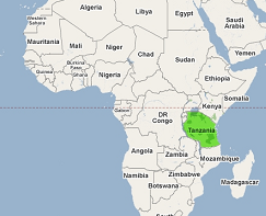
KILIMANJARO MOUNTAIN IN TANZANIA EAST AFRICA
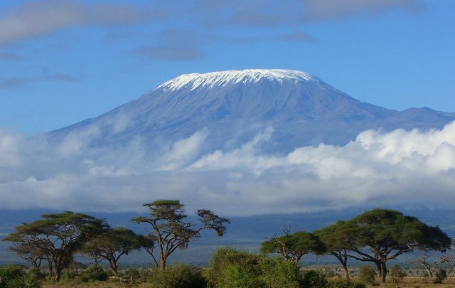
WHERE IS KILIMANJARO MOUNTAIN? Mount Kilimanjaro is located in Tanzania, a country in East Africa. The mountain is one of the seven summits (the highest peaks on each of the seven continents), and rises 5,895 meters or 19,340 feet above sea level. It is the tallest freestanding mountain (not part of a mountain range) in the world. The nickname for Mount Kilimanjaro is the Roof of Africa.
Tanzania is located on the east coast of Africa. Zanzibar, an island off the mainland in the Indian Ocean, and the Zanzibar Archipelago, are also part of Tanzania.Also Tanzania is bordered by Kenya and Uganda to the north, by Rwanda, Burundi and the Democratic Republic of Congo to the west, and by Zambia, Malawi and Mozambique to the south. Kilimanjaro National Park is located in the northeastern area of Tanzania, near the Kenyan / Tanzanian border. Tanzania has mild weather. Mount Kilimanjaro is approximately 200 miles south of the Equator.
GEOLOGY AND PHYSICAL FEATURES
Kilimanjaro is the highest dormant volcano in Africa.
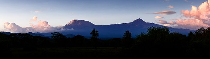
Kilimanjaro is a large stratovolcano and is composed of three distinct volcanic cones: Kibo, the highest; Mawenzi at 5,149 metres (16,893 ft);[9] and Shira, the shortest at 4,005 metres (13,140 ft).[10] Mawenzi and Shira are extinct, while Kibo is dormant and could erupt again.
Uhuru Peak is the highest summit on Kibo's crater rim. The Tanzania National Parks Authority, a Tanzanian governmental agency,[1] and the United Nations Educational, Scientific and Cultural Organization[2] list the height of Uhuru Peak as 5,895 m (19,341 ft). That height is based on a British Ordnance Survey in 1952. Since then, the height has been measured as 5,892 metres (19,331 ft) in 1999, 5,891 metres (19,327 ft) in 2008, and 5,888 metres (19,318 ft) in 2014.
DRAINAGE
The mountain is drained by a network of rivers and streams, especially on the wetter and more heavily eroded southern side and especially above 1,200 metres (3,900 ft). Below that altitude, increased evaporation and human water usage reduces the waterflows. The Lumi and Pangani rivers drain Kilimanjaro on the eastern and southern sides, respectively
GEOLOGY
The interior of the volcanic edifice is poorly known, given the lack of large scale erosion that could have exposed the interiors of the volcano.
Eruptive activity at the Shira centre commenced about 2.5 million years ago, with the last important phase occurring about 1.9 million years ago, just before the northern part of the edifice collapsed. Shira is topped by a broad plateau at 3,800 metres (12,500 ft), which may be a filled caldera. The remnant caldera rim has been degraded deeply by erosion. Before the caldera formed and erosion began, Shira might have been between 4,900 m (16,000 ft) and 5,200 m (17,000 ft) high. It is mostly composed of basic lavas with some pyroclastics. The formation of the caldera was accompanied by lava emanating from ring fractures, but there was no large scale explosive activity. Two cones formed subsequently, the phonolitic one at the northwest end of the ridge and the doleritic "Platzkegel" in the caldera centre.
Both Mawenzi and Kibo began erupting about 1 million years ago. They are separated by the "Saddle Plateau" at 4,400 metres (14,400 ft) elevation
The youngest dated rocks at Mawenzi are about 448,000 years old. Mawenzi forms a horseshoe shaped ridge with pinnacles and ridges opening to the northeast which has a tower like shape resulting from deep erosion and a mafic dyke swarm. Several large cirques cut into the ring, the largest of these sits on top of the Great Barranco gorge. Also notable are the Ost and West Barrancos on the northeastern side of the mountain. Most of the eastern side of the mountain has been removed by erosion. Mawenzi has a subsidiary peak named Neumann Tower (4,425 metres (14,518 ft)).
Kibo is the largest cone and is more than 15 miles (24 km) wide at the "Saddle Plateau" altitude. The last activity here has been dated to between 150,000 and 200,000 years ago and created the current Kibo summit crater. Kibo still has gas-emitting fumaroles in the crater.Kibo is capped by an almost symmetrical cone with escarpments rising 180 metres (590 ft) to 200 metres (660 ft) on the south side. These escarpments define a 2.5-kilometre-wide (1.6 mi) caldera[16] caused by the collapse of the summit. Within this caldera is the Inner Cone and within the crater of the Inner Cone is the Reusch Crater, which the Tanganyika government in 1954 named after Gustav Otto Richard Reusch upon his climbing the mountain for the 25th time (out of 65 attempts during his lifetime).[17][18] The Ash Pit, 350 metres (1,150 ft) deep, lies within the Reusch Crater. About 100,000 years ago, part of Kibo's crater rim collapsed, creating the area known as the Western Breach and the Great Barranco.
An almost continuous layer of lavas buries most older geological features, with the exception of exposed strata within the Great West Notch and the Kibo Barranco. The former exposes intrusions of syenite. Kibo has five main lava formations:
Phonotephrites and tephriphonolites of the "Lava Tower group", on a dyke cropping out at 4,600 metres (15,100 ft), 482,000 years ago
Tephriphonolite to phonolite lavas "characterized by rhomb mega-phenocrysts of sodic feldspars" of the "Rhomb Porphyry group", 460,000–360,000 years ago
aphyric phonolite lavas, "commonly underlain by basal obsidian horizons", of the "Lent group", 359,000–337,000 years ago
porphyritic tephriphonolite to phonolite lavas of the "Caldera rim group", 274,000–170,000 years ago
phonolite lava flows with aegirine phenocrysts, of the "Inner Crater group", which represents the last volcanic activity on Kibo
Kibo has more than 250 parasitic cones on its northwest and southeast flanks that were formed between 150,000 and 200,000 years ago and erupted picrobasalts, trachybasalts, ankaramites, and basanites.They reach as far as Lake Chala and Taveta in the southeast and the Lengurumani Plain in the northwest. Most of these cones are well preserved, with the exception of the Saddle Plateau cones that were heavily affected by glacial action. Despite their mostly small size, lava from the cones has obscured large portions of the mountain. The Saddle Plateau cones are mostly cinder cones with terminal effusion of lava, while the Upper Rombo Zone cones mostly generated lava flows. All Saddle Plateau cones predate the last glaciation.
According to reports gathered in the 19th century from the Maasai, Lake Chala on Kibo's eastern flank was the site of a village that was destroyed by an eruption
CLIMATE
The climate of Kilimanjaro is influenced by the height of the mountain, which allows the simultaneous influence of the equatorial trade winds and the high altitude anti-trades, and the isolated position of the mountain. Kilimanjaro has daily upslope and nightly downslope winds, a regimen stronger on the southern than the northern side of the mountain. The flatter southern flanks are more extended and affect the atmosphere more strongly.
Kilimanjaro has two distinct rainy seasons, one from March to May and another around November. The northern slopes receive much less rainfall than the southern ones. The lower southern slope receives 800 to 900 millimetres (31 to 35 in) annually, rising to 1,500 to 2,000 millimetres (59 to 79 in) at 1,500 metres (4,900 ft) altitude and peaking "partly over" 3,000 millimetres (120 in) in the forest belt at 2,000 to 2,300 metres (6,600 to 7,500 ft). In the alpine zone, annual precipitation decreases to 200 millimetres (7.9 in).
The average temperature in the summit area is approximately −7 °C (19 °F). Nighttime surface temperatures on the Northern Ice Field (NIF) fall on average to −9 °C (16 °F) with an average daytime high temperature of −4 °C (25 °F). During nights of extreme radiational cooling, the NIF can cool to as low as −15 to −27 °C (5 to −17 °F).
Snowfall can occur any time of year but is associated mostly with northern Tanzania's two rainy seasons (November–December and March–May).[85]:673 Precipitation in the summit area occurs principally as snow and graupel (250 to 500 millimetres (9.8 to 19.7 in) per year) and ablates within days or years
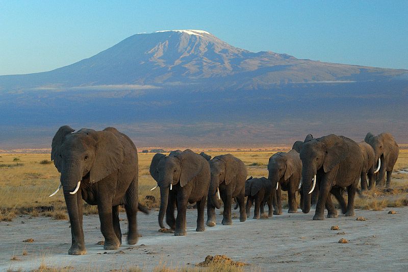
ANIMAL LIFE IN KILIMANJARO
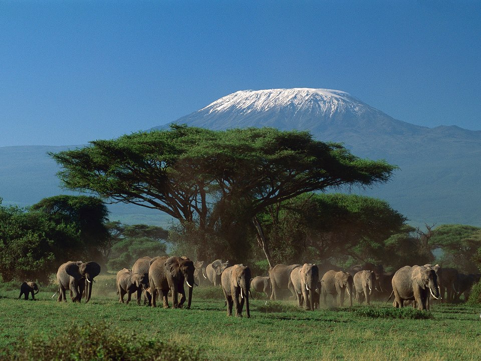
Elephants at Amboseli National Park against Mount Kilimanjaro
Large animals are rare on Kilimanjaro and are more frequent in the forests and lower parts of the mountain. Elephants and Cape buffaloes are among the animals that can be potentially hazardous to trekkers. Bushbucks, chameleons, dik-diks, duikers, mongooses, sunbirds, and warthogs have been reported as well. Zebras and hyenas have sporadically been observed on the Shira plateau.
Specific species associated with the mountain include the Kilimanjaro shrew[83] and the chameleon Kinyongia tavetana
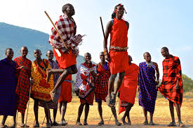
CULTURE AND LIFE OF PEOPLE I N KILIMANJARO TANZANIA.
First of all people of TANZANIA are so peace and full of love. near kilimanjaro you will see some tribes of people living there and have beautful and interesting culture, some of them are masai tribe in which you can get a chance to see their lifestyle like songs and dances and others, also you can see their cultural wearing styles which is beautful also.
.jpg)
ABOUT SECURITY AND POLITICAL SITUATION IN KILIMANJARO
The political situation in Tanzania is so cool and good so that this insure security and peacefull moment to all the tourist and guests in the country in generally. also Tanzania is known as the father of peace in Africa as her people are so cool and love each other.
THANK YOU AND WELCOME TO TANZANIA EAST AFRICA..
PLEASE

Thank you jimmy45 for a wonderful article. Africa is to be loved. beautiful country and lovely people. Kilimanjaro is magnificent and your photos are beautiful. I shall re-read this later as here it's early and there are things to do. It brought back memories of Africa, the smells, the sounds, the sights and the animals.
okey thanks alot
Super, www.tanzafaritours.com
thanks but upvote please