Soda creek falls, Cascadia state park, Oregon US.
Even though the weather wasn't perfect Saturday one of my best friends and I cruised out into the cascades to do a little hiking. After consulting the map we drew up a tentative plan including a couple of options. On the list was an eight and a half loop up to Rooster rock, a mile and a half out and back to Soda creek falls, or just a woods cruise up through the Quartzville creek area.
We started from Sweet Home, where Dennis lives, and cruised east on hwy 20 heading to the trail head for rooster rock which was about twenty or so miles away. We went prepared for almost anything, rain gear, safety equipment, snacks, and warm under layers. We were almost positive that we would eventually run into snow as we watched the temperature drop as we moved farther east into the cascades.
When we arrived at the trail head for Rooster rock we parked and decided to check the boards for any information that we had yet to find from the map and the All Trails app. The weather was still pretty miserable and we were both substantially wet by the time we got back to the truck from checking the sign board. The sign board contained no more information about the hike which helped us in making our decision to abort Rooster rock for the day. We were mostly concerned about becoming soaked and then having our clothes freeze once we crossed the snow line on this hike with 3,000 feet in elevation gain.
We decided to cruise back west a little ways to do the Soda creek falls hike which is only a .75 mile hike out to the falls totaling a 1.5 mile round trip. We figured after a short little hike to get the blood flowing we could just go back and cruise up Quartzville creek and find some snow. The trail head for Soda creek falls is located at Cascadia state park about ten miles east of Sweet home. The hike is rated easy and can be enjoyed by hikers of any experience or condition. There is probably about 200 feet of elevation gain over the entirety of the hike which winds its way up Soda creek through a thick cascade forest.
You find the trail head at Cascadia state park, there is a big parking lot for hikers as well as an information board. There is also a large campground with single and group sites alike. Although the park is technically closed for winter it is still open for those willing to brave the winter weather or just stop and use the restroom. Looking at the info board led us to the trail head and on our way for the afternoon.
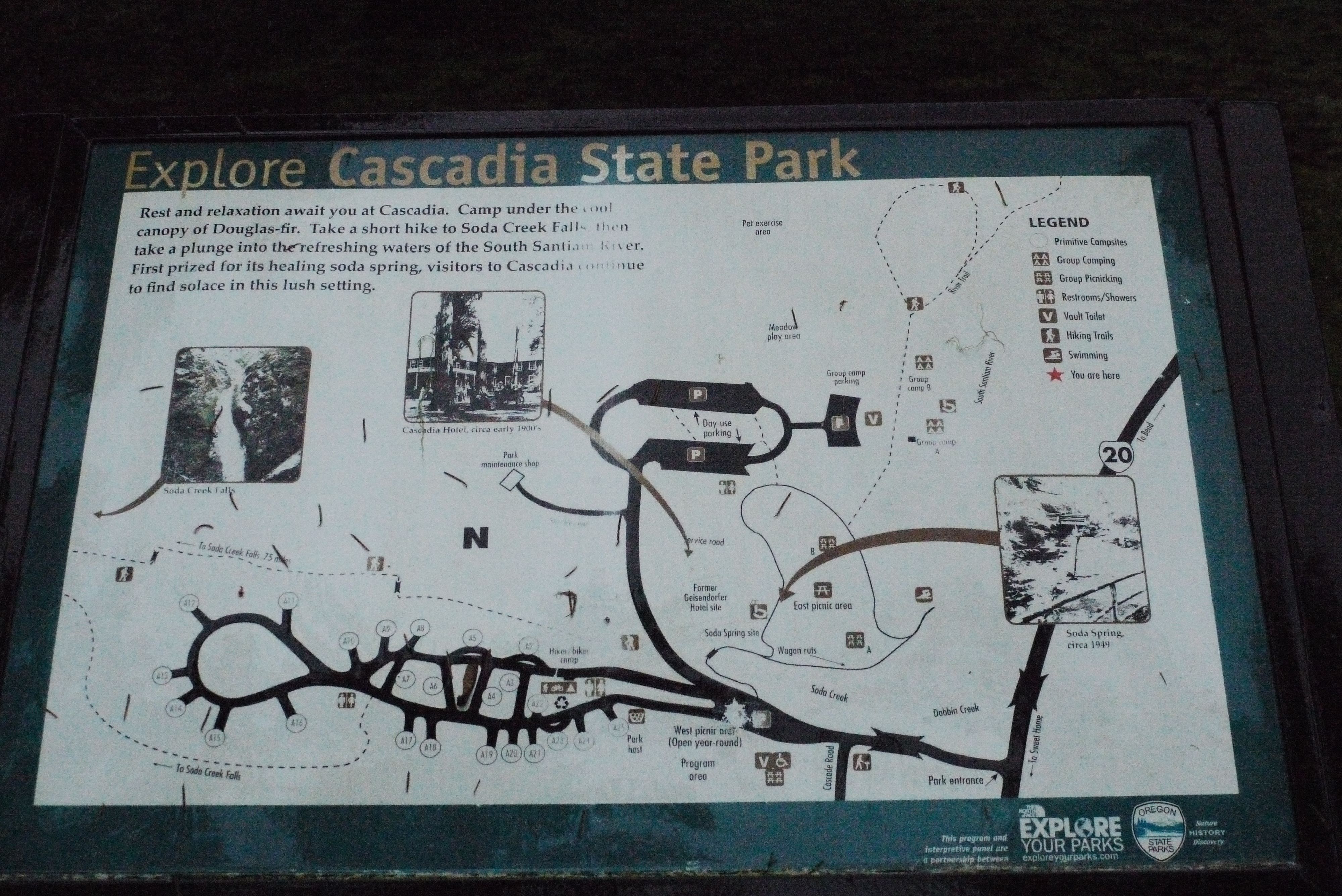
Information board at Cascadia state park showing the trail head and trail for Soda creek falls
The trail heads up Soda creek in between the main campground and the group site. You follow it up a nice trail through thick vegetation the whole way until you get to the falls.
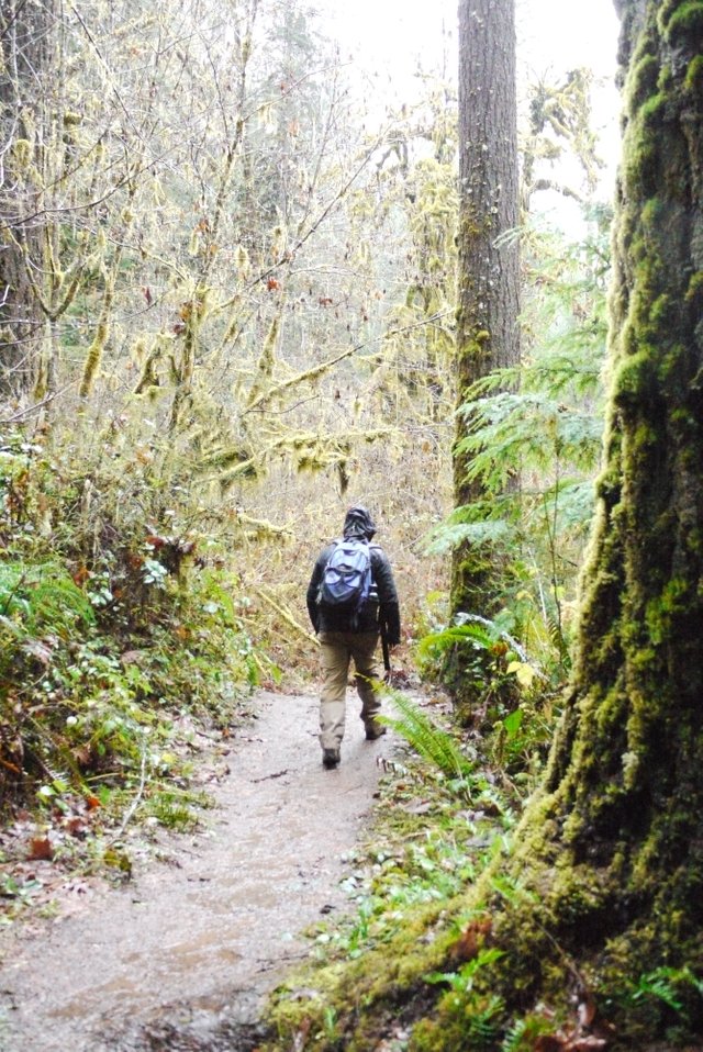
Dennis in full rain attire
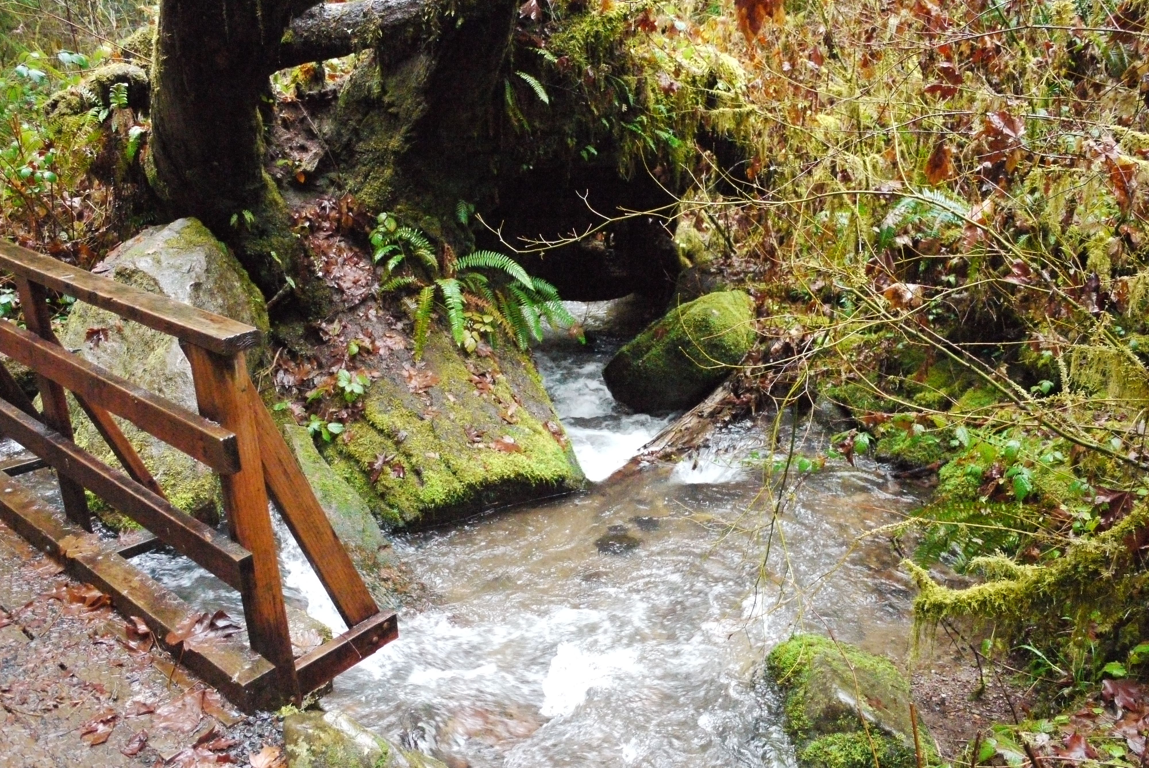
There is one creek crossing early into the hike. There is a nice wooden bridge that crosses just upstream of where Soda creek funnels underneath of an uprooted root wad from times past.
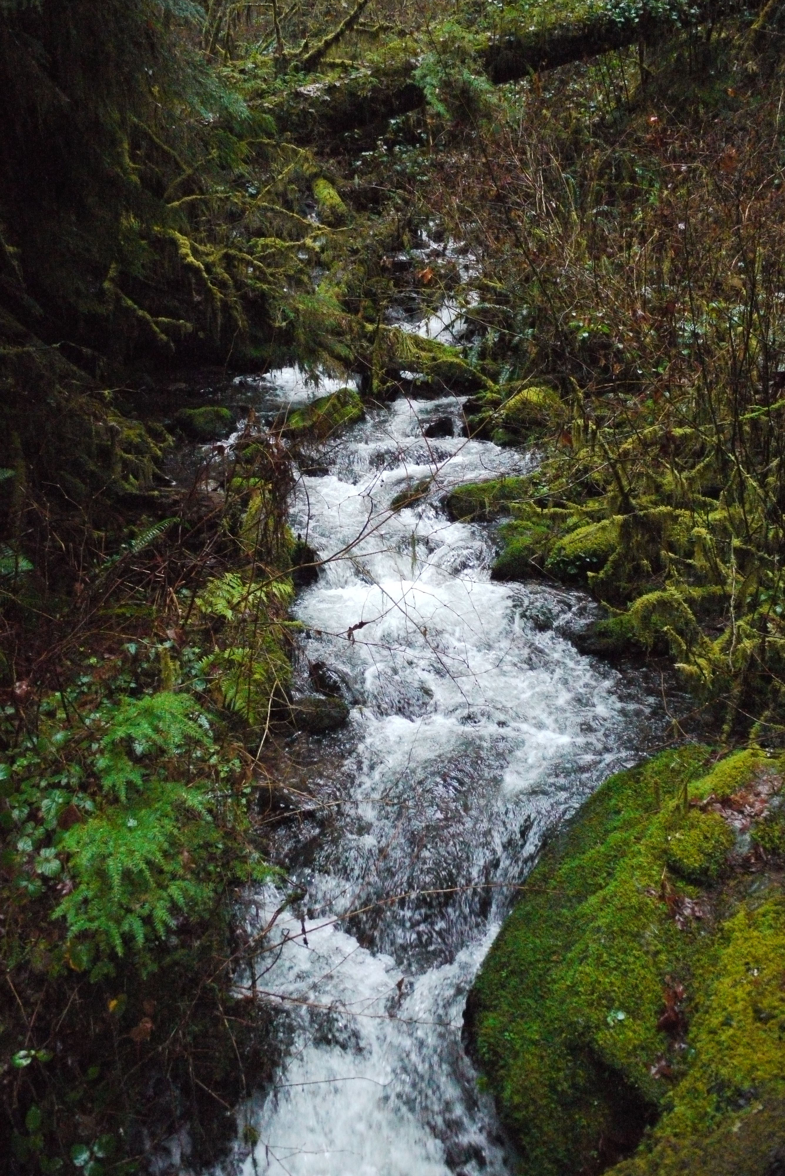
Soda creek
After crossing the creek you stay on the west side till you come to Soda creek falls about a half of a mile more down the trail. It was your typical wet Oregon conditions while Dennis and I were there so the trail was often muddy and sometimes overflown with clean pacific northwest runoff.
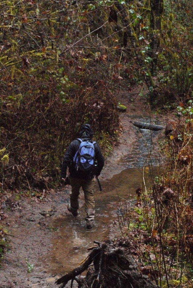
Dennis navigating a flooded trail
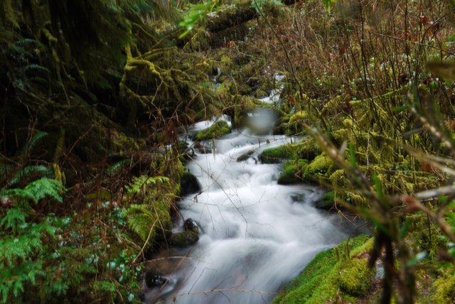
The trail winds through the trees and along the creek without much change in elevation. You are offered a good view of the creek if you're brave enough to walk out a fallen tree that crosses the river. I did and ended up getting an almost good shot of the creek, I say almost because it has a water droplet on the lens which takes focus away from the shot. Shortly after this you will come to two short incline sections before you get your first sight of Soda creek falls.
Soda creek, f/3.5, 1/160 sec, ISO 3200
Soda creek w/ droplet, f/18, 2 sec, ISO 200
We heard the falls before we saw them and I kept my eyes peeled as we walked around one last corner and I saw the white spray of water between the wet firs and cedars. I snapped of the out of place white shimmer in the midst of green and earthen browns.
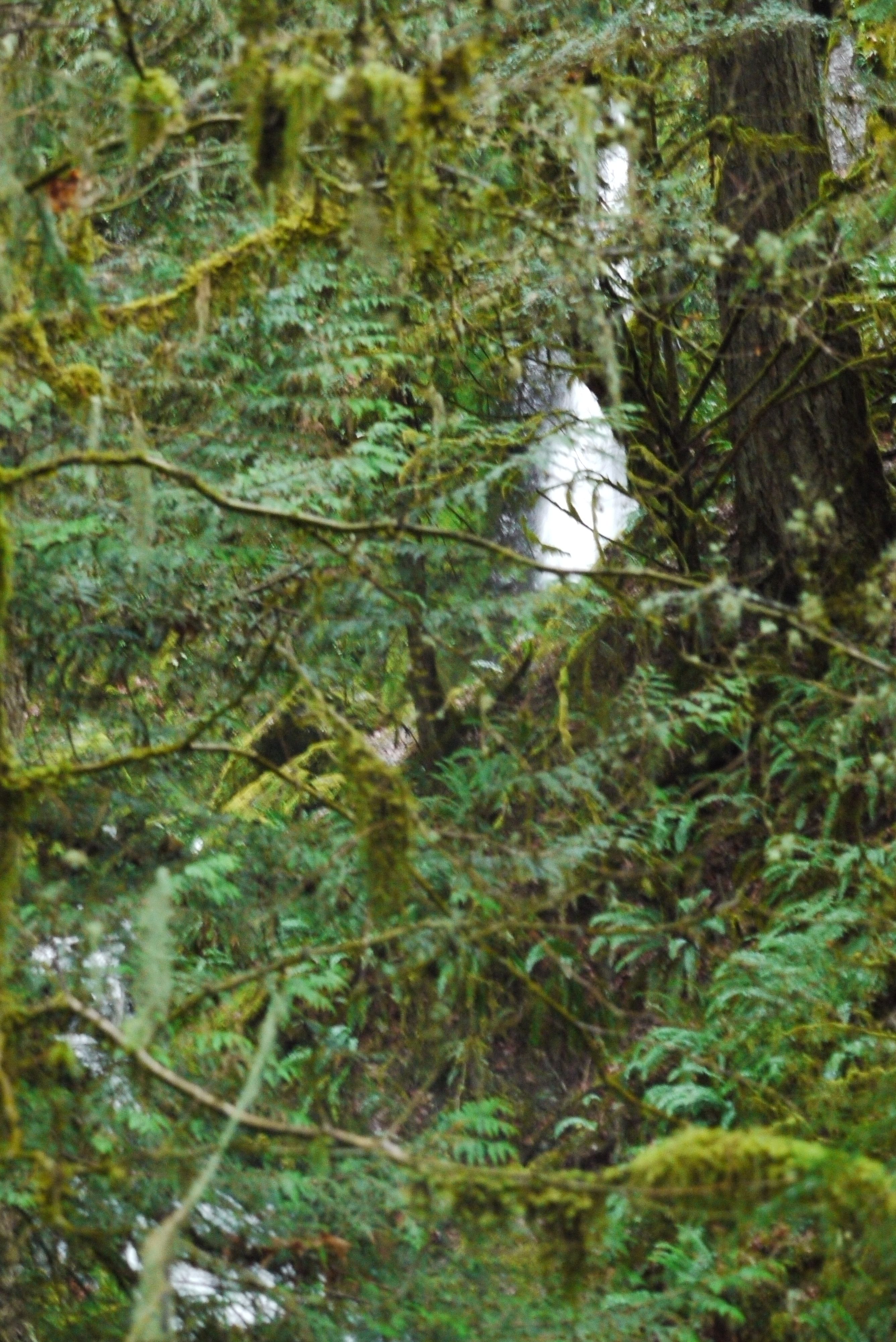
First view of Soda creek falls through the trees
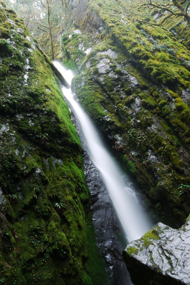
Once you finally get to the falls the height of them can truly be grasped. Although not a continuous drop the water falls from about a 150 foot cliff. The falls is broken up into three falls as the water slices through the upturned layers of rock. The final fall is the greatest, with the water falling unimpeded for closed to 100 feet. There isn't a lot of water that comes over Soda creek falls but the landscape and geology that it cuts through makes it one of the favorite that I've visited. There is a big area to sit and take pictures or just chill both right next to the falls and a little bit above the falls along the trail.
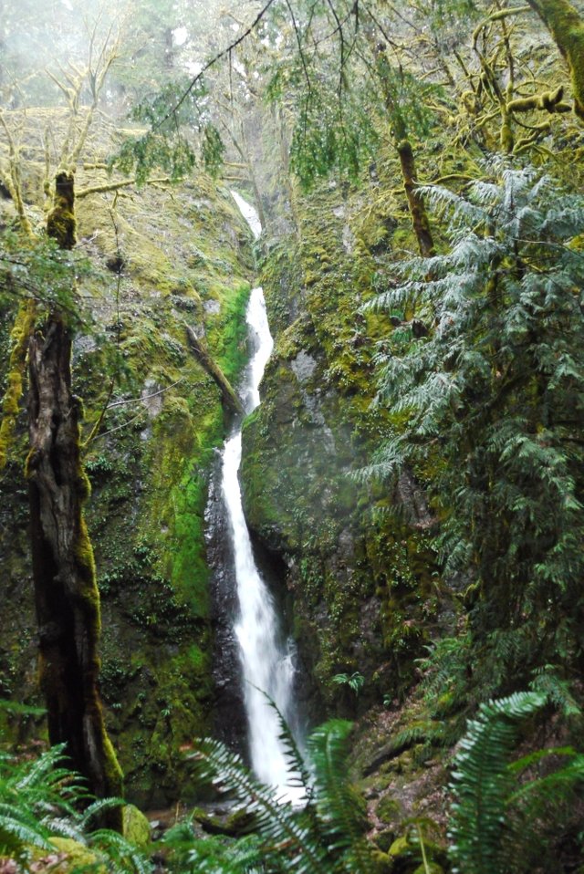
Full view of Soda creek falls

Soda creek falls gently falling 150 feet into its pool below, f/22, 6 sec, ISO 100
f/22, 6 sec, ISO 100
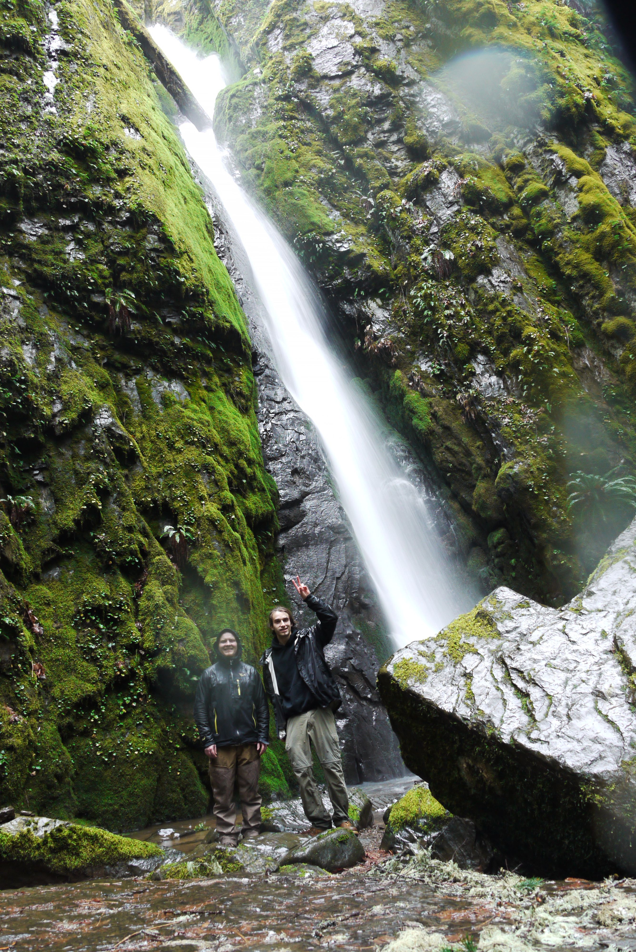
Dennis and I in front of Soda creek falls
Overall I really enjoyed the hike out to Soda creek falls, it wasn't to hard or long and still offered everything I was looking for. A beautiful waterfall at the end of a completely empty trail. Blame it on the weather but I was grateful that we didn't see anybody else, if always feels more pure and natural. Imagining what it would be like to be the first person to lays eyes on one to the many gifts of nature. It's the perfect hike for a rainy day if you are ever in the area, the rain will keep the masses away and it's short enough to not end up drenched by the time you get back to the car. Thank you so much for taking the time to read and scroll through my pictures. If you can't get out to Soda creek, get out somewhere! There is so much beauty all around you for free just waiting to be discovered. Find it and share it with others, growing a love and appreciation for all that nature offers is one of the best ways to build support for protecting our natural areas. It's harder to view these areas as profits when you have a connection with them. Get out and hike!!! And always practice and teach leave no trace principles!!!!!
B
[//]:# (!steemitworldmap 44.398835 lat -122.479362 long Soda creek Falls trail head, Cascadia state park, Oregon. d3scr)
Congratulations, Your Post Has Been Added To The Steemit Worldmap!
Author link: http://steemitworldmap.com?author=larrabeb
Post link: http://steemitworldmap.com?post=soda-creek-falls-cascadia-state-park-oregon-us
Want to have your post on the map too?