The Chinook Pass
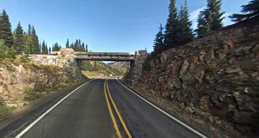
Chinook Pass (elevation 5430 ft./1656 m.) is a pass through the Cascade Range in the state of Washington.The pass provides the east entrance to Mount Rainier National Park, and carries State Route 410 between the towns of Enumclawand Naches. Because of the high elevation, Chinook Pass is usually closed in November due to very heavy snow and significant avalanche danger. It usually opens in mid May and is not uncommon to have a snow depth at the summit of up to 15 feet.As part of the All-American Road program, Route 410 through Chinook Pass has been designated by the U.S. government as the Chinook Scenic Byway. It is considered to be one of the most beautiful routes in the United States. Because the summit is above the treeline, there are many places to park along the road to view the scenery. As commercial vehicles are not allowed through the National Park section of State Route 410, this route is also favored by summer tourists.
Chinook Pass was chosen as a route across the Cascade Mountains as a compromise. The height of the route would mean that it would likely never be a year-round road. The alternative was Naches Pass, which with the addition of a short tunnel would be much lower (and easier to keep open in winter). The Naches Pass plan is still on the books as SR 168, but it has never been built.The cost of the tunnel was the deciding factor, and the Chinook Pass route was chosen.The Yakima side of a road over Chinook Pass was partially completed in 1914, but then work was abandoned for several years. This section was referred to as the 'Normile Grade'. In 1921 work began again on the Yakima side, below Normile, on the American River. This work was done using horse teams. In 1924, an army tractor was brought in to speed up the work. Work on the west side of the road commenced later, and took longer. The two sides did not meet until 1931 at Tipsoo Lake near the summit.

Location of Chinook Pass
Elevation5,430 ft (1,655 m)
Traversed by State Route 410
counties, Washington, United States
Range Cascades
coordinates 46.8717°N 121.515483°W
Chinookpass