World's Easiest 6000 metre Mountain(s)
Below is an article I wrote in April 2017 for Summitpost (a great source for hiking, climbing and mountaineering) regarding mountains that are often referred to as the worlds easiest 6000 metre climbs. Link to original article- https://www.summitpost.org/world-s-easiest-6000-metre-mountain-s/998218
Between the months of Dec 2016 and Apr 2017 I had the opportunity to climb a number of peaks in South America, four of them with the title 'world's easiest 6000 metre climb', these would be Huayna Potosi, Acotango, Uturuncu (all in Bolivia) and Chachani (Peru). In my opinion, I decided to list them in order of difficulty-
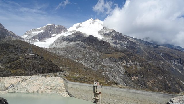
No. 1 Huayna Potosi (6088 m) from base camp (4750 m), 2 days to summit
Probably without doubt the most difficult of the four, there are two sections that are 45°+, one an ice climb, the other rock and there is a definite need for crampons and ice axe. There are also one or two bergschrunds (crevasses in the glacier ice) that need to be navigated.
Climbing grade PD (slightly difficult)
No. 2 Chachani (6057 m) Cabrerias route, from Arequipa (2350 m), 3 days to summit. North Scree route, from pass (5050 m), 2 days to summit
Depending on what route you take. If it's via the Cabrerias route (i.e. from the south), then it's a tough hike. There's a basin between the (sort of) pass at 4830 metres and the high camp (due west) at Pampa Grande (approx. 4900 metres) which is pretty gnarly. You have a choice of more or less following the contour which takes you across loose scree at an angle, going in a straight line that takes you across a large boulder field or dropping down into the valley to avoid the boulder field, meaning you loose about 200 metres in height and climbing up (fairly) loose scree to Pampa Grande. If it's via the North scree route, then this is pretty straight forward and it's just the altitude to contend with. Cramptons and possibly an ice axe would be required for both routes throughout most of the year.
Climbing grade F (easy)
No 3 Acotango (6056 m) from Tambo Quemado (4380 m), 2 days to summit
Dirt road up to the ridge line at 5530 metres with traces of a dirt road up to approx. 5650 metres then path up to the summit. When I climbed, there was little to no snow on the route, when very close to the summit, there is an incline of about 45° made up of loose scree (presumably this would be covered with snow), this offered no purchase, fortunately there is a rocky outcrop to the left which allows you to climb the final section to the summit. If there was more snow, crampons would be necessary, probably no real need for an ice axe.
Climbing grade not known
No. 4 Uturuncu (6020 m) from Quetena Chico (4150 m), 2 days to summit
By far the easiest, not just because of the height (note: most other sources say about 6008 metres) but because there is a dirt road that goes to 5500 metres with traces of the road going to 5770 metres in the 'saddle'. The last 250 metres are a straight forward climb to the summit with a little bit of snow. The only thing that makes Uturuncu difficult, is getting to Quetena Chico (the nearest village) which is pretty remote. I climbed this in February and I didn't put my fleece on until about 100 metres from the summit. A local pointed out something interesting that this may be due to the volcano still being semi-active (i.e. giving of heat). This would be plausible as there was sulphur vapour venting as I made the ascent and sometimes you could hear activity beneath the ground, especially in the saddle (this sounded like water that was being heated).
Climbing grade F (easy)
(It probably goes without saying but while all these are advertised as 'the easiest 6000 metre mountain', there is nothing easy about a 6000 metre climb. Relative to other 6000+ metre mountains, maybe but there is still high UV radiation, altitude/low oxygen (at approx. 5750 metres, there is 50% of the oxygen available at sea level), below freezing temperatures (normally), snow and possibly penitentes to deal with.)
Note: I also climbed Alto Toroni (5995 metres), Bolivia, and there is some debate as to it possibly being a 6000 metre mountain. If it is, then I would put this somewhere in the middle between Chachani Cabrerias route and Chachani North scree route.
Other shots-
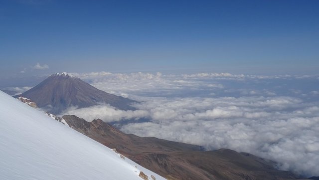
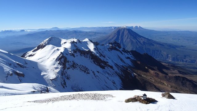
View of Misti from Chachani, Cabrerias route
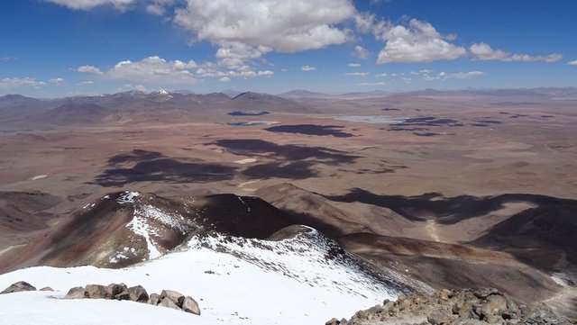
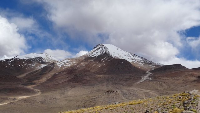
View from Uturuncu
Photos taken with a Sony DSC-HX60V
Hey @steve-d! Are those all of your own personal photos? If so it may be of value to state this in your post so that perhaps you get more street cred for this cool post. I'm now following you!
Your balance is below $0.3. Your account is running low and should be replenished. You have roughly 10 more @dustsweeper votes. Check out the Dustsweeper FAQ here: https://steemit.com/dustsweeper/@dustsweeper/dustsweeper-faq
upvote for me please? https://steemit.com/news/@bible.com/2sysip