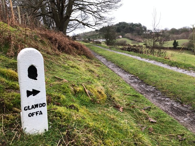
Offa's Dyke Path: Prestatyn to Bodfari
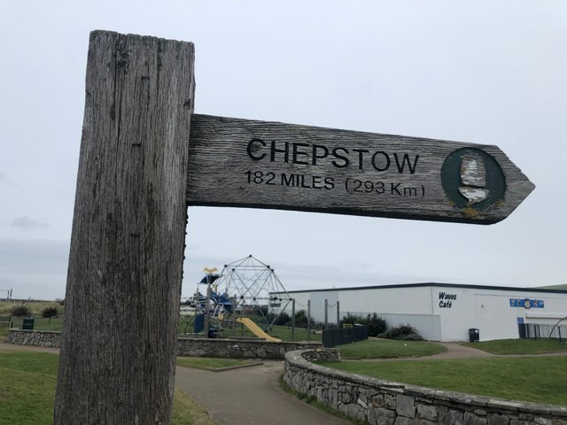
Running the entire length of Wales is a huge ancient ditch. The ditch, known as a dyke, spans 182 miles from Prestatyn in the north to the English town of Chepstow in the south, roughly following the modern border between England and Wales.
Whilst the path generally sticks to what visibly remains of the Dyke, in the north it runs parallel by a few miles so unfortunately there won't be any photo's of the actual earthwork until we get to mid Wales.
The ancient monument (one of Britain's biggest) is named after Offa, an Anglo-Saxon king who is believed to have ordered its construction during his reign from AD 757 to 796.
Although the Dyke's purpose is a hot topic for debate, it is generally believed that it was a kind of defensive trench to keep the unruly Welsh tribes of modern day Powys county from wandering into Mercia which is now the west of England.
Folklore accounts detail that is was customary for the English to cut off the ears of any Welsh found on the wrong side of the Dyke and for the Welsh to hang every Englishman found on the west side.
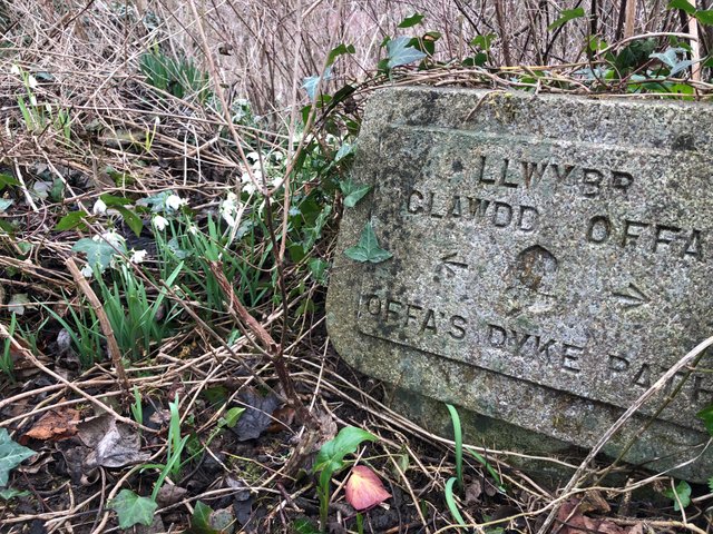
Offa's Dyke path
Fascinated by the fact that our modern day British borders have changed very little in the last 1300 years, some work friends and myself accepted the challenge to hike the entire length of the Dyke, incrementally, over the course of the year.
The Welsh seaside town of Prestatyn, a few miles down the coast from where we live would be our starting position and with a window of opportunity in-between the recent storms of Ciara and Dennis, we began our advance on Chepstow, or at least for today - the village of Bodfari, thirteen miles away.
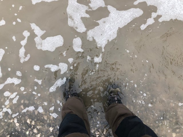
The weather was overcast as we made our way onto the beach at Prestatyn but with the rain holding off, we took the short walk into the surf at high tide for a Kodak moment and a Gore-Tex test run in my boots!
After maneuvering our salty soles back onto the promenade, we all took turns to photograph the official starting monument.
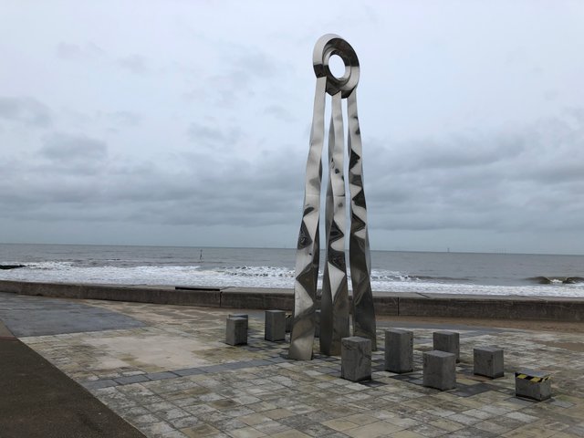
It wasn't until returning home later that day that I discovered we had all shot the monument from the wrong side!
The shiny sculpture resembles the sun and when starting the route from Prestatyn it appears in the eastern sky, symbolising the rising of the sun and the start of a new journey as opposed to the photo above where it appears in the western sky signifying the setting of the sun and the end of the journey for any hikers going the opposite direction and finishing their adventure in Prestatyn.
Get your mistakes out early as the saying goes!
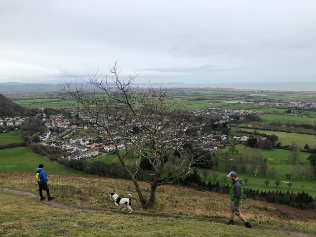
Heading away from the coast and uphill through the tidy high-street we made our way towards the hilltop village of Gwaenysgor (Gwine-uss-guh). We all knew how steep this section would be as is it the customary place to drive to after passing your driving test to enjoy the view point at the top overlooking the whole coast.
Where our nostalgic road met the junction to the path we needed to follow, plonked on a grass verge was a huge Roman helmet. There had been evidence found of a Roman bath house on the hillside and the artwork had been recently installed to mark the rough location.
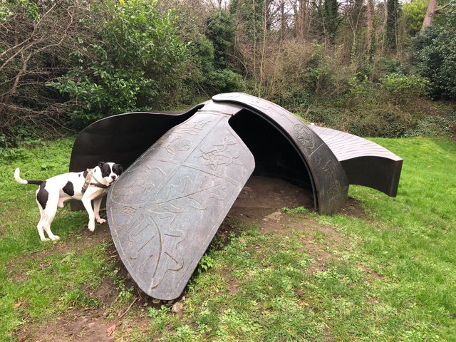
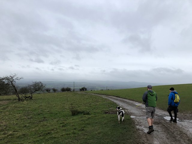
Patch the trail hound looking for some Roman bones
A coastal vista looking back to where we started had now developed and although grey, the rain was still holding off.
Patch, my friends fine animal, determined to photobomb all of my shots is staring at what's left of a two-hundred year old cottage on the hillside. The small dwelling was once home to a married couple and their nine children!
Sadly, the information board on the far wall details the tragic death of the husband after a fall in the local lead mine in which he worked.
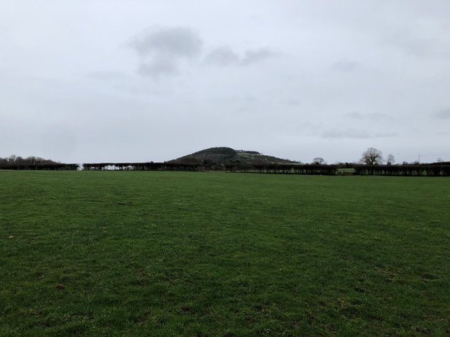
Levelling out slightly after entering some fields, the prominent figure of Gop hill appeared on the horizon. This lump is shrouded in history and is rapidly approaching the top of my list of places to explore.
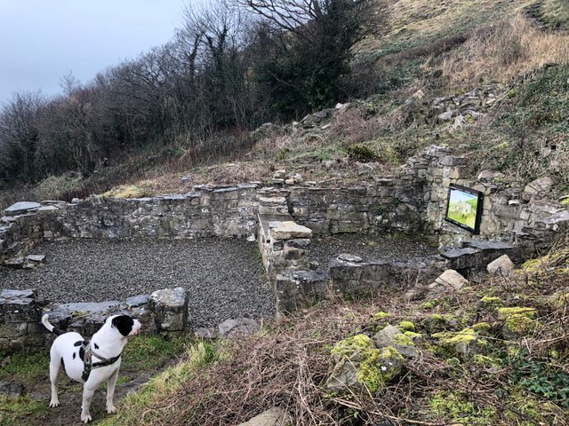
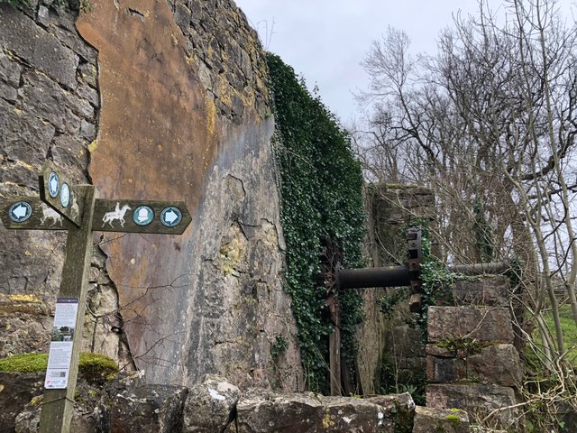
Entering some woods with the sound of a stream coming into ear-shot, we noticed the shell of old building peering through the bare-naked branches.
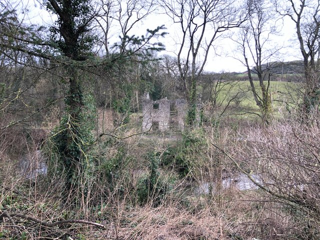
It was a small detour away from the trail but worth an explore. We routed around inside for a short while and determined that it was an old water mill. We could see the pit where the wheel would have once sat on the outside wall.
.JPG)
Just before leaving, we spotted an inscribed stone in the centre of the wall, above the door.
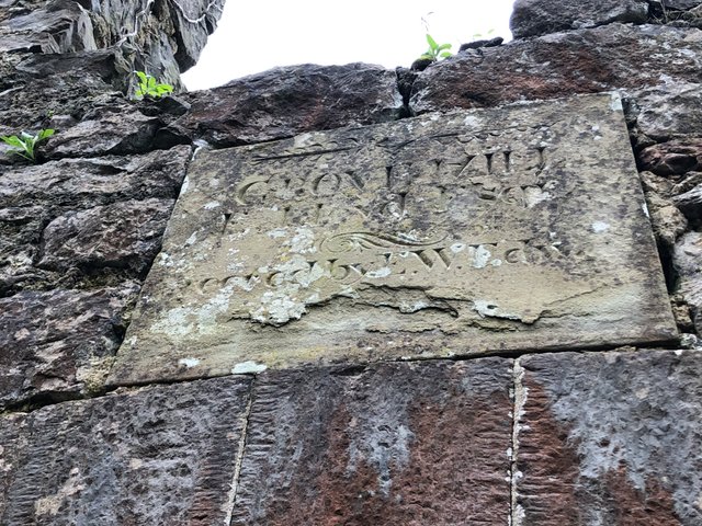
The sandstone block had weathered a fair bit and the bottom part had long flaked off. We couldn't find a date but managed to read out:
GROVE MILL
E. Lloyd Esq.
...ened by E.W Edw...
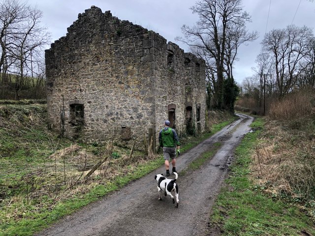
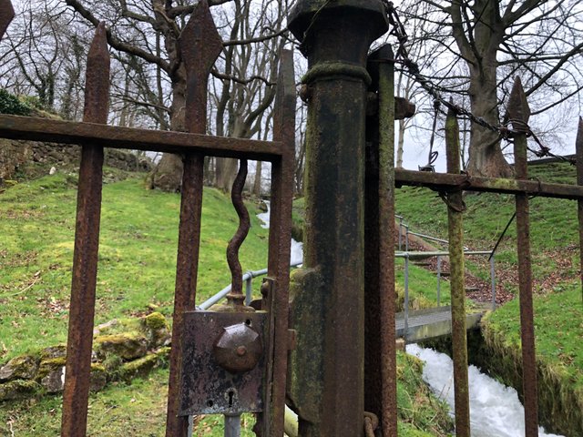
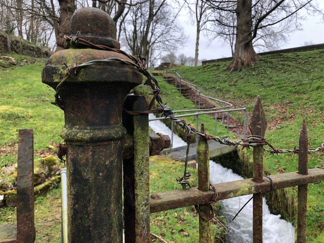
Just around the corner and up a small hill, close to a farmer feeding some new born lambs, was another old watermill. This one was bigger and still had part of the old wheel visible. It wasn't the wheel that caught my eye though, it was the Adams Familyesque iron gate and fence that separated the path from some fast flowing water ways.
Our next mission for the afternoon was to check out the ancient tumuli that litter the farmers fields around these parts. A tumulus is an ancient burial mound of stones and earth that has been piled up over a grave. They often mark the burial sites of important people, warriors and battle sites from ancient times.
Walking down a hill towards a small lane by the houses, we could clearly see, on the opposite hill, a huge burial mound in the field behind the white house. We located the smaller one further up the hill with the help from a map. The hedgerow grows straight over the top of it and we would have otherwise missed it.
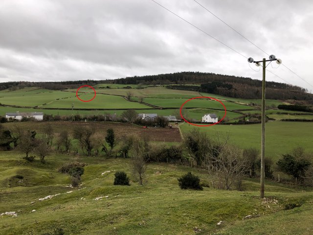
Our amateur and fantasy theory was that there was a battle in this valley and the losing army were buried under the bigger mound because there would be more of them and the victorious dead were carried uphill to the smaller grave with the glorious view. Who knows what lies beneath them?
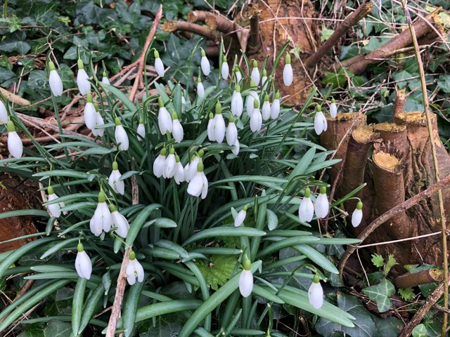
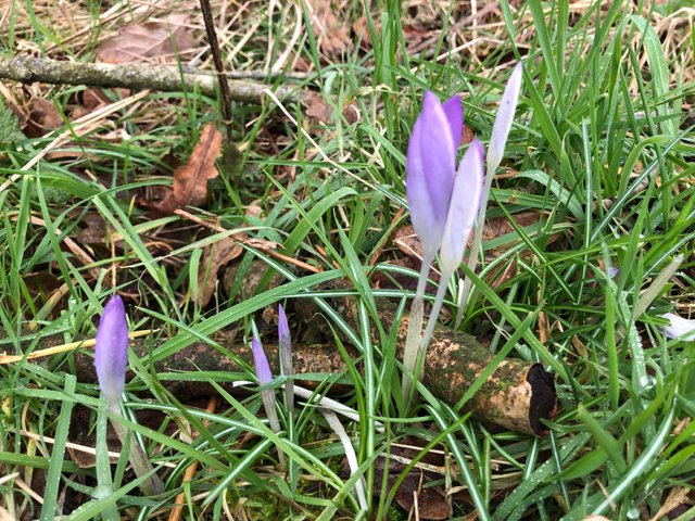
We let imagination carry us over the hill opposite and into the woods where after a bleak winter it was nice to see some early spring flowers making an appearance.
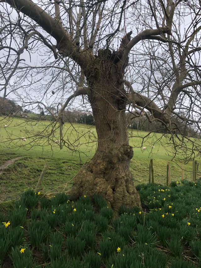
Just over four hours in and tiredness was beginning to take a hold. We'd hiked about ten miles and still had another three to go. The rain started but only slightly and it was actually nice and refreshing on our cheeks as we plodded through the increasingly muddy fields.
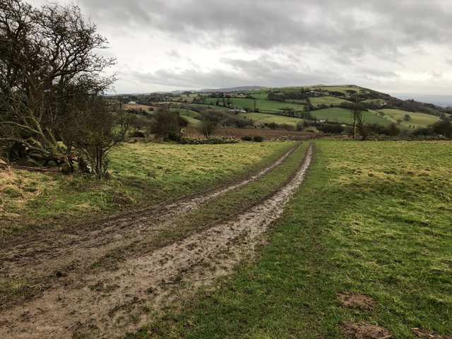
It wasn't long before our target, Bodfari, came into view below.
We picked off another tumulus, although not as obvious as the previous ones. In-fact it's not even worthy of a photo!
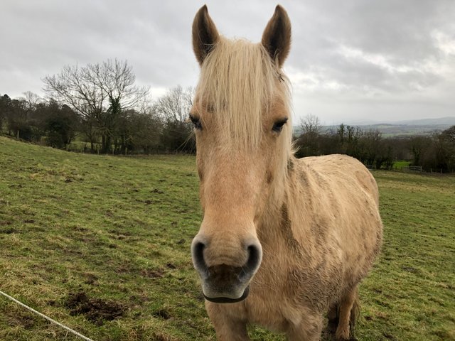
What is worthy of sharing though, is this friendly girl that we met to finish off our first leg. She followed us all the way up the fence line in an attempt to get the bananas that we had just shared out.
The rain held off for most of the day and there were plenty of points of interest to be explored. We had a moving time of six hours, walked just over thirteen miles and gained eight-hundred feet in elevation.
Thirteen miles down, one-hundred and sixty-nine to go!
Thanks for reading.
I can't believe I never knew there was a dyke that ran the length of Wales! As a child I travelled with my family between England and Wales every year at least once a year. You'd think someone would have mentioned it at some point!
haha I've lived here all my life and I'm always finding new stuff! That's what's special about it for me, it never gets boring!
Thanks for reading
!engage 50
@minismallholding you have received
50 ENGAGEfrom @livinguktaiwan!View and trade the tokens on Steem Engine.
Wow! This looks like an epic walk! Are you going to post about the entire walk?
I'm part of the @SteemitWorldmap curation team and it would be great to see your post on the map so it can be shared with more people on and off the chain.
You can find out more about it on http://steemitworldmap.com. Just click on the 'code' at the bottom of the map and follow the instructions or check out the FAQ to get your post on the map. Hope to see you soon and that you will follow us @steemitworldmap for our daily #TravelDigest!!!
Yeh I'll be posting about the whole route. We should complete it in about twelve stages. Next stage is penciled in for 1.3.20.
Keep meaning to check this worldmap thing out. Looks cool
Please do check it out, it's great for keep track of all your travels, not to mention you can easily share it friends and family who aren't on Steem as it's visually more easy to find your travel posts.
!engage 50
@x-53degreesnorth you have received
50 ENGAGEfrom @livinguktaiwan!View and trade the tokens on Steem Engine.
What an enchanting place and beautiful photographs, thanks for sharing!
$trdo
Congratulations @fenngen, you successfuly trended the post shared by @x-53degreesnorth!
@x-53degreesnorth will receive 1.39290638 TRDO & @fenngen will get 0.92860425 TRDO curation in 3 Days from Post Created Date!
"Call TRDO, Your Comment Worth Something!"
To view or trade TRDO go to steem-engine.com
Join TRDO Discord Channel or Join TRDO Web Site
Hey thank you!
Really appreciate the read
@tipu curate
Upvoted 👌 (Mana: 10/20 - need recharge?)
This post was shared in the Curation Collective Discord community for curators, and upvoted and resteemed by the @c-squared community account.
If you are a community leader and/or contest organizer, please join the Discord and let us know you if you would like to promote the posting of your community or contest.
@c-squared runs a community witness. Please consider using one of your witness votes on us here
Congratulations @x-53degreesnorth! Your post made the TravelFeed team happy so we have sent you our big smile. Keep up the good job. 😃
We noticed that you did not publish your post through TravelFeed.io or edited your post on other Steem frontends. For better-looking blogs, we recommend you use our EasyEditor. As a bonus, when you post through our platform, you receive double upvotes from us, you are eligible for the top pick of the day (resteem + featured on the TravelFeed.io front page) and you can earn extra rewards from being featured in our daily curation posts. You can simply login with your existing Steem account using Steemconnect or Steem Keychain. See you next time on TravelFeed.io!
Thanks for using TravelFeed!
@elsaenroute (TravelFeed team)
PS: TravelFeed is in social media to reach out more people, follow us on Facebook, Instagram, and Twitter.
Congratulations @x-53degreesnorth, your post successfully recieved 1.39290638 TRDO from below listed TRENDO callers:
To view or trade TRDO go to steem-engine.com
Join TRDO Discord Channel or Join TRDO Web Site