Halfway between North pole and the Equator ~ My first hiking experience, Bruce trail, Ontario
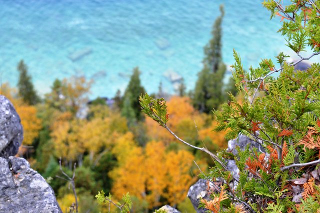
One of the lookout view from the trail. (Please don't reuse the pictures without permission)
I love adventure but I was never a hiking type and I guess am still not after getting lost in those cold woods for sometime .But beautiful pictures of the turquoise water above the limestone cliff lured me into it😁
Last time in the Montreal blog I already told about how difficult it is to find a means of transport off season to tourist place away from the city area. So we decided to jump in when we saw the ad for an organised tour by Park Bus.
The first thing that I do now a days in the morning is to check the weather and to my horror exactly on the day I decided to go for my first hike there was the first snow flurries of the year. 😼 But luckily the weather at Lion's head was good but a bit windy and no flurries. Check the video I added here to see the transition of snow covered place in between Lion's head town. Weather is crazy at times here.
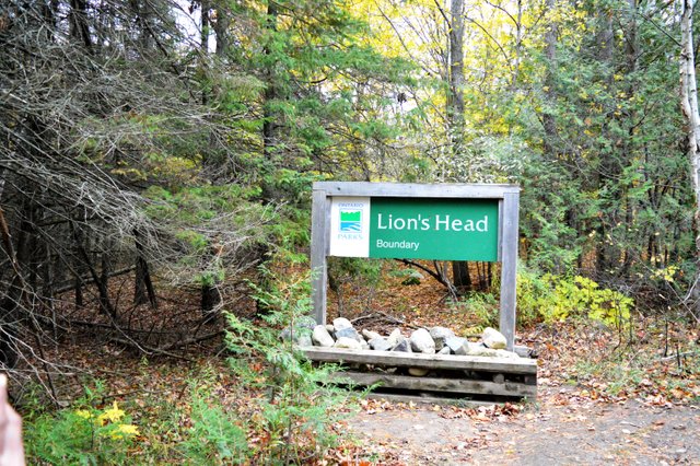
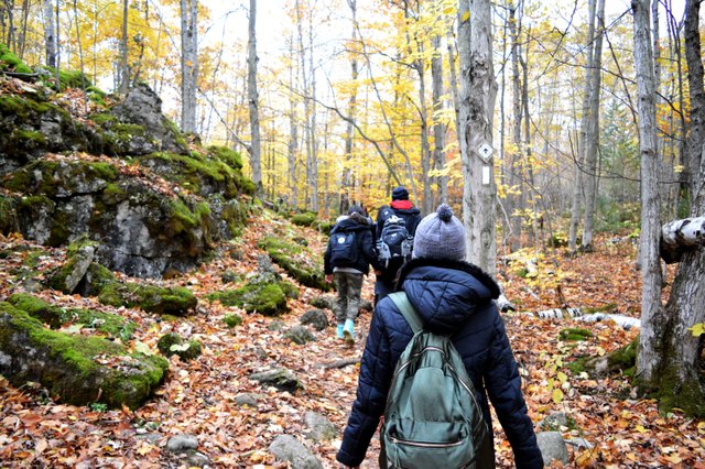
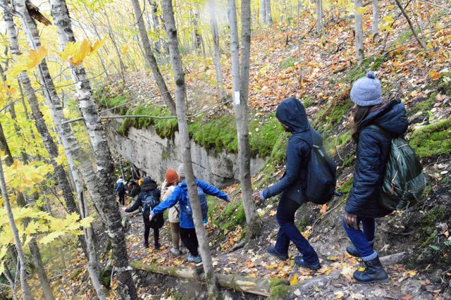
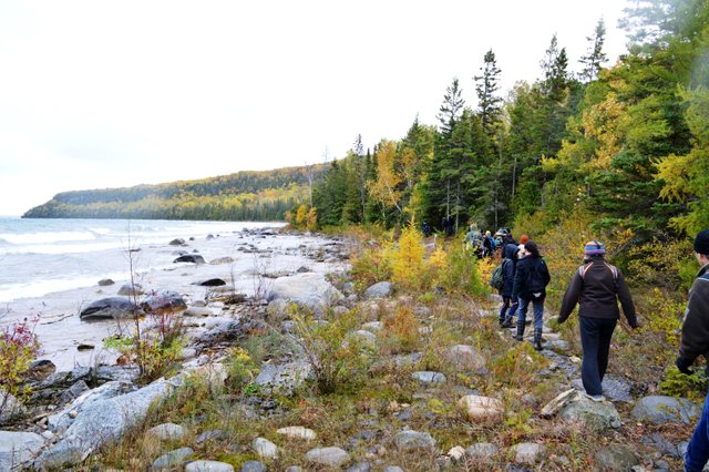
So we had the bus pick up at 6:40am and its a four hour journey from Toronto to Lion's head town. You have to hike through scenic woods of Bruce trail to view the Lion's head. Obviously it got its name as the geological form resembles the head of the lion. It's also a national reserve. Bruce trail is one of Ontario's longest trail that extend from Niagara to Tobermory and have many side trails. Lion's head is one of them. You can decide if you want to take a longer trail or shorter trails. Also we were allowed to hike in group or alone. And they even let us choose the speed in which we want to cover the trail and they had three volunteers. One of them take us on a fast paced longer trail, and another a slower paced short trail and one in between the two.
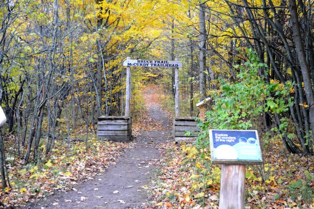
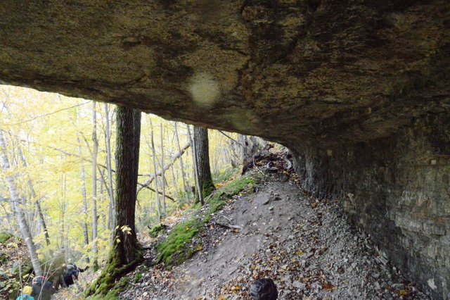
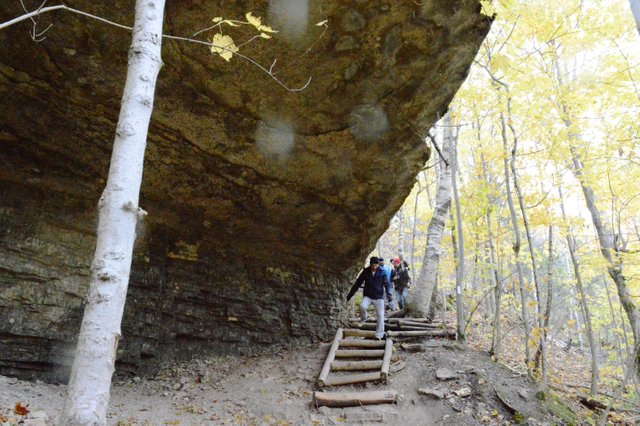
We decided to go a bit slower enjoying all the scenic beauty. The shortest trail was 3.5km. We started hiking by 12pm by the Moore Street entrance. We were to return to a small cafe called Lion's head Inn at 5:15pm were we will be picked up by the bus for return.
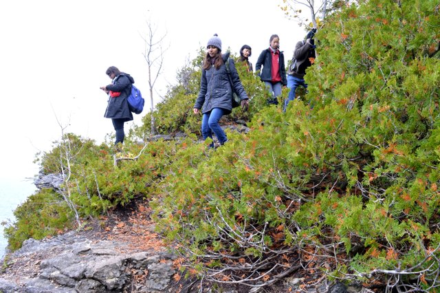
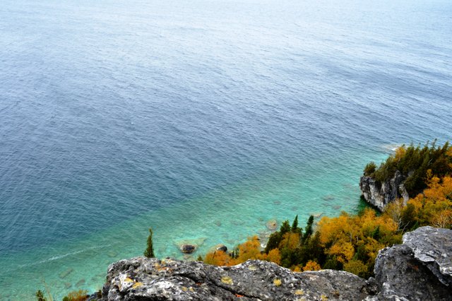
Sometimes the path seemed extremely dangerous like the one above with the steep cliff on one side and the wind tugging us.
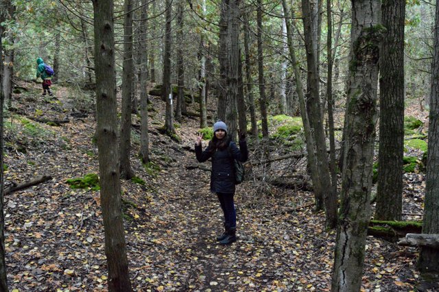
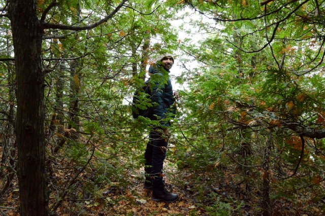
Thats me
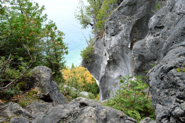
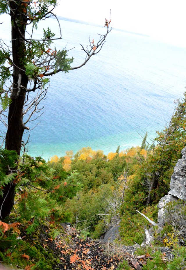
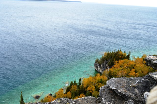
There are many lookout points in between the trails that overlooks the Georgian Bay. It was beautiful. Looked just like a painting from the above.
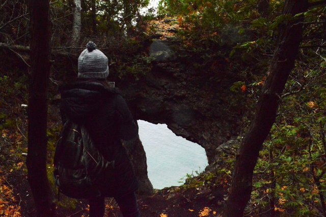
Can you see the hole in the rock which gives you a glimpse of the crystal blue water below. There were many such poth holes in rocks formed by glacial effects.
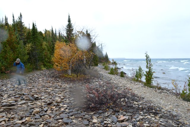
At one point of the trail we reached to the bottom beach area where it started raining lightly.
Later we moved from the slow paced group to the fast paced one. It's easy to get lost here with the densely placed trees and the ever curved trail paths. But all the paths are marked by painting trees with white (main trail) and blue (side trails) patches. You just need to follow it. Also they have provided us with a map.(I still had it crushed in one corner of my bag. I am adding a picture of it too😉)
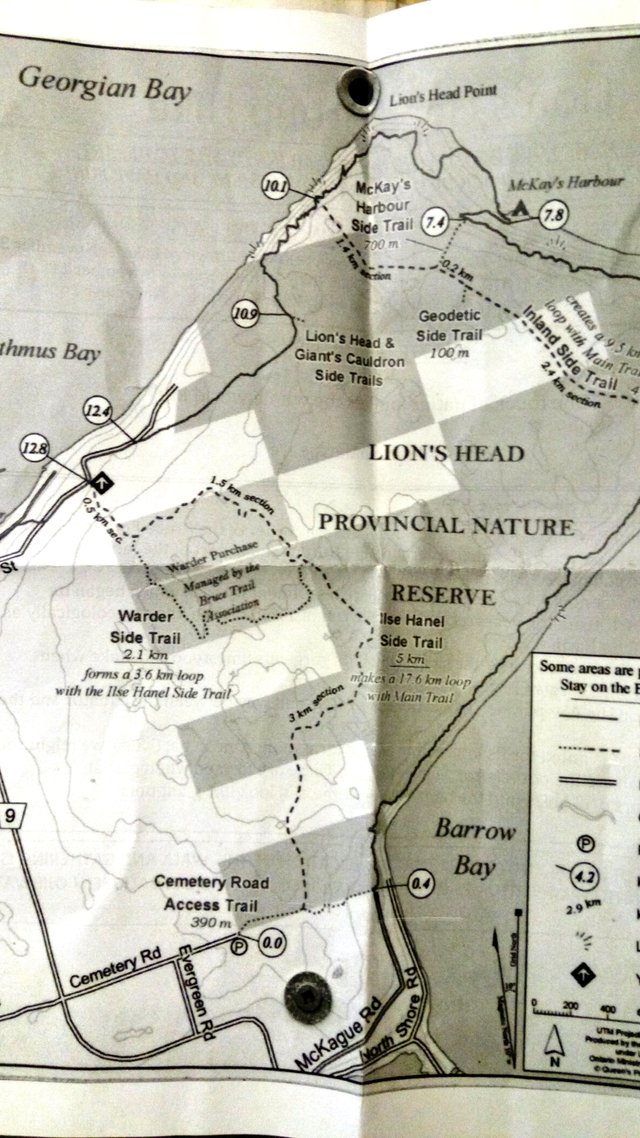
By now there were many sub groups and they were moving forward on their own. We decided to take the Geodetic side trail which leads to halfway between Equator and North pole. The information on the map sadi Lion's head is located on the 45th parallel and exactly between equator and North Pole. We followed the map as well as the tree markings and the small information boards until this happened.
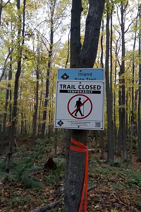
We decided to go backwards and take the trail to the other side. We walked and walked. No one was in vicinity and complete silence. We mixed up the trail and at one point had no idea if we were going forward or backward. I was sure we will get out of the wood somehow and the bus won't not leaving without us but the thought of walking double distance made me exhausted.
After walking a bit we found two ladies who was lost just like us. All the four of us moved together and found the way out finally. The walking was not over yet. It's about 1km on the roads to the cafe we were supposed to be. The other ladies had a car and dropped us to the cafe were a warm pre booked dinner was waiting for us. By the time we reached at around 5 o' clock many groups have returned and were having their meal.
We were asked to bring our lunch to eat in between the trail. Read here to see what happened to our lunch.
The bus came at around 5:45pm. And we were back in the city by 11pm after one hell of a hiking experience.
!steemitworldmap 44.991381 lat -81.258859 long Lion's Head CT d3scr
All pictures belong to me, taken using Nikon D3200
Until next time
@silenteyes
Do read my Montreal Blog here
Posted from my blog with SteemPress :http://localhost/wordpress-4.9.8/wordpress/2018/11/07/halfway-between-north-pole-and-the-equator-my-first-hiking-experience-bruce-trail-ontario/
Howdy there silenteyes! wow what a hike! The views and scenery is amazing though, I'm so glad you got so many great shots, well done!
Thanks a lot @janton . Yep, I clicked a lot of pictures for steemit 😊
Hiya, just swinging by to let you know you're being featured in our daily Travel Digest. Please drop by to check out all the rest of today's great posts and consider upvoting the Travel Digest if you like what we're doing.
This post was shared in the Curation Collective Discord community for curators, and upvoted and resteemed by the @c-squared community account after manual review.
@c-squared runs a community witness. Please consider using one of your witness votes on us here
Thank you and voted as witness :)
Congratulations! Your high-quality travel content was selected by @travelfeed curator @mrprofessor and earned you a reward, in form of a 100% upvote and a resteem. Your work really stands out! Your article now has a chance to get featured under the appropriate daily topic on our TravelFeed blog.
Thank you for being part of the TravelFeed community!
Learn more about our travel project on Steemit by clicking on the banner above and join our community on Discord
Wow, I really love this post! All of the detailed pictures of are great - and I love that snap with the water drops on the lens. Looks like a beautiful day was had, thanks for sharing.
Thanks a lot @lilyraabe :)
What a great adventure you had! I truly love the first two photos! Thank you for sharing!
Thanks for the read @delishtreats :)
Seems like a beautiful hike @silenteyes, that blue water looks so tropical, but it seems cold, such a contrast ahha
Yep.The view of bluish water from above was indeed mesmerising. I did adjust the contrast a bit too ! But I have never seen such clear waters before.
Really nice post! The photos are very beautiful and I like the video too :)
I think your SteemPress link at the bottom of the post is broken, though...
Thanks a lot @veryspider. I just noted the broken link. No idea how to fix it though😐
Wow soooo interesting. That makes me remember that it's been more than a year since my last trek.
Posted using Partiko Android
Yes. At least you can breath in a lot of pure air among those trees !!
Congratulations, Your Post Has Been Added To The Steemit Worldmap!
Author link: http://steemitworldmap.com?author=silenteyes
Post link: http://steemitworldmap.com?post=halfwaybetweennorthpoleandtheequatormyfirsthikingexperiencebrucetrailontario-3wmm4wijgl
Want to have your post on the map too?