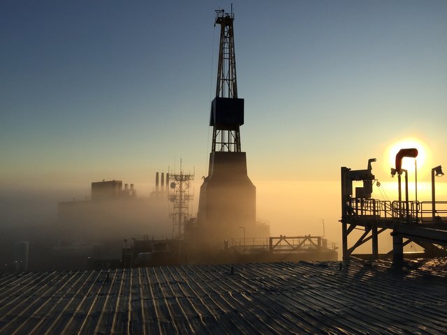
Insight into the world of crude oil, from digging to refining, to a look at other by-products- EXPLORATION OF OIL
Today, let take a dive into the oil and gas sector. Been an intern in one of the leading sellers of a variety of crude oil products (i.e DPK- Dual Purpose Kerosene, AGO- Automotive Gas Oil, PMS- Premium Motor Spirit and Base oil), I had quite a lot of fun going to work, learning new things from various departments and sure, my month ending salary. Want to know how much it was? Then, visit Eterna PLC at Ikoyi, Lagos. Apart from the tasks that were delegated to me, I loved working with the laboratory Chemist. We talked about the industry every time he was free and I enjoyed it. Need I tell you that the oil and gas industry is the wealthiest sector, at least in Nigeria? This is because of the whole citizen’s dependence on crude oil. Crude oil when broken down is used virtually everywhere from residential homes to offices to factories to automobiles. As a curious individual, I have decided to take a full-length view of the industry and how the ball is been played.
INTRODUCTION
You may want to wonder a little on how oil and probably gas came to exist. Did God wave a magic wand or was it part of the plan from the beginning? We owe this to plants and animal that died many millions of years ago. After they died, they stopped been on the surface and got buried deep down by sand and some other helpful materials. Pressure from sediment and heat from the inner surface now turns the remains of the decayed parts into oil and gas. Simple, right?
To start with, let take a look at the exploration of the crude oil. To dig a well to get oil and gas from, you must be sure the land has oil and it has it in abundance. Digging a well that doesn’t hold enough oil or can’t match up with the whole expense of the setup is not cost effective. Locating oil deposits is therefore as important as anything. So, why is exploration important?
Today, technology is every profession’s first love because all that was done in the time past were done without tech and also in a long time that could actually have been spared, with expensive procedures or techniques and unpleasant environment. There are three requirements involved in the search for oil. I call them the three g’s of the Geologist; they are Geology, Geophysics, and Geography. The Geologists are also of a thankful heart in this modern world. Every oil deposits they embarked on locating in the years past were carried out on how knowledgeable they were about the formation of rocks.
Knowledge about rock formations was not enough though; they had to interpret some other conditions like types of soil, surface rock, and surface features. To evaluate the rock’s subsurface buildup in the early ages, all these conditions had to be done without the aid of much technology. With the ‘advent’ of technology and its subsections, interpretation of rock formation have been made easy. Technology surveys such as seismology, satellite imaging, stratigraphy, aerial photogrammetry, sonar, gravitational, and magnetometry are now been used to locate oil reservoirs. Though some of these surveys have been in existence prior to technology fully taking over, I’d do well by talking on some if not all.

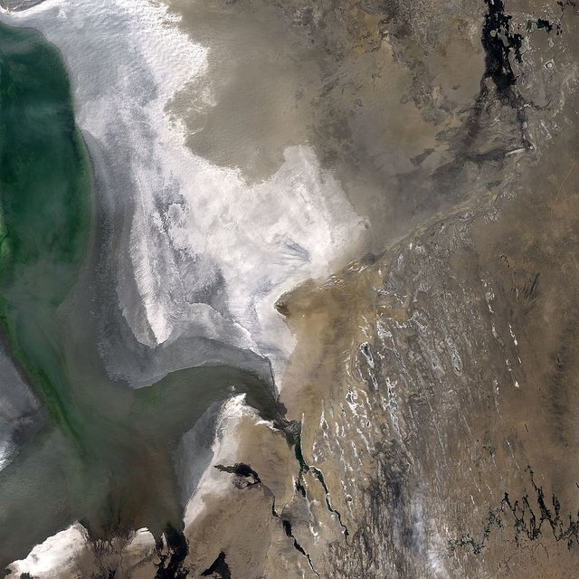
Satellite imaging
Since satellites have started to get a lot of use in this modern world like for weather applications, remote sensing, satellites orbiting around the earth is on the rise and it has not left the oil and gas industry too. So how does satellite imaging works?
Well, hydrocarbons are known to leak from deep down to the surface and this is known as seepage (leaks through). The hydrocarbons leak from deep accumulations. The seepage is split into two i.e the microseepage and macroseepage. Microseepage is a dense volatile hydrocarbon, this means the hydrocarbons are weak and are not seen quite easily while the macroseepage is oil seeps that becomes visible by getting to the surface and existing in seen quantities. So once the satellite captures the seepage whether micro or macro, sensor, and temporal dataset process it in order to know the types of data. Then a satellite anomaly generated map is come up with and is been closely related to common oilfields.
.jpg)
Satellite imaging gives areas inaccessible to by planes a lifeline. It is not only used by emerging companies for exploration monitoring or accessing facilities but for seismic planning and emergency and quick response also. An advantage here is that with satellite imagery, it is easy to monitor oil spillage and tapping of pipelines illegally.
Satellite imaging is also advantageous in that it detects well reservoir and seismic lines. It also differentiates rock types.
Satellite imaging is the future of survey, it will help oil and gas companies make easy exploration without license and exploration risks.
Aerial photogrammetry
Aerial photogrammetry is another survey that is been used by Geologists. It is a science of measuring accurately via digital photo imagery and photographs to notice or find things above the surface of the earth like rocks. The world is running fast and science isn’t stopping either. All I have ever been familiar with is a camera of 20 pixels belonging to a Nikon camera, but cameras used here would possess unimaginable pixels. From using these super-cameras, coordinate i.e X, Y, and Z of a point and graphical ‘representation’ are now produced.
In this survey, cameras with special functions are used in airplanes and they provide views that are 3-dimensional (XYZ). The coordinates are then used to determine possible oil deposits and formation of land.
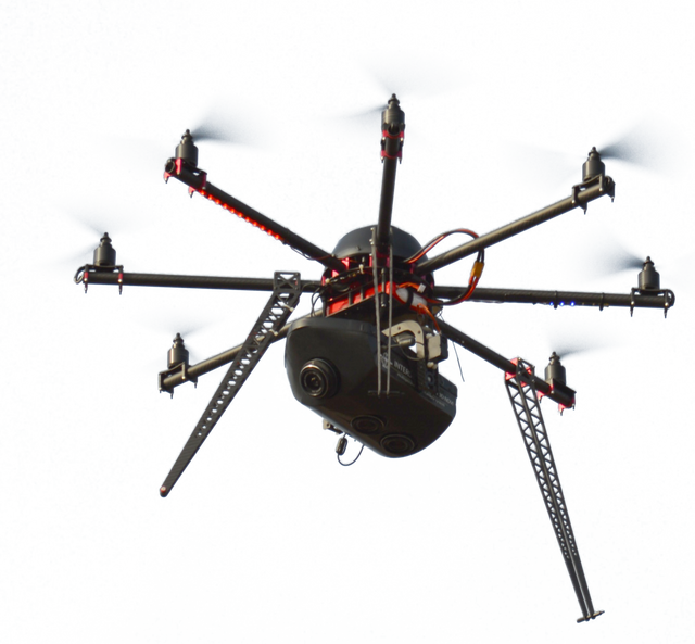
Drone, another latest technology has since relegated the aircraft used and this minimizes the cost spent in this survey. This makes the survey one of the best.
There are a couple of advantages of Aerial photogrammetry over the disadvantages. It gives pinpoint and accurate information of what was photographed at any time. Another major advantage is that it makes places that are not accessible due to urban infrastructure to be accessible since it is done in the air. The major disadvantage is that the operation could be disturbed by unfavorable weather, snow, dark shadows or even water.
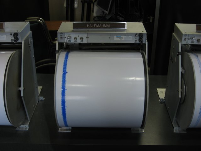
Seismology
Seismology has to do with seismic waves. It is obvious here that they are intertwined. Geologists say there is a seismic wave which is an energy wave when there is an explosion or an unexpected breaking of rock in the earth. The waves recorded when there is a breaking of rocks are seismic waves. Seismology is, therefore, the study of seismic waves. There are two main types of seismic waves which are surface waves and body waves. The major difference between the two main types is how they travel.
Body waves usually come before surface waves in that body waves travel through the interior layers of a rock while surface waves as the name suggest travels on the surface of the rock. In the occurrence of an earthquake, the body waves have more frequency than the surface waves. There are other subclasses of waves under the body and surface waves pertaining to an earthquake, but for the purpose of crude oil or natural gases, I’d skip that to move to the next point.
So how is the seismological survey relevant in the locating of crude oil?
.jpg)
In seismology, equipment such as the seismograph (signal recording device that uses a network to record motions in the ground) and seismometer (the motion of the earth is usually detected and recorded by sensors called seismometer) are placed on the rock. Rock layers are subjected to sound waves or shock waves created by blasts of compressed air underwater, vibroseis trucks, or by firing explosive charges inside small holes. After creating, they are passed through the rock’s inner layers. Reflection of the shock waves is then made to send an echo back to the rock’s surface which is recorded through geophones and measurement is made via seismograph, seismometer and other seismic instruments. The ‘relative’ time between when the shock waves is made and the echo returns or reflect is used to know how deep the subsurface is. Since different rocks are been observed, they reflect back differently which then aids data measurement.
Seismologists are geologists that work mostly in petroleum exploration to see into how seismic waves can be used to locate oil deposit. They carefully plan, start and execute how they can locate our precious oil.
Magnetometry
Magnetometry involves magnetic field. Measuring the magnetic field of mapped rocks will tell you whether there is presence of crude oil. Rocks that usually contain oil have low magnetic readings. The major instrument used here is magnetometer. The earth magnetic field allows for magnetic effect from induced rocks. Sedimentary rocks are the culprit here since they have low ‘susceptibility’ and are transparent to magnetism. An example of magnetometer used is Schmidt vertical-field balance. The balance measures the magnetic field by reading the torque (twisting force or force that allows rotation of an object about an axis) on the device produced by the earth’s magnetic field.
Other instruments used alongside magnetometer is the transmitter (an instrument used to produce waves for the purpose of transmitting data or signals) which generates the primary field and the receiver (an instrument that converts electromagnetic waves into usable form like light and sound) which measures the induced secondary field. The advantage of Schmidt vertical-field balance and magnetometry generally is that, it makes exploring of crude oil in shallow regions successful. A major disadvantage of the magnetic method is that it does not modify the magnetic field strength, it only measures it. This therefore makes it a dormant method. Magnetometry could be well integrated with the seismic method, it helps interpret seismic program using 2-D or 3-D maps.
Gravitational
.jpg)
.jpg)
This method of survey is based on prediction and as the name implies, it has to do with gravity. In a particular region, an instrument called the gravimeter is employed to measure the gravitational field against the density of the region under watch. Prediction of oil deposits or reservoirs can be made from simply studying the density. The detection of gravity anomalies in rocks is associated with oil exploration. This survey, though dormant like the magnetometry survey, over a mapped area measures the earth’s variation in the magnetic fields and then relate these changes as pertaining to the subsurface.
Roundup
This topic is actually an interesting one and I believe you would enjoy subsequent series to come. This is just an icing of the whole cake. I am not a petrochemical engineer but I must tell you, this topic has been one of the best I have researched.
Each technological survey or method is unique and could be used as wished and as most satisfying. In exploration world, the seismic survey is been greatly used, this is quite okay, but exploration and oil and gas companies should take a look at other methods. Each has its advantage that edges another but this doesn’t mean a particular one is the best.
Note also that, magnetic and gravitational surveys are well suited with the seismic survey. They can be incorporated together. The most integrated are sonar and seismic survey.
I hope you did not find this boring because I enjoyed learning and writing about this. In the nest series, I’d talk about the drilling methods and types of wells or oil reservoirs.
If you write STEM (Science, Technology, Engineering, and Mathematics) related posts, consider joining #steemSTEM on steemit chat or discord here. If you are from Nigeria, you may want to include the #stemng tag in your post. You can visit this blog by @stemng for more details.

I'm a proud member of @promo-mentors where you get mentored and guided on how to make quality posts on steemit amongst other benefits. Do join us on discord. We anticipate your arrival.

SOURCES
Petroleum - Location and extraction
Hello! I find your post valuable for the wafrica community! Thanks for the great post! @wafrica is now following you! ALWAYs follow @wafrica and use the wafrica tag!
It's good to know how black gold is extracted. Thanks for enlighten me.
I'm humbled bro.
Thanks for reading through.
You are most welcome
Nice post you've got there. Never knew of the methods used to discover the existence of until I read your post. The likes of seismology and satellite imaging.
We learn in everyday in the STEM family and I'm glad to have been able to point out few things.
Thanks @h-max for your nice comment.
A comprehensive one here. Really gave a cool insight into the world of oil exploration.
Gracias bro for taking your time to read. I personally developed the interest as been one of the richest sectors. 😆😆
Weldone bro. Keep it up.
Thank you, the short-man name. 😀
Fractional distillation method is a complex method of fuel separation which i never understood in time.. But now i see how well thee products do from digging to extraction.
Many more post to come on separating to by-products.
Thanks for reading bro!
I haven't heard of magnetometry until now, looks like a very interesting method to know more about. Well done for your clear explanations. Kudos
Thank you for your warm comment.
Wow, so this much study has to go down before we have petrol in our engines...Mehn, it is a lot of work fa
Thanks for this educating post...Keep Writing!
Yes, a lot has to be done. Thank you for reading!
You're welcomed! I Learned
Hi @michaelwrites!
Your post was upvoted by utopian.io in cooperation with steemstem - supporting knowledge, innovation and technological advancement on the Steem Blockchain.
Contribute to Open Source with utopian.io
Learn how to contribute on our website and join the new open source economy.
Want to chat? Join the Utopian Community on Discord https://discord.gg/h52nFrV