TANAP - The Most Beautiful Park in Poland & Slovakia
Read "TANAP - The Most Beautiful Park in Poland & Slovakia" on TravelFeed.io for the best experience
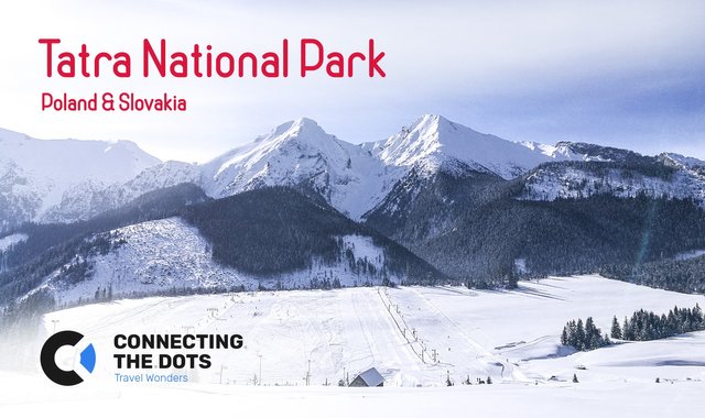
TANAP
TANAP (Tatra National Park) was established only in 1954 by the Communist Government, based on the plans made during the interwar period. The park is a good historical what of what building nations tried to do with the recreational areas. The clash between environmental protection and technological modernization unveils two different visions of how a modern society should look like in the 20th century.
Having in mind that even though some parts of the park are completely modernized, some parts are totally remote. It is important to follow all the rules in order to protect this wonder of nature Tatra Mountains are and to keep yourself together with your friends safe.
![]()
- Location: Poland & Slovakia
- Established: 1954
- Area: 785 km² / 303 mi²
- Lat/Lon: 49°10′N 20°08′E
- Highest point: Gerlach (2,655m / 8,711ft)
- Good accomondation: Zakopane, Tatranská Lomnica, Starý Smokovec, Štrbské Pleso, Ždiar, & Poprad
- Polish emergency number: 985
- Slovak emergency number: 18300
![The view from Nosal, Zakopane in Poland. Photo by Alis Monte [CC BY-SA 4.0], via Connecting the Dots](https://steemitimages.com/640x0/https://ctdots.eu/wp-content/uploads/2019/12/panorama-nosal-tatra-national-park-winter.jpg)
The Meaning of Route Marking Colors
One of the most important things to understand in Tatra National Park before any hike is that route marking doesn’t mean difficulty, thus your judgment should not be based on the color, or at least in this manner. The marking is there for the type of the route:
Red – used for the most important and long-distance routes.
Blue – used for the routes connecting important places.
Yellow – used for short connections between other routes.
Green – basically for everything else.
![On the way to Zamkovského chata, Slovakia. Photo by Alis Monte [CC BY-SA 4.0], via Connecting the Dots](https://steemitimages.com/640x0/https://img.travelfeed.io/ctdots%2F20200128T222249718Z-IMG_20180216_124328.jpg)
Recommended Routes in TANAP during Winter
The High Tatras is one of those places you worth returning again and again. The majestic silence and absolute beauty of winter mountains keep amazed anyone willing to challenge themselves. Too bad it is impossible to see it all at once, thus good research is recommended before setting your foot on any of the routes. Most of the routes listed below, I walked myself therefore I didn’t chose them randomly. It is a result of hours and hours of research to make sure I’m getting most of my time in Tatra National Park. If you don’t have time to do the research yourself, I recommend checking this 4-day winter hiking itinerary.
For Beginners:
- Nosal Mountain: Kuźnicka Polana (975m / 3,199ft) – Nosal (1,103m / 3,619ft) – Kuźnice (1,025m / 3,363ft) – 1h15 – Hike map – Green marking.
- Siklawica Waterfall: Dolina Strążyska (902m / 2,959ft) – Siklawica Waterfall (1,123m / 3,684ft) – 1h00 – Hike map – Red marking.
- Skalnata Chata (Cable car): Tatranska Lomnica (848m / 2,782ft) – Skalnata chata (1,725m / 5,659ft), or even Lomnicky Peak (2,634m / 8,642ft).
Intermediate:
- Morskie Oko: Palenica Białczańska (984m / 3,228ft) – Wodogrzmoty Mickiewicza (1,100m / 3,609ft) – Morskie Oko (1,406m / 4,613ft) – 3h00 – Hike map – Red marking.
- Vodospad Skok: Štrbské Pleso (1,327m / 4,354ft) – Vodospád Skok (1,782m / 5,846ft) – 2h30 – Hike map – Yellow marking.
- Popradske Pleso: Štrbské Pleso (1,327m / 4,354ft) – Popradske Pleso (1,500m / 4,921ft) – 2h00 – Hike map – Red marking.
- Zamkovského chata: Starý Smokovec (1,023m / 3,356ft) – Hrebienok (1,285m / 4,216ft) – Rainerova Chata (1,321m / 4,334ft) – Zamkovského chata (1,475m / 4,839ft) – 2h00 – Hike map – Green marking.
Hard:
- Kasprowy Wierch: Kuźnice (1,025m / 3,363ft) – Myślenickie Turnie (1,360m / 4,462ft) – Kasprowy Wierch (1,987m / 6,519ft) – 4h00+ – Hike map – Green marking.
- Téryho chata: Starý Smokovec (1,023m / 3,356ft) – Hrebienok (1,285m / 4,216ft) – Rainerova Chata (1,321m / 4,334ft) – Zamkovského chata (1,475m / 4,839ft) – Téryho Chata (2,015m / 6,611ft) – 4h00 – Hike map – Green marking.
![On the way to Vodospad Skok, Slovakia. Photo by Alis Monte [CC BY-SA 4.0], via Connecting the Dots](https://steemitimages.com/640x0/https://img.travelfeed.io/ctdots%2F20200128T221710368Z-IMG_20180215_150438.jpg)
Official Rules of TANAP
These are the official rules of TANAP (Tatra National Park) taken from the park’s website. More information could be found in the sources segment at the bottom of the article together with locations for special activities like paragliding.
- Information notice boards about the National Park serve you, the visitor – please do not damage them. In order to enjoy your visit please use marked hiking tracks, footpaths and cycling tracks as well as Tourist Information Centres. In order to protect the nature and to ensure your safety, hiking tracks in the mountains are not accessible to public between 1 November and 15 June. Enjoy your hiking in the daytime, between an hour after sunrise and hour before sunset.
- Hiking away from marked tracks, under the supervision of experienced guides, is available between 16 June and 31 October. (paragraph 4, item 5 of the Visitor’s Charter)
- Picked flowers will wither, captive butterflies will die, chicks of an eagle could fall from their nest if disturbed. Therefore touch the nature by your heart only.
- It is not permitted to camp or bivouac anywhere in the National Park. It is prohibited to light fires anywhere in the National Park other than in designated sites in tourists villages.
- If you are enjoying your stay in the National Park with your pet dog then the dog should always be on a lead and muzzled. In specifically designated nature reserves dogs are not permitted to enter at all.
- Peacefulness of nature is there for you to enjoy. It should not be polluted either by lights effects or loud music, or any other noises.
- Please do not pollute the environment. Take your rubbish home with you. To avoid fires please refrain from smoking during dry periods.
- Protect the underground beauty of the nature. Do not try to enter inaccessible caves and gullies.
![Skalnate Pleso could only be accessed by cable car as the route leading to Skalnate Pleso is closed down for skiing. Photo by Alis Monte [CC BY-SA 4.0], via Connecting the Dots](https://steemitimages.com/640x0/https://ctdots.eu/wp-content/uploads/2019/12/lomnickyj-stit-winter-slovakia.jpg)
Closed Routes in TANAP (11.01 – 05.15)
Due to safety reasons, the following routes are closed for tourists from 1st November to 15th June. Respecting these prohibitions could save you your life, or at least a lot of trouble to park rangers. If you still want to do any of these routes, you are required to hire an experienced guide.
- Bielovodska dolina from the clearing Biela voda – blue marking.
- Javorova dolina from the crossroad under Muran – green marking.
- Zadne Medodoly from the chalet under Muran – blue marking.
- Monkova dolina – Siroke sedlo – Kopske sedlo – green marking (educational track).
- Kopske sedlo from Bielovodske pleso – blue marking.
- Jahnaci stit from Zelene pleso – yellow marking.
- Velka Svistovka from Zelene pleso – red marking.
- Velka Svistovka from Huncovska vyhliadka – red marking.
- Mala Studena dolina from Teryho chalet – green and yellow marking.
- Velka Studena dolina from Zbojnicka chalet – blue and yellow marking.
- Slavkovsky stit from Slavkovska clearing during snow cover – blue marking.
- Velicka dolina from Velicke pleso – green marking.
- Rysy from the crossroad above Zabi potok – red marking.
- Mengusovska dolina from the crossroad above Zabi potok – blue marking.
- Magistrala from Sliezsky dom to Popradske pleso during snow cover – red marking.
- Mlynicka dolina from the waterfall Skok – yellow marking.
- Furkotska dolina from the tourist track Magistrala – yellow marking.
- Furkotska dolina from the chalet at Solisko – blue marking.
- Krivan from the crossroad at Jamske pleso – blue marking.
- Krivan from the chalet at Tri Studnicky – green marking.
- Koprova dolina from Kmetovy waterfall – blue marking.
- Ticha dolina from the chalet Tabor – yellow marking.
- Kamenista dolina from the shepherd’s cabin towards Pysne sedlo – blue marking.
- Bystra dolina from the clearing under Kotlova towards Bystra – yellow marking.
- Rackova dolina from either Prostredne towards Rackove sedlo – yellow marking, or Gaborovo sedlo – green marking, or Bystre sedlo – blue marking.
- Jamnicka dolina towards Otrhance – green marking, and towards Jamnicke sedlo – blue marking.
- Baranec from the map’s elevation Klinovate – green marking.
- Ziarska dolina from the top side of the forest towards Baranec – yellow marking.
- Ziarska dolina from either Ziarska chalet towards Ziarske sedlo – green marking, or towards Smutne sedlo – blue marking, or towards Jalovecke sedlo – green marking.
- Jalovecka dolina from the crossroad towards Salatin – green marking and towards Banikovske sedlo – blue marking.
- The main ridge of Zapadne Tatry from Hutianske sedlo up to Pysne sedlo – red marking.
- Smutna dolina from Tatliakove pliesko towards Smutne sedlo – blue marking and towards sedlo Zabrat – green marking.
- Spaleny Zlab from the the ski-track towards the map’s elavation Brestova – blue marking.
- Spalena dolina from the crossroad above the waterfall towards Rohacske plesa – blue marking and towards Banikovske sedlo – yellow marking.
- Latana dolina from the crossroad towards Lucna – green marking and towards sedlo Zabrat – yellow marking.
- Bobrovecka dolina from the crossroad under Umrla – blue marking towards Bobrovecke sedlo, and towards sedlo Prislop – green marking.
- Hruby vrch and Bobrovecke sedlo from Juranova dolina – red marking.
Sources
TANAP.org – the official Tatra National Park website.
![Almost at the top of Kasprowy Wierch, 1984m. Photo by Alis Monte [CC BY-SA 4.0], via Connecting the Dots](https://steemitimages.com/640x0/https://ctdots.eu/wp-content/uploads/2017/04/last-steps-to-winter-kasprowy-wierch-tatra-mountains.jpg)
View this post on TravelFeed for the best experience.
a lot of useful info. bookmarked it, because there is a real possibility that i would end up there someday.
I'm glad you found this useful. I was not sure if I should share it here, because it is a technical information and not that much an interesting read! But now I know it was worth it:)
it is a bit technical and not for everyone (but you still have great photos for everyone :) ) but it could be useful for people planning to go there as they can get some ideas of what to look for and how hard will it be to get there.
Congratulations, Your Post Has Been Added To The Steemit Worldmap!
Author link: http://steemitworldmap.com?author=ctdots
Post link: http://steemitworldmap.com?post=tanap-the-most-beautiful-park-in-poland-and-slovakia
Want to have your post on the map too?
Good to know:)
Congratulations @ctdots! Your post brought a smile to the TravelFeed team so we have sent you a smiley. Keep up the good job. 🙂
Thanks for using TravelFeed!
@elsaenroute (TravelFeed team)
PS: Have you joined our Discord yet? This is where over 1000 members of the TravelFeed come together to chat. Join us!
Hiya, @itchyfeetdonica here, just swinging by to let you know that this post made into our Honorable Mentions in Daily Travel Digest #754.
Your post has been manually curated by the @steemitworldmap team and got an upvote from @blocktrades to support your work. If you like what we're doing, please drop by to check out all the rest of today's great posts and consider supporting us so we can keep the project going!
Become part of the Haveyoubeenhere community: