Glassy Mountain [ulog #9]
Monadnock is an originally Native American term for an isolated hill or a lone mountain that stands above the surrounding area, typically by surviving erosion. Geologists took the name from Mount Monadnock in southwestern New Hampshire.[3]
There is a small paved road that climbs to the summit of the mountain, roughly following the long ridge line that is visible in the photo below. There are several hiking trails on the mountain and an abundance of varied flora. At the summit of the mountain, there are several communications towers.
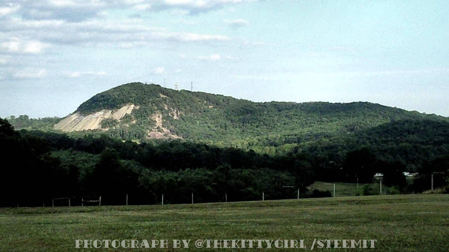
Because of the location of the mountain and the fact that there are no other higher mountains in the immediate vicinity, it is visible from a surprising number of locations throughout the country. That, and its distinctive shape and history make it an iconic symbol of the area.
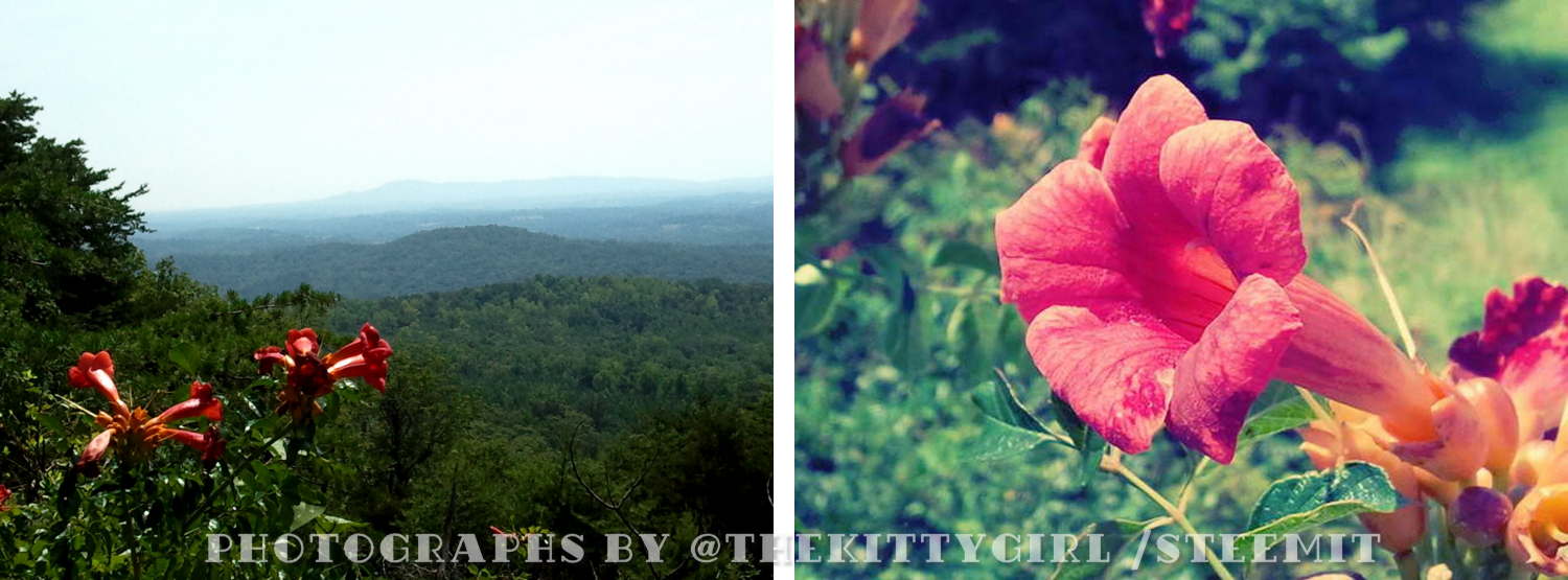
Most of the mountain is forested, so there aren't many places for scenic vistas to be glimpsed while driving up. One place along the roadside near the summit, however, a lovely view to the east opens between a large expanse between the trees. From that point, Roper Ridge, Cedar Rock Mountain, and Paris Mountain are visible. The day I went up there, the Trumpet Creeper (Campsis radicans) vines were in bloom! This plant is native to the area and called "Hummingbird Vine" by many, as the nectar in the flowers is a favorite of the local hummingbirds.
When I was a child, several mountains had "fire towers" on them which were manned by the Forest Service and afforded a view over the trees. Rangers in the towers kept watch for forest fires and alerted crews on the ground when they spotted one. I've heard it said that each tower was equipped with a "compass table" in the cabin.
Each tower had a staircase which was usually locked at the bottom to prevent the public from climbing up and possibly becoming injured. I always wanted to go into one of the towers and see the view, but was never able to do so. With modern technology and satellite imagery, most of the towers have been abandoned or dismantled. Here are photos of the tower atop Glassy Mountain, which is no longer in service.

The trail is quite level and nice in a couple of places, but most of it is on a relatively steep slope. It was easy enough to go down, but coming back up (which was simple in my younger days) was much more problematic now that I am in my sixties with weaker legs and weaker heart. As they say, "It's hell, getting old."
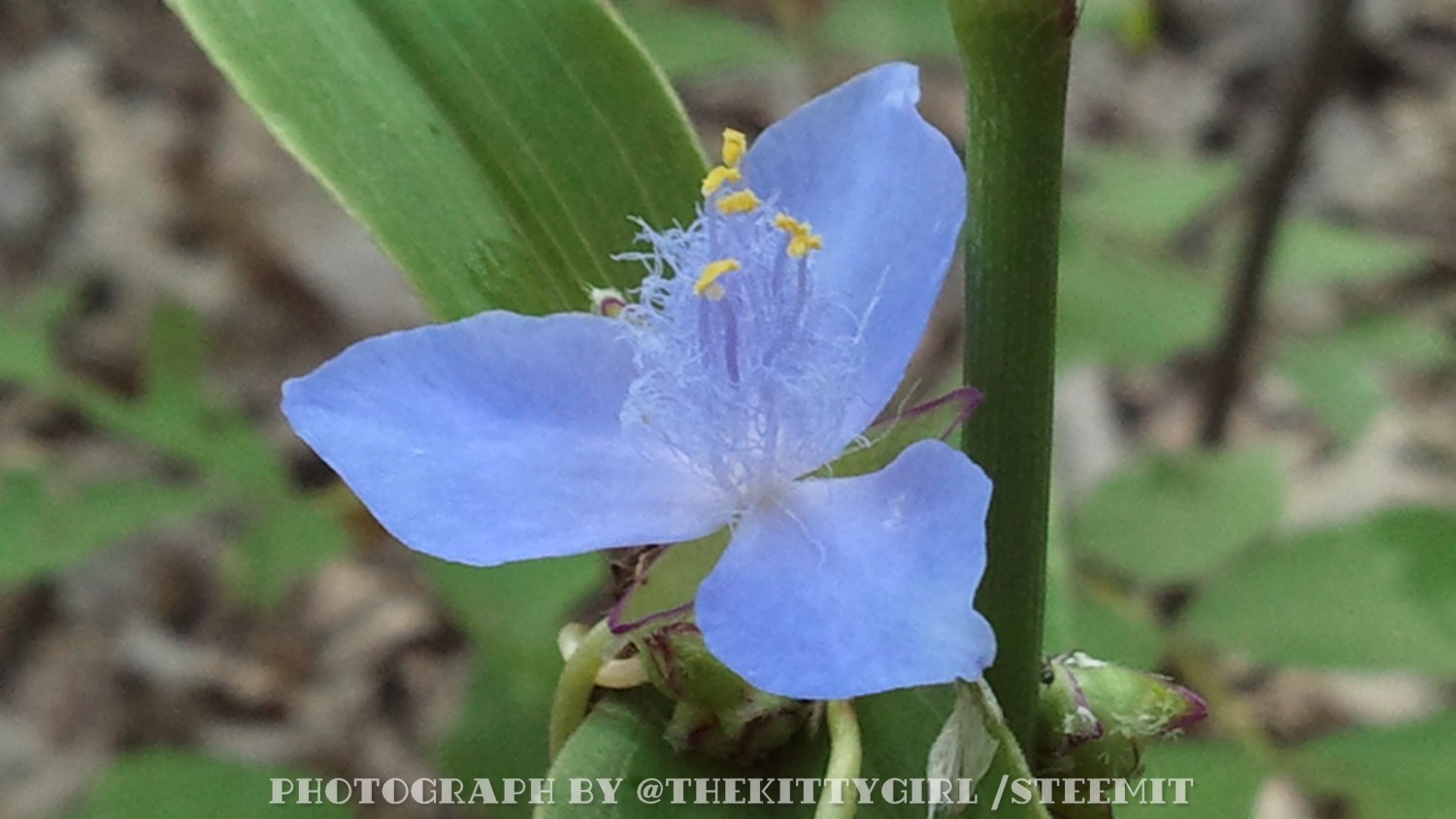
One of the most delightful things I found on the trail was a spiderwort plant in bloom. There are many species of spiderwort, but I believe this one might be Tradescantia ohiensis, as the other spiderwort most common in this area (Tradescantia virginiana) tends to a darker blue, sometimes with a tinge of purple. The light blue of this little florescence is lovely!
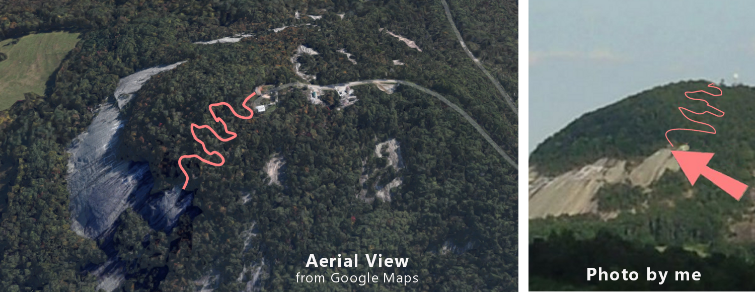
Quite a breathtaking sight can be seen when the trail finally opens onto the top of the granite face of the mountain! Perhaps it is so striking because this mountain isn't very high, making the houses, barns, and roads easily discernible below.
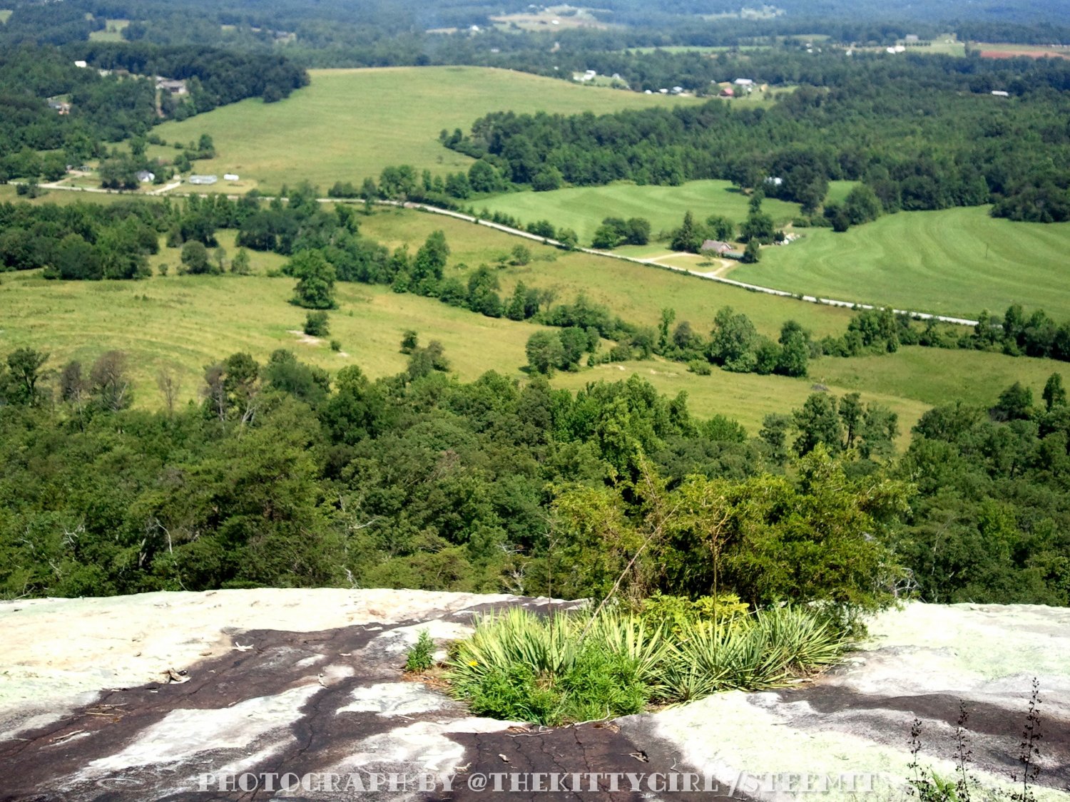
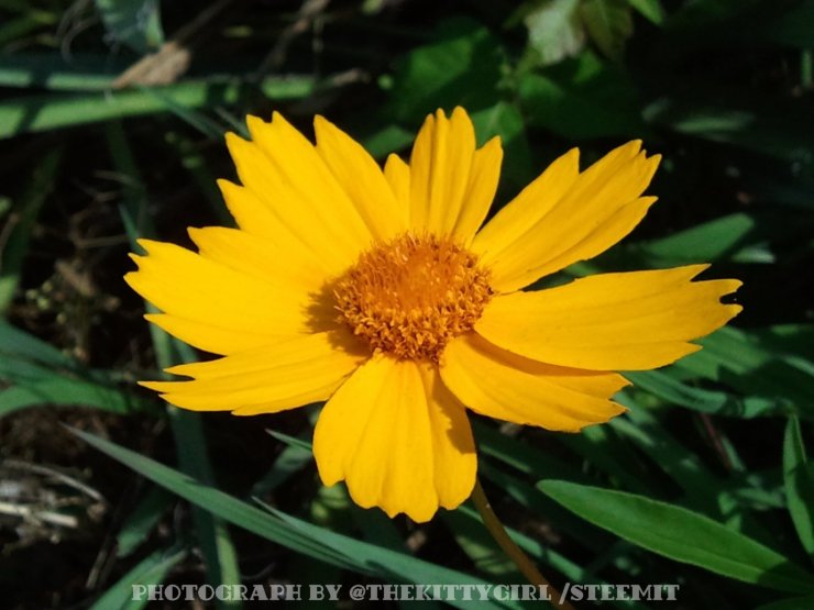
A small oasis of grasses and plants can be seen growing on the rock in the above photo. Several species of plants thrive in environments like this and are seldom found anywhere else. Among the greenery, I spied a yellow flower and wanted to see it more clearly, so I carefully inched down the rock on my butt to find a magnificent Coreopsis flower! As with many other flowers, there are several varieties within this genus, but this one appears to be the Lanceleaf Coreopsis (Coreopsis lanceolata). It is such a stunning flower! There are quite a few of these beauties all over the mountain.
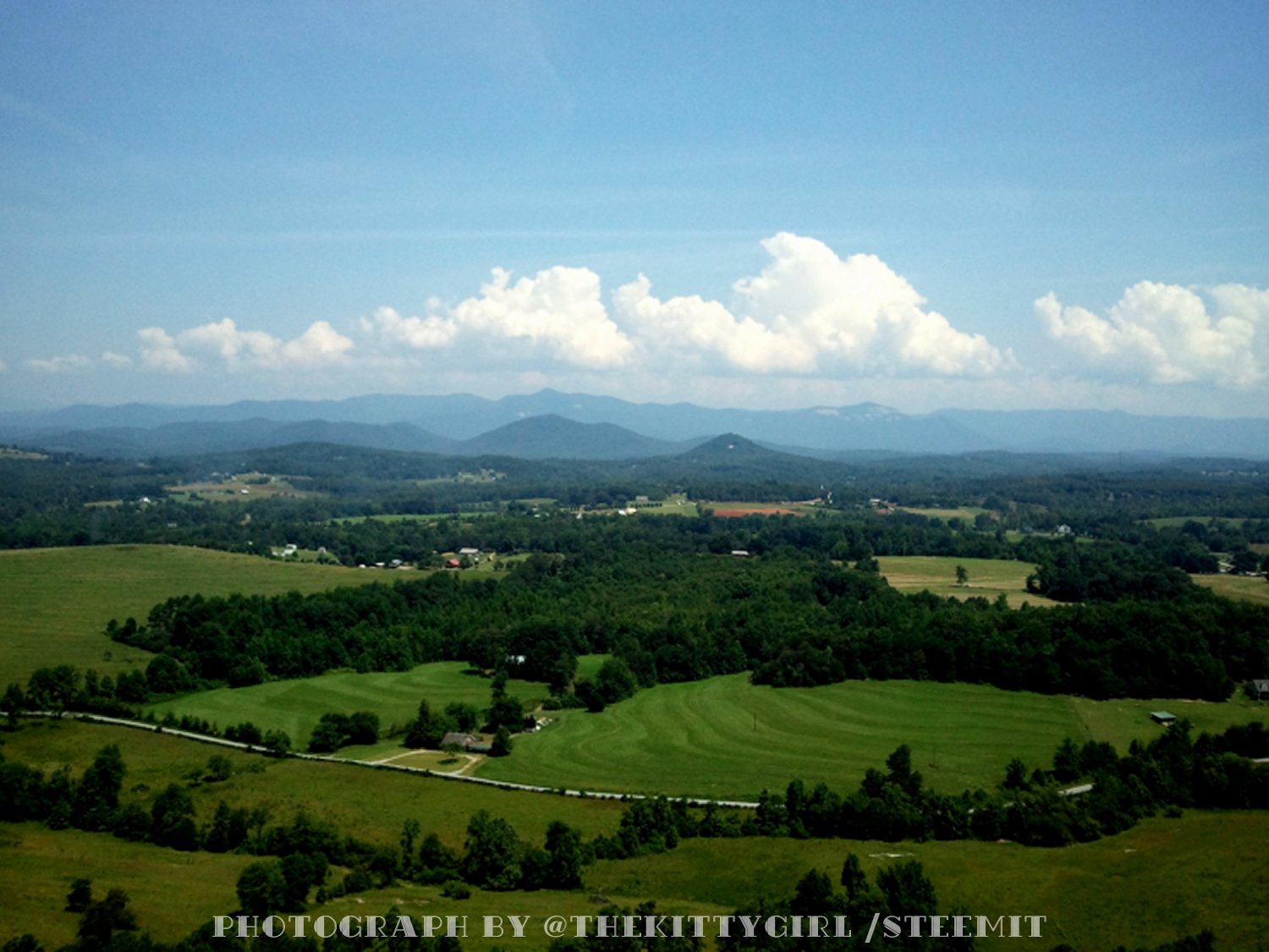
Since the granite face of Glassy Mountain is on the north side, the view in the distance is towards the border between South Carolina and North Carolina. From that vantage point, I could easily spot individual mountains in the scene that I know well — Big Rock Mountain, Reese Mountain, Chapman Mountain, Brown Montain, Tater Hill, Bullard Montain, Langley Mountain, Long Mountain, Hickorynut Mountain, Horse Mountain, Pinnacle Montain, Table Rock Mountain, Raven Cliffs, and others!
I'm not particularly skilled at "stitching" several photos together into one seamless panorama, although I've accomplished it in the past with much effort, but I am not doing it here, so kindly pardon the seams... 🤨 but please click the following photo for a larger view! 😁

• CLICK THE PHOTO TO ENLARGE •
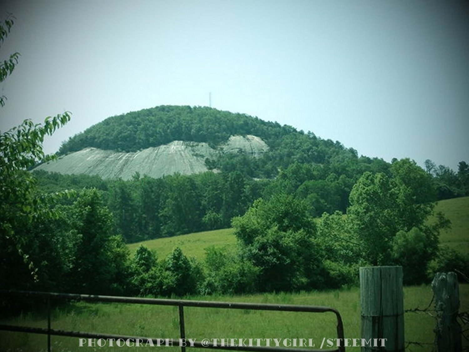
After struggling up the steep trail back to the car, my heart was racing and I was sweating profusely, so I collapsed into the driver's seat and rested a few minutes before heading back down the mountain. I took a longer and more scenic drive down than I went up, rambling the eastern slope to the plain below, then around the north side, and on to the west. Along the way, I stopped to make this final shot of the mountain, looking up towards the face over an old farm gate.
All of the mountains in this blog post are part of the Blue Ridge Mountain chain, so called because of their distinctive bluish color when viewed from a distance. That color is caused by isoprene which the trees release into the air. [2] The Blue Ridge Mountains are part of the greater Appalachian Mountain Range, and are among the oldest mountains on the face of the earth. As such, they have been worn-down by wind and rain over millennia and are no longer as high as younger mountain ranges like the Rockies, the Alps, the Andes, or the Himalayas. I have lived in, or near, the Appalachians for forty-eight years of my life, so they feel like "home" to me.
This post is tagged as part of the #wednesdaywalk challenge started by @tattoodjay where folks make photos during a Wednesday walk. I think it was actually on a Tuesday when I took this hike sometime back, so don't tell Jay... 😬 LOL
SOURCES
1 Glassy Mountain Heritage Preserve
2 Wikipedia: Blue Ridge Mountains
2 Wikipedia: Monadnock
!steemitworldmap 34.900984 lat -82.659907 long Pickens County, SC D3SCR
a big hug to @enginewitty for designing the following personal banner for me 🤗
OMG what STUNNING photos. I can not wait to get back to the mountains someday (hopefully sooner than later) thank you for sharing. I love how GREEN and alive everything is!
They look like a beautiful place to live and no wonder you've stayed there most of your life! Thanks for taking us on your walk and I could feel my heart racing going up the mountain with you :D
Congratulations, Your Post Has Been Added To The Steemit Worldmap!
Author link: http://steemitworldmap.com?author=thekittygirl
Post link: http://steemitworldmap.com?post=glassy-mountain-ulog-10
Want to have your post on the map too?
what a beautiful area for the walk, dont worry about the seams in the panoramas they still show the majestic views
Thanks for joining Wednesday Walk tip!
Hi @thekittygirl! You have received 0.1 SBD tip from @tattoodjay!
Check out @tattoodjay blog here and follow if you like the content :)
@tipU voting service | For investors.
That was quite the Wednesday walk and drive. You captured it all including the plants, Trumpet Creeper is also native here and is one of my favorite vines too. Thanks for sharing Tiffany.
It's good to be where you are
That was quite a walk
And I'm with your on that fluorescent blue... so pretty
Thank you or taking us with you @thekittygirl :D
This post is sponsored by @SteemitBloggers in collaboration with @appreciator. Just keep up the good work.