[Translation][Spanish] Basic Air Data Website (1151 words)
Project Details
Basic Air Data is a site that hosts open source projects (still made by their team) for measuring of air properties, using technologies like Bluetooth, Interfaces, apps for smartphones, and others. Really important for meteorology. The data in the ADC can be transmited via USB to put it in a MicroSD as backup. This is a work in progress.
Links related to the translation
https://crowdin.com/project/basic-air-data-website
https://crowdin.com/project/basic-air-data-website/reports
https://github.com/BasicAirData/AirDataComputer
Source Language
English
Translated Language
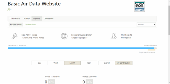
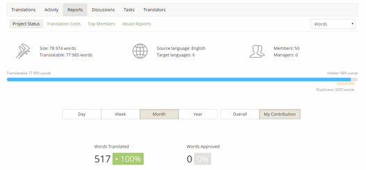
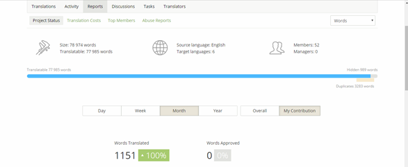
I translated this project into Spanish language. The project has 78 974 words (Translatable: 77 985) and 1151 that were translated.
Number Of Words
1151 words
Previous translation on the same project
Number of words translated on the project before this report (if any): 0
Before I start:
In Progress:
My contributions in https://crowdin.com/profile to this project are:

Example sentences in Spanish:
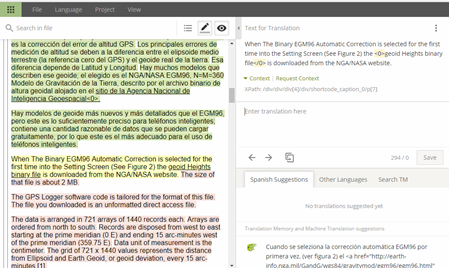
• Los principales errores de medición de altitud se deben a la diferencia entre el elipsoide medio terrestre (la referencia cero del GPS) y el geoide real de la tierra.
• Hay modelos de geoide más nuevos y más detallados que el EGM96, pero este es lo suficientemente preciso para teléfonos inteligentes; contiene una cantidad razonable de datos que se pueden cargar gratuitamente, por lo que este es el más adecuado para el uso de teléfonos inteligentes.
• El gráfico de la figura 3 muestra el resultado de esta <0>secuencia de comandos de Scilab (un analizador que calcula el valor máximo de gradiente de toda la red entera) WW15MGH_max_grad.sce, que representa el área con el gradiente máximo de la red EGM96.
• Denominado no dispersivo porque no depende de la frecuencia y, por lo tanto, no puede eliminarse fácilmente, este retraso neutral es causado tanto por la estratosfera como por la troposfera.
• Además, debido a la naturaleza de la señal del GPS, los acantilados, los edificios altos y los árboles pueden bloquear la señal del satélite. La lluvia, la niebla y la nieve también pueden afectar la calidad de la señal.
• Aquí en la página 15 se informa de una manera muy generalizada y simplificada la influencia de algunas fuentes de error de GPS.
Activity:
Posted on Utopian.io - Rewarding Open Source Contributors
Thank you for the contribution. It has been approved.
You can contact us on Discord.
[utopian-moderator]
Hey @isacastillor I am @utopian-io. I have just upvoted you!
Achievements
Suggestions
Get Noticed!
Community-Driven Witness!
I am the first and only Steem Community-Driven Witness. Participate on Discord. Lets GROW TOGETHER!
Up-vote this comment to grow my power and help Open Source contributions like this one. Want to chat? Join me on Discord https://discord.gg/Pc8HG9x