Elk & Kings Mountain, Oregon Coast Range.
On Martin Luther King day two weeks ago my exchange brother, my best friend and I decided to spend our day off hiking and getting to the top of a couple mountains. Our hike was located on hwy 6 between Beaverton and Tillamook Oregon. We got a late start and didn't get to the parking lot till about 10 am. I was a little worried about day light as it's winter here and the sun has been setting at around 5pm. I found this hike in a guide book for scrambling around Oregon and the book gave a rough estimate of 6-8 hours to complete, but figured we could just hustle our way through and be fine.
Trail sign at the Elk Mountain parking lot
The loop is 9.5 miles total and takes you along the Wilson river for 3.5 miles first if you are doing the loop counter clockwise as the book suggests. After a half mile or so you will cross the first of a handful of drainage creeks flowing into the Wilson river.
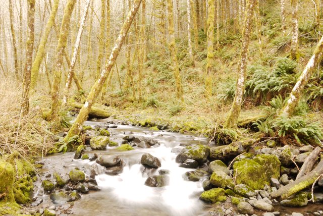
The first creek you cross
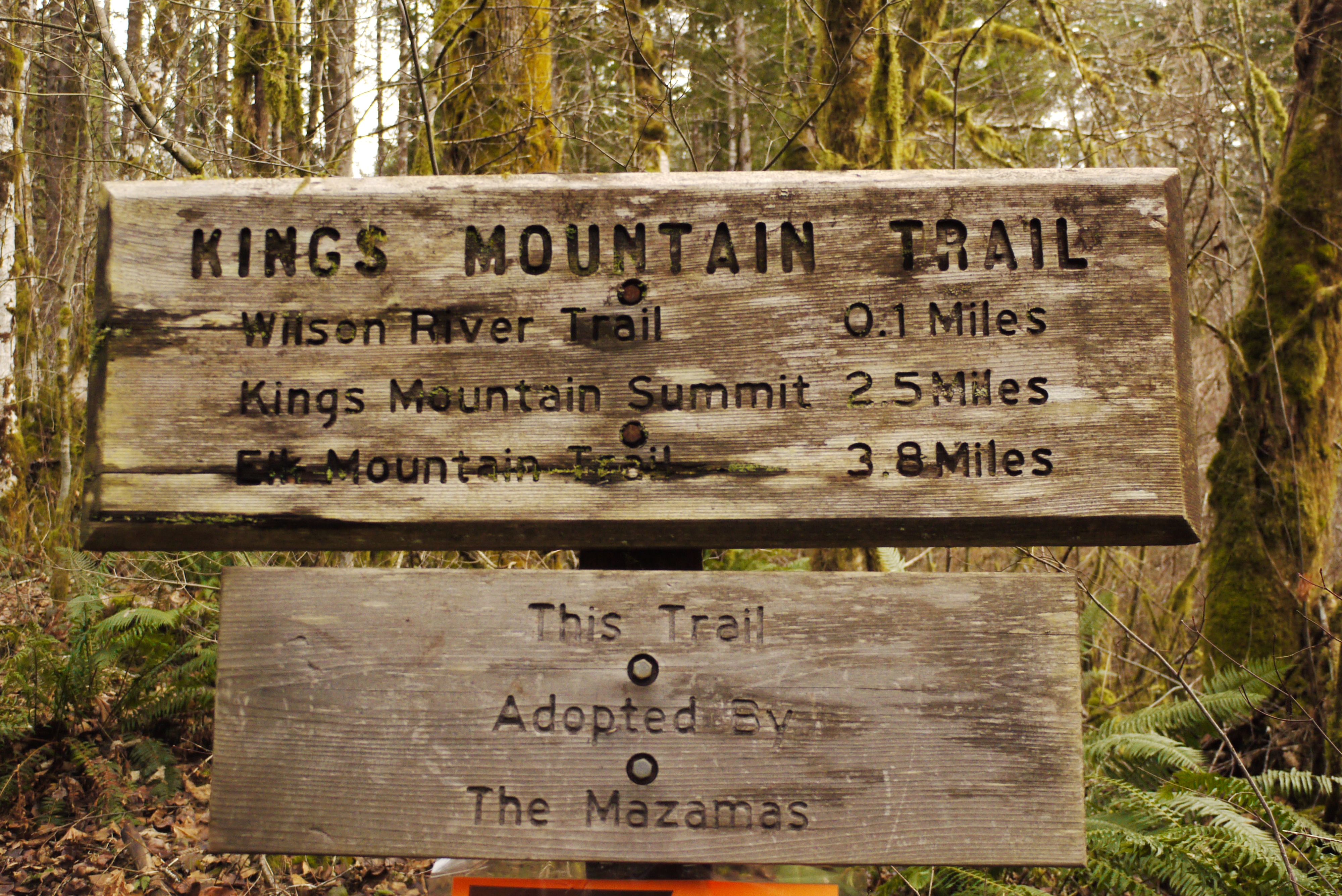
After winding our way through the trees and along the Wilson for another three miles we came to a trail sign leading up a ridge and away from the Wilson river for the first time. This is where we took our first little snack break to regain our stamina before heading up the ridge.
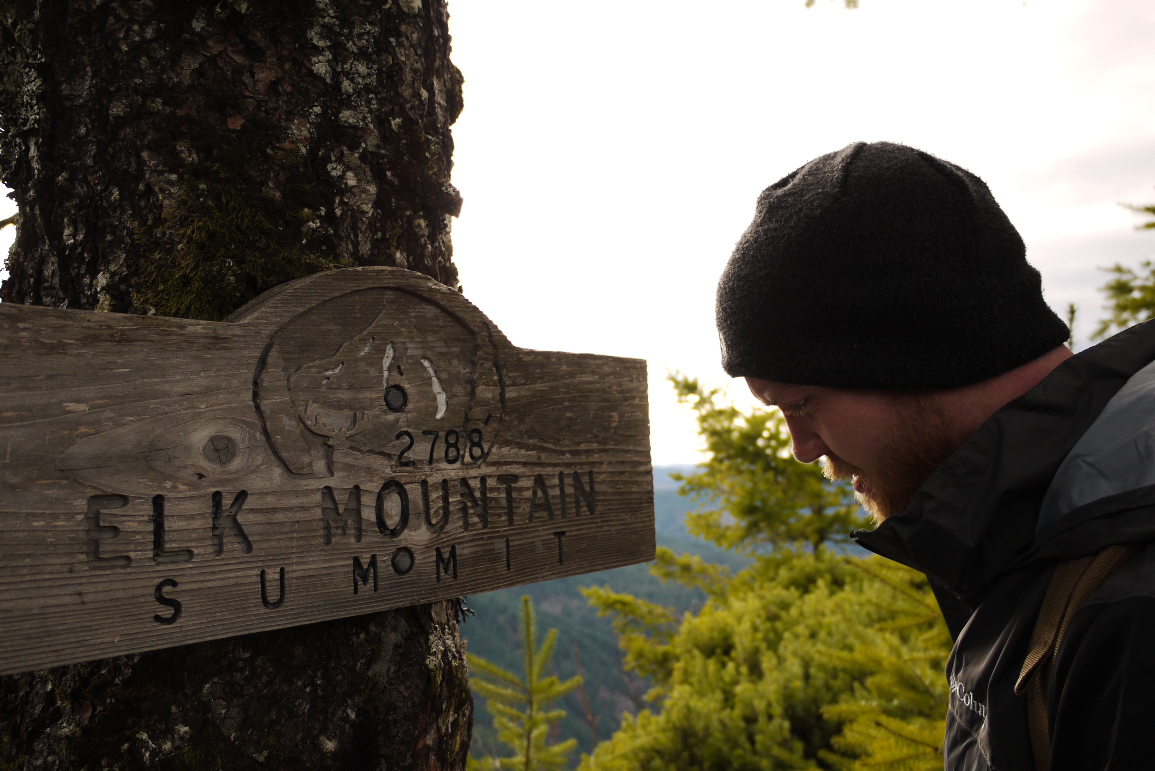
Elk mountain sign leading up the ridge and away from the Wilson
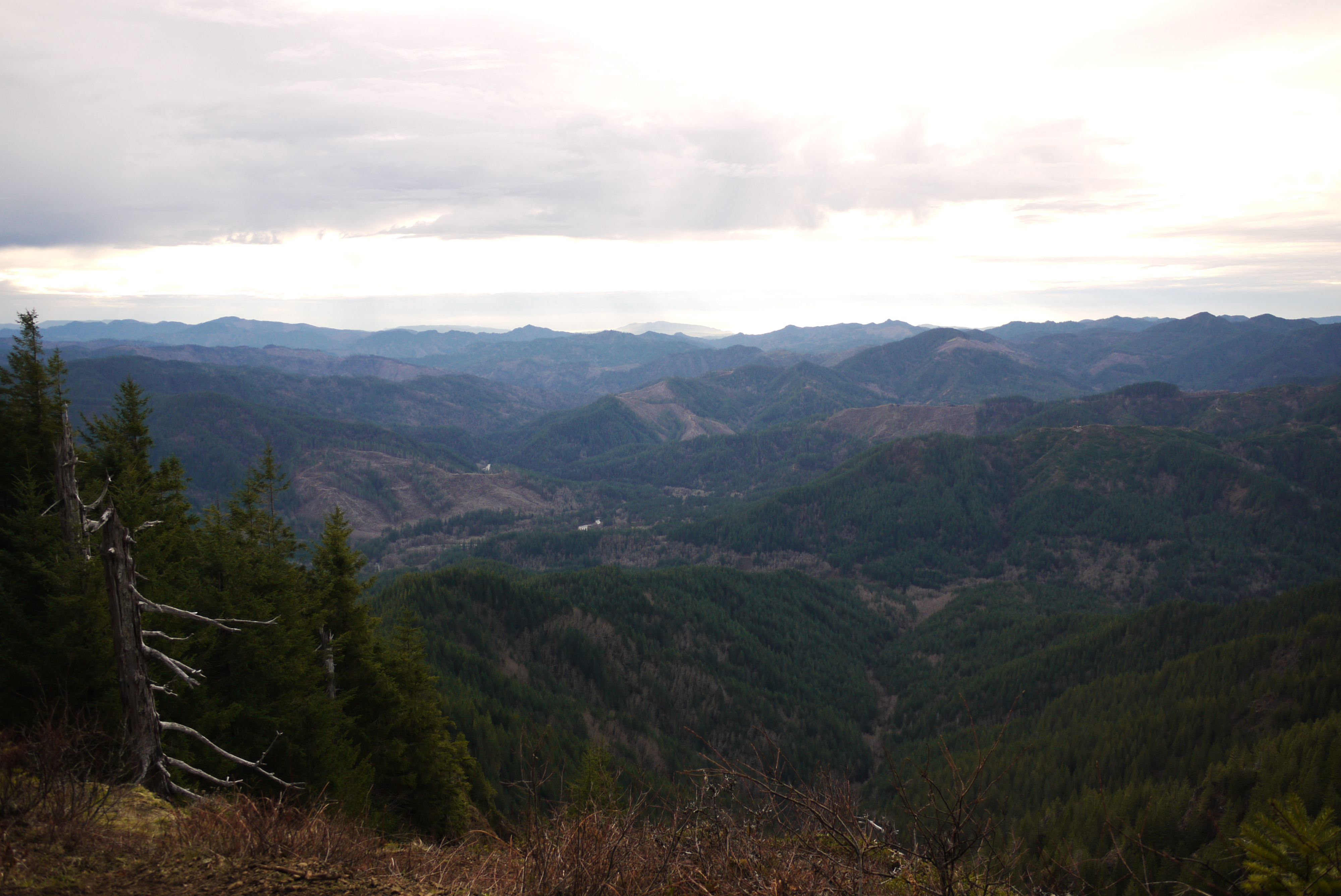
The trail heading up the ridge was pretty steep climbing 1,500 feet in a little over a mile. Even though the trail was narrow for most of the way with steep drops on either side it didn't feel like we were exposed due to the thick trees blanketing the mountain sides. Along the way we scrambled our way from viewpoint to viewpoint with the vastness of the coast range becoming grander every time we stopped to look and catch our breath.
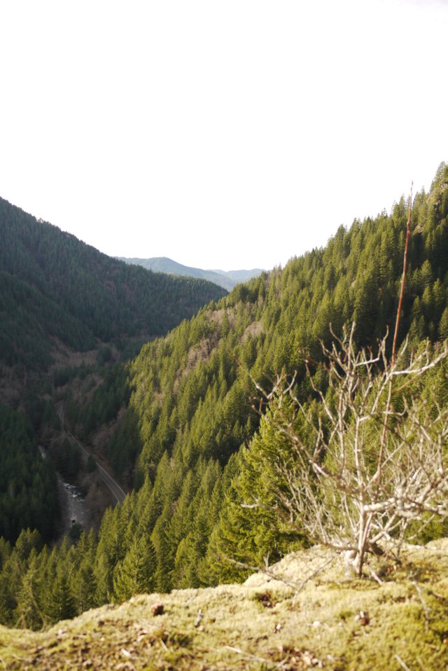
A good look back down at hwy 6 and the Wilson river
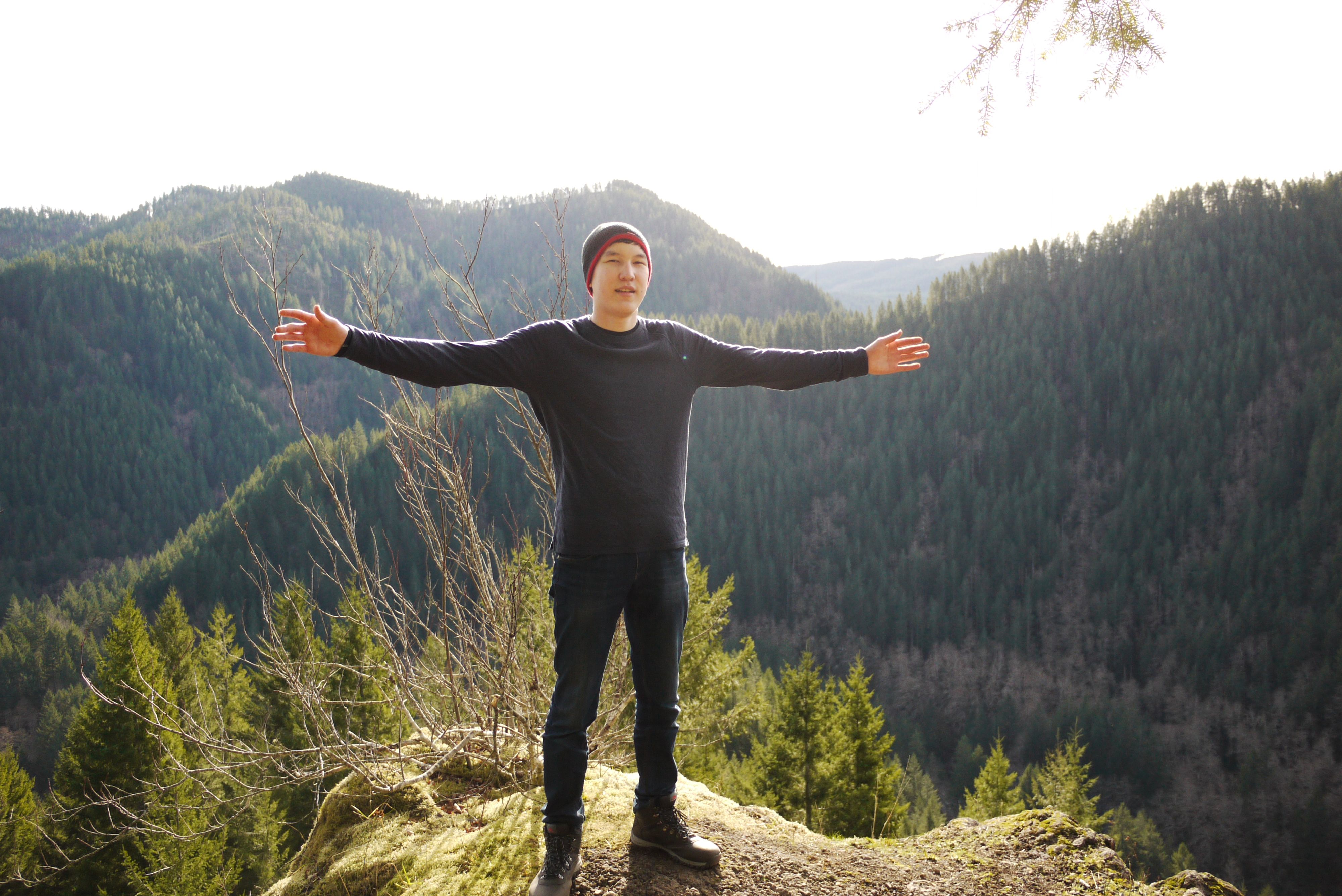
My exchange brother posing in the light
As we neared the top of Elk mountain the hiking became a bit more difficult as our breath ran short and hiking turned into scrambling. We were making good time though and we continued to wind our way up the ridge.
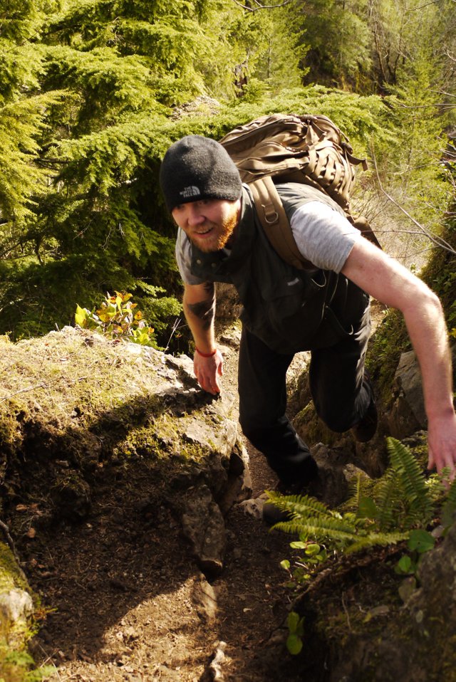
My best friend making his way up a particularly narrow section
We got to the top of Elk mountain and took time to enjoy the views of the cascade range and mt. Hood to the east and a massive cloud front where the ocean would have been on a clear day. We signed the register proving to the world that we had made it and snacked a bit before we continued the last four miles ahead of us. Just on the other side coming up was a group of about seven people so we got to hiking before the summit became to crowded.
Nevin signing the register and the top of Elk mountain
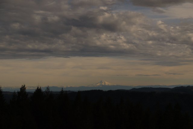
The view east from Elk mountain, Mt. Hood in the distance
We climbed down the other side of Elk and winded our way around the ridge taking a horseshoe route to Kings mountain. The trail makes this big horseshoe bend to keep you from losing to much elevation before climbing another 1,400 feet to the top of Kings mountain which is the taller of the pair.
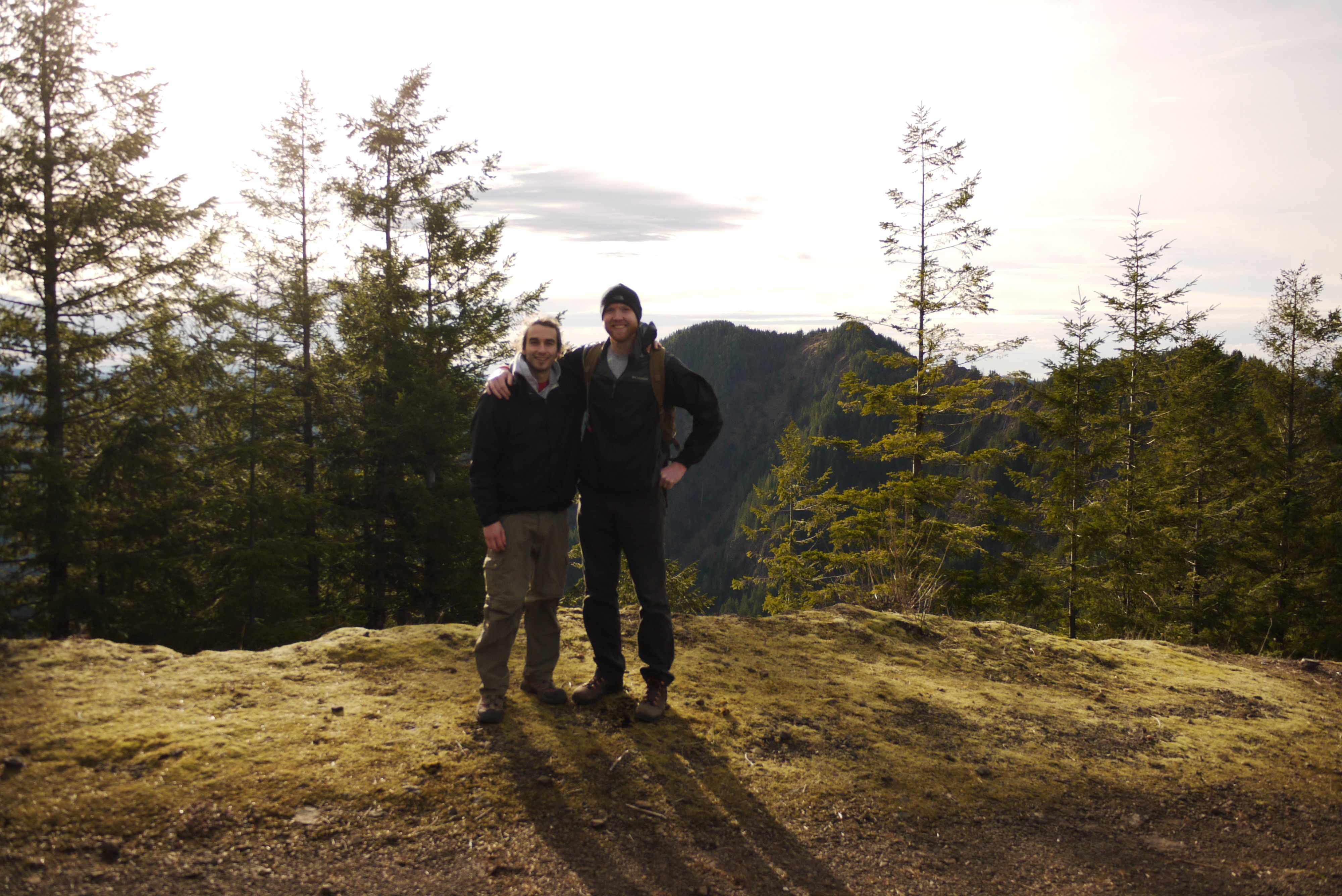
Nev and I, Kings mt. in the background
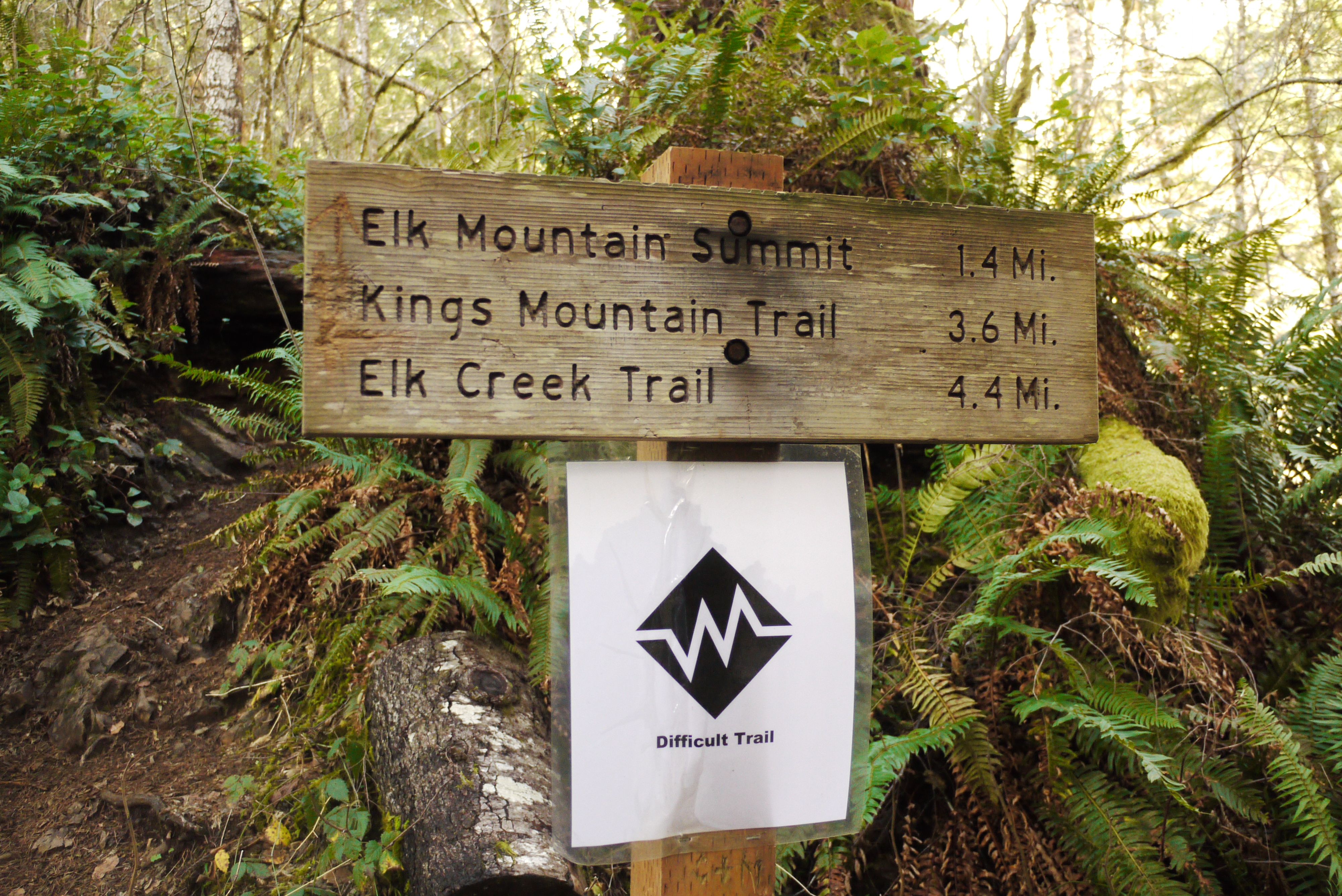
We came to the last trail sign pointing us towards Kings and were glad to know we only had about 2.5 miles left. We were all pretty tired by this point and stopped for a quick refuel of cliff bars and gardettos.
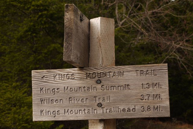
Last trail sign before Kings mt.
About a half of a mile after this sign we came to a steep part of the trail with a sheer drop off on one side. Luckily there was a rope there to help us get down.
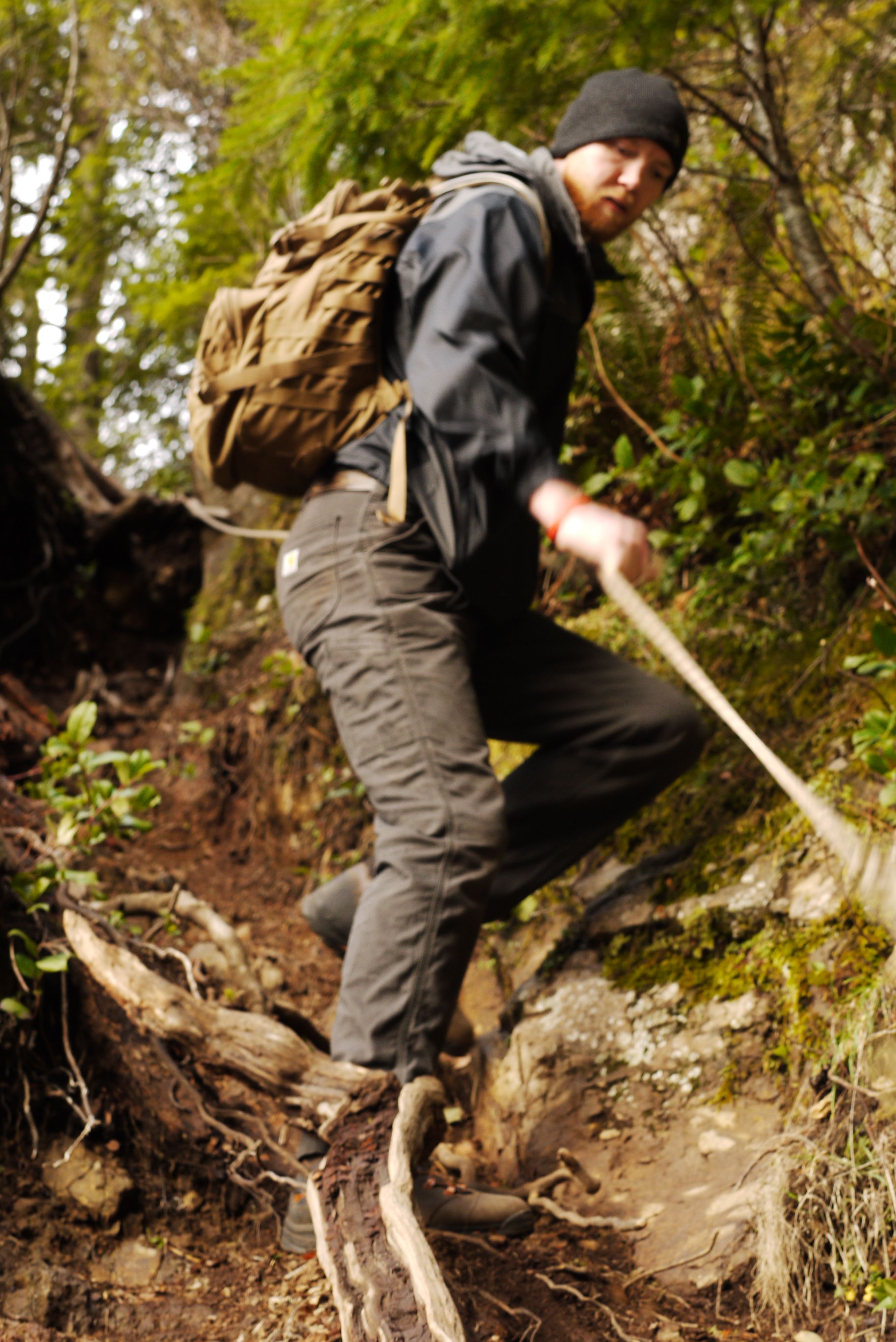
Nevin rappelling down the trail
From here it wasn't long before we were making our last ascent up to the summit of Kings mt. and what to us symbolized the last of the hard scrambling and climbing. From here on out it was downhill and we still had 2 hours of daylight left.
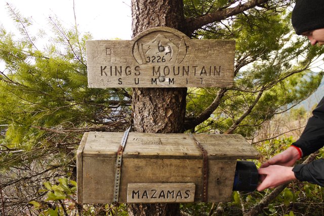
Register box at Kings mt. summit
A wonderful view of the Oregon coast range
We finished the hike in a total of 5 and 3/4 hours, a solid 15 minutes faster than the book time. All three of us were glad to see the truck after a long day. We felt accomplished though, if you have summited a mountain or finished a all day hike than you know the feeling. If you haven't then I highly suggest finding your nearest beginners mountain and climbing it. Even though your legs will hate you and your lungs will have a hard time functioning when you get to the bottom there is no greater feeling.
So get out and hike today!!!!!
Always follow leave no trace principals when visiting the outdoors. We are all stewards of our environment and it's our responsibility to leave it better for the next hiker the next generation and even the next species.
Thanks for taking the time to look and read this!!!! Let me know in the comment section of your favorite hikes/mountains to visit!!!
!steemitworldmap 45.6 lat -123 long Elk & Kings mt. trailhead d3scr
B
I like your photo report, especially pictures of mountain peek in the distance. You have really nice blog and you should always include the story around your photos because when you do it, you do it good. People love to read about experience of the photographer - it help them to better understand the context of the moment. There is small formatting mistake under the text of one of your photos so you can consider correcting that, but it is not a big deal. I hope you will successfully build your follower base and be here for a long time. I will definitely follow you! :-)
Thank you for your reply!!! I really appreciate your advice. As a student I struggle finding the time to give each adventure a proper story but will try and do it more often. Would you point out the formatting error and I'll fix that!
Welcome! :-) And about error - you have a blank space after the letter and * sign bellow one of the images...
Hiya, just swinging by to let you know that this post made the Honorable mentions list in today's Travel Digest!
Looks like a fun hike. I love loop trails where you get to hike new terrain the whole time and still end up back where you started :) I live in the Eugene/Springfield area but have never done any hiking around the coast.
Cheers - Carl
I like the coast range during the winter, no snow on the tops of the mountains. I've done mt. pigsah by Eugene, and the hike known as blue pool, diamond peak. What are your favorite local day hikes around Eugene? I'm located in Corvallis so Eugene isn't far away and I want to get out at least twice a month.
Hey would love to build a steemit community in Or, follow for follow?
Hey Larrabeb!
This is awesome! I'm in Oregon too! We just went hiking to Table Mountain in Washington but didn't get up nearly as high as this.
You should include this on @steemitworldmap and maybe they'll include you in their Travel Digest!
Nice man, are you located up near Portland then? I edited to try and get it in there. We'll see if it works!!!
Dude, it totally worked, you were in their digest! Well done!
That's freaking awesome, where do I find that at?
You were in the honorable mentions of this post:
https://steemit.com/steemiteducation/@flaversham/kp-s-teacher-tales-3-be-a-role-model-online-and-off
Hey would love to build a steemit community in Or, follow for follow?
Absolutely Brandon! Looks like we're going to give Kings Mountain a try tomorrow!! Reviews sound brutal, but it'll be a good test.
It's not too bad! Let me know what you think about it and post some pictures!!!
Definitely dude!
Congratulations @larrabeb! You have completed some achievement on Steemit and have been rewarded with new badge(s) :
Click on any badge to view your own Board of Honor on SteemitBoard.
For more information about SteemitBoard, click here
If you no longer want to receive notifications, reply to this comment with the word
STOPCongratulations, Your Post Has Been Added To The Steemit Worldmap!
Author link: http://steemitworldmap.com?author=larrabeb
Post link: http://steemitworldmap.com?post=elk-and-kings-mountain-oregon-coast-range
Want to have your post on the map too?